Description
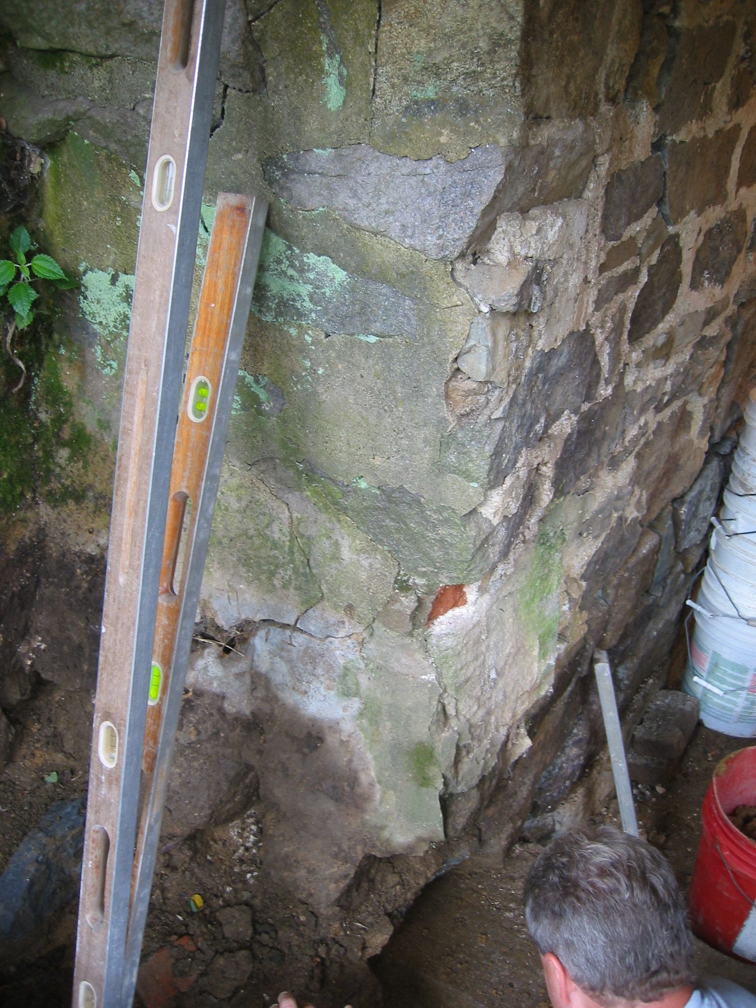
Exterior corner (“quoin corner”) of pier to left [south] of cellar doorway after removal of later door frame and non-original jamb-plinths.
View prior to removal of displaced and unstable masonry, re-alignment to original position, and re-laying of pier stonework. Darker stones at foundation level (which were below the modern grade) have been excavated and found to be displaced from original alignment and out-of-plumb relative to the south door jamb.
Further excavation uncovered the base of this segment of the partition wall ( which is also the northern abutment of the root-cellar vault). The foundation base-blocks [darker stones at lower level in right half of photo] are set on bedrock, which also provides natural "footings" under the north and east foundation walls [see discussion and note {1} to DTR09PH69--1001.01.153], and possibly under much of the structure. This solid rock "platform," the banked site, and the proximity to the creek seemed to affirm the prudent selection of the location for the 1767 DeTurk building, until creek flooding and the high water table presented greater difficulties than anticipated in maintaining dry and clean conditions in the food storage, preparation and cooking cellars. After a few generations, probably by the middle of the 19th century, the family built the kitchen addition [since removed] seen in DTHPH1--1001.01.021, located on the upper ground level safely above the creek and water table.
The lighter stones in the left half [behind the levels] are the flush-pointed {1} face-stones of the east exterior wall south of the doorway and north of the retaining wall intersecting this pier [SEE DTR090PH69--1001.01.153 & DTR09PH42--1001.01.126.
The finding of possible "key" stones projecting from the abutment pier south of the door frame {2} and the inclined surfaces of other stones at the interface indicates that the earlier retaining wall would have been 2 or 3 inches south of the presumed original location of the south jamb, and was possibly "battered" [inclined or stepped back into the retained embankment]. This would align the earlier retaining wall roughly in the position of the short masonry "bench" presently forming a low buttress against the upper retaining wall {3}.
FOOTNOTES
{1} see footnote {3} to DTR09PH66--1001.01.150.
{2} behind and below the levels leaning against the wall to the left in this photo.
{3} see DTR09FN3--1001.01.176 for the position of the higher retaining wall, DTR09PH43--1001.01.127 for a detail view including the lower buttress ("bench"), and DTR09PH49--1001.01.133 for a detail view of the pier and retaining wall [green moss along left edge of photo].
L. Ward, 2009, updated Oct 2021
Catalog details
- Catalog number
- 1001.01.149
- Alternate number
- DTR09PH65
- Accession number
- 1001.01
- Date
- 07/29/2009
- Creator
- Larry Ward
- Object name
- Print, Photographic
- Record type
- Standard
- Classification
- Documentary Artifact