Digital collections

Browse the archive

Search published catalog records or narrow the collection by type and collection.

778 records

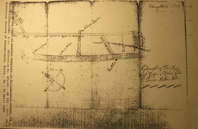
(Copy of Microfilm) "Schuylkill 1719," indicating structure locations
Archives 1003.01.10

“A Draught of The Three Last Courses of Oaley [sic] Road To Thomas Miller’s [Sic, Millard’s] Mill”

Morlatton · 1719

A copy from MICROFILM, by The Historical Society of Pennsylvania: A 1719 map entitled “A Draught of The Three Last Courses of Oaley [sic] Road To Thomas Miller’s [Sic, Millard’s] Mill”, from the public records of the Court of Quarter Sessions of Philadelphia County. This survery “Draught” provides an abundance of historical and topographical details on sites and structures in the Manatawny region [the territory northeast of the Schuylkill River ranging from the French Creek to the site of present-day Reading, later the smaller tract between the Manatawny and Monocacy Creeks on the banks of the Schuylkill] in the first quarter of the 18th century: 1. The approximate and correlative locations of the houses of Mouns Jones, Andrew Lycons, and "Marcus Hulyns" [sometimes called "Huling's" house, which by about 1730 functioned as the first licensed "Publick" House in Manatawny, later the "White Horse Tavern", which in about 1763-5 was relocated slightly northward to the extant stone tavern building on the "Main Road"]. 2. Thomas Millard’s Mill on the opposite river bank about a quarter of a mile down-river from Mouns Jones’s house; 3. The Manatawny segment of the “Main Road to Philadelphia”{a} and its compass readings; {a} This roadway nomenclature indicates that a passable road connected the small Manatawny settlement to Philadelphia, the primary port and commercial center in the mid-Atlantic colonies, by 1719, probably a few years earlier, in response to the 1715 Petition requesting a road to the “Plantations” of Mouns Jones and his neighbors. This “Main Road” land-corridor was critical to the fur trade and general mercantile enterprise conducted by Mouns Jones under an Indian Trader License from William Penn through his agent James Logan. Jones was a holder of a License by 1717 and traded on his own account and in partnership with Anthony Sadowski [Logan Journals, Historical Society of Pennsylvania]. The transactions recorded in the Logan Ledgers in this period between Logan and Mouns Jones and his son Peter, sometimes including the “Manatawny Polander” Sadowski as their partner, indicate that the Manatawny traders were hauling [also “Hawling” or “waggoning”] large quantities of consumer and Indian Trade goods by wagon in exchange for furs acquired from the Native Americans, over the “Main Road” delineated on this Draught. 4. The “Oaley [sic] Road, the main artery for the transport of grain and other crops from the fertile Oley Valley to Millard’s mill and to the road systems through Montgomery and Chester Counties to Philadelphia. 5. The compass Bearing of the last course of the Oaley Road to the ford crossing to Millard’s mill; 6. The approximate compass alignment of the Schuylkill River. Laurence Ward, June 2016

View record
Page 1 of 3 footnotes
Archives 1008.01.041

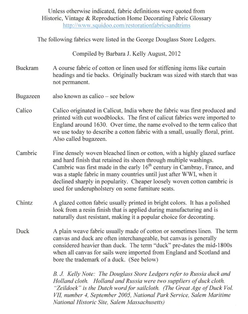
"foot notes on textiles"

General Information · 2012 August

Compiled by Barbara Kelly 2012 August notes taken from the George Douglass Store Ledger. Notes related to fabrics that were listed in the ledgers.

View record
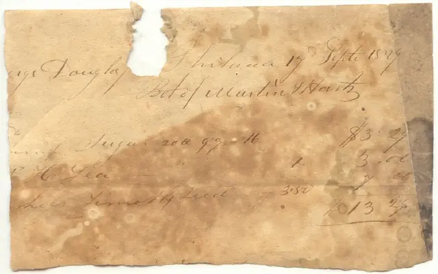
George Doughlass receipt
Archives 1006.01.029

"George Douglass (Jr.) Receipt"

George Douglass · 1829 September

Incomplete receipt on piece of parchment [Geo]rge Douglass (Jr.) Philadelphia 17 Sept[ember] 1829 Bot of Martin and (+) Hartz [?] Sugar 20 u[nits] [at or times] 16 $3.29 1 T Tea 1 3.00 [2 b]ahils (bails) Timothy Seed 3.50 7.00 $ 13.29

View record
Keim, Family History, Page #1 (1979)
Archives 1002.01.058

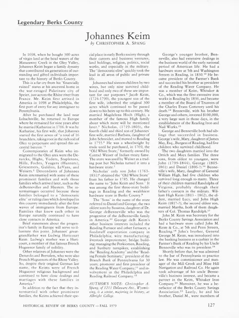
"Johannes Keim"--article on Keim history

Keim · Fall 1979

Three-page of article titled "Johannes Keim" by christopher A. Spang appearing in the Fall 1979 (Volume XLIV, No. 4) issue of "Historical Review of Berks County," a quarterly publication of the Historical Society of Berks County. Article gives a brief history of Johannes Keim (starting in 1698) and key descendants ending in the mid 19th century. Topics disccussed include various Keim business dealings, land holdings (including the Keim Farmstead), religious activities, and military service. See additional images or MULTIMEDIA LINKS for complete text.

View record
Muster Roll List - Page 1 of 3
Archives 1008.01.039

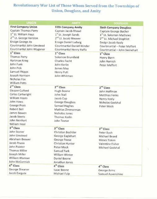
"Muster Roll"

General Information · 1986

A recreated Revolutionary War (Muster Rolls) List of Those Whom Served from the Townships of Union, Douglass, and Amity. The information was provided by the following citation. Citation (see note): Hollenbach, Raymond. Berks County Soldiers in the American Revolution. Berks County, PA: Berks County Genealogical Society, 1986. LCCN: 86157913 59, [29] p.: ill.; 22 cm. Includes index. Registers of births, etc.--Pennsylvania--Berks County. Soldiers--Pennsylvania--Berks County--Genealogy. Berks County (Pa.)--Genealogy. Pennsylvania--History--Revolution, 1775-1783-- Registers. United States--History--Revolution, 1775-1783--Registers.

View record
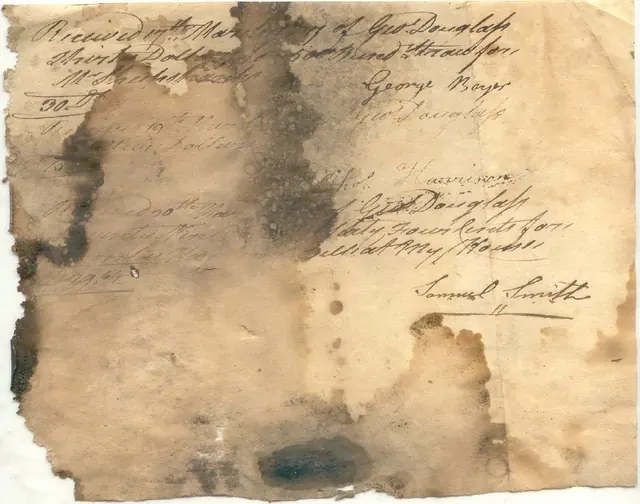
Receipt/Payment Received for George Douglass
Archives 1006.01.031

"Payment Received/Receipt"

George Douglass · 1827 March

Payment Received/Receipt: Three Dates: 17th March 1827, 19th March 1827, 30th March 1827 Signed off by George Boyer, Thomas Harrison, and Samual Smith on payments received by George Douglass for; Mr. Sheepshank and himself. "Received 17th March 1827 of George Douglass Thirty Dollars for 500 Bined Straw for Mr Sheepshank --------- 30 D George Boyer --------- Received 19th March 1827 of George Douglass Fifteen Dollars --------- 15 Tho[mas] Harrison --------- Received 30th March 1827 of George Douglass Twenty nine Dollars and sixty four cents for Thomas Harrison bill at my house ---------- D 29,64 Samual Smith" -----------

View record
No image
Archives 1000.01.122

"Plantations" in Early Pennsylvania

Mouns Jones

Plantations in Early Pennsylvania Within five years after settling on the banks of the Schuylkill River on their tracts north of the Manatawny Creek, Mouns Jones and his neighbors petitioned the Royal Governor in 1709 for a road for the convenient passage to and from their “plantations”, describing both their individually surveyed and “patented” farmlands and the agrarian settlement community they had “planted” there. The term was used in both senses in various contexts in early documents. In his 1681 “Account of the Province Of Pennsylvania In America”, William Penn explicitly and repeatedly used “plantations” [the “seeds of nations”] as a synonym for “Colonies” [e.g., the “Greeks planted many parts of Asia…” according to Penn]. Regarding his vast wooded Province, Penn was unequivocally describing the settled and occupied areas of the colony to which the First Purchasers had “transplanted” themselves, their families, and their cultural traditions. Penn’s First Purchasers were figuratively “taking root” in the lands and emerging communities they occupied. According to the journals of Evans, Bartram, and Weiser describing their 1743 journey from Bartram’s homestead SW of Philadelphia [formerly the site of Mouns Jones’ first “plantation”] through Tulpehocken to Onondaga, NY, the three journalists perceived a lack of development of “arts and sciences” by Natives in America before its “plantation by the whites...”, an unequivocal reference to the settlement and development of Penn’s expansive “Sylvania” by European immigrants. However, in the same set of narratives, Lewis Evans used “plantation” to designate agricultural land holdings, observing that “Tulpohoocking [sic] is settled by High Dutchers, who have fine plantations, raise great quantities of wheat”, milled to “very fine flour, which they bring in the spring and fall seventy or eighty miles to Philadelphia.” The 18th century wagon road from Tulpehocken to Philadelphia traversed north-central Berks County, joined the “Oaley” road near the Boone family’s land holdings and mill, passed the Black Horse and White Horse Taverns in Morlatton, then turned to the southeast through Perkiomen and Germantown to the bustling market hub of Philadelphia. The British noblemen appointed to supervise trade between England and the colonies, unofficially known as the “Lords of Trade”, were officially designated the “Committee of Trades and Plantations.” Although semantically ambiguous, the Lords’ jurisdiction related to commerce with all communities in Penn’s colony, not merely to the farmers living on and working their cleared and “planted” fields. The term “plantation” soon expressed a related but different meaning: a tract of land with a significant portion of its acreage seasonally “planted” with subsistence produce, barter goods, and cash crops. Amos Long has observed that “Large farmsteads were frequently referred to as a plantation on early legal descriptions and deeds.” The Annals of Swedes on the Delaware described the “manner in which a colony from Sweden was first planted here…”, a clear use of the term as denoting a communal immigrant settlement. The use of “Plantation” persisted in the riverside settlement, described as “Manatawny” in early documents, later becaming known as “Molatton”, then “Morlatton”, through the middle of the 18th century. A 1751 advertisement for the sale of the White Horse Tavern, then located in the riverfront house formerly occupied by Marcus Huling a short distance down-river from Mouns Jones house, included the Tavern-owner’s entire “plantation, which lies on the road by the Swedes”. It is apparent from contemporary sources that “plantation” conveyed two distinct meanings during the first century of settlement in Pennsylvania. Penn wrote that the first “planters” in these parts were the Dutch and soon after the Swedes and Finns”, both skilled and productive in “husbandry.” The term concurrently designated both the populated communities developing within Penn’s Province and the substantial family farmsteads spreading across the cleared tillable ranges of Penn’s vast rolling piedmont. L. Ward, 9/19/15

View record
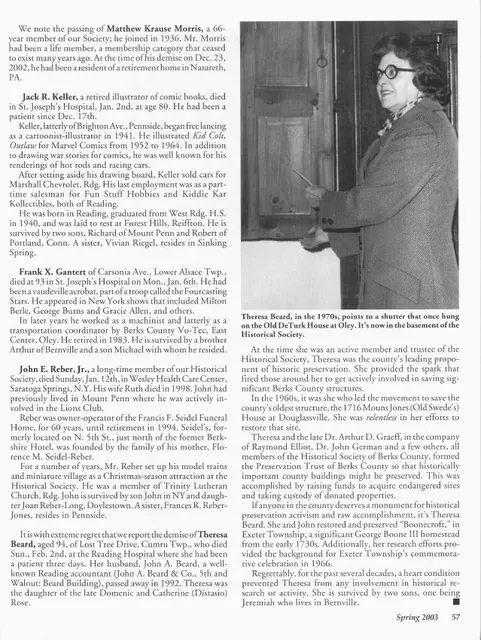
General Info, Theresa Beard's obituary (2003)
Archives 1008.01.002

"Random

General Information · Spring 2003

Six paragraphs of text appearing at the end of a column titled "Random Thoughts" written by George M. Meiser, IX and appearing on page 57 in the Spring 2003 (volume 68, number 2) issue of "Historical Review of Berks County," quarterly journal of the Historical Society of Berks County. Paragraphs document Theresa's involvement with historic preservation and serve as an obituary.

View record
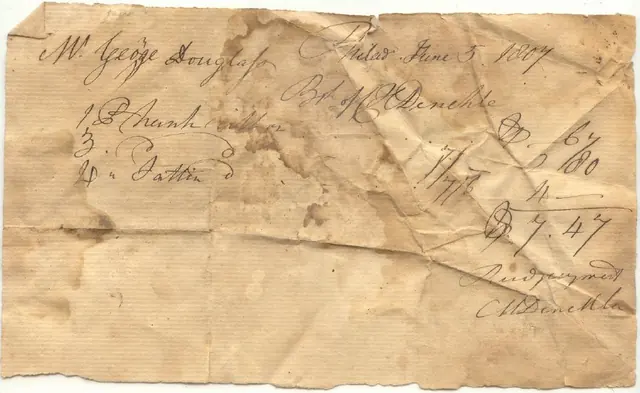
Receipt / Payment received George Douglass (Jr) from M Denekla
Archives 1006.01.032

"Receipt / Payment recevied'

George Douglass · 1807 June

Receipt / Payment received Mr. George Douglass bot of Mr M Denekle Location: Phildelphia Date: 3 June 1807 Philad[elphia] June 5 1807 Mr. George Douglass Bot (bought) of Mr. M Denekle 1 (symbol means "paid"?) trunk? mirror (paid symbol) ___67 3. ( paid symbol?) 7/7/6 2 80 4. sattin (satin?) (paid symbol) 4___ (paid symbol) 7.47 Received payment M Denekle

View record
1765 George Douglass House, NE perspective
Photos 1006.01.066

1765 George Douglass House, NE perspective

George Douglass

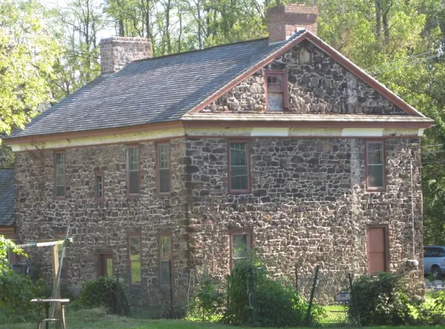
Northeast perspective view of the original 1765 house-block showing its principal features other than façade details: NE (back) eaves wall with asymmetrical fenestration based on differences in placement of interior elements (built-in closet ["Schrank"] in recess from chimney-plane of SE chamber on 2d floor, and kitchen fireplace and doorway passage on 1st floor); rubble stone construction of the secondary walling. The principal façade [not shown in this photo] facing “Old Philadelphia Pike” is of cut and dressed ashlar sandstone. Original plastered cove cornice; see pencil detail drawing of "Main Cornice" of Pottsgrove Mansion noting 3 ½" radial recess of plastered segment of cornice assembly from the cord between moldings above and below the arced plaster transition. Attached photos 5883, 5884, and 5886 show 17th century plastered cove cornices in England, which were quite possibly antecedent influences for similar cornice treatments in Germantown, north of early Philadelphia, and for Pottsgrove mansion, a few miles east of the Douglass house. Larry Ward

View record
Michael Fulp House, partial collapse & foundation restoration, #608
Photos 1005.01.057

18 photos of foundation and cellar wall restoration

Michael Fulp House · 2010

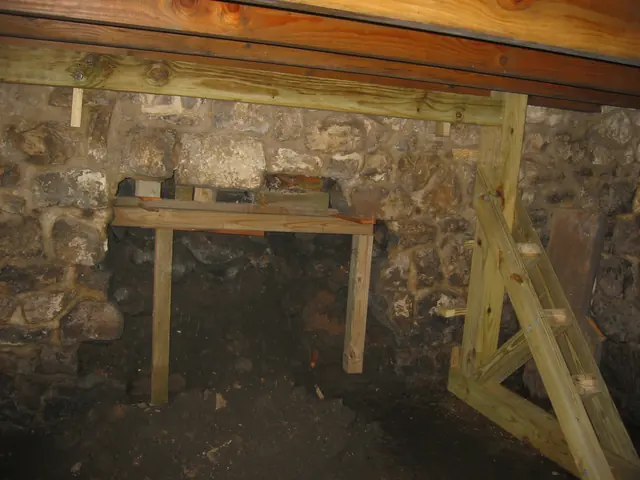
Series of 18 digital photographs depicting the September-October, 2010 reconstruction of the collapsed interior segment of the north gable foundation of the Michael Fulp [formerly "Bridge Keeper's"] House. This project also included the stabilization of the projecting exterior plinth in the sub-grade ranges forming the entire perimeter of the building. By 2008, after 225 years of exposure to numerous floods, soaking rain events, and absorbed snow-melts, augmented by a modest contribution from roof and ground run-off, the early lime mortar applied in the beds and joints throughout the foundation walling had become disintegrated and brittle ["friable"]. The relentless soak-freeze-thaw cycles caused the incremental dissolution of the lime binder from the mortar, producing an incoherent residue of sandy clay and coarse gravel rubble in the beds and joints between stone "units" of the walls [see photo #920 in this series, 11/13/10, and 4/7/11 photos #2873 & #2875 ]. Such residual material [see Image #920 and photo #2863, 4/7/11] provided a marginal bearing and bonding medium rather than establishing a stable and virtually "monolithic" integration of the foundation walls. Compromised mortar fails in the important function of distributing loads evenly throughout the wall. This function is an essential prerequisite to structural equilibrium and monolithic integrity in a masonry structure. Lacking a sound matrix of well-bondED mortar, stone walling depends on the tenuous stability afforded by its existing "in compression", a state "bound" only by gravity and lacking a binder between stones. This condition is barely more stable than a mortar-less ["dry-laid" or "stacked-stone"] wall, which survives only when all loads are borne in compression. The inevitable result from these incursions and their decomposing effects was the lateral and rotational displacement of foundation stones, allowing the injection of a muddy slurry and dislodged stones through the rubble core of the wall, propelled by hydrostatic(a) thrust into the cellar [see Image #669, 7/3/09]. By early 2009 the interior cavity created by the dislodged foundation materials extended 12-15 inches inside the interior plane of the wall [more than half its transverse width], and measured about 5 feet square in elevation. This gaping void had the appearance of a roughly delineated "fireplace" [photo #908]. (a) Technically, the movement of fluids under pressure becomes "hydraulic," usually operating in a closed system but roughly analogous here. The energy in the fluid current transports solids in its path until the lateral pressure is dissipated, which occurred in this situation when the foundation stones, "mortar" residue, and muddy slurry are thrust onto the cellar floor. All that remained standing of this wall segment was the exterior layer ["wythe"] of stones, containing little mortar of any significant bearing value [see image #236 , which shows the essentially mortar-less exterior facing, and photo #920 cited above]. Compounding the progressive degradation of this wall, and the impending catastrophic failure prevented by the shoring seen in photo #608, was the failure to deploy adequate "bond-stones" in the early foundation, partly because of the single-excavation technique discussed later in this record(b). Bond stones should be set at right or oblique angles to the planes of the wall and should be deployed to tie wall wythes together through the core of the wall. (b) Although inadequately utilized in the base-range of the foundation [below exterior grade], a limited number of relatively large stones were "toothed" into the above-grade wall segment under the first floor window [see Images #2869 & 2880, 4/7/11]. However, the loose ["friable"] rubble-core material of the wall, not a true bonding or bearing agent, severely limited the effect of these stone "ties," as evidenced by the two laterally-radiating settlement fractures extending from the window sill extremities down to grade. "Quoins" in the corner piers, alternating in "stretcher-header" alignment, are classic (and ancient) examples of bond-stones, and in this building they are substantial in size and well deployed. However, the early builders apparently considered the thickness of the wall between corners to be sufficiently massive to ensure a stable structure, without systematically installing bond stones in wall ranges between corner piers. The critical mass, thickness, adequacy of footing, and bonding quality of a stone wall are essential components of compressive stability. Equally important is well-formulated mortar, compounded to bear the stone mass and timber loads, to provide a "shock-absorbing" medium between stones, and to allow moisture to evaporate out through the joints. To be an effective load-distributor and stress-attenuator, mortar must be fully "mudded-in", filling all beds, joints, and voids with a firm but resilient and marginally adhesive "padding" for the stone "units". Two indispensable attributes of "random rubble" masonry walling in stable compression are vertically aligned ["plumb"] wall wythes and structurally coherent central cores. A wall of variable thickness and an out-of-plumb alignment produces a diminished margin of error in fulfilling its load-bearing function in stable "compression." Such defects impede the effective transmission of the incumbent loads through the foundation masonry to the clay bearing-plane supporting the base-blocks of the building. A corollary of this principle explains the uniform settlement of the whole structure without significant displacement of stone units or de-stabilizing fractures in the mortar network of the walls. Such monolithic settlement apparently occurred in the cases of the federal-era additions to the George Douglass mansion and the White Horse Inn [see records GDHPH…. and WHT…] Although more critical in eaves walls, which must counteract and effectively neutralize roof loads and thrust, any masonry wall should be constructed to transmit its incumbent stresses, including its own mass, "to ground" by confining the forces acting within it to the wall core [in general, the vertical rubble masonry mass sandwiched between "wythes"]. To remain stable, this vertical force-path must be confined within the "central third" of the thickness of the wall. Rubble masonry walling was never designed to provide stability against oblique or shearing loads. Good mortar functions at a high mechanical level in bearing compressive forces, but offers little frictional or structural resistance to lateral or oblique thrusts and loads. Photo #1883, 12/17/10 shows the south gable wall of the Fulp house during re-construction. The mason deployed bond stones transverse to the run of the wall, and laid a densely packed rubble core. The purpose of analyzing the construction techniques and mortar failure in a building whose foundation walls had survived for over two centuries is not to question the skills or practical structural techniques of the early builders. Rather, the benefit of determining the factors leading to threatened, partial, or total failure is to ensure that appropriate structural principles and traditional craft methods are fused to produce a sound remediation plan and an effective and lasting stabilization program. The restoration and reconstruction efforts of preservationists and the craftsmen they employ adhere as closely as possible to the materials and methods of the early builders, allowing for the introduction of modern materials, such as metal ties deployed in the bed mortar and lag-screws securing window frames to the adjacent wall ranges, to provide an inconspicuous but redundant mechanical advantage designed to extend the structural life-expectancy of the restored building and its components. The unstable condition of the foundations under the Fulp house was due in part to the original construction method, which consisted of laying-up the wall stones directly onto the bearing soils from inside the cellar{p} excavation rather than from both sides of the wall. This method precluded any opportunity to establish a plumb and well-pointed exterior wall-plane. The outer segments of the foundation were built-up by pushing stones against the vertical soil-bank forming the perimeter of the excavation. Some stones protruded into the soil and others didn't extend to the bank, leaving others cantilevered and only partially supported. This method was more economical, saving excavation and back-fill time, but it also precluded the opportunity to fully apply mortar by "deep-pointing" the exterior joints and beds of the foundation [see photo #236, showing voids in the exterior segment of the foundation]. The result was a foundation with a very irregular exterior contour, lacking any semblance of a common plane or sound bearing core. It is only because of the solid footings provided by the thicker plinth of the foundation walls and the well-executed "quoin" corner piers that these elements of Michael Fulp's modest house survived intact for nearly 185 years. {p} this method was employed only in the southern half of the foundation, where the cellar cavity exists, but obviously not in the northern half of the house, where only a crawl space exists below the first floor. The mortar applied from the inside the cellar excavation to the core of the wall [by "deep-" or "back"-pointing] didn't reach the exterior voids in the wall as face-joint pointing would. This reduction in the mass of mortar in the wall system allows more water penetration and eventually is unable to resist the lateral movement of stones and soils driven into the cellar by hydrostatic pressure. See archive record MFR10PH3--1005.01.059 for photos and discussion of the protective measures applied to the exterior foundation masonry to block and discharge such infiltration, and record MFR10FN2--1005.01.058 regarding the drainage system installed to rapidly reduce the hydrostatic pressure acting against the wall from the tons of water and mud surrounding the building below grade. Part of the remediation of the progressively under-functioning masonry in this building included the insertion of smaller stones ["pins," "plugs," and "chinks"] in beds, joints, and voids which were too large to be filled by mortar alone. Well-formulated mortar is the ideal "padding" and load-distributor in a random-rubble masonry wall, but should not be relied on as the primary bearing material. This function is better served by stone "units," integrated by bond-stones skillfully deployed in laying-up the wall. A loose aggregation of smaller stones, not well chosen for their size, shape, and potential bearing contribution, transfers the incremental stresses in the structure to other segments, potentially subjecting those components to strains beyond their capacity. As an example, photo #2882, 4/7/11 shows a large aggregate of small stones bound together by mortar, but otherwise not integrated into the foundation. In the course of the current restoration project the outermost stonework of the entire foundation of the building has been stabilized and reinforced with stones inserted into voids where possible, and packed fully with mortar pointed flush to the undulating contours of the face-stones ["barn-dash" pointing], and pargeted. Although redundant so long as the wall is in compression, this additional bedding and pointing mortar [more than ten tons in the entire project] will provide a significant increment of structural stability for many decades. The full foundation restoration process consisted of: (1) dismantling and re-laying the unstable segments of the interior wall (2) bonding the reconstructed foundation with longer stones "toothed" transversely through the wall (3) packing carefully formulated mortar and small stone into all joints and voids ("deep-pointing" and "back-pointing") (4) re-pointing the exterior wythe from an exterior excavation to provide a "flush" pointed contour to receive the mortar pargeting coat; (5) pargeting the exterior sub-grade exterior surface with the same mix as the bed mortar{2} [see photo #1158, 10/7/09 showing a "scratch coat"(n) of mortar on a portion of the repaired stonework; the balance of the rebuilt sub-grade foundation will be similarly pargeted, followed by (6) a "finish coat" of mortar of varying thickness to produce a contoured wall-plane more closely approximating a "plumb" alignment. (n) incised ["scratched"] with the trowel point to create "keys" which will be filled in with the finish pargeting, or plaster, to bond the two rendered applications together. This wall reconstruction process was followed by the application of two coats of a "green" water-based, rubberized liquid waterproofing ["Eco-Flex"] and a flexible "dimpled" drain board sheet material ["Delta Drain"] covered by an adhering high-grade "geo-textile" filter fabric. The latter two materials serve a more critical function than merely providing a moisture barrier. The drainage plane between the fabric and the impervious sheet material against the parge-coat allows some of the water absorbed in the soil to filter more quickly downward through the fabric fibers and open spaces between the drain board "dimples." This released water percolates into the stone drainage bed, is collected in the perforated piping and then discharged to a remote outlet through a solid pipe. This system dissipates a significant component of the hydrostatic pressure acting on the foundation, reducing both the magnitude of the lateral force and the volume of water attacking the foundation mortar and stonework and drains the foundation perimeter exponentially faster than natural percolation through the top-soil(c). These two significant benefits will substantially decelerate the relentless process which has degraded, and ultimately destabilized, this foundation for decades. (c) After the minor flood [river rose to second step of this building and flooded its cellar to a depth of about 18 inches] of March, 2011, and again in the flood of September, 2011 which reached the top of the Fulp window openings, several thousand gallons of ground water were drained away from the foundation through this system within a few days after the flood-crest. The portions of the sub-grade foundation flanking the central range remained marginally more stable, partly because of the buttressing and tying effect of the quoin corner piers and intersecting eaves wall foundations [see photos #1238 & #1241, 10/11/10, which show the slightly displaced but relatively stable east and west ranges of the foundation of the north gable wall]. Although relatively stable, the foundation segments flanking the rebuilt central section and extending to the corners were reinforced by raking out the loose mortar joints, packing mortar into the beds between stones ["deep-pointing"], and re-pointing the exterior joints. This "deep-pointing" process was followed by application of the "cementitious" pargeting material specified on the project engineering drawings [see MFR10DWG1--1005.01.055]. The "rendered" layers will then be covered with the drain board and fabric as described above. These foundations had survived for over two centuries because of the massive dimensions of the masonry wall system and a high quality local inventory of fieldstone highly suited to durable "rubble" construction(p). Nevertheless the walls were in peril of a catastrophic event as the more unstable segments began disintegrating. The 2010 restoration substantially reduced the risk of such an event. See archive record MFR10PH3--1005.01.059 for further discussion of the restoration of various foundation segments. (p) The stone types in the building will be listed in this record when the geological analysis is completed. FOOTNOTES {1} This building manifests both the effectiveness of this type of masonry and its deficiencies when imperfectly executed, as is apparent in the lack of "bond-stones" and deficient mortaring, both of which components are critical to creating a structurally sound and durable masonry wall. {2} On the advice of the project engineer the ratio of aggregate [primarily sand] to binders [cement and lime] was not less than 2 to 1, and not more than 3 to 1, thus neither too strong nor too weak, i.e. too hard or too soft. Hard mortar traps moisture in the beds and joints, subjecting the structure to damage from freezing and protracted dissolution of the mortar. See photo record MFR10PH4--1005.01.060 regarding the process of sampling and selecting mortar for function, texture, color, and compatibility with the stones composing the building. The mortar recipes used in this project consisted of sufficient water to "hydrate" the lime to the optimum consistency ["viscosity"], plus: A. For the restoration of cellar walls and foundations: 5 parts New Jersey "Yellow Bar" sand; 2 parts white lime; and ½ part gray Portland cement B. For above grade stonework beds and inner joints: 4 parts BP New Jersey Buff sand; 2 parts BP Masons White sand; 2 parts white lime; and 1 part gray Portland cement C. For pointing above-grade exterior joints: 4 parts BP Masons White sand; 2 parts BP New Jersey Buff sand; 3 parts white lime; and ½ part gray Portland cement. {3} In the original construction and periodic "restorations," most wall ranges were not "bonded" with larger stones keyed ["toothed"] through the core of the wall [the chimney and "quoin" corners are exceptions, indicating a conscious decisions to employ bond-stones only for specific "necessary" functions]. Further, many vertical mortar joints were set too close together, creating long potential failure-paths. These "fault-lines" would be impeded by more massive stones which would compress and "break" the otherwise uninterrupted series of joints susceptible to transmission of radiating fractures. Larry Ward

View record
1814 General election returns for Amity Township from White Horse Tavern
Archives 1007.01.002

1814 general election returns for Amity Township

White Horse Tavern · October 11, 1814

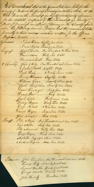
1814 Handwritten report of general election returns for the County of Berks voting district composed of Amity Township and parts of Douglass and Union Townships. Polling was conducted at the White Horse Tavern. Offices open for election were Governor, Congress, Assembly, Sheriffs, Coroners, Commissioners & Auditors. Each candidate is listed along with the number of votes he received. Document signed by witnessing judges. In 1789 Berks County had been divided into 5 Election Districts; electors in the 5th District [Amity, Colebrookdale, Douglass, Earl, and Union] were directed to vote “at the public house of William Witman-called the White Horse” [Montgomery, "History of Berks County" (1886), page 475]. By 1814, undoubtedly because of population growth and long travel times from the perimeter of the vast 1789 District, its area had been reduced considerably to the Amity and the adjacent portions of Union and Douglass Townships. See additional image or MULTIMEDIA LINKS for view of reverse side.

View record
41: Drawing by Barry Stover
Archives 1000.01.135

1957 HABS drawing of Mouns Jones “Ruins”

Mouns Jones

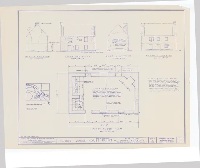
Plans and elevations on this sheet show the c. 1956-57 loss of the roof and some stonework. The plan also indicates the original locations of the approximately central river-side doorway and the board partition separating the hall/kitchen from the parlor with the corner fireplace. Drawings by Barry Stover.

View record
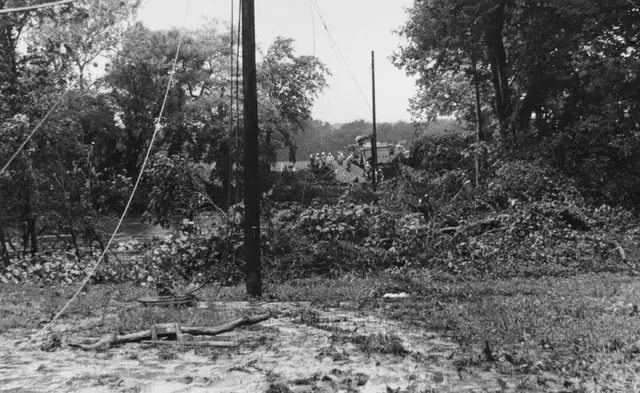
Morlatton Village, flood aftermath (c.1972)
Photos 1003.01.047

1972 flood aftermath

Morlatton · c.1972

Black & white photographic print showing what is assumed to be aftermath of flooding from hurricane Agnes in 1972. Image depicts Metropolitan-Edison workers reparing the electric line that travels across the Schuylkill River. Area seen is from the Mouns Jones House looking toward the river. Note written in blue pen on verso reads "MET-ED REPAIRING ELECTRIC LINE ACROSS RIVER FROM MOUNS JONES HOUSE. POLE IN FRONT ON MOUNS JONE PROPERTY"

View record
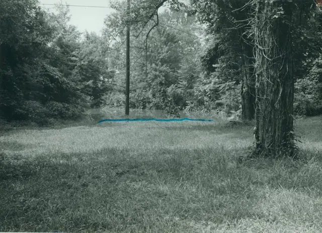
Morlatton village, flood aftermath (c.1972)
Photos 1003.01.048

1972 flood aftermath

Morlatton · c.1972

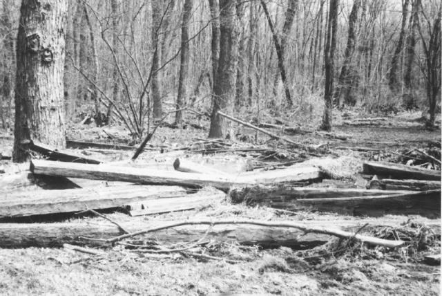
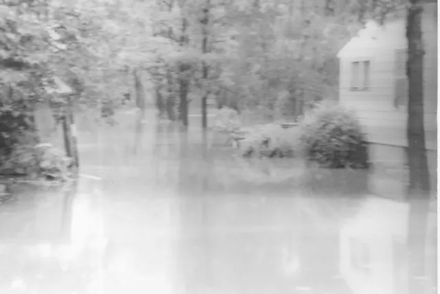
Black & white photographic print showing what is assumed to be aftermath of flooding from hurricane Agnes in 1972. Image depicts an unknown area within 50 yards of the Mouns Jones House. See additional image for note written in blue pen on verso.

View record
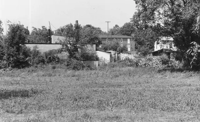
General, 1972 flood picture showing view of creamery
Photos 1008.01.004

1972 flood aftermath

General Information · 1972

Black & white photographic print showing aftermath of flooding from hurricane Agnes in 1972. Image depicts area along Old Philadelphia Pike near the Schurr Creamery. Note written in black pen on verso reads, "Flood Picture 1972" Note written in red pen on verso reads, "Schurr Creamery" See MVPH4 thru MVPH24--1003.01.009 thru 1003.01.029 for additional images related to hurricane Agnes flooding.

View record
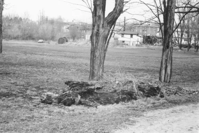
Morlatton vllage, aftermath of 1972 flood
Photos 1003.01.013

1972 flood aftermath around Moraltton Village

Morlatton · 1972

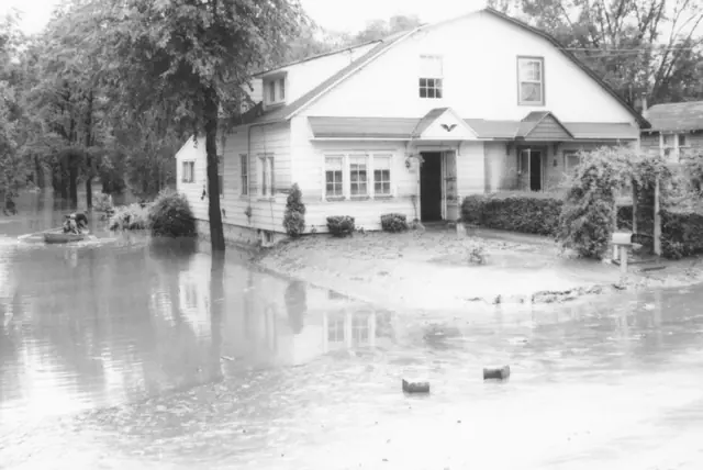
Black & white photographic print showing aftermath of flooding from hurricane Agnes in 1972. Image depicts area west??? of Mouns Jones Lane. See MVPH4 thru MVPH24--1003.01.009 thru 1003.01.029 for additional images of hurricane Agnes flooding.

View record
Moraltton Village, aftermath of 1972 flood
Photos 1003.01.014

1972 flood aftermath around Moraltton Village

Morlatton · 1972

Black & white photographic print showing aftermath of flooding from hurricane Agnes in 1972. Image depicts area surrounding Mouns Jones House. Note written in blue pen on verso reads, "MOUNS JONE LAND AFTERMATH OF A FLOOD 1972" See MVPH4 thru MVPH24--1003.01.009 thru 1003.01.029 for additional images of hurricane Agnes flooding.

View record
Moraltton village, aftermath of a 1972 flood
Photos 1003.01.015

1972 flood aftermath around Moraltton Village

Morlatton · 1972

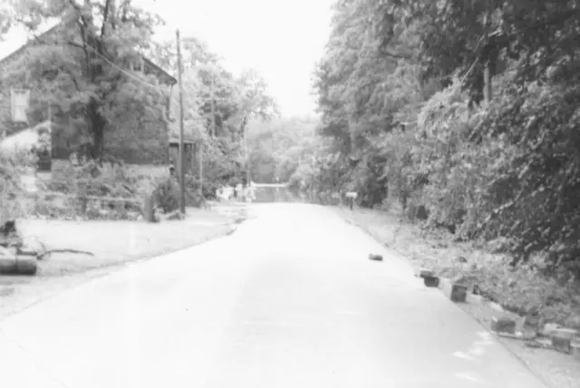
Black & white photographic print showing aftermath of flooding from hurricane Agnes in 1972. Image depicts area along Old Philadelphia Pike. White horse Inn can be seen in background (left of photo)???? Note written in blue pen on verso reads, "AFTERMATH OF A 1972 FLOOD SHOWING GALLON CANS ALONG ROAD" See MVPH4 thru MVPH24--1003.01.009 thru 1003.01.029 for additional images of hurricane Agnes flooding.

View record
Morlatton Village, aftermath of a 1972 flood
Photos 1003.01.016

1972 flood aftermath around Moraltton Village

Morlatton · 1972

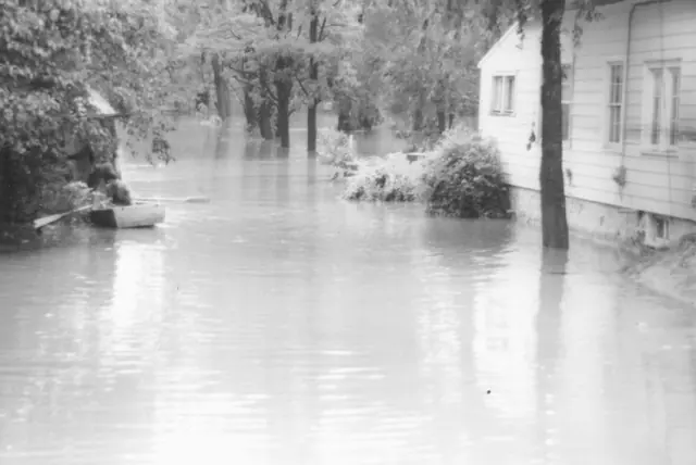
Black & white photographic print showing aftermath of flooding from hurricane Agnes in 1972. Image depicts area along Mouns Jones Lane looking toward Mouns Jones House from George Douglass House. Note written in blue pen on verso reads, "FLOOD LOOKING DOWN MOUNS JONES LANE" See MVPH4 thru MVPH24--1003.01.009 thru 1003.01.029 for additional images of hurricane Agnes flooding.

View record
Morlatton Village, aftermath of a 1972 flood
Photos 1003.01.017

1972 flood aftermath around Moraltton Village

Morlatton · 1972

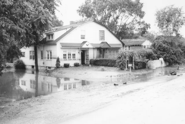
Black & white photographic print showing aftermath of flooding from hurricane Agnes in 1972. Image depicts corner area of Mouns Jones Lane looking toward Mouns Jones House from George Douglass House. Note written in blue pen on verso reads, "CORNER MOUNS JONES LANE NOTICE REFLECTION IN WATER HOME OF MR. & MRS. HUMMEL" See MVPH4 thru MVPH24--1003.01.009 thru 1003.01.029 for additional images of hurricane Agnes flooding.

View record
Morlatton Village, aftermath of 1972 flood
Photos 1003.01.018

1972 flood aftermath around Moraltton Village

Morlatton · 1972

Black & white photographic print showing aftermath of flooding from hurricane Agnes in 1972. Image depicts corner area of Mouns Jones Lane looking toward Mouns Jones House from George Douglass House. Note written in blue pen on verso reads, "CORNER OF MOUNS JONES LANE AFTER FLOOD" See MVPH4 thru MVPH24--1003.01.009 thru 1003.01.029 for additional images of hurricane Agnes flooding.

View record
Morlatton Village, aftermath of 1972 flood
Photos 1003.01.019

1972 flood aftermath around Moraltton Village

Morlatton · 1972

Black & white photographic print showing aftermath of flooding from hurricane Agnes in 1972. Image depicts area of Mouns Jones Lane looking toward Mouns Jones House from George Douglass House. See MVPH4 thru MVPH24--1003.01.009 thru 1003.01.029 for additional images of hurricane Agnes flooding.

View record