
![Exterior of northwest portal [Union Township side], image#8 (1936)](https://ihfmesrtggjwnhkkettk.supabase.co/storage/v1/object/public/archive-public/hptbc/images/003/100301002-8.JPG)
Description
Series of 9 images showing various views of the covered bridge at Morlatton Village.
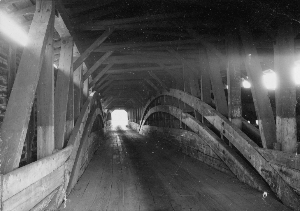
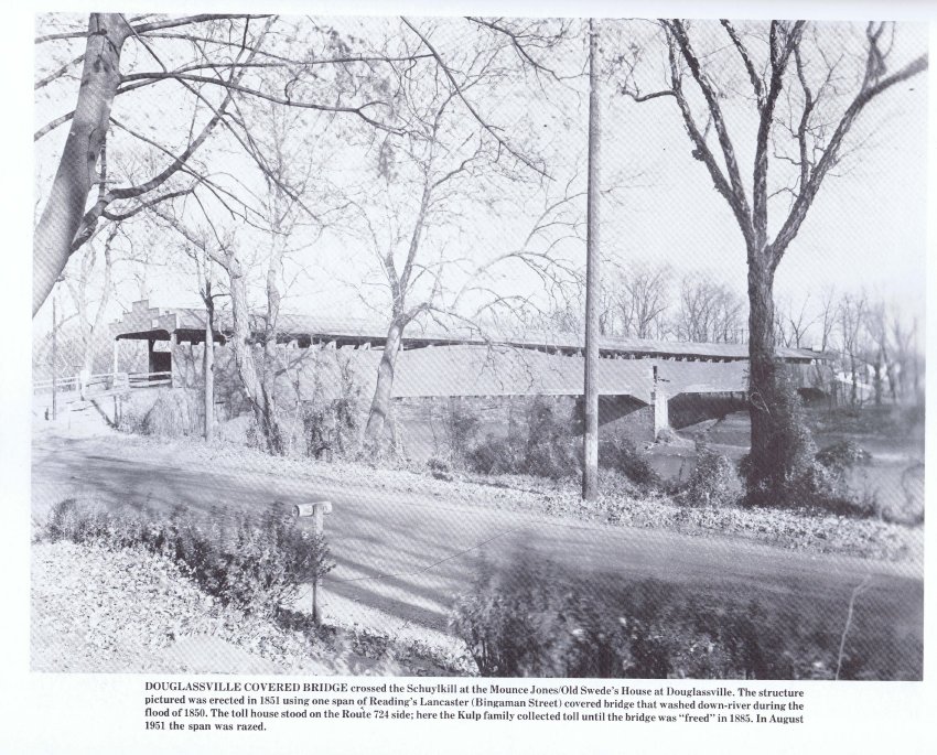
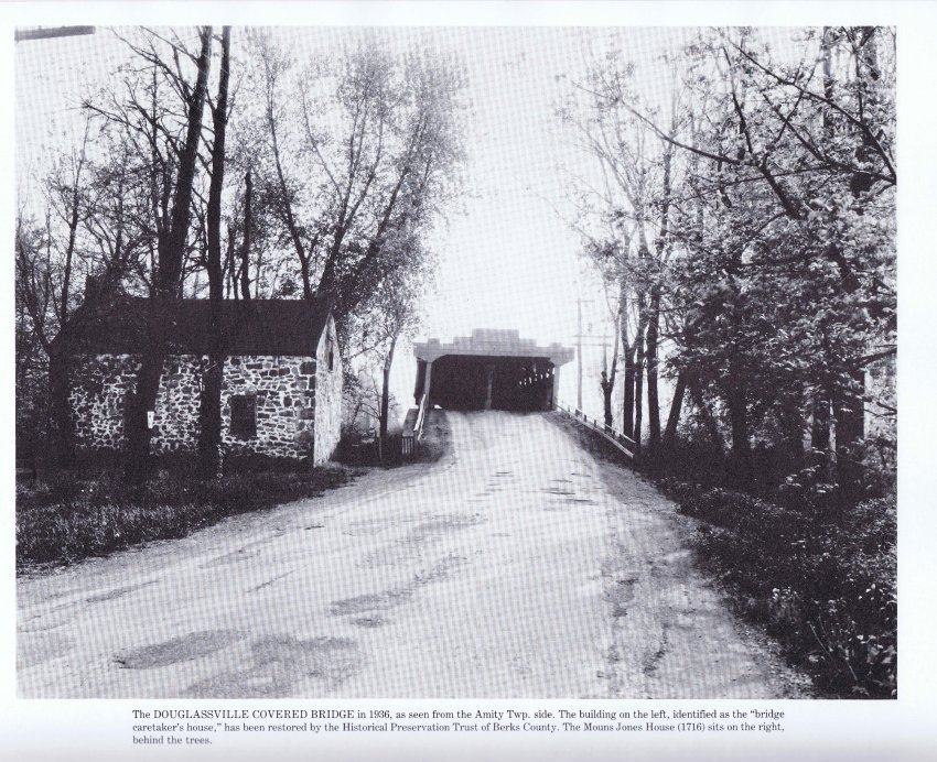
Image #1: Interior black and white photograph of one lane of the “double-barrel” covered bridge crossing Schuylkill river from Morlatton Village, Douglassville, Berks County to Union Township, Berks County. This bridge was constructed c.1832-33 and appears in this location on the hand-colored map of Amity [and a portion of Union] Township on page 27 of the “Atlas of Berks County” published in Reading in 1876, and in Bridgens’ Berks County Atlas of 1862. Both of these Atlas maps designate the Kulp house, on the Union Township side of the river, as the “Toll House."
Blue ink note on verso of Image #1 reads:
”Douglassville, Pa Covered Bridge demolished in 1951’s [sic] 2 LANE BRIDGE”
Note originally read ”... demolished in 1950’s...” but someone wrote a number one over the original zero.
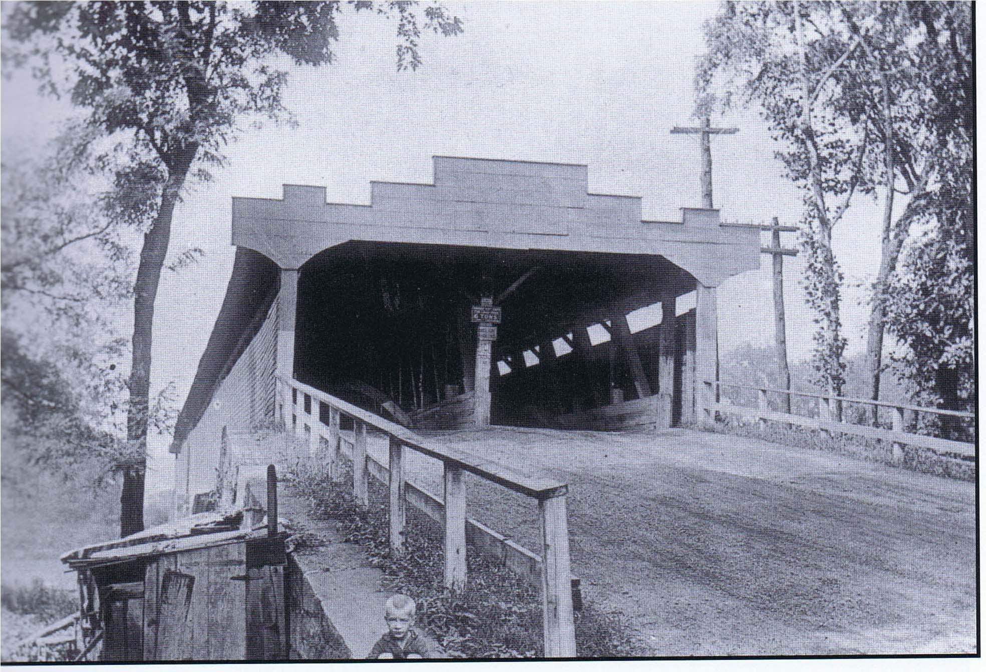
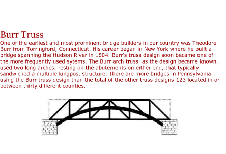
Image #2 in this record is a halftone print of a 1926 photograph from the collection of Bill Cauff, Jr. published, with accompanying text, at page 1 of “Covered Bridges of Reading and Berks County” by Benjamin L. Bernhart, Reading, PA (2000). The longitudinal arches barely visible in this image constituted the tension-members of the “Burr arch” truss{1} which was composed of a pair of long arches on each side of the bridge’s divided two-lane interior, king posts between two parallel beams [a top plate and a bottom plate (“sill”)], and angled braces. The function of this composite form of truss was to carry the massive weight of the bridge’s two spans between stone piers and to attenuate and neutralize the dynamic [“live”] loads imposed by wheeled and foot traffic along the planked bridge floor.
Image #3 is a perspective view of the bridge, also from a halftone from a photo in the collection of Bill Cauff, Jr., showing a worker beginning to remove the roof from the bridge on August 16, 1951. This photo is reproduced on page 2 of the Covered Bridge book by Benjamin Bernhart cited above.
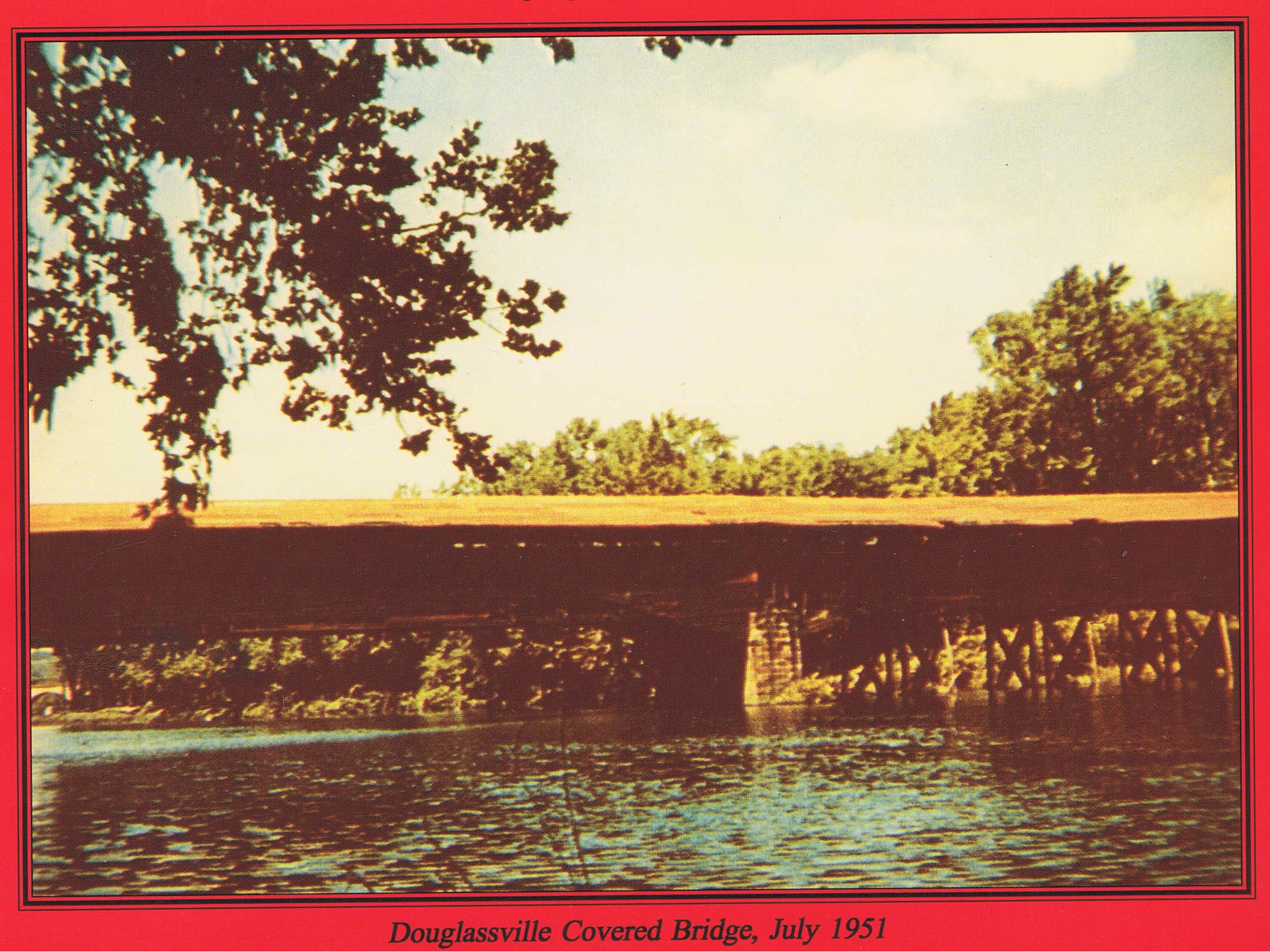
Image #4 is a colored photo entitled “Douglassville Covered Bridge, July 1951” reproduced on the rear cover of the same publication, showing the massive stone piers supporting the bridge, including replaced segments, for nearly a century and a quarter{2}.
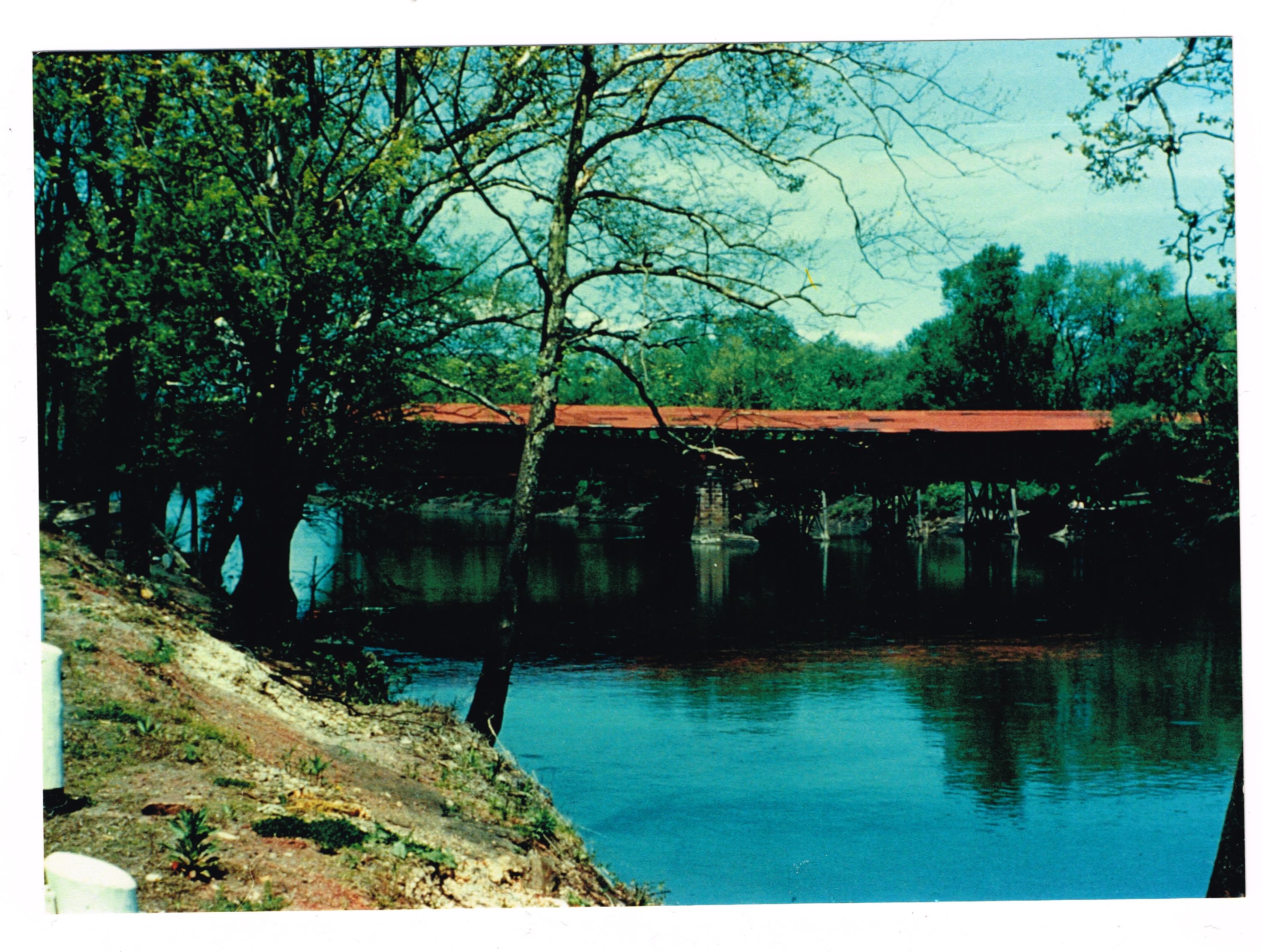
Image #9 is included in this record with the generous permission of The Theodore Burr Covered Bridge Society of Pennsylvania, Inc. According to Board minutes, the Historic Preservation trust of Berks County took an early interest in the Society, becoming a member in 1964. The Douglassville Bridge consisted of four pairs of Burr arch trusses supported by three transverse stone abutment piers
Image #10 is a c.1950 photo from the Union Township bank of the river, looking north. Taken by Mildred Care, who resided near the bridge on the Union Township side of the River, and published here with the generous permission of the photographer’s daughter, Janice McCrudden of Amity Township. The bridge had been closed to vehicle traffic. Note the steel truss supports under the Amity Township [right] half of the bridge.
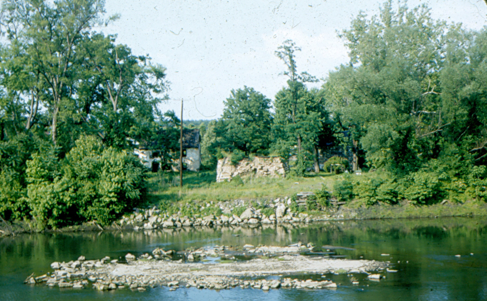
Image #11 is a digital image from a photograph by Harry Franklin Stauffer of Farmersville, Lancaster County, PA, taken June 5, 1955 and captioned “SWEDES FORD-DOUGLASVILLE-BERKS CO-6-5-1955”. The white pargeted [“stuccoed”] building to the left is the Mouns Jones House. A corner of the Michael Fulp [formerly “Bridge keeper’s”] house is barely visible to the right of the stone formation in the center of the photograph, which is the eastern abutment pier (removed c. 1967) for the c. 1832 covered bridge that was removed c. 1952. Stauffer took the photograph when the river was very shallow, probably close to the traditional low-water mark of 12 inches at this ford-site. The stone debris in the middle of the river channel are footing remnants for the middle pier (of three). This structure is visible above the river surface only during near-drought conditions. This pier was the support structure midway across the two-chord Burr arch bridge, as is visible in images #3, #4, #6 & #10.
Stauffer’s designation “Swede’s Ford” is incorrect; Swede’s Ford is 10-12 miles down river and the Ford at the Morlatton Village site was called “White Horse” Ford as early as 1770, on a map [Scull] of the region, presumably because of the nearby White Horse Tavern [“Inn”]; see archive record WHTTX4--1007.01.032 on the possible origin of the “White Horse” place-name and trade sign icon.
FOOTNOTES
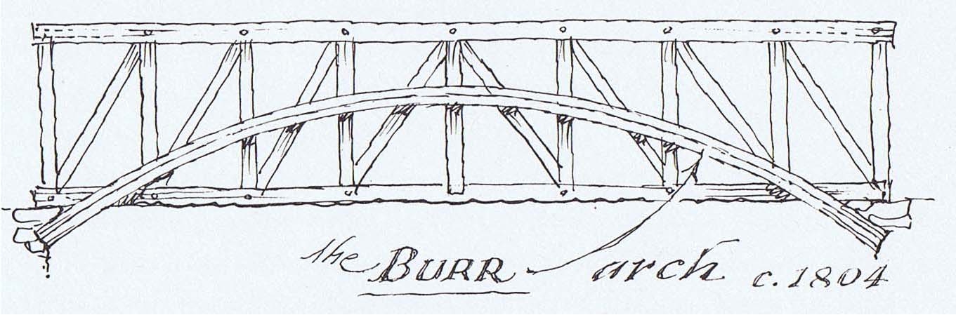
{1} Conceived c.1804 and patented by Theodore Burr in 1817 [see image #5, an elevation sketch drawing by Eric Sloane published on page 93 of his “I Remember America”].
{2} 19th-century industrial ingenuity embraced modern-style recycling on a large scale: according to research published in the Bernhart book cited above, the 1850 flood [earlier, “freshet”; see archive record MVPH47--1003.01.052 for a more detailed flood history for this range of the Schuylkill River] severely damaged the Morlatton/Douglassville bridge. A large section from Reading’s Bingaman Street bridge was conveniently transported by the torrent past Douglassville and came to rest northwest of Pottstown, virtually intact. It was salvaged for use in reconstructing the damaged sections of the Douglassville span.
Catalog details
- Catalog number
- 1003.01.002
- Alternate number
- MVPH1
- Accession number
- 1003.01
- Date
- c.1940-1950
- Creator
- Unknown (Image#1) & Cauff, William (Images #2 through #4) Stauffer, Harry Frankl
- Object name
- Print, Photographic
- Record type
- Standard
- Classification
- Documentary Artifact