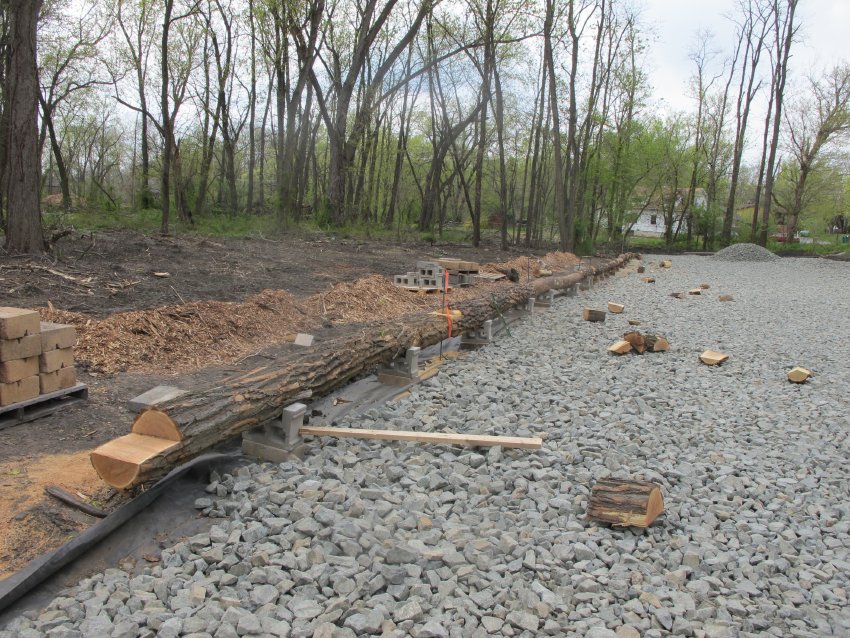
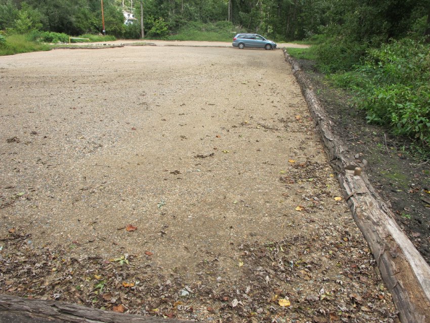
![#10, 9362: bedded-in area #1 ["White Horse Lot"]](https://ihfmesrtggjwnhkkettk.supabase.co/storage/v1/object/public/archive-public/hptbc/images/005/100801024-10.JPG)
![#23, Plan of parking area 1 ["White Horse lot"]](https://ihfmesrtggjwnhkkettk.supabase.co/storage/v1/object/public/archive-public/hptbc/images/006/100801024-23.JPG)
![#24, Plan of parking areas 2 & 3 ["Swede's Lane lots"]](https://ihfmesrtggjwnhkkettk.supabase.co/storage/v1/object/public/archive-public/hptbc/images/006/100801024-24.JPG)
Description
Series of 29 digital images (photographs, plans, and field notes drawings) depicting the design and construction of three parking areas located within Old Morlatton Village, Amity Township, Berks County, PA.
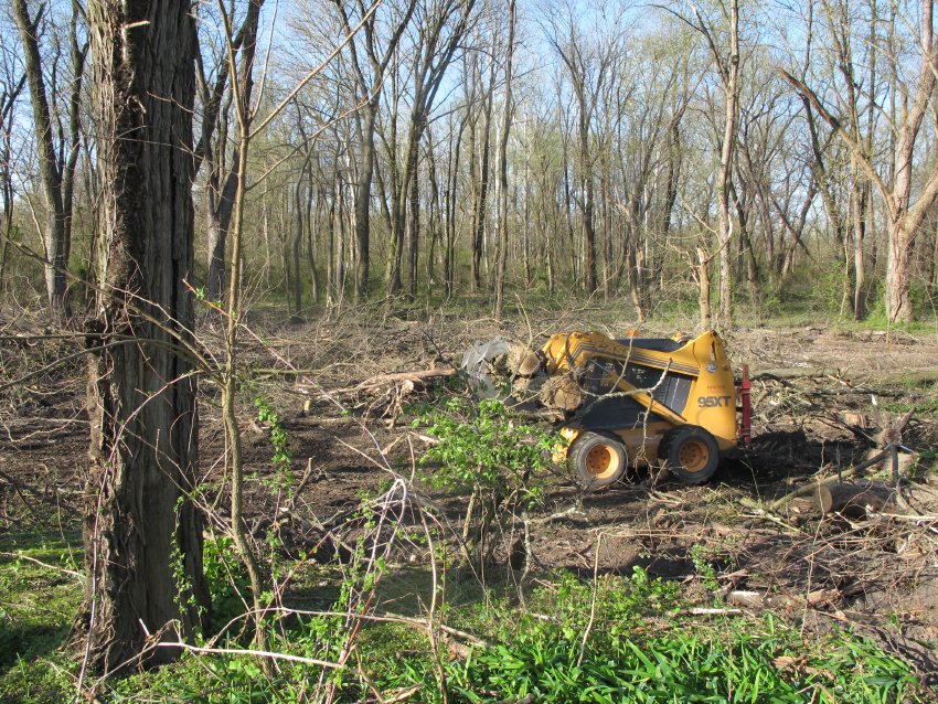
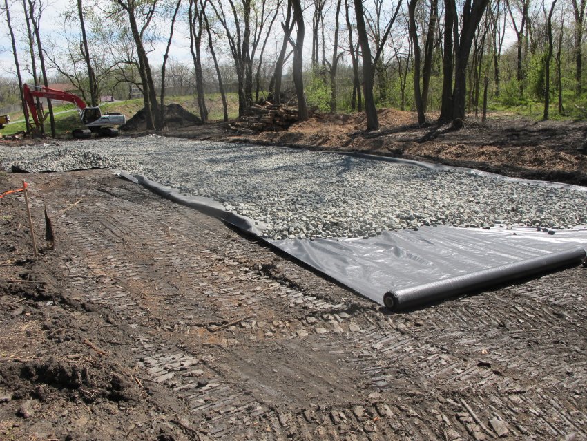
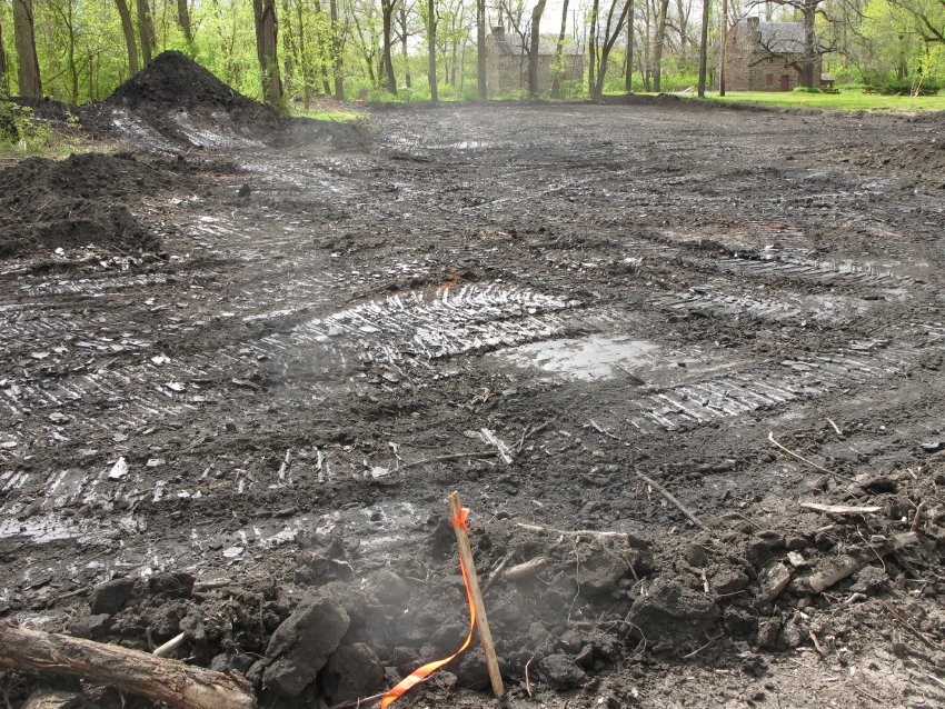
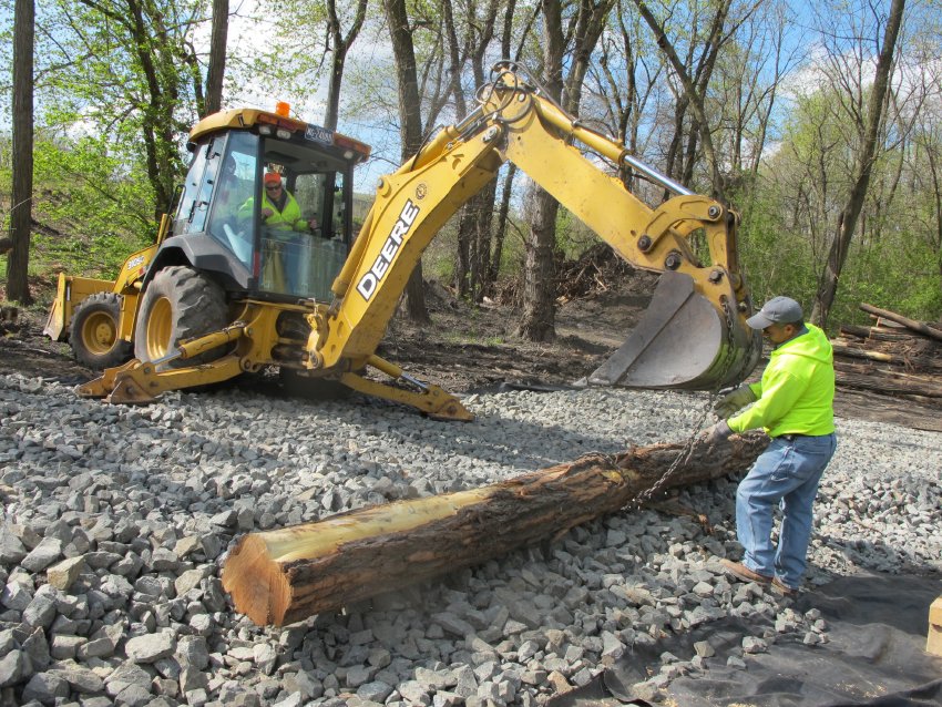
Work began on the Morlatton Village Parking area project in late March, 2012 with tree-felling, grubbing-out roots and thatch, excavation to a depth of 12 inches below existing grade to remove unstable bearing material [root-thatched, coal-silted, and low-viscosity loam], and bucking logs to specified lengths for sorting by diameters for use as perimeter barriers [Image #1, 7896, 3/27/12; [Image #2, 8012, 4/4/12; and Image #3, 8127, 4/12/12].
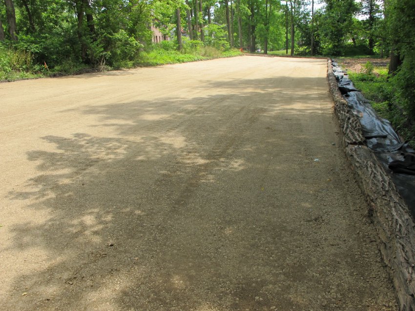
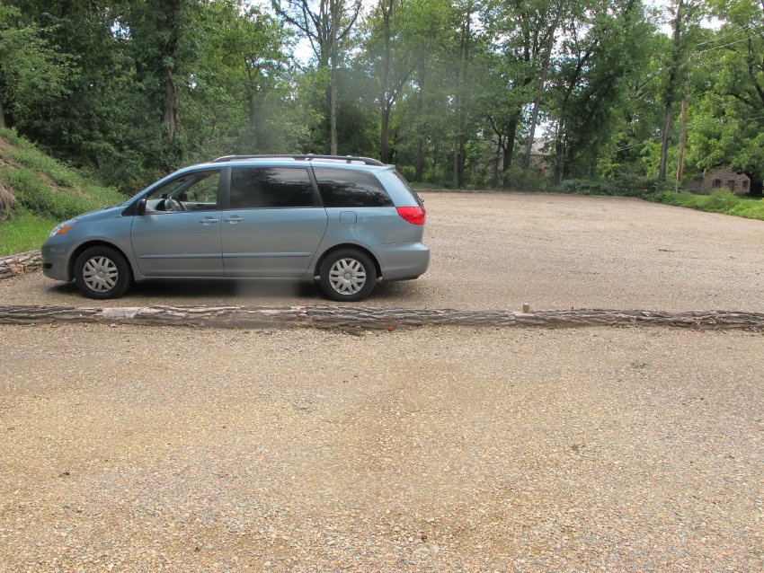
Phase 1, located west of Old Philadelphia Pike across from the White Horse Inn and George Douglass structures, was completed and in use in late June [Image #4, 8773, 6/8/12].
Phases 2 and 3, located in the wooded setting of the lower village along Swede Lane, were constructed in the same sequence as Phase I, completed in mid-August, 2012, and in service for the September 28 Historic Heritage tour [Image #5, 9836, 8/20/12] and for recreational use by Thun Trail users and other visitors to the historic site.
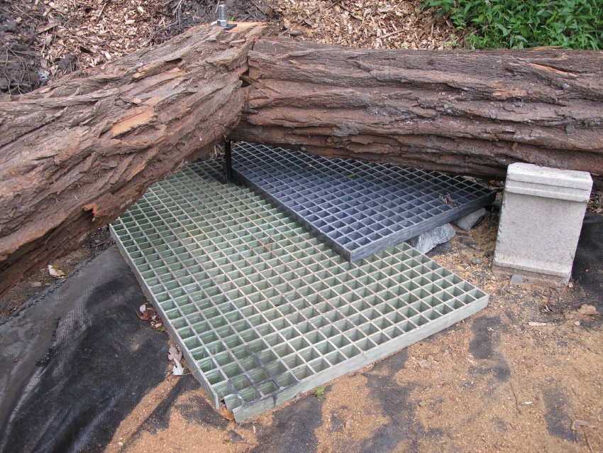
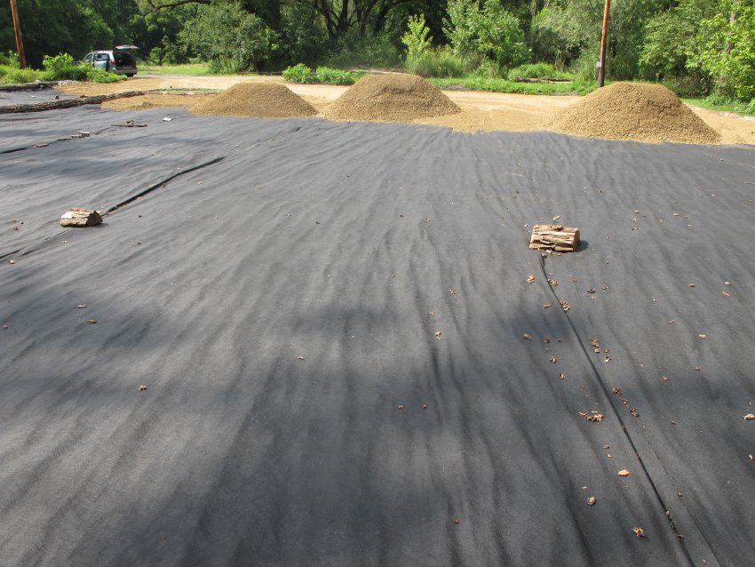
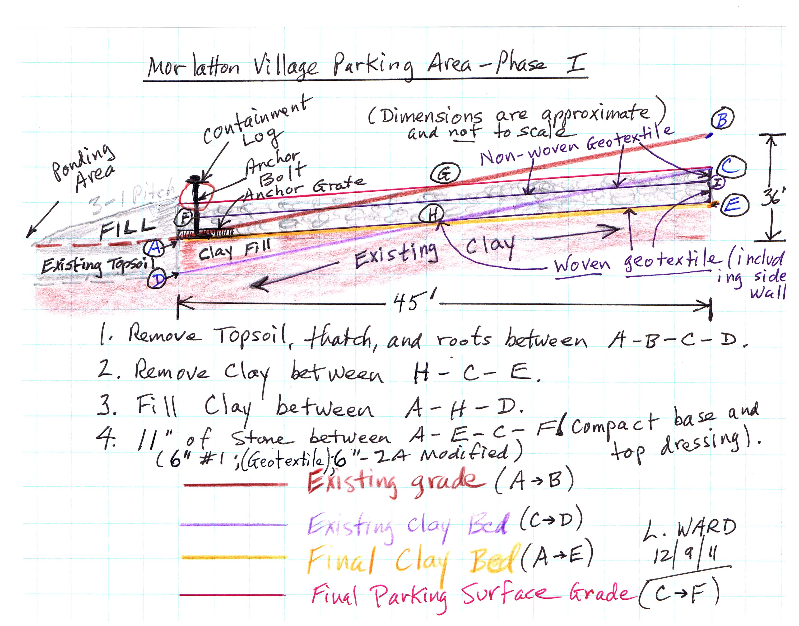
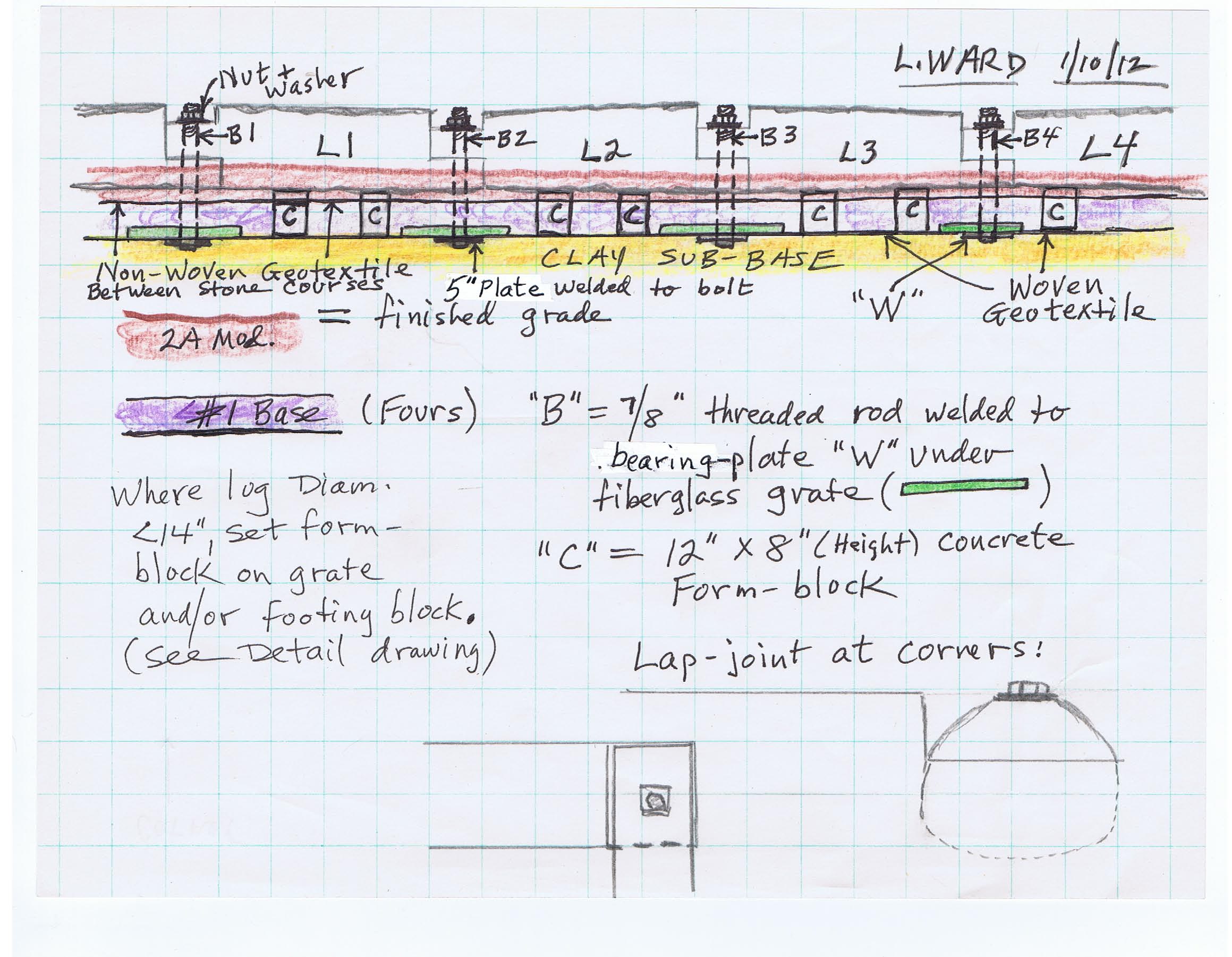
The stone base [#1 size, also called "fours", based on an average length in inches] was spread to a minimum depth of 6 inches on a woven geotextile stabilizing fabric unrolled onto the clay sub-base. Base-stones were also back-loaded onto the segments of grates outside the log perimeter to balance the primary counterweight added to the log mass. Smaller grates were lapped over the short side of the main anchor grates to inhibit shearing-lift and equalize distribution of the stone-load bearing on the anchor rods to maximize the mass resisting flotation of the logs in flood conditions i.e., neutralizing the buoyancy of the logs [Image #6, 9352, 7/30/12].
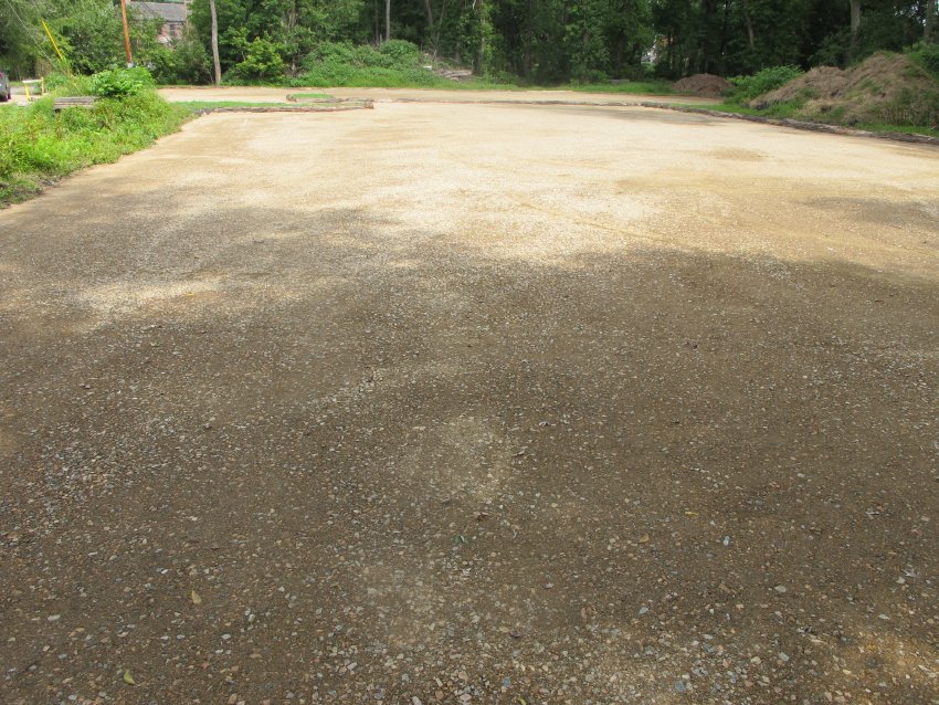
2A modified gravel was spread to a minimum depth of 6 inches on a non-woven fabric laid on the #1 base-stone [Image #7, photo 9721, 8/13/12]. This geotextile layer serves as a drainage membrane and separation layer between the base and top stone courses. The 2A top dressing was rough-graded with a backhoe, fine graded with a track-loader, and compacted with a 36-inch vibrating roller. The perimeter of the parking surface was finished with a vibrating plate-tamper, and hand-tamped where necessary.
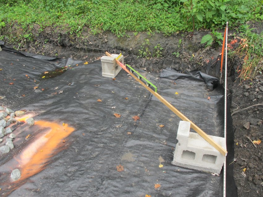
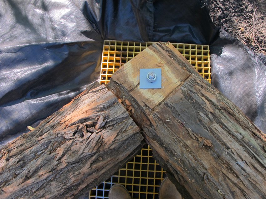
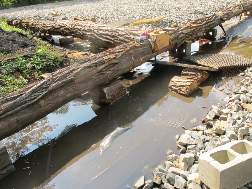
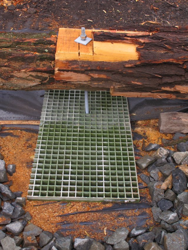
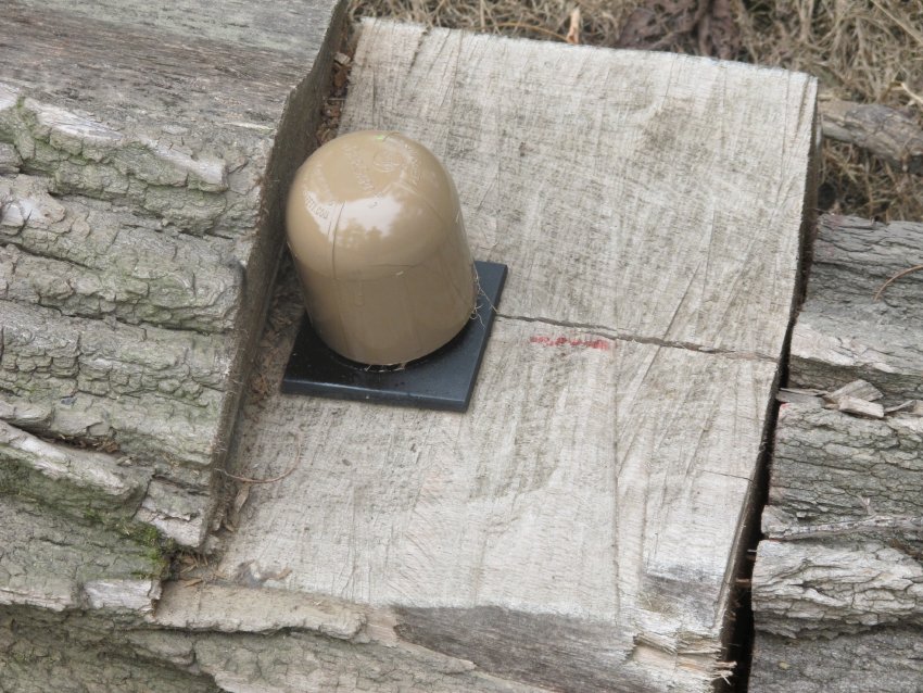
The boundaries of the parking areas are defined and contained by locust logs harvested from the site and set on leveled concrete support blocks, some of which are flanged to constrain log-roll and to gauge the desired final surface grade inside the log perimeter [Image #8, 9154, 7/14/12 and Image #9, 8089, 4/10/12] . Each lap-joined coupling of logs in a series is weighted down by hundreds of pounds of "ballast," consisting of the foot-thick combination of base-stone and 2A gravel surface material ["top dressing"]. Each individual grate or lapped pair of grates is charged with 600 to 800 pounds of stone. The aggregate stone mass loaded onto the fiberglass grates [Images #10, 9362, 7/30/12; #11, 8228, 4/17/12; #12, 9271, 7/22/12] adds more than 50,000 pounds [equivalent to chaining 4 or 5 steel anchors, each the weight of an average backhoe, to the log-chain] to the weight of the 67 logs, which weighed approximately 80,000 to 100,000 pounds in the aggregate while "green," becoming lighter as they dry out.
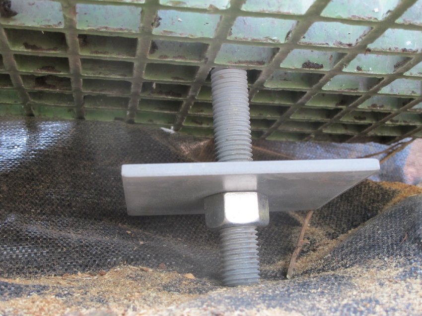
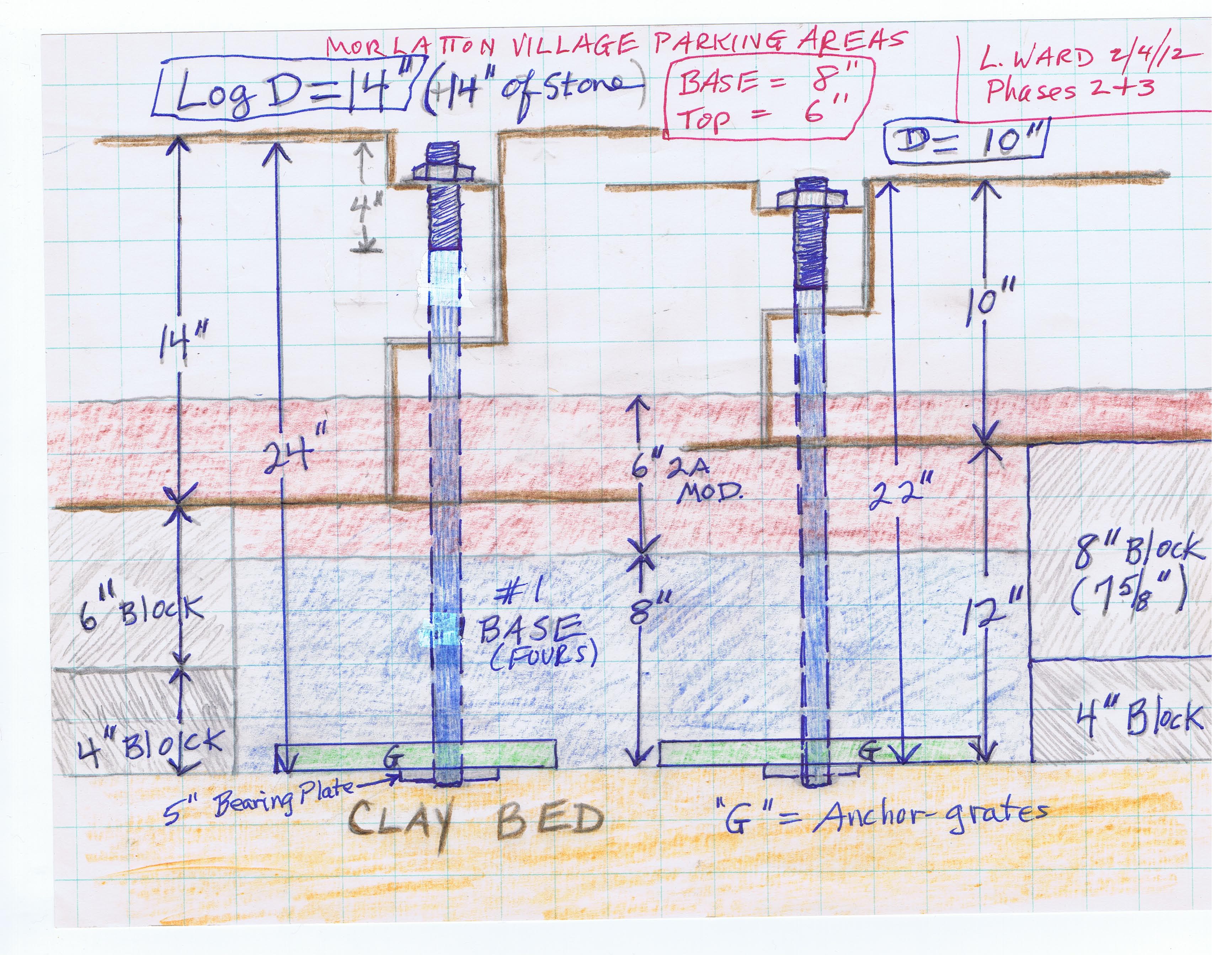
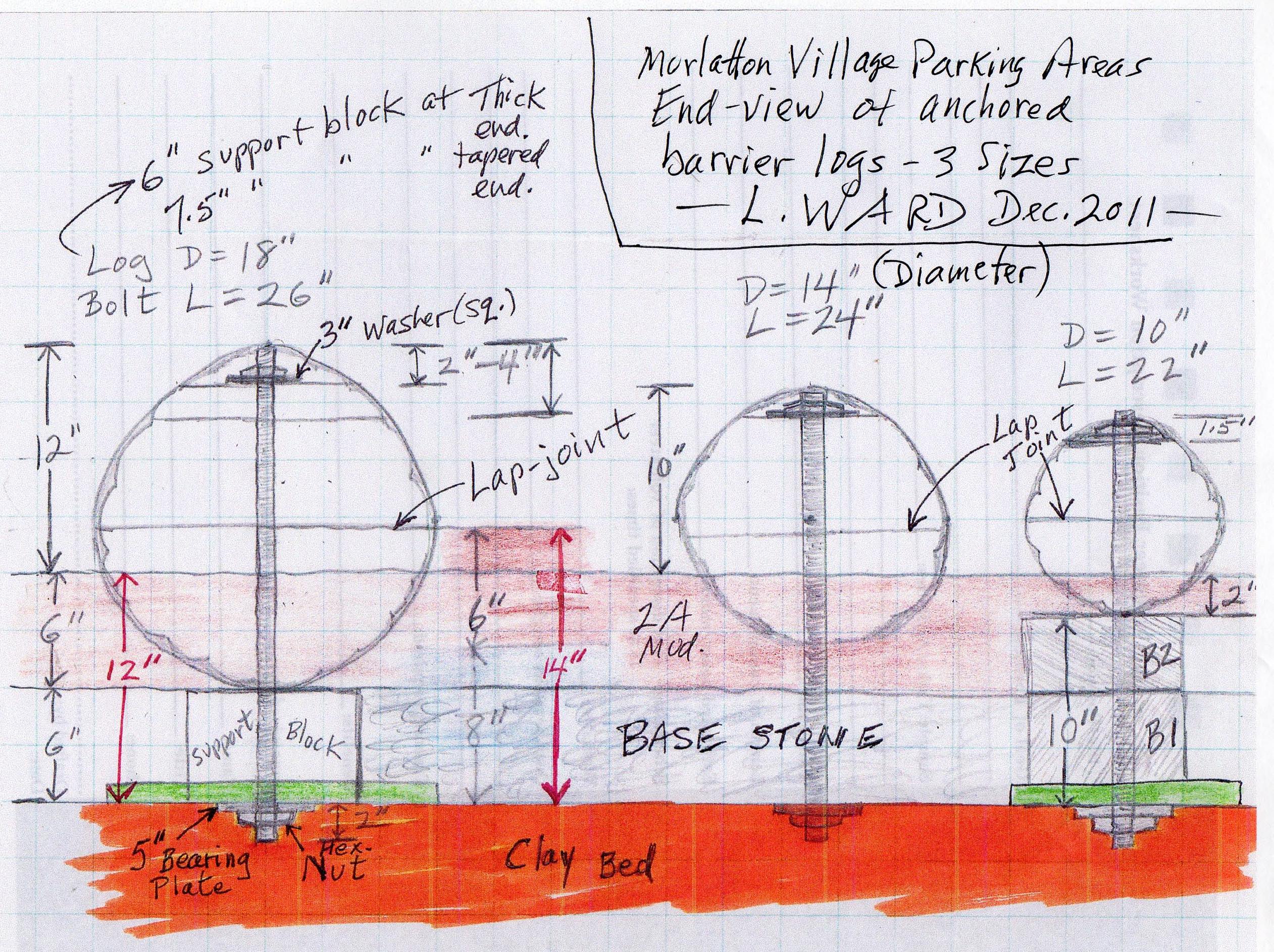
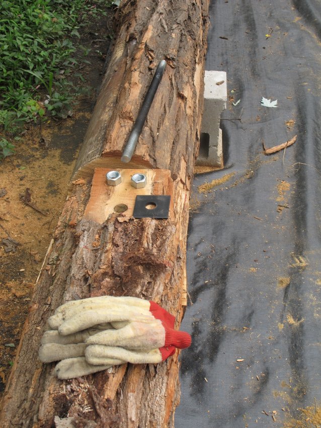
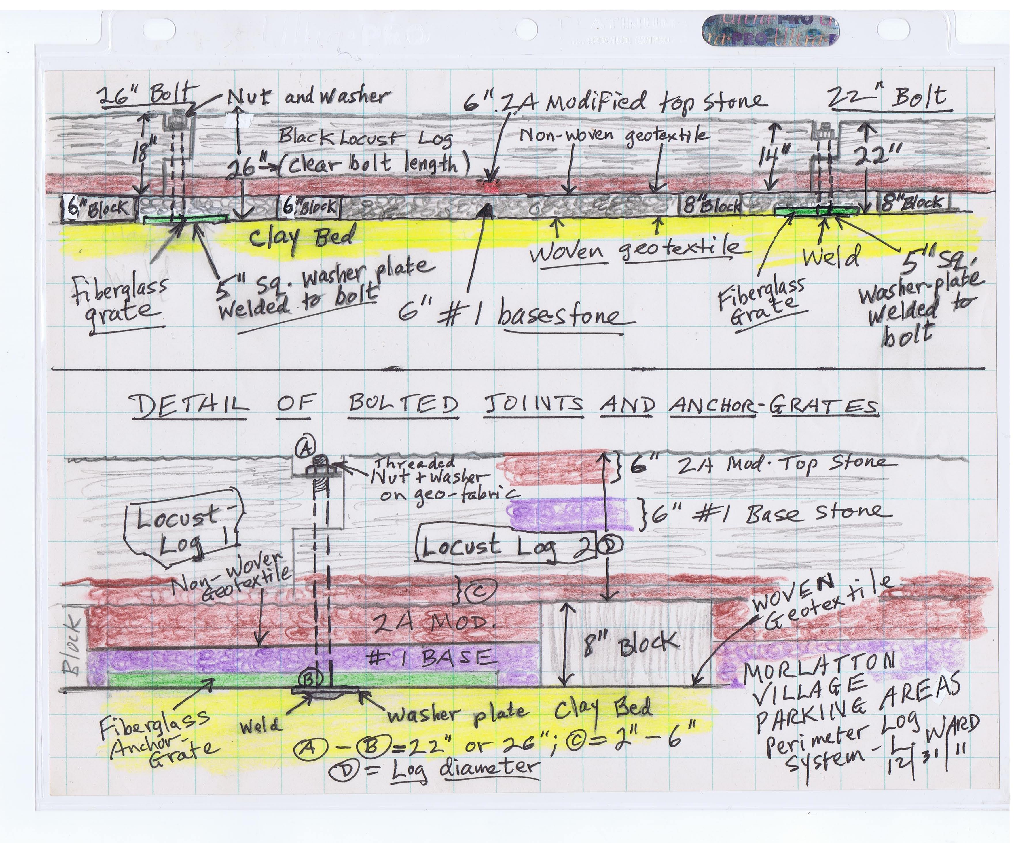
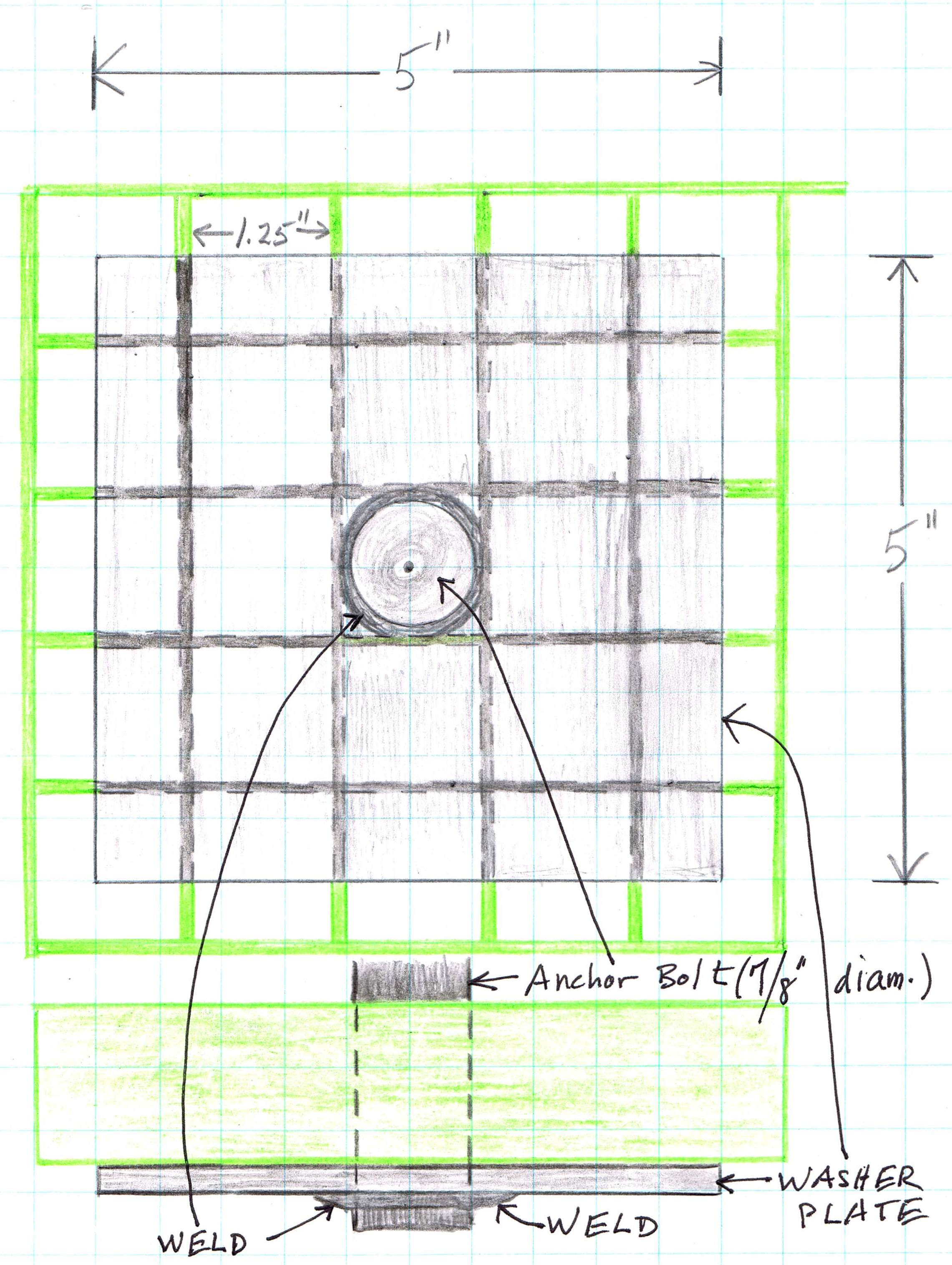
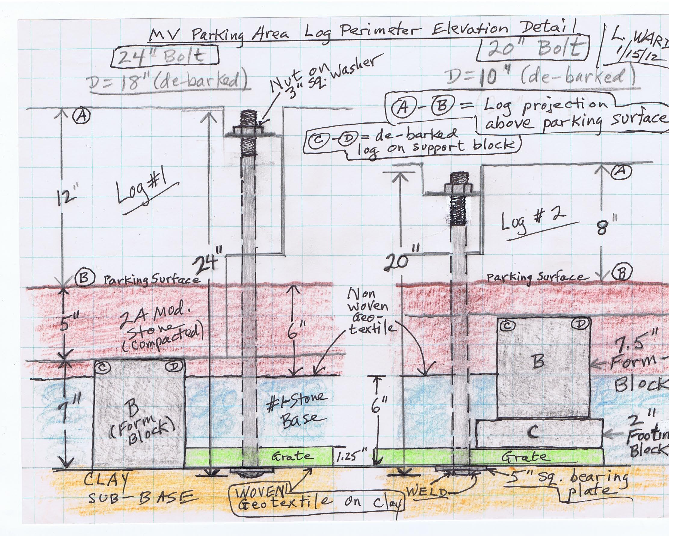
The stone-weighted grates are coupled to the logs by a bearing plate [ground-level photo, Image #13 8261, 4/19/12] and threaded steel rods [Image #14, 8243, 4/19/12] fastened to the lap-joints with a nut and 3-inch square washer-plate [see Image #15, Dimensioned-dwg1] and Image #16, Dimensioned-dwg2, both depicting bolted log-joints]. This added weight provides in the aggregate a redundancy factor of approximately 50% excess counter-force against the buoyancy and lateral thrust imposed by flooding. The steel rods and back-filled embankments outside the logs should neutralize thrust from the exponentially increased river current during flooding, which can cause this force to be magnified ten-fold, depending on flood-water depth.
The exposed bolts were zinc-coated and painted for weather protection and rust inhibition [Image #17, 9312, 7/29/12], and capped for safety [Image #18, 9507, 8/4/12].
Amity Township has generously provided the land for these facilities, as well as construction equipment and skilled personnel who supervised and executed the labor-intensive logistics of the installation [Image #19, photo 8101, 4/12/12].
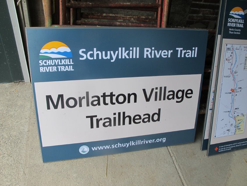
The combined 70-vehicle parking areas will accommodate Thun Trail users [sign shown in Image #20, 9121, 7/13/12], the two areas are shown in Images #21 (photo 245, White Horse area) and #22 (photo 249, Swede's Lane Area). Amity Township residents, tour guests, and all who are interested in experiencing an authentically preserved and historically significant 18th-century Pennsylvania riverside village, which had served for the century between the Revolutionary period and the Civil War as the civic and economic hub of the community.
Scaled drawings of the two parking areas are shown in Images ##23 and 24.
Working sketches of the materials, grades, and mechanical system employed to rig and anchor the perimeter logs against river flooding are shown in Images #25 through 29.
Laurence Ward, updated September 2020 and January, 2021
Catalog details
- Catalog number
- 1008.01.024
- Alternate number
- MVTXT12
- Accession number
- 1008.01
- Date
- April - August 2012
- Creator
- Ward, Laurence
- Object name
- Print, Photographic
- Record type
- Standard
- Classification
- Documentary Artifact