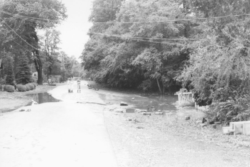
Black & white photographic print showing aftermath of flooding from hurricane Agnes in 1972. Image depicts area looking toward mouns Jones House from the George Douglass House.
Note on verso in blue pen reads "1972 AGNES FLOOD LOOKING FROM MOUNS JONES HSE TO DOUGLASSVILLE"
See MVPH4 thru MVPH24--1003.01.009 thru 1003.01.029 for additional images of hurricane Agnes flooding.
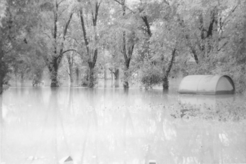
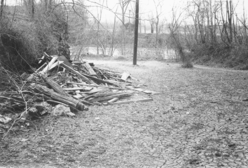
Black & white photographic print showing aftermath of flooding from hurricane Agnes in 1972. Image depicts area just north of Mouns Jones House.
Note on verso in blue pen reads "Agnes 1972"
Note on verso in red pen reads "Flood picture just north of Mouns Jone Hse"
See MVPH4 thru MVPH24--1003.01.009 thru 1003.01.029 for additional images of hurricane Agnes flooding.
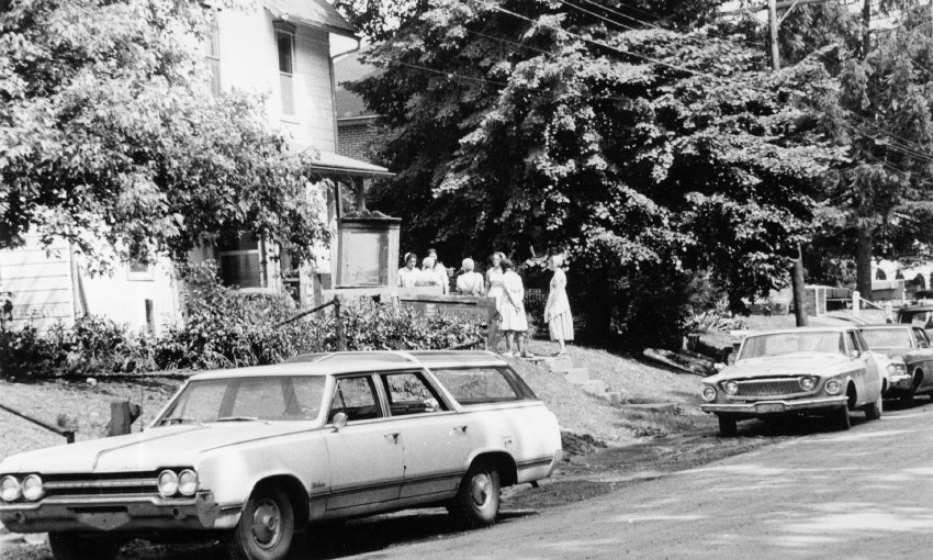
Black & white photographic print showing group of unidentified Mennonite women who helped provide relief to Douglassville victims of flooding from hurricane Agnes in 1972. Image depicts area near St. Gabriel's episcopal Church.
See additional image for note written on verso.
See MVPH4 thru MVPH24--1003.01.009 thru 1003.01.029 for additional images related to hurricane Agnes flooding.
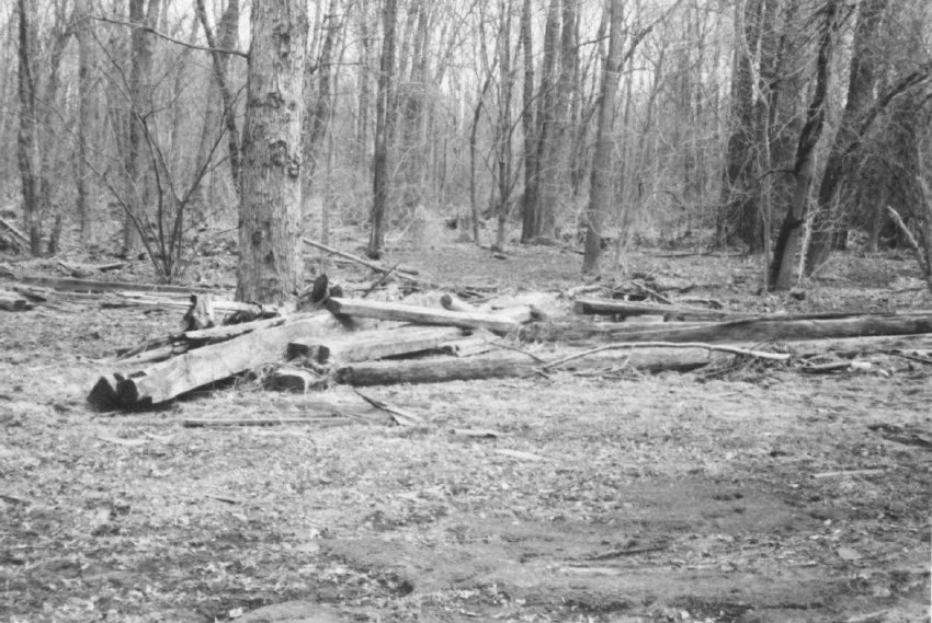
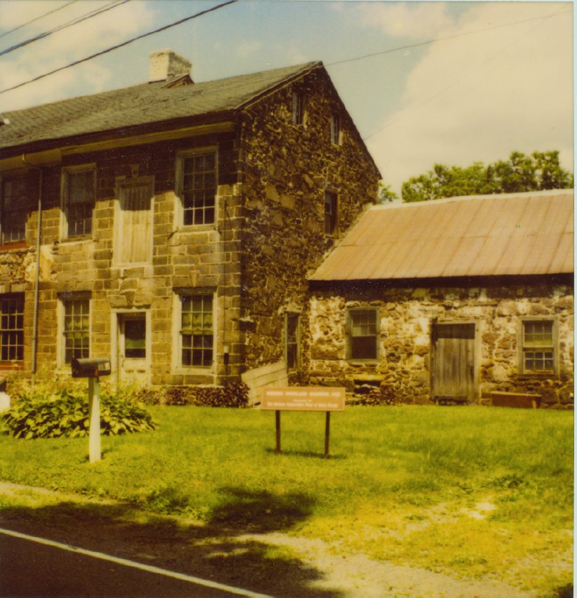
Black & white photographic print showing aftermath of flooding from hurricane Agnes in 1972. Image depicts area surrounding Mouns Jones House.
Note on verso in black pen reads "Agnes 1972 Flood Mouns Jones Hse"
See MVPH4 thru MVPH24--1003.01.009 thru 1003.01.029 for additional images of hurricane Agnes flooding.
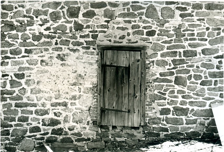
Digital image of original photograph taken by Steve Kindig. Image shows exterior view of door and hardware in the west masonry wall at upper (first floor) ground level. The oak lintle and tops of jambs of the cellar kitchen window are seen along the lower left edge. Brick infill between door jambs and masonry indicates later period of doorway (19th century).
See discussion to DTHPH1--1001.01.021 regarding the 19th-century addition accessed through this door.
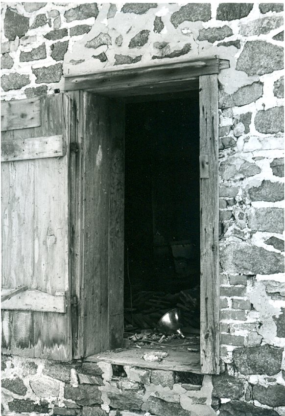
Digital image of original photograph taken by Steve Kindig. Image shows former doorway through west masonry wall providing access between first floor and 19th-century kitchen addition (removed). Brick infill between door jambs and stone masonry indicates later period of doorway (19th century)
See DTHPH1--1001.01.021 for discussion of the removed addition.
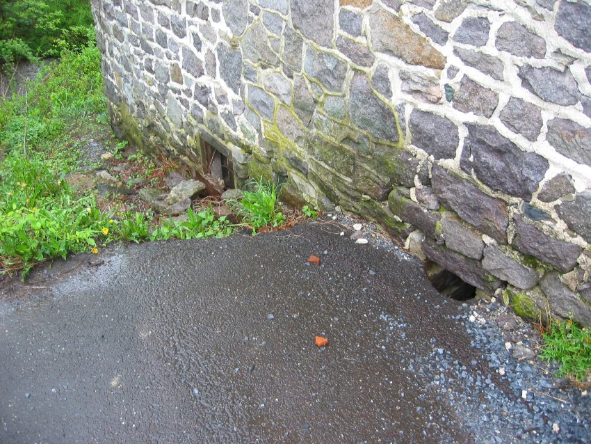
Digital photographic print showing hole along western grade and elevation, allowing inflow to cellar kitchen of surface drainage from long macadam driveway.
Image depicts conditions existing immediately prior to and necessitating the 2009 restoration of building.
This is a low resolution image.
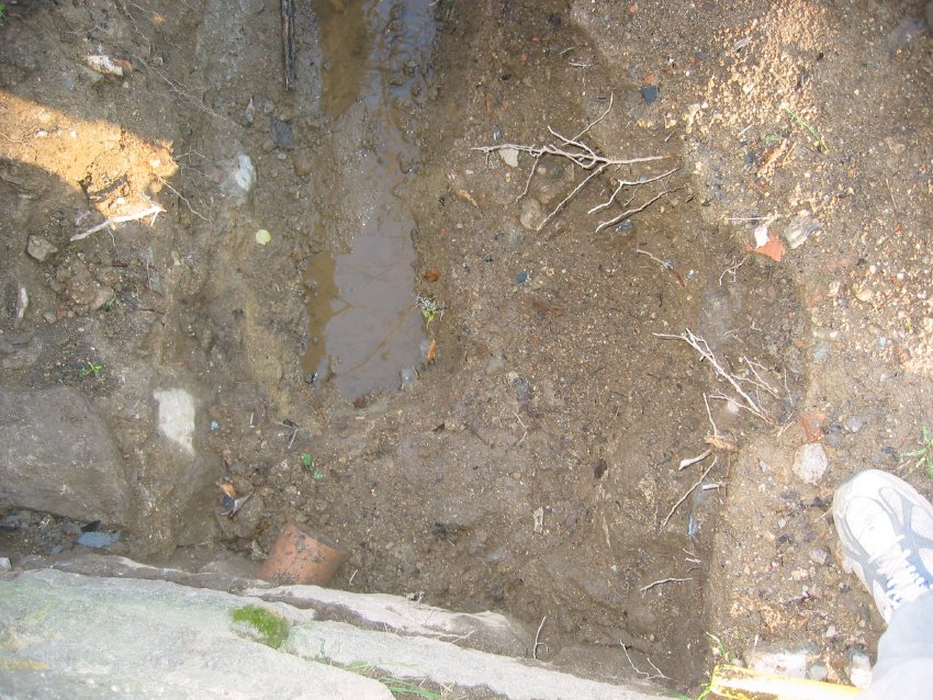
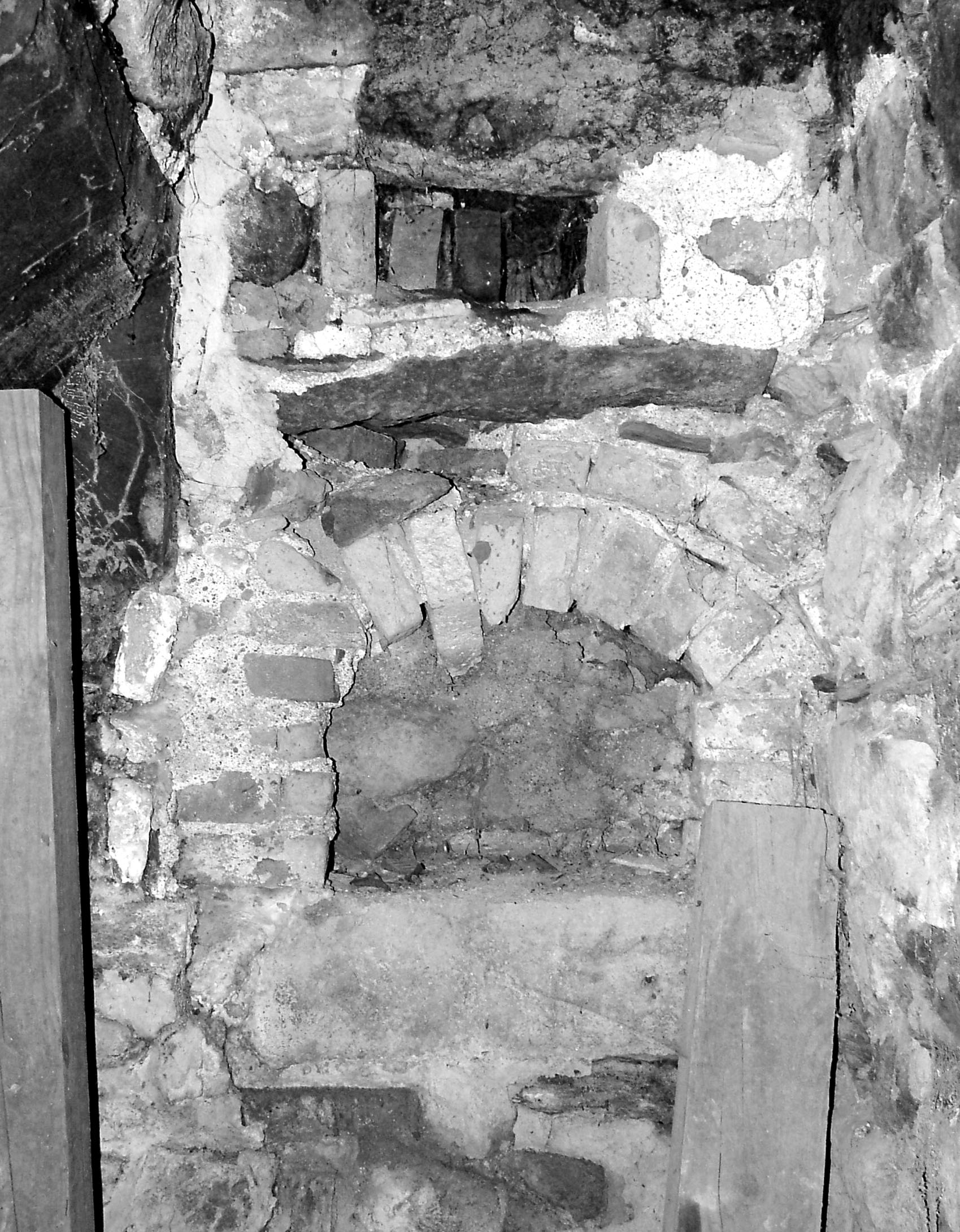
Excavation to a depth of approximately 15 inches uncovered the 1970s terra cotta drain pipe outlet exterior to the north wall near the northeast corner of the kitchen wall. This drain was set too high above the water table range and did little to reduce either the volume of water saturating mortar joints and wooden elements of the doorway or the duration of the contact of those elements with water.
A mortared aggregation of stones against the foundation is seen above and below the drain pipe in the left third of the photo. This was possibly a retaining wall, a revetment against creek incursion, or a buttress providing lateral support for the un-banked north gable wall.
Laurence Ward, 2009
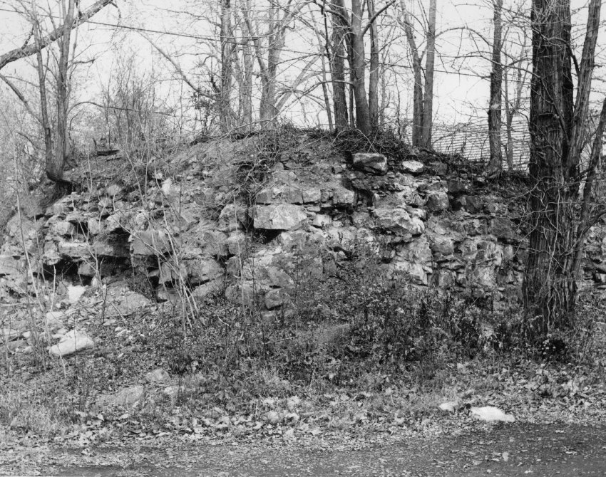
Black & white photographic print showing stone access ramp to covered bridge before its removal.
Note written in blue pen on verso reads, "Stone Ramp to the Covered Bridge at the Mouns Jones House--Douglassville, Pa. facing River Picture taken 1968"
Black & white photographic print showing stone access ramp to covered bridge before its removal.
Note written in blue pen on verso reads, "Mouns Jones House Showing Ramp to Covered Bridge and Schuylkill River -- Douglassville, Pa"
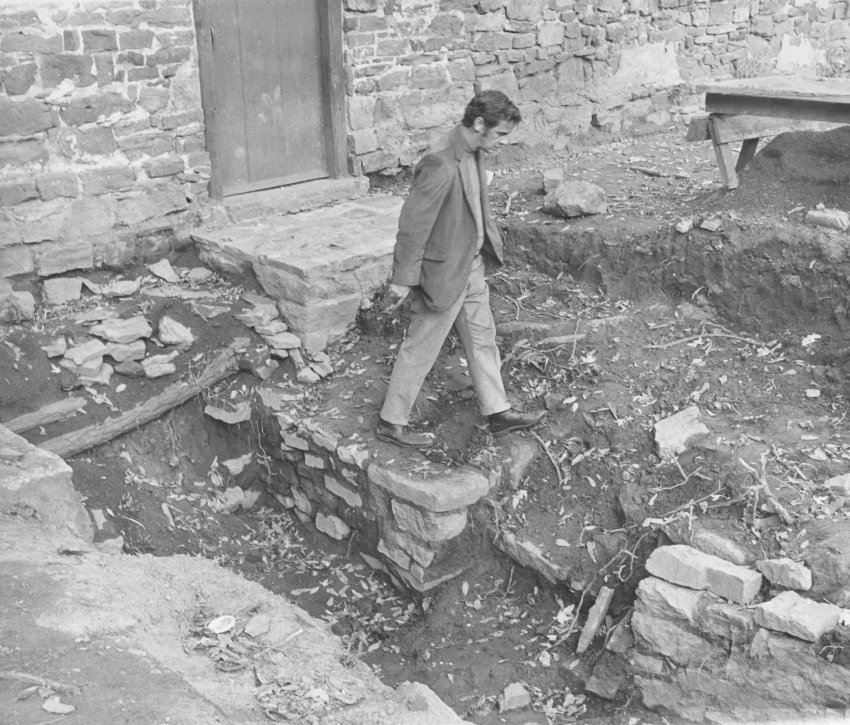
Black and white photographic print showing a 1970 archaeological dig outside the doorway in the center of the southwest eaves wall of the Mouns Jones House. The photo depicts Arthur Dickson (dig coordinator) pointing to unearthed stone wall remnants appearing to be either retaining walls or part of a foundation. Conch shell (sometimes used as a signal horn to announce the approach of a canal boat toward a "port") and pottery sherd can be seen in foreground (bottom left in photo). See MJHPH60--1000.01.065 for further discussion of the historical records relating to Mouns Jones’ land holdings and early transactions regarding his “plantation.”
A more extensive archaeological project commenced in 2011 and has continued for years to explore, photograph, document, and analyze this stonework and other selected sites and sub-grade features within the Mouns Jones house curtilage.
During 2021-22, the project progressed to the interior first floor area of the 1716 house. Interior excavation has uncovered significant domestic and historic artifacts and determined conclusively that no cellar ever existed under the house. This finding is based on the unearthing of bed-stones, set about 10” below the kitchen hearth level on an undisturbed clay sub-strate to support flooor joists.
Laurence Ward, updated June 2023
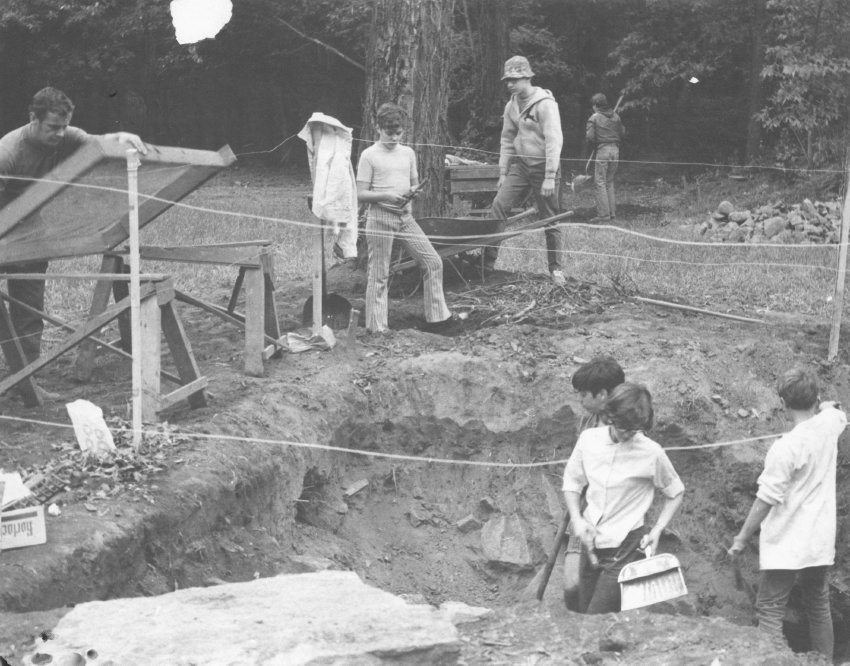
Black and white photographic print showing amateur archaeological dig outside the west eaves wall of the Mouns Jones House. Photo depicts Arthur Dickson (at left) and students working on dig.
Note written in blue pen on verso reads, "Archaeological dig 1970 Arthur Dickson Teacher at Pottstown Junior High Sch"
Note stamped in black ink on verso reads,
"Photography by
John A. Beard
XXXXX [address withheld]
Reproduction Prohibited Unless
Picture Credit Is Given"
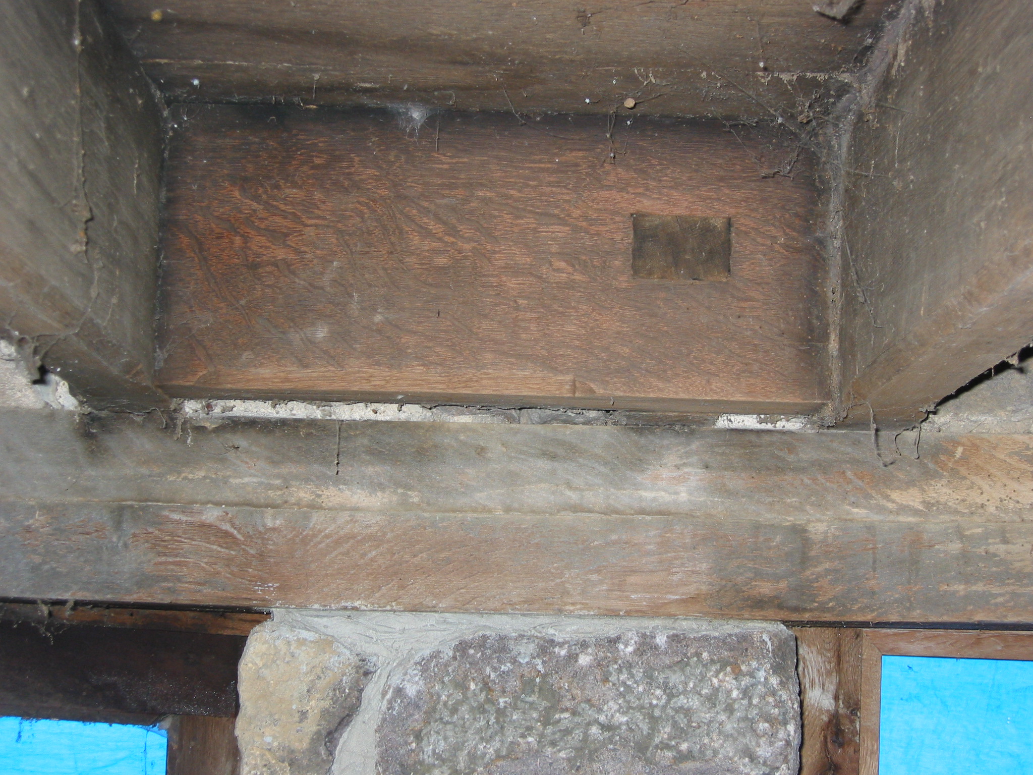
Two digital photographic images showing the anchoring header for hood outlookers above the kitchen doorway of the DeTurk House.
This "header"{1} is secured laterally into its flanking pair of first-floor joists by mortise and tenon{2} joints, indicating that a hood over the kitchen doorway was an integral part of the original construction. The end-grain of the tenon is flush with the inner surface of the header. A "pin" or "peg" driven through the wood above the mortise into the tenon stabilizes the joint. [See DTR09PH111--1001.01.207 for a detail view of this header after removal of old tenon remnant.]
The stopped chamfer terminates with a typical vernacular "lamb’s tongue", less ornately delineated than many earlier examples, {2} about an inch from the left [northern] joist, but "stops" about 4 inches from the right [southern] joist because of the framing "intersection" of the header with the outlooker through and beyond the mortise. This visual eccentricity is plausibly explained by the medieval tradition which implicitly defines "framing intersections," for purposes of locating chamfer "stops," to include a "virtual" junction of a framing member with the projected section of another member{3}.
The stacked pair of timbers across the center of the photo consists of the [upper and longer] bearing plate ["joist plate"] for the first floor joists, and the [lower and shorter] relieving lintel over the doorway and window openings of the east eaves wall in the lower ground-level kitchen. They are supported by the masonry pier [bottom-center of photo] between these openings, the masonry wall north of the window, and the pier joining the east eaves wall to the partition ["cross"] wall between the kitchen and root cellars. Similar plates are embedded in the west eaves wall and serve the same functions.
FOOTNOTES:
{1} "Anchor beam," in the British vernacular lexicon.
{2} The reduced-section projecting timber segment at an end of a framing member which fits tightly into a "mortise" [hole] in another member to structurally join the two members. The resulting mechanical connection is typically secured with wooden pegs driven transversely through the joint. A 1797 Chester County "Practical House Carpenter's Directory" uses "tenent" for this element; also "tenant" or "tennent" in the southern tier of the Mid-Atlantic colonies [Lounsbury, Illustrated Glossary of Early Southern Architecture and Landscape, Univ. of VA Press, 1999].
{3} Appearing in numerous instances throughout the framing system of this building as a simple concave ["coved"] bevel, or "splay," without beading or other decorative embellishment. The "stop" gradually returns the chamfer to the vanishing point at the right-angle edge ["arris"] of the header. For this reason, in the British tradition this form of beveled "stop" has been called a "converging" chamfer, distinguishing it from the abrupt right-angle [horizontal or vertical] chamfer terminations seen in some 17th-century English and Welsh vernacular woodwork. More finely articulated [typically with a curvilinear ("ogee") profile] versions of this expressive vernacular detail, obviously designated by its undulating namesake, appear in formal and monumental masonry structures on the continent of Europe and in the British Isles.
{4} However, such traditions were not rigidly interpreted; photo DTR09PH133--1001.01.229 shows the chamfer on the joist south of the northern outlooker extending part-way under the tenon of the anchoring header, stopping a few inches from the intersecting relieving lintel; this location of the chamfer stop apparently ignores the "intersection" of the joist with the extended section of the header through its southern tenon. An example of stopping a chamfer, with a simple beveled cove and in conformity with the joinery tradition, appears in the 2d image [Frame # 81709-929] which shows the chamfer on the lower southern arris of the first floor joist closest to the kitchen fireplace chimney breast stopped several inches before the meeting of the joist and the summer beam’s lap-joint with the fireplace lintel.
Larry Ward (2009)
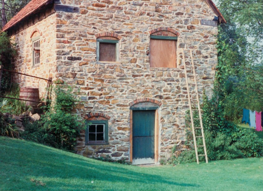
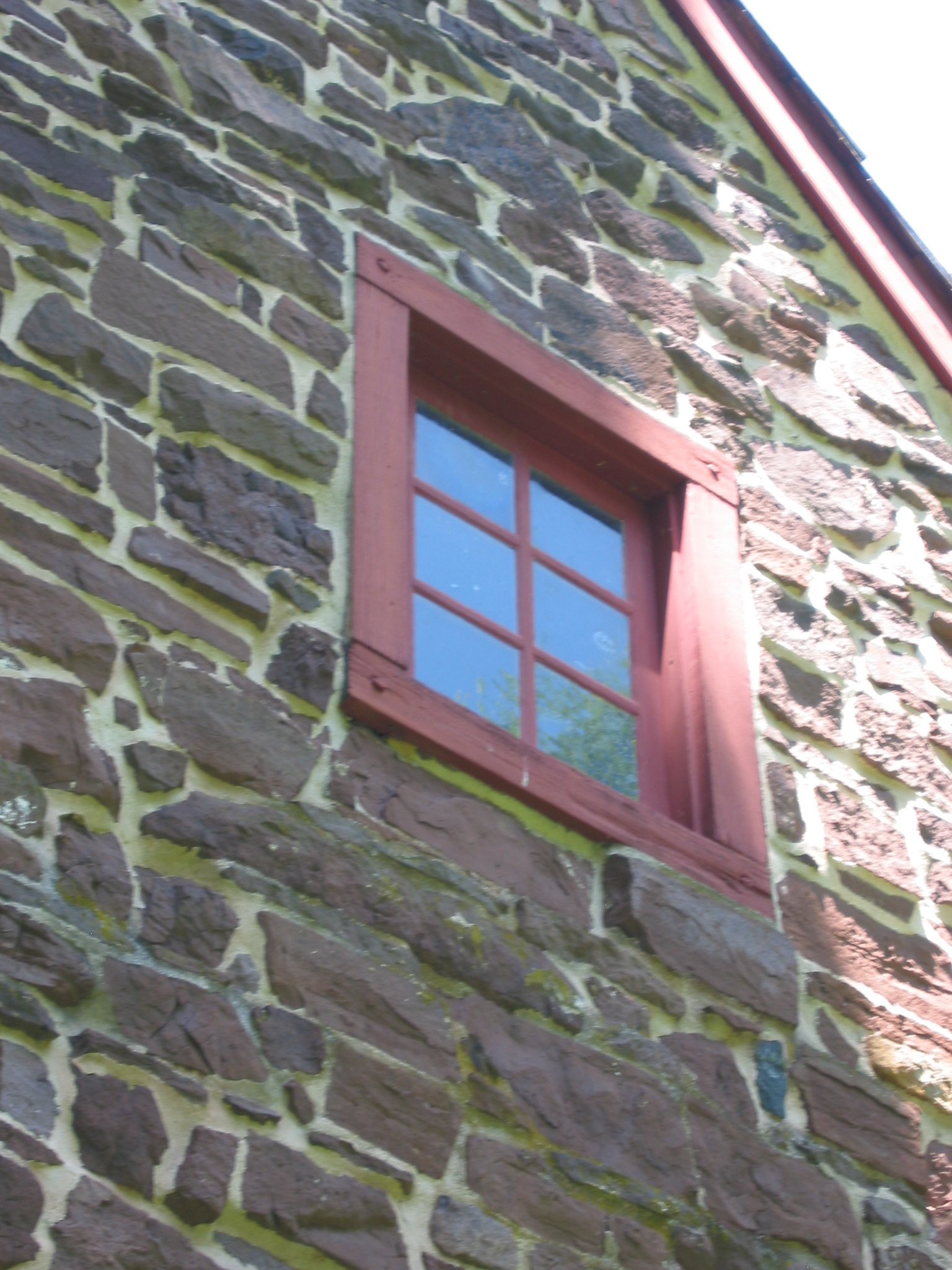
Color photographic print showing detail of the southwest perspective view of the Keim ancillary building during restoration of the southeastern gable wall window.
Details include: brick segmental relieving arches; random rubble masonry.
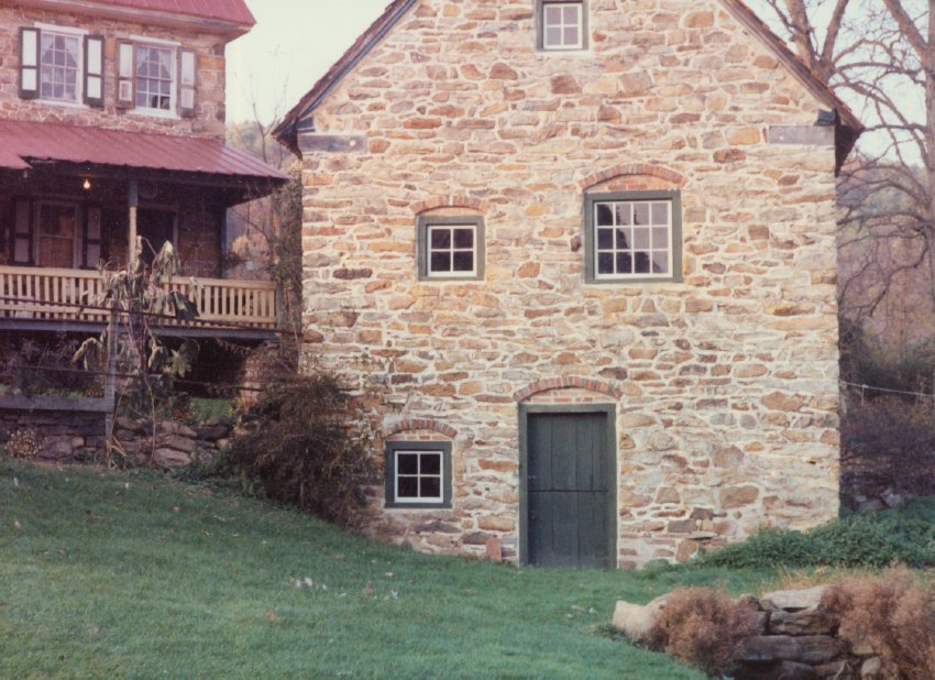
Color photographic print showing detail of the south elevation view of the Keim ancillary building. Note that the eastern range of the Keim Federal era addition to the 1753 house and 1930s porch can be seen in the left of this photo.
Details include: brick segmental relieving arch; 19th-century paneled shutters above porch
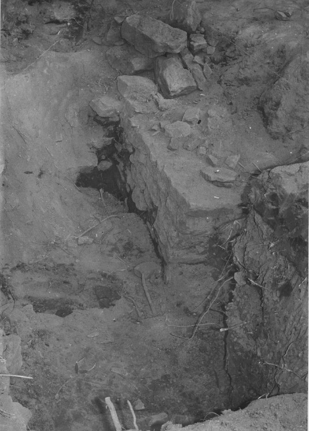
Image #1: Black and white photographic print showing detail of amateur archaeological excavation outside the west eaves wall of the Mouns Jones House in 1969 or 1970.
Image #2 shows text of notes written in blue pen & red pen on verso, which refer to "this wall against the south [sic: closer to southwest] wall of the House--we do not know if this would be the wall to his early house 1701{n} or to an out building [sic]."
{n} The reference to an hypothesized 1701 dwelling is apparently based on the date of William Penn's grant ["warrant"] of approximately 10,000 acres in Manatawny to Swedish settlers, including Mouns Jones and his wife and six children{1}. It is unlikely that Mouns’ first dwelling was constructed much before 1704, when Reverend Sandel noted that he had taken up residence at Manatawny.
Alternatively, some of the sub-grade stonework uncovered in the 1969-70 and 2011-2014 archaeological investigations southwest of the house might have been the disturbed remains of piers or footings ["sleepers"] supporting the porch shown in the photographs in records MJHPH1--1000.01.001, MJHPH62--1000.01.067, MJHPH65--1000.01.070, MJHPH96--1000.01.107, and MJHPH97--1000.01.108. Image #
The two large stones under the plinth masonry in image #3 are probably the base stones [or a fractured single base stone] which originally supported the stone sill under the original doorway. The sill under the relocated doorway will be placed under the re-centered doorway on the premise that it is plausibly the original sill.
Jones' parcel, surveyed or plotted according to the authority of the prime patentee [land title recipient] Andreas Rudman comprised slightly less than 500 acres, with frontage on the eastern banks of the Schuylkill River, which was then the primary artery of transportation and communication between Philadelphia and its expanding northwestern frontier. Jones house was, at the dawn of the 18th century, the outermost homestead settled by a European on the northwestern perimeter of Penn's Philadelphia County; see the history and analysis of the Manatawny "Swede's Tract," including Mouns Jones's parcel, by Philip Pendleton in the September 1988 issue of "The Historical Review of Berks County.".
Rudman did not participate in the land grant motivated by personal avarice. He served for years without salary and often paid church debt out of his own funds. His relatively short tenure in "Molatton" and his hyphenated term as leader of the Swedish Lutherans in Philadelphia [Wicaco Church] is detailed in an essay entitled The Life and Influence of Andreas Rudman, First Minister in Berks, by Ronald W. Oudinot, published in The Historical Review of Berks County, Volume XLIV, Number 2, Spring, 1979, at page 59, et seq.
According to one unpublished account, Jones built "his original log cabin" in 1701 adjacent to the White Horse Ford crossing the river. The same account asserts that Jones and his wife and children "moved in 1704 to Manatawny (Douglassville) in Amity Township, Berks County…." This assertion was probably based on a 1704 letter from a traveling minister [Andreas Sandel] stating that "Mans Jonson" had "taken up" residence there.
In 1709 Mouns and neighboring owners petitioned the Provincial Council for a road from the outskirts of Philadelphia to their "plantations" at Manatawny. The road had not been laid out or physically opened by 1715, when another petition was initiated by Jones and other planters in the region. However, a 1719 Draught shows the proposed extensions of the “Oaley” road to the ford across from Millard’s mill [see record # MVFN01].
By 1712 the Jones family had been ensconced in their first dwelling in the Manatawny settlement, for at least eight years. Assuming river frontage of about a quarter of a mile, Jones's narrow tract extended about two miles northeastward from the river.
In May 1712 a letter from Charles Gookin, Lieutenant Governor of Pennsylvania, cites a Mouns Jones letter dated May 4, 1712 to the Governor requesting that a meeting with four "Indian Kings" be convened "at the said house of Mouns Jones of Manatawny."
Images #4 and 5 [#8916, 6/7/14] is a collection of pottery sherds found during the 1969-70 archaeological campaign; these fragments, mostly slip-decorated or incised redware, were returned to the site in 2011 by a participant in the 1970 "dig". A careful re-excavation and documentation of the sub-grade curtilage west of the existing stone house has been conducted from 2011 through 2014 to determine whether any further findings might shed light on the early construction sequence and purpose of this stonework. The 2014 excavations have unearthed early slip-decorated artifacts including redware sherds and additional sub-grade stone wall segments [Images 6 & 7].
FOOTNOTE
{1} See the history and analysis of the Manatawny "Swede's Tract," including Mouns Jones's parcel, by Philip Pendleton in the Sept., 1988 issue of "The Historical Review of Berks County."
Laurence Ward, April 2010
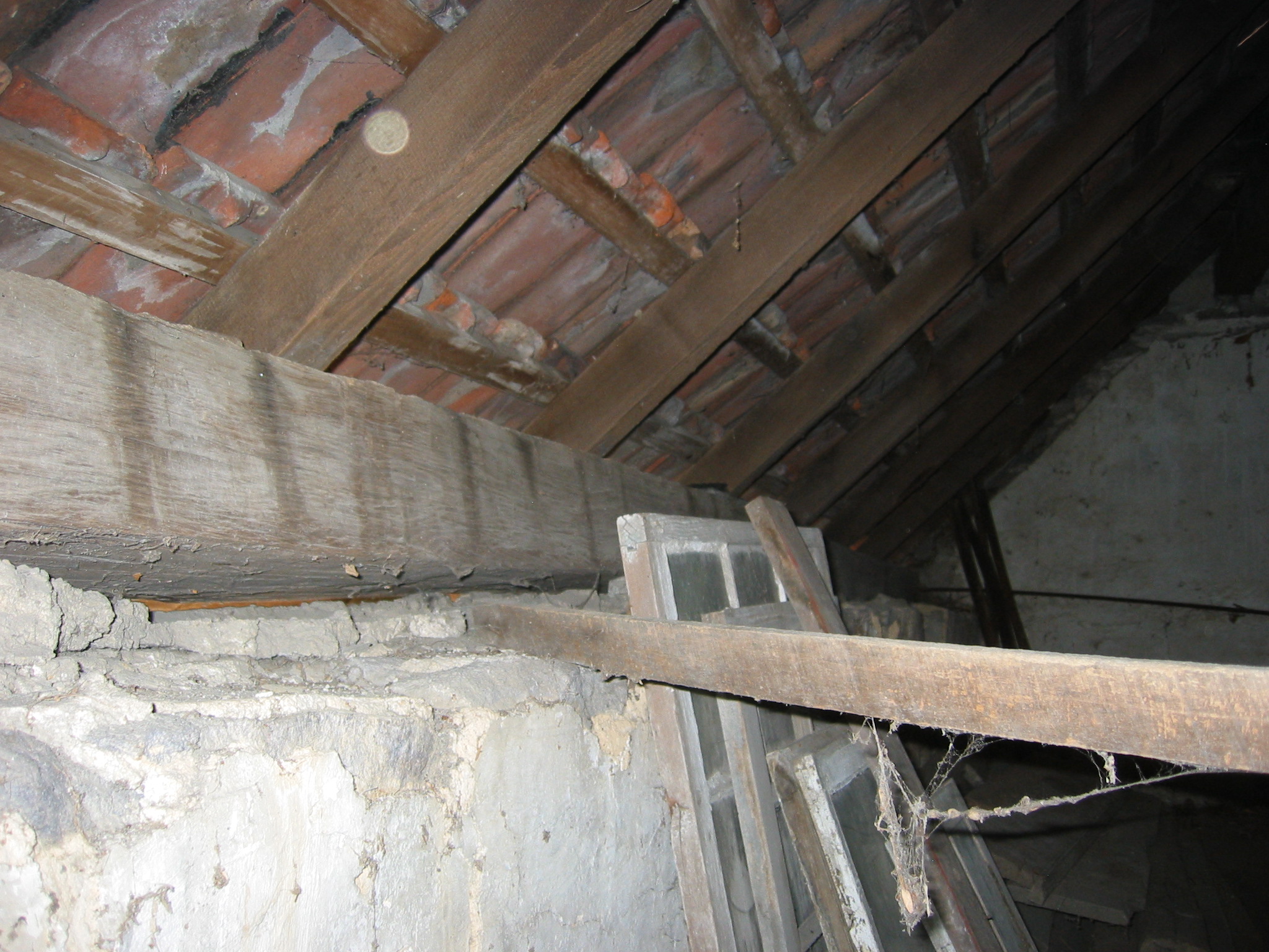
Southeast portion of DeTurk House attic granary showing east eaves wall plate [large hewn beam extending into the corner starting at the left edge of the photo]. This plate is rotated several degrees from the horizontal and curves outward, either from roof thrust or possibly because of a prior structural function, probably in another building{1}. Although insufficient "curing" [drying through evaporation] is possible as a contributory cause of the curvature, it is quite unlikely that the original builders would have installed a "green" timber for the important function of a wall plate deployed to carry the substantial loads of a roof and its timber support structure.
The roof rafters and lath were installed in the 1970s. The early clay tiles were assembled from several sources, including a group found in this 1767 building (see DTHTX18--1001.01.017 manuscript sheet headed ‘[DeTurk] Restoration Plans’ paragraph 2, which states "Enough tiles are available for the roof: 1000? Stored in DeTurk House, 1st floor, 700? Stored at Jack Keller’s farm…600? stored at Dr. German’s house (donated by Paul Blatt, Bernville)."
The iron tie rod on the right (shown more fully in the left half of photo DTR09PH102--1001.01.198) was installed in the 20th century to restrain roof thrust. This retrofit was necessitated by the inadequate integration ["tying"] of the wall plates into the structure in the original building campaign. This problem was compounded by the inability to install continuous tie beams from eaves-corner to eaves-corner because of the chimney in the north gable wall and the granary door in the south gable wall. A secondary possible cause of the partial failure of the roof support system was the replacement of lighter roof covering, wooden shingles, with heavier slate and clay tiles during various re-roofing projects on the building. This would impose substantially greater lateral thrust on the rafter plates and the masonry stone courses supporting them, tension on the rafters and their support members.
FOOTNOTE
{1} The darker vertical bands, possibly from joists bearing on this timber and reducing oxidation from exposure to air, on the inner [west] face of the rafter plate{n} might indicate prior use as a summer beam. The outward curve [which would project downward if the plate were rotated to set the bands facing upward under joists], would probably be caused by deflection of the beam from many years of load-bearing in functioning as a “summer” or girder.
{n}so called because of its primary function as the “wall” plate [generically, any timber borne on, or embedded in, a masonry wall] supporting the roof rafters and the loads they bear.
Laurence Ward, 2009, updated March 2021
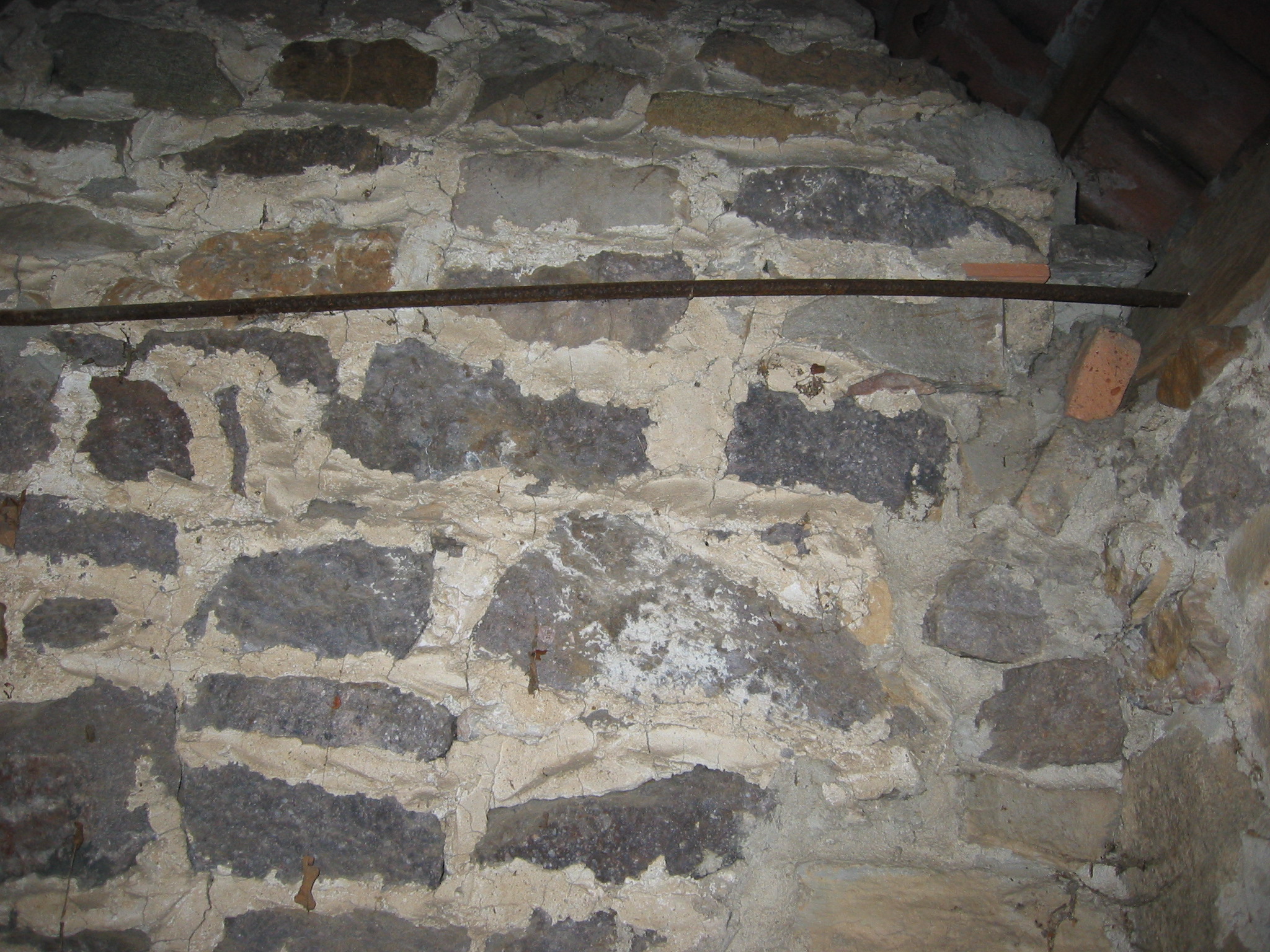
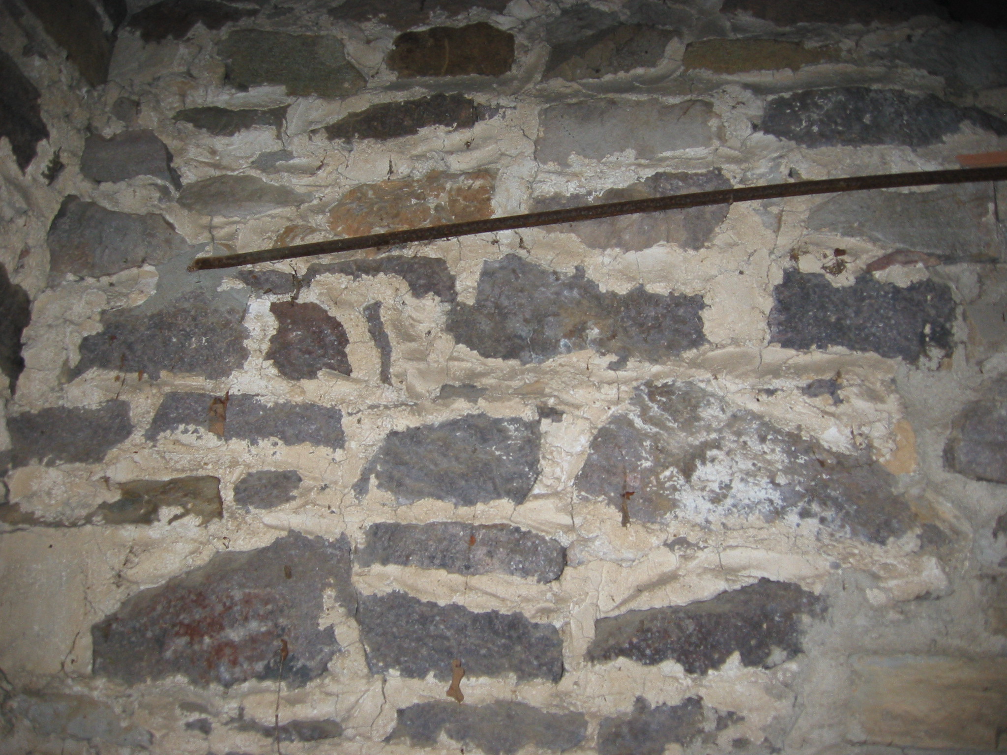
Iron tie rods were added in the 20th century as restraints against roof thrust acting on the eaves wall plates. The rod is seen entering the wall plate just below the upper right corner of the photo (the bricks are non-original in-fill). A nut secured the threaded end of the rod against the exterior vertical face of the plate. These interior rods apparently replaced exterior rods [see DTHPH7--1001.01.029] which undoubtedly became ineffective because of the rotting-out of the exposed end-grain of the wall plate securing the rod spanning the north gable at the eaves level.
Laurence Ward, 2009
Iron tie rods were added in the 20th century as restraints against roof thrust acting on the eaves wall plates [“rafter plates”]. This pair in the north gable are secured by threaded nuts on the exterior face of the wall plates, and by embedding the interior terminals in mortar joints [seen to the left in this photo]. These interior rods apparently replaced an exterior rod [see DTHPH7--1001.01.029] which undoubtedly became ineffective because of the deterioration of the exposed end-grain of the wall plate securing the rod spanning the north gable at the eaves level.
The gray mortar at the anchor-point is essentially modern “Portland” cement, not a traditional lime-sand or lime-clay mix which would have been applied in the earlier periods of the building.
Laurence Ward, 2009
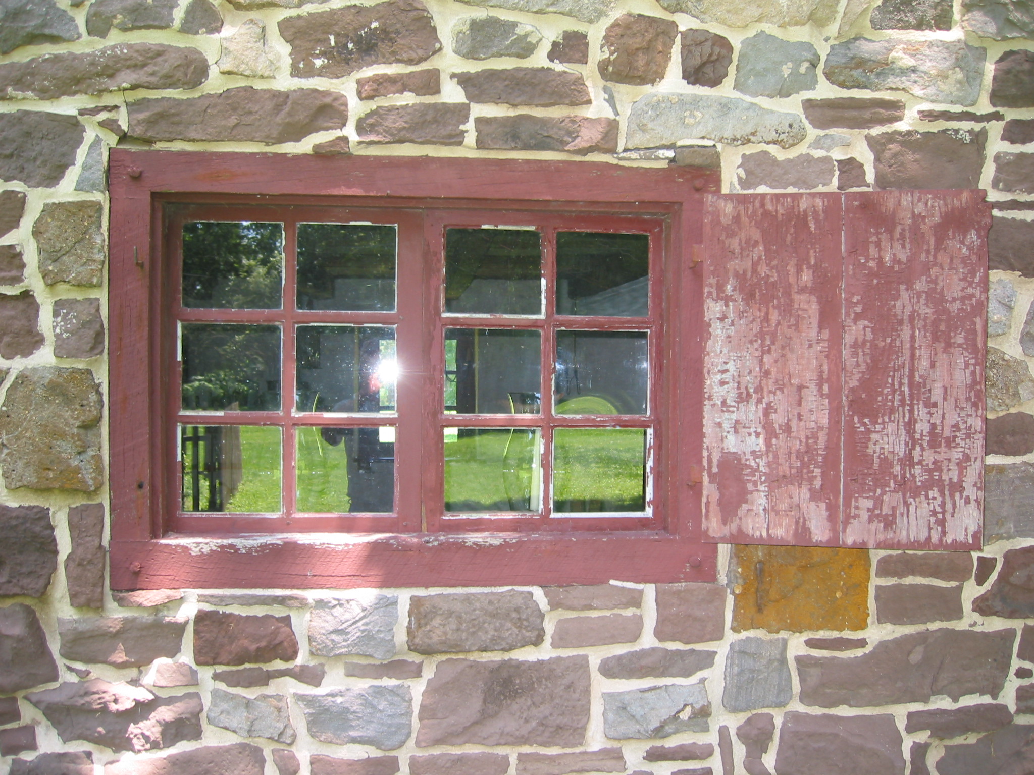
Digital photograph showing replicated casement window on the second floor of the south gable wall. The six-light [“pane”] casement configuration shown here conforms to the woodcut drawing in MJHDWG2--1000.01.089.
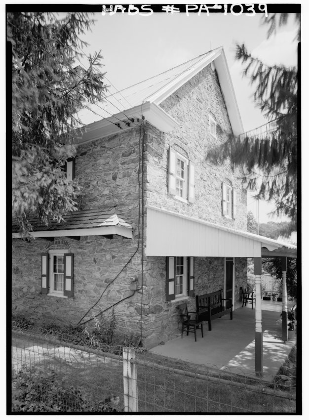
Northwest perspective view of the c. 1753 Jacob Keim house from Historic American Buildings Survey Photograph.
Description:
This view from photo, HABS PA #1039, shows: the pent roof on its original cantilevered “outlooker” supports on the northern eaves wall, with projecting “flashing course” protecting joint between shingles and house-wall [left]; the gable end segment of the 1930s roofed porch [right]; box cornice replacement of early plastered cove cornice; and brick relieving arches above windows.
Laurence Ward, February, 2021
Series of 3 color photographic prints of detail views of the additions on the southeast gable end of the 1765 George Douglass House:
Image #1, Douglass House, perspective view of the 2 story Amity Store addition with freight door to 2d floor ware-house, and 1 story addition used for processing meat and other food products as part of the "general store" mercantile functions of the 4-structure complex. Store ledgers commencing in the late 1760s and owned by the Trust are kept by in archival conditions by the Berks History Center, where they may be viewed on its premises.
Image #2:The white-painted wall [removed in the early 21st century] connecting back corners of the 1765 house and the 1-story food processing structure is not original to the period. It enclosed a brick-paved yard facilitating the passage of people, food ingredients, and finished goods for sale in the store facilities in the period between the house [which included the original Amity Store in the room fronting the original kitchen from the late 1760s until the construction of the store addition c. 1798-1810], the 1-story addition, the store addition, and the stacked root cellar and smoke-house between the store addition and the 1-story structure. A late 18th century document in the Trust's collection is an inventory of "Pork in the Smoke House", reciting sales from and processed additions to the pork to be smoked for sale.
Image #3: Elevation view of the Store and 1-story additions. The chimney at the gable-end of the 1-story addition vented a very large fireplace used in connection with the processing of food for sale and for the Douglass family, and for their guests and business visitors, and probably for those employed in the various enterprises conducted by George Douglass Sr. and Jr. from 1765 to the death of George, Jr., c. 1832.
Larry Ward, August, 2023