
Description
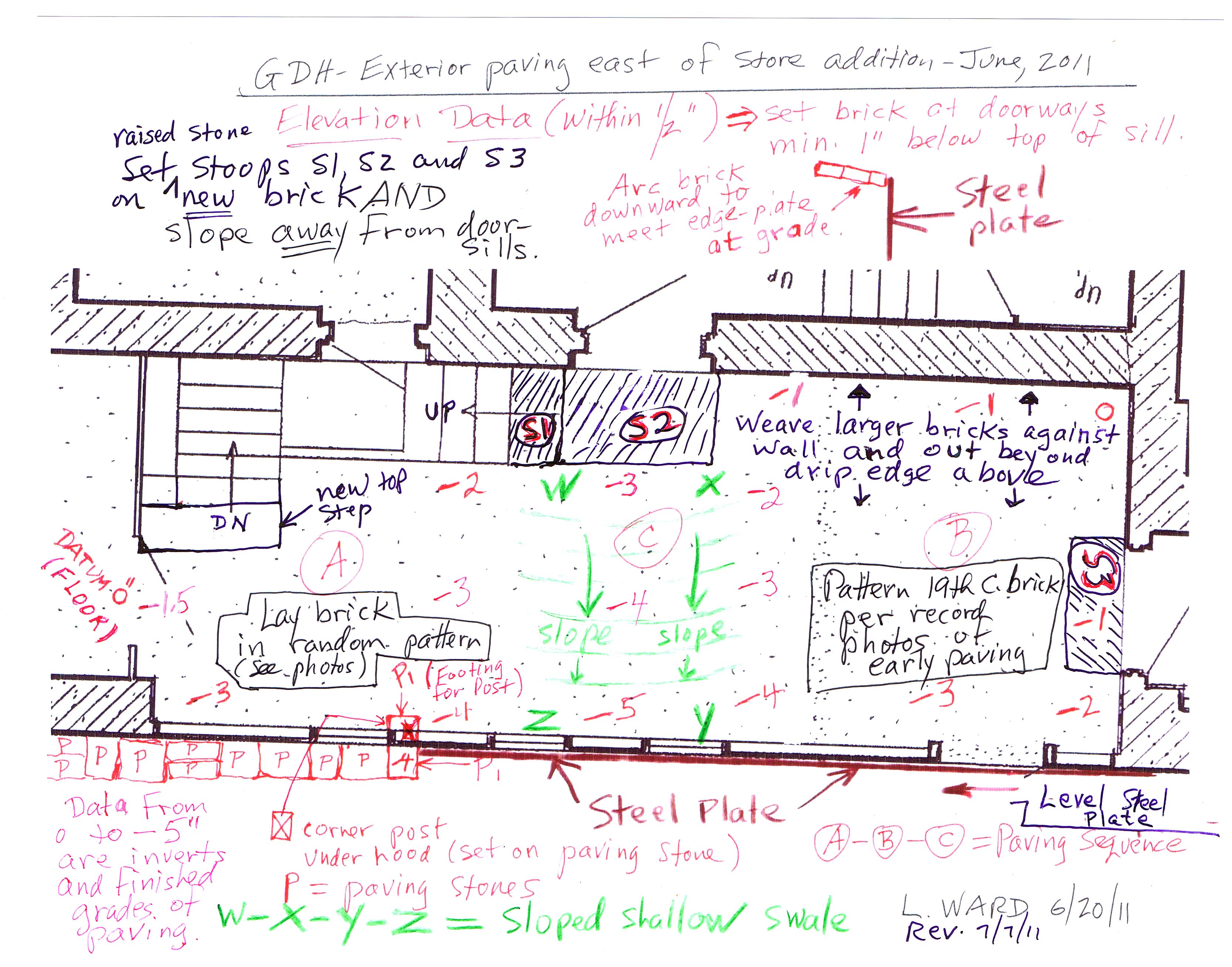
Electronic copy of a field notes drawing (and 12 digital photographs) providing the data for grading and repaving the store yard area behind the c.1800 store addition to the 1763 George Douglass house.
The drawing provides the relative grade objectives for the restored brick paving on the open quadrangle bounded by the 1765 George Douglass house, the c.1800 store addition, and the c.1830 ancillary addition. The negative numbers in red denote the "inverts" [in inches] of selected final grade elevations below the benchmark level ["datum"]. In this case the selected datum is the existing 20th-century concrete floor level of the c.1830-1840 structure. The grades shown are calibrated to conduct surface flow across the restored brick paving and away from the doorways, steps, and masonry walls of the buildings, directing the flows to the north-south drainage course ["swale"] east of the steel plate retaining the edge-bricks along the margin of the store yard.
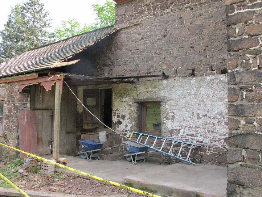
The two-level{1} concrete paving [removed], which consisted of approximately five tons of heavily aggregated 20th-century concrete, is shown in photo #3871 (6/7/11).
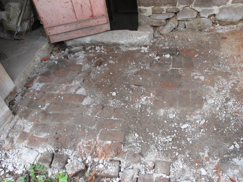
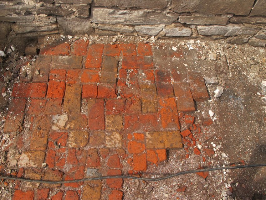
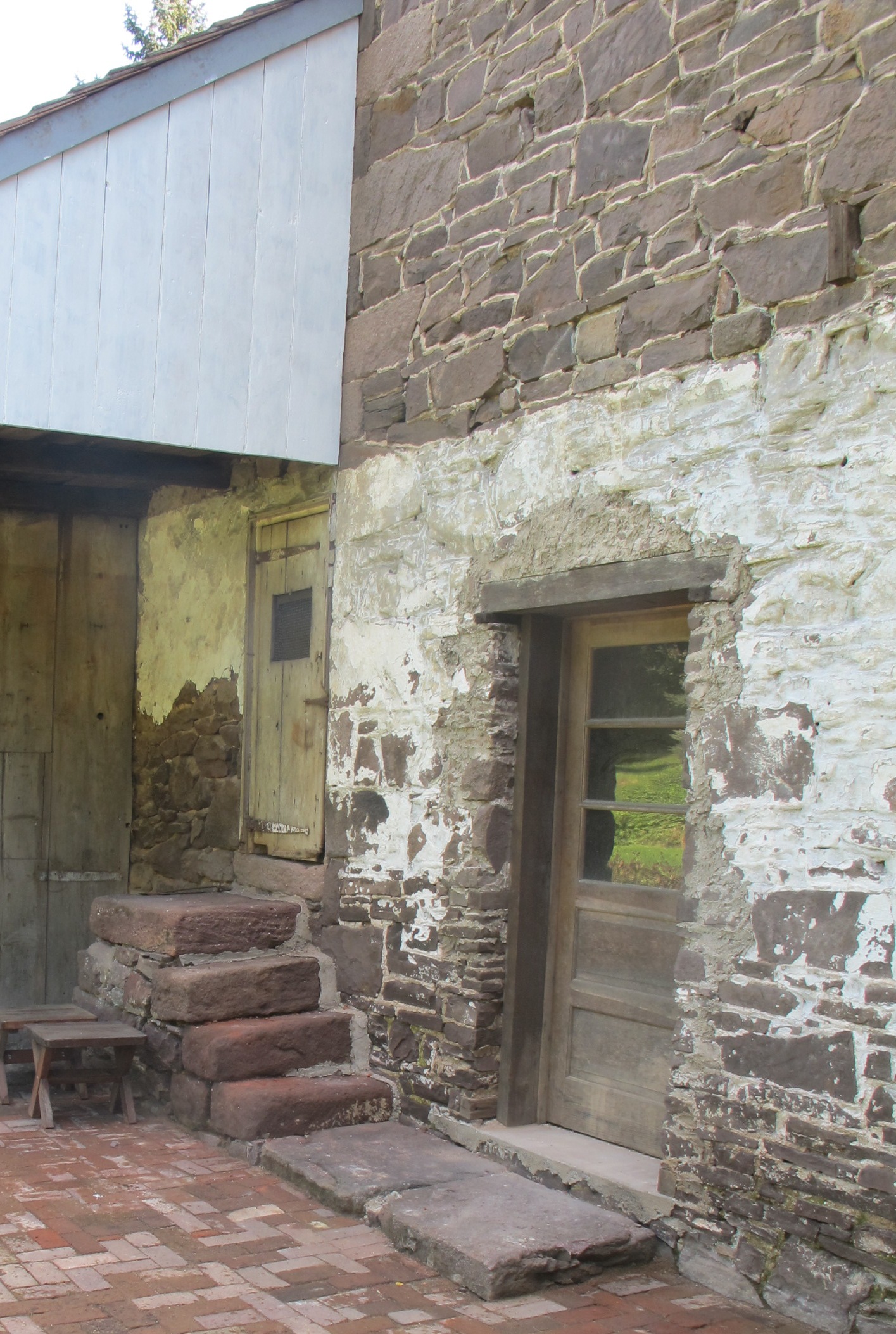
Photos #3939, #3942 & #3949 (6/10/11) show the brick paving found beneath the southern portion of the concrete slab adjacent to the stone steps to the root cellar and the stair-block to the smoke chamber[n].
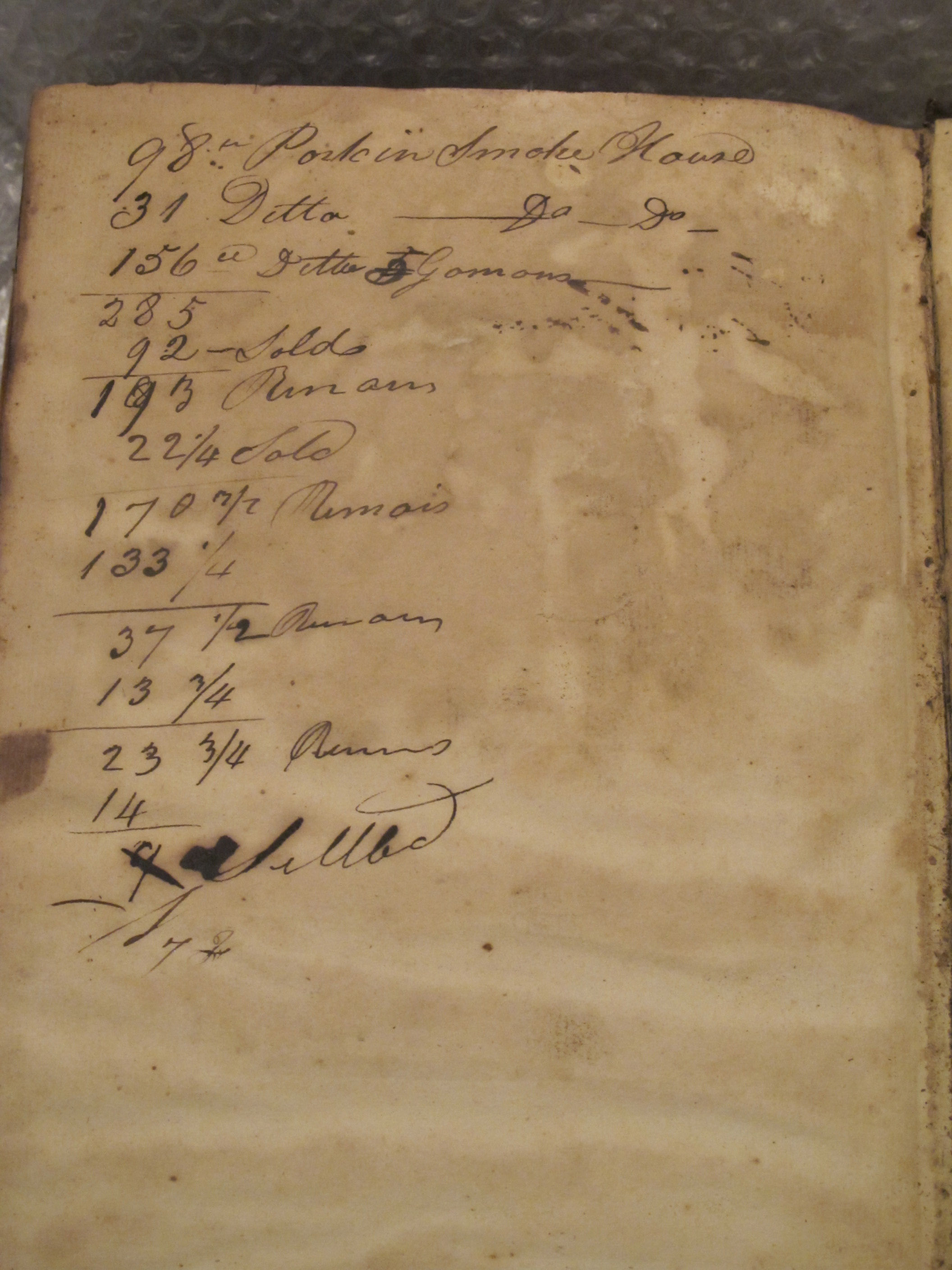
[n] The existing smoke chamber is located above the vaulted vegetable cellar between the store addition and the ancillary addition to the south. This two-story smoke chamber/root cellar block appears to be structurally integral with the ancillary addition, forming an ell joined to the south gable wall of the store addition. Inside the front board of the 1803 Day Book for the Douglass-[William] Jenkins store [see archive record HPTOBJ1--1008.01.022], there are ink manuscript entries listing the varying quantity of pork in the “smoke house.” It is not known whether this reference is to the extant smoke “chamber” or to another structure on the site by 1803, possibly surviving as the free-standing partial ruins to the east of the 1765 Douglass mansion.
If the window in the south gable wall of the store addition was closed off when the present smoke chamber structure was built [possibly as late as c.1840], then the c.1800 store addition pre-existed the smoke chamber, making it highly unlikely that the smoke chamber/root cellar element existed in 1803. Thus the “smoke house” recorded in the 1803 Day-Book would not have been the present smoke chamber.
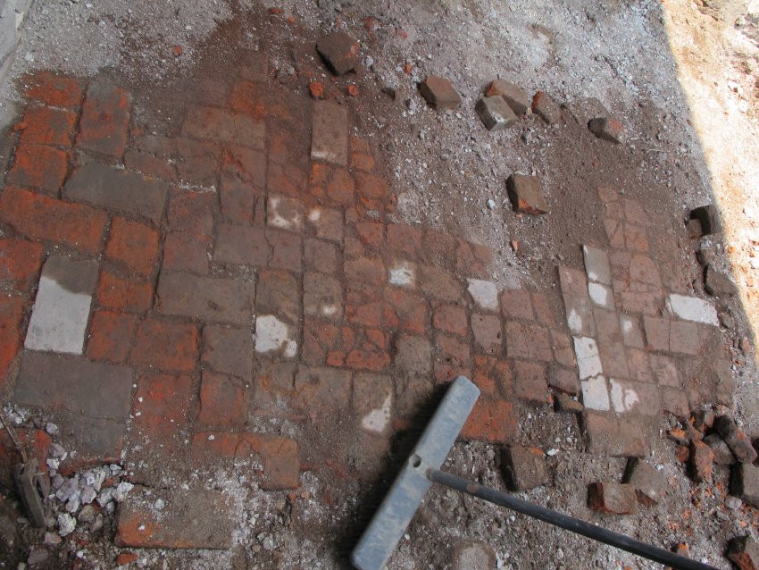
Photo #4010 (6/17/11) shows the surviving brick paving against the rear [eastern] wall of the c.1800 store addition to the 1765 house. These remnants included a few whole bricks, but the majority of the paved area, probably installed in the mid-19th century and possibly contemporaneous with the construction of the ancillary addition, consisted of broken bricks ["halfs" and "brickbats," or "bats"]. The brick re-paving was laid in a random pattern based on these surviving remnants.
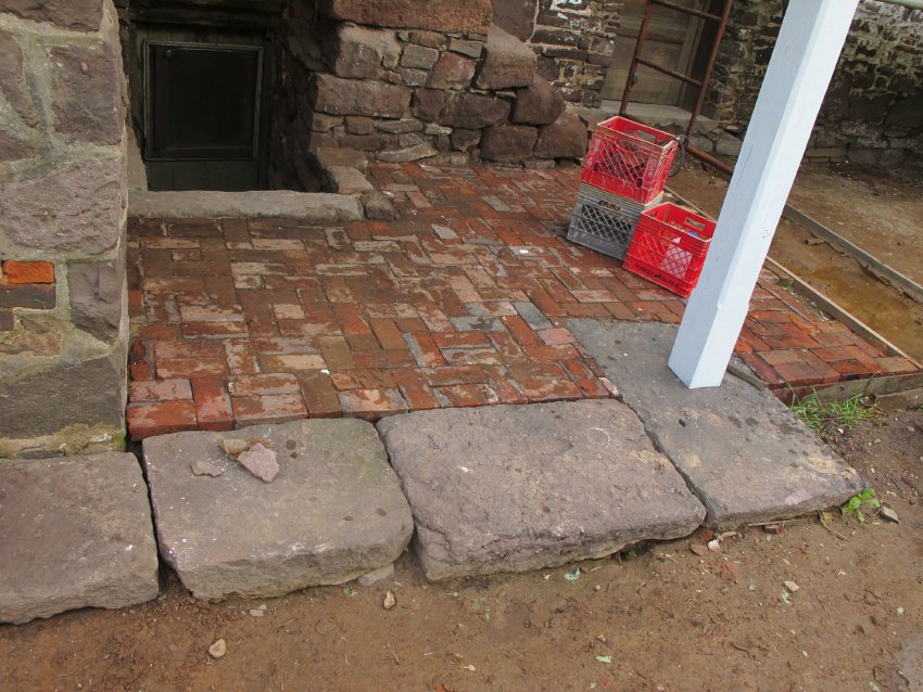
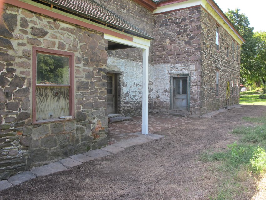
Photograph #5734 shows the re-paved southern section of the yard, the stone pavers under the drip-edge of the roof-extension hood, and the interior corner area graded to shed surface runoff away from the building walls (upper right corner of photo)].
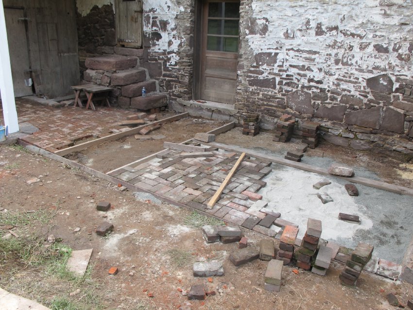
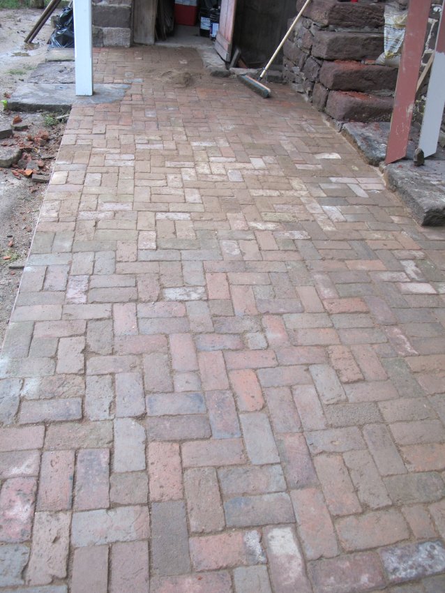
#5811 shows brick paving in progress, with boards functioning as straight-edges set to establish correct slopes along all axes{2}. Bricks will be woven-in between the completed segments to establish the grade objectives. The gray stone screenings and white sand-cement mix will "key" into the joints between bricks when subjected to moisture, thus forming a stable bed for the paving. #5938 is a detail view of laid bricks, stone screenings, and the soil between the leveling boards ["straight edges"] tamped and prepared for the sand-cement setting material.
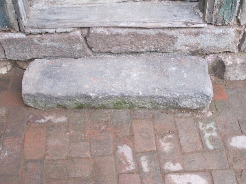
Prior to grading the area to be paved with 19th-century bricks of varying dimensions (found on-site and in other areas of Molatten Village), a 3-inch-thick tread-stone was inserted beneath the top landing of the steps to the food-storage cellar below the smoke chamber. This was necessary to raise the grade of the top landing stone to the level of the concrete floor [the 0-datum benchmark] of the 1840 addition, to ensure positive pitch away from the buildings and produce the incremental grade changes ["pitch"] to achieve the final relative elevation objectives specified in the drawing(a).
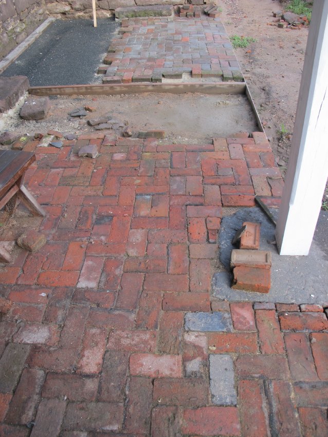
(a)The inverts on the drawing were adjusted "in the field" to achieve the required slopes on all axes [photo #6164 shows the completed brick paving, the stone pavers under all drip-edges, and the roughly graded north-south earthen swale parallel to the steel-plated edging of the brick-work; #6021 is a detail view of the brick paving].
The larger paving bricks laid along the eaves walls, under the eaves drip-edge two stories above, will serve as a deflector and conductor for roof runoff. The joints directly under the drip-edge, which are subject to washout of the sand between bricks, will be grouted with a mortar (without cement) using the same coarse brown sand(b) as constituted the dry-grout swept into the joints in other segments of the brick-paved store yard, adding a lime binder to inhibit washout.
(b) Home Depot "All-Purpose" bagged sand.
Stone stoops, found elsewhere on-site, were set at the doorways to the 1765 kitchen and the c.1800 store addition, and at the red sandstone stair-block to the smoke chamber above the "root-cellar" in the later addition [photos ##6025 and 6158].
FOOTNOTES
{1} The two grade levels of the continuous concrete slab were joined by a 7-inch riser.
{2} North-south, east-west, radial, and diagonal.
Larry Ward
Catalog details
- Catalog number
- 1006.01.022
- Alternate number
- GDHFN4
- Accession number
- 1006.01
- Date
- 07/07/2011
- Creator
- Ward, Laurence
- Object name
- Field Notes
- Record type
- Archive
- Classification
- Documentary Artifact