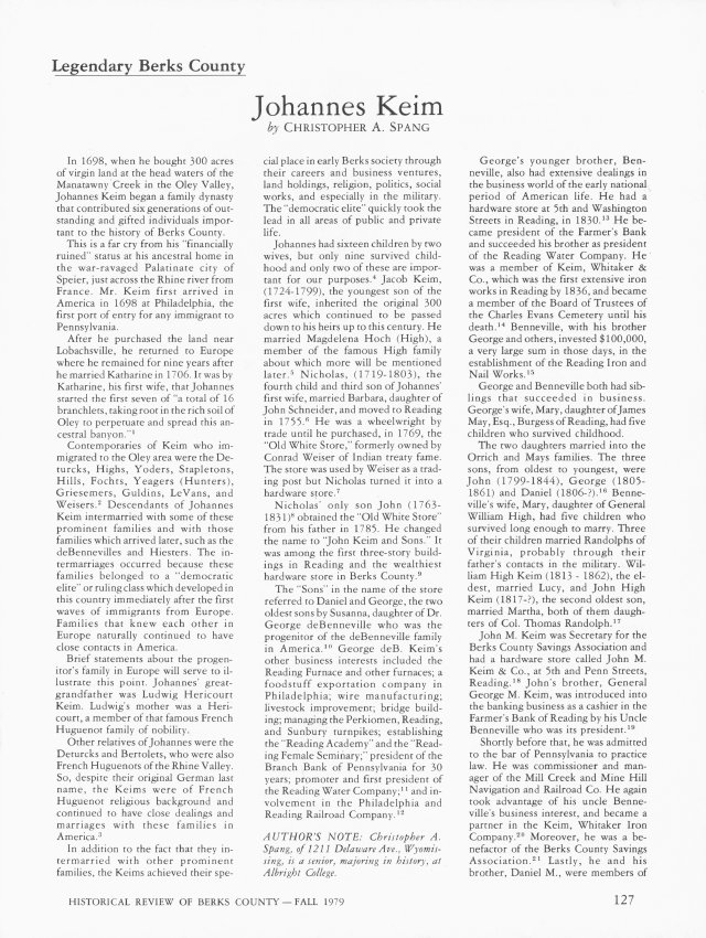
Three-page of article titled "Johannes Keim" by christopher A. Spang appearing in the Fall 1979 (Volume XLIV, No. 4) issue of "Historical Review of Berks County," a quarterly publication of the Historical Society of Berks County.
Article gives a brief history of Johannes Keim (starting in 1698) and key descendants ending in the mid 19th century. Topics disccussed include various Keim business dealings, land holdings (including the Keim Farmstead), religious activities, and military service.
See additional images or MULTIMEDIA LINKS for complete text.
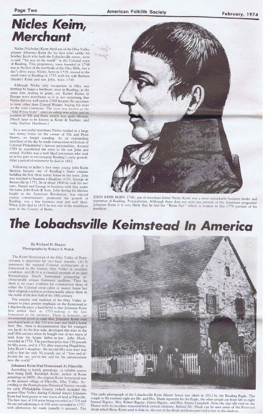
Three-pages of short articles from Volume II, No. 5 (February , 1974) issue of "American Folklife," a monthly newspaper devoted to the American culture published by the American Folklife Society.
First article, appearing entirely on page 2 and titled "Nicles Keim, Merchant," gives a brief history of Nicles Keim, third son of John Keim by his first wife and older brother to Jacob Keim who established the Keim Farmstead in Lobachsville.
Second article, beginning on page two & ending on page three is entitled "The Lobachsville Keimstead in America" was written by Richard Shaner with photos by Robert Walch. This article presents a brief history of the Keim family as well as evidence supporting the fact that Jacob Keim (NOT John) established the farmstead at Lobachsville. Also presents evidence that John settled near Pikeville.
Third article (with photos), appearing entirely on page four and titled "Folklife Plans," features information about the American folklife Society's restoration of the Keim Farmstead buildings, mainly the house and the cabin. Subjects briefly discussed include returing a later modified doorway into a window opening as well as the discovery of colonial brick flooring.
See additional images or MULTIMEDIA LINKS for complete images of pages two, three, and four.
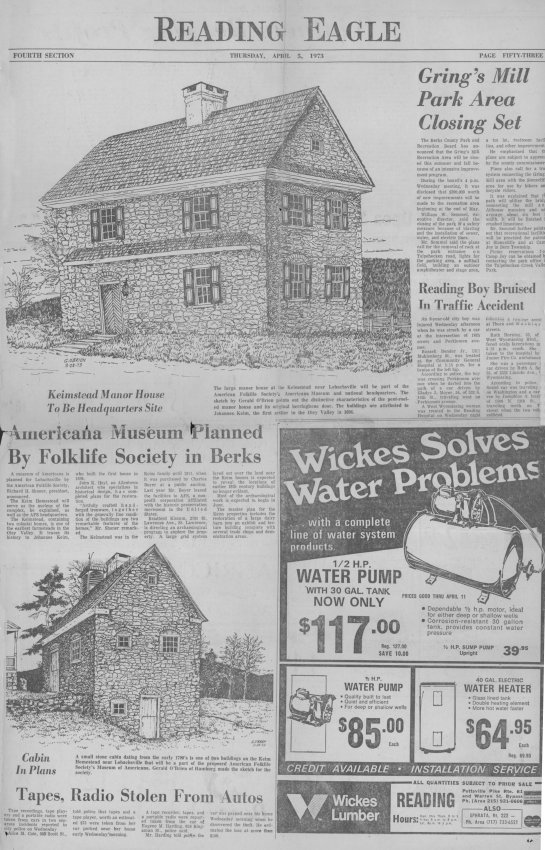
Half-page article with drawings (by Gerald O'Brien) from the Thursday April 5, 1973 edition of the "Reading Eagle." Article appears on page 53, Fourth Section.
Article briefly discusses American Folklife Society's (owner of Keim farmstead in 1973) plans for converting the Keim farmstead into a history museum & national headquarters site.
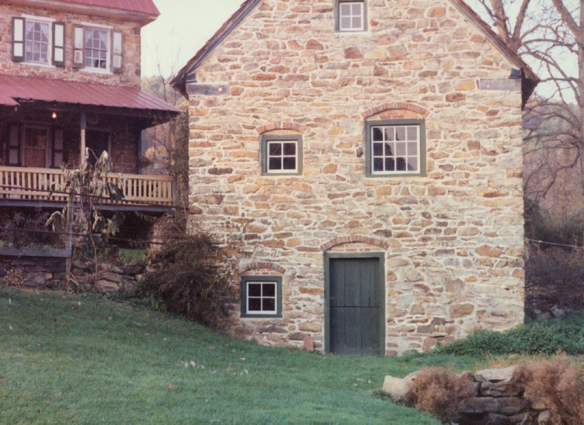
Color photographic print showing detail of the southwest perspective view of the Keim ancillary building during restoration of the southeastern gable wall window.
Details include: brick segmental relieving arches; random rubble masonry.
Color photographic print showing detail of the south elevation view of the Keim ancillary building. Note that the eastern range of the Keim Federal era addition to the 1753 house and 1930s porch can be seen in the left of this photo.
Details include: brick segmental relieving arch; 19th-century paneled shutters above porch
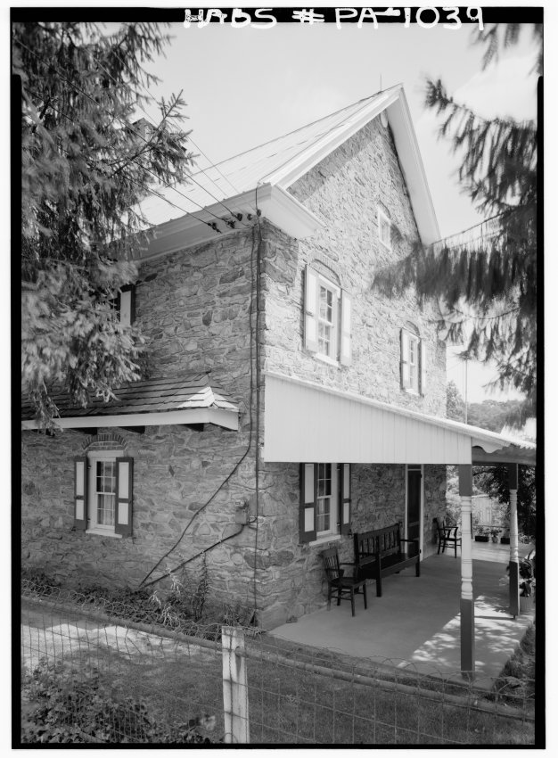
Northwest perspective view of the c. 1753 Jacob Keim house from Historic American Buildings Survey Photograph.
Description:
This view from photo, HABS PA #1039, shows: the pent roof on its original cantilevered “outlooker” supports on the northern eaves wall, with projecting “flashing course” protecting joint between shingles and house-wall [left]; the gable end segment of the 1930s roofed porch [right]; box cornice replacement of early plastered cove cornice; and brick relieving arches above windows.
Laurence Ward, February, 2021
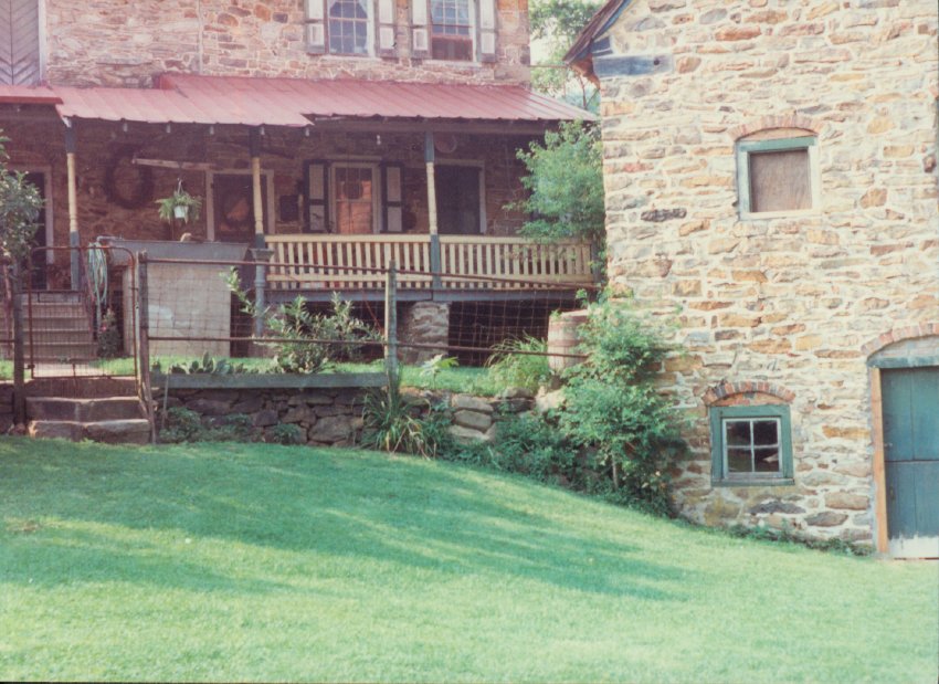
Color photographic print showing details of the south elevation view of the Keim House and southwest gable wall of ancillary structure.
Details include: brick relieving arch, chevron door, portion of 1930s porch.
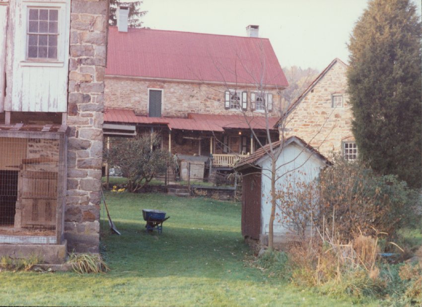
Color photographic print showing detail of the south elevation view of the Keim House. Note that portions of the Keim Cabin, Keim Barn, and Keim Outhouse (right) can be seen in this photo.
Details include: chevron door, brick relieving arch, 1930s porch.
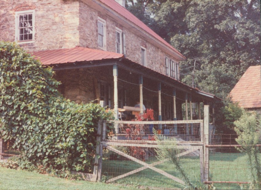
Color photographic print showing detail of a southwest perspective view of the Keim House. Note that the re-tiled roof of the Keim ancillary building can be seen along the right margin of the photo.
Details include: 1930s porch on south eaves wall and west gable wall, both grossly distorting the original proportions, massing, fenestration, and concealing period Germanic details of the 1753 house in rare combination. See record KR11PH3 for the rationale and preservation principles considered in removing the 1930s porch in 2011.
Updated, Laurence Ward, February, 2021
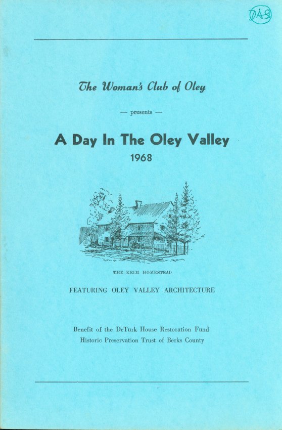
Ten-page booklet (6" w x 9" h) outlining a driving tour of the Oley Valley arranged by The Woman's Club of Oley.
Features include: map, one-page introduction, brief histories for seven sites, and acknowledgements of property owners and tour committee members.
The Keim Homestead is the second site featured. Brief historical text for Keim Homestead begins on page 4.
Full text of bookelt can be found under additional images or MULITIMEDIA LINKS.
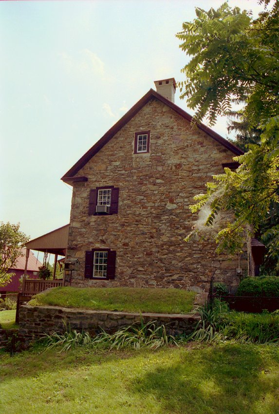
Frame # 15 of 16 (2-17) from 35mm color negatives, all various views of the buildings on the Jacob Keim Farmstead.
East gable elevation of Keim house with 20th-century Victorian-style porch on south eaves wall [left edge of photo], capped and parged chimney, and alternating "quoin" stone corner pier. This gable wall terminates the early addition to the 18th century farmhouse. In the mid-foreground is an arched and sod-covered root cellar, [aka a “ground cellar], formerly beneath a small gabled structure shown in an 1897 photograph and now protected by a roof with sloped doors for exhibiting the vault’s exterior [“extrados”].
Laurence Ward, updated March 2021
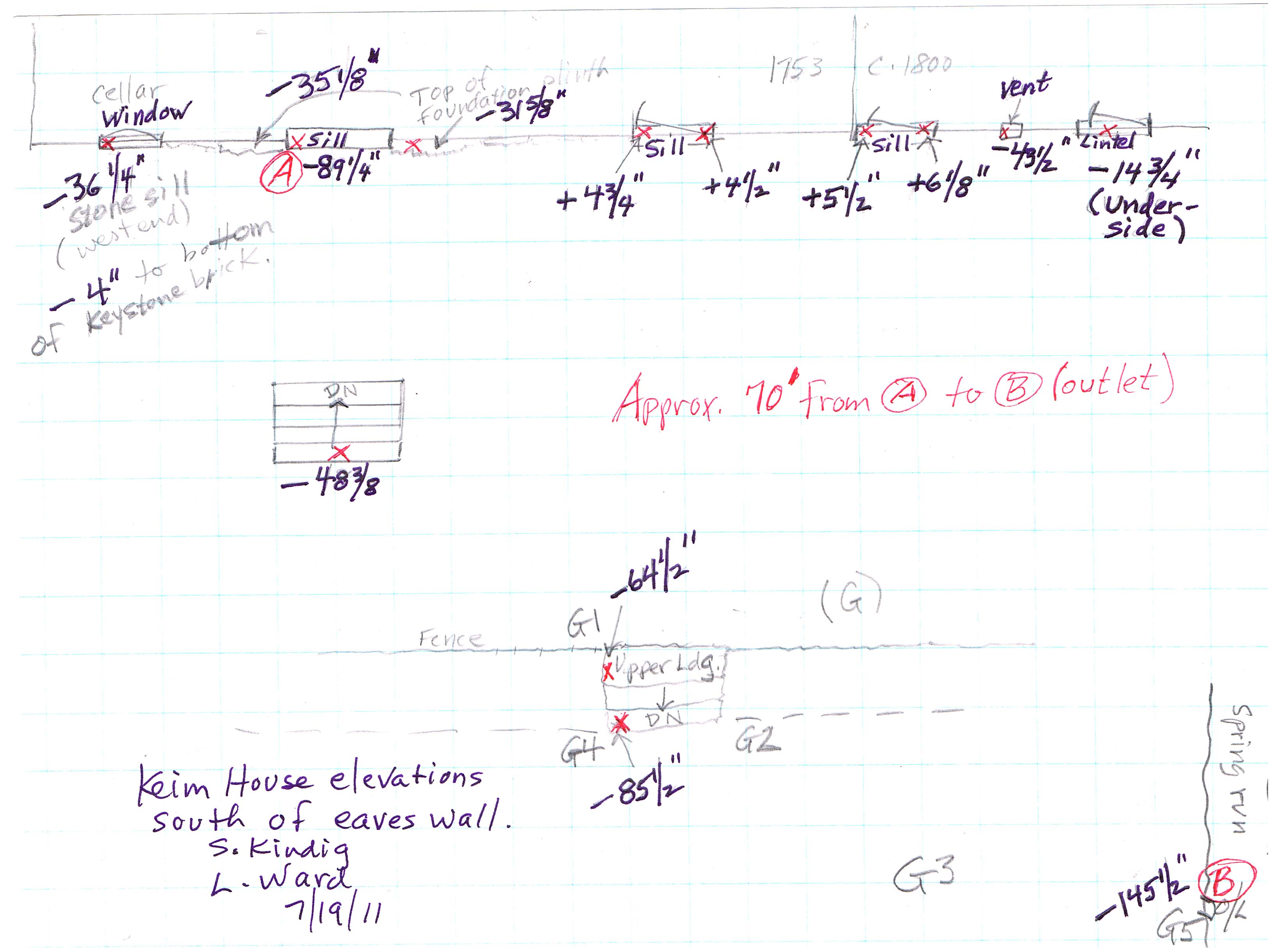
Keim House, field notes drawing, elevations South of the Southern eaves wall (2011). Digital image #1 is a Field Notes drawing showing the Keim House grade elevations south of the south eaves wall.
Description:
The data recorded on this sketch [together with future archaeological investigations] will provide guidance for determining the early and restored objective grades of the terraced yard area bounded by the 1753 house, the c.1800 addition, the mid-18th century "ancillary" wood-turner's shop building, and the low stone retaining wall separating the yard from the grass area north of the barn. The resulting data, in conjunction with soils strata and the degree of their disturbance, will possibly aid in determining the relative pre-and post-construction grades and the existence or non-existence of masonry supports for early entry structures at the 1753 and federal-era doorways. No such foundation remnants have been discovered as of 2015. This information will also facilitate the planning for surface drainage to be controlled by the final slopes, swales, and contours established for the terraced ground area and the contiguous inclined grade to the barn. Under early tradition and Common Law, these living and work areas adjacent to the house and principal dependency buildings have been called the "curtilage", and have been endowed with a privacy aspect for the occupants.
The wall and stone steps leading from the terrace to the barnyard were probably created in the 2d quarter of the 20th century (prior to the 1941 HABS photo in these archives), contemporaneously with construction of the two-wall porch that is depicted in archive record KHPH9--1002.01.044. Image #2, a photo taken c. 1929-1931 by Amandus D. Moyer, confirms the absence of a porch structure on the western gable wall as of the photo's date. The Moyer photo provides some indication of the early 20th century grades and slopes.
The early grade along the building is delineated by the top of the foundation plinth{1} which was concealed during the past century by the stone piers supporting the porches and the overfill of incoherent soils and small stones under the c.1930s porch (removed in 2011).
A stratum of dark top-soil a few feet below the present grade (which aligns with the top of the plinth) indicates that the post-construction (1753) grade was probably established by depositing sandy clay, probably excavated from the cellar space or from elsewhere on the farm, on top of the pre-construction topsoil.
The drawing in this record provides the plinth elevations on each side of the cellar entry opening [the east plinth is about 3.5 inches higher than the west]. These levels and the depth ["invert"] of the cellar doorway sill were the benchmarks which provided the relative elevations of the reconstructed stone retaining walls flanking the "cellarway" consisting of the stone steps and passage through the foundation wall [see record # KR11PH1].
The elevations recorded on the drawing and the point-to-point dimensions noted also indicate the appropriate pitch and run of the swales, contours, and topography of the surface drainage courses from the foundation, the roof runoff drip-line, and the perimeter-line of the retaining walls. All these grade contours are sloped toward the absorption area north of the barn and the margins of the spring-run south of the "ancillary" wood-turner's workshop building [see photos in record KR11PH2--1002.01.088]. These data could also provide a rational basis for future re-establishment of a close approximation of the grades south of the early farmstead buildings.
The elevation data also provided a mathematical framework for the constructive geometry and dimensions of the "cellar-cap" door and frame which would have spanned the retaining walls and sheltered the cellarway{2} passage; see archive record KR11PH1--1002.01.087 for commentary and photographs describing the reconstructed cellar entry-way, the probable form of early "cellar doors" [see the 1786 Rules of Work of the Carpenters' Company of the City and County of Philadelphia] which sheltered this opening, and the hypothesized "bulkhead" framing and sides ["cheek-walls"] which supported the angled and "hung-double" doors{3}.
The re-created retaining walls serve the dual functions of bearing the cellar doors and their support structure, and restraining the lateral soils and hydrostatic pressure from intruding into and jeopardizing the stairwell.
FOOTNOTES
{1} The base-wall ["footing", in modern terms; "basement" in neo-classical terminology] projecting beyond the plane of the wall it supports. This foundation segment, coarser in its irregular exterior plane than the "random rubble" contours of the above-grade walling, delineates the below-grade portion of the foundation. The plinth is thicker than the upper wall ranges, providing a structurally advantageous "basement" [the structural masonry perimeter supporting the building's superstructure and enclosing the cellar], and is not laid with a plumb face-plane or finish pointing, since it was not expected to be seen. It is quite possible that this segment of the foundation walls was laid from inside the cellar excavation, eliminating the need for pointing the exterior face of the plinth. The durability of the walling thus depended on "deep-pointing" the beds and joints from the interior of the cellar, rather than the more common practice of bedding and bonding ("mudding-in") the foundation stonework from both sides of the foundation, and often laying-up the exterior walls from a "builder's trench." Assuming that the base-stones are footed on a solid bearing sub-strate [on the Keim site, a dense amber-colored clay], both construction techniques provide a stable bearing system to carry the compressive load imposed by the massive super-structure of the masonry and timber-framed 1753 dwelling.
The top ["coping" or "water table"] of the plinth descends from west to east, delineating the final desired grade established as described above, and disappears as the grade along the wall falls toward the stone sill below the cellar doorway in the Federal-period addition. See the top of the "rubble" plinth in Image #3 [flanking the cellar doorway opening].
{2} Although a door could have been fastened to the interior abutments of the arched opening with pintles ["hooks", in 18th century terminology], no evidence has yet been found "documenting" a door frame attached to the arched masonry opening or joined to the joisted framing system above the cellar cavity enclosed by the basement. This suggests that no vertical door was present in the early period, which would further indicate the possibility of an "open-way" through the arched passage into the cellar. A door would obviously have provided a barrier of much smaller surface area than a "cellar cap" [the early term for the 19th-century "bulkhead" label] alone for the convection of heat out of the cellar in winter and into it in summer. A door and a cap would obviously provide a more effective thermal barrier than either alone.
{3} The raking bulkhead walls at the cellar entry on the northeast eaves wall of the c. 1762 White Horse Inn in Douglassville appear to be integrated with the foundation walls abutting the opening in a similar manner to the hypothesized bonded joint which probably originally tied the Keim cellarway retaining walls to the foundation plinth.
Laurence Ward, April, 2016 and updated January, 2021
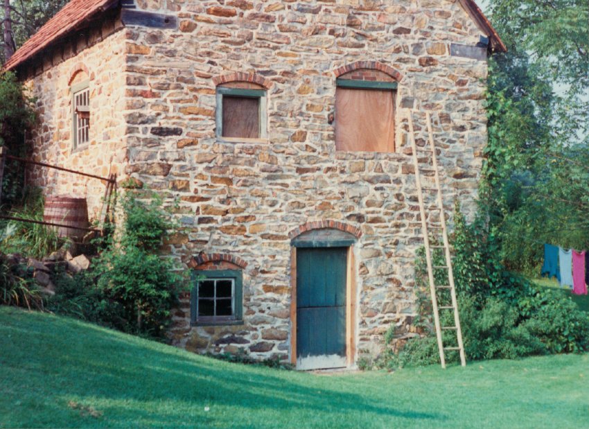
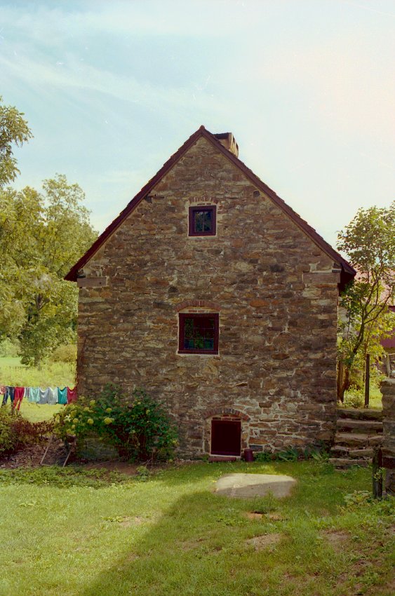
Frame # 16 of 16 (2-17) from 35mm color negatives, Keim ancillary building, north gable end, from a set of various views of the buildings on the Jacob Keim Farmstead.
Gable-end elevation view of Keim ancillary building. Details include: random-rubble masonry, brick relieving arches, casement windows, wall-plate ties at eaves level of gable-end.
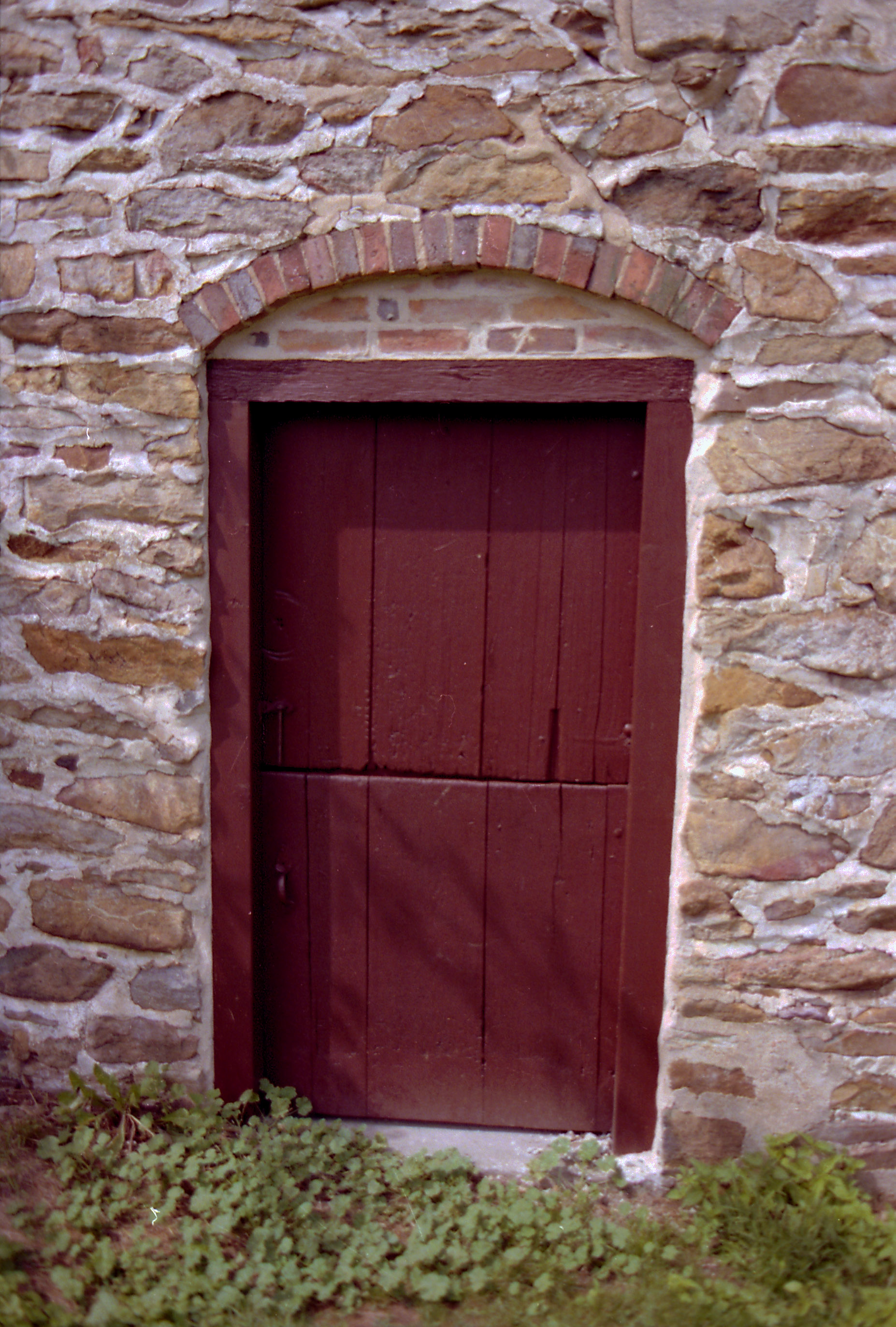
Frame #5 of 16 (2-17) from 35mm color negatives, Keim ancillary building, ground-floor gable-end "Dutch" door, from a set of various views of the buildings on the Jacob Keim Farmstead.
Keim ancillary building gable-end doorway.
Details include: random-rubble masonry, brick relieving arch, brick infill, two-leaf (Dutch) door, oak jambs and lintel.
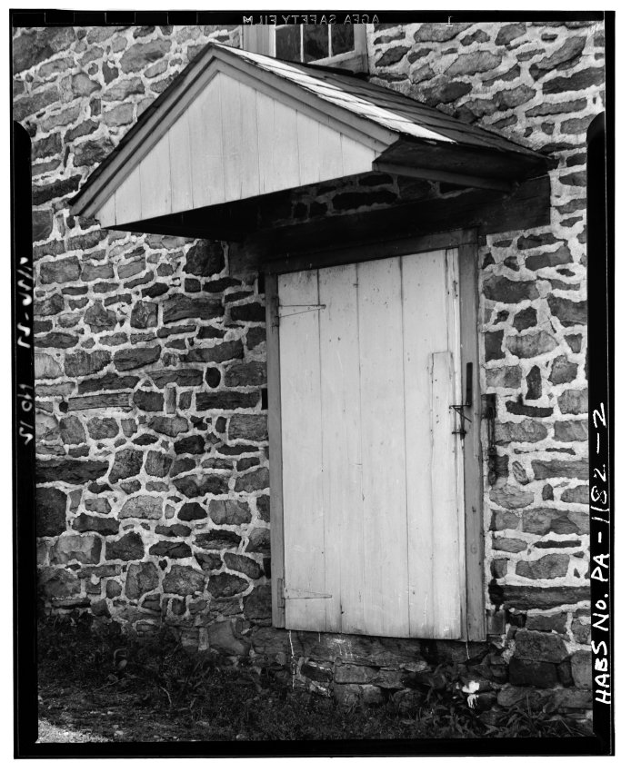
Digital image of Keim Barn from original photographic print showing gable-hooded doorway.
Details include: non-period door and hardware, gabled doorway hood.
Origianl HABS caption for the image is as follows:
"DETAIL VIEW OF HOODED DOOR."
Data sheets for HABS images (KBPH1--1002.01.029 & KBPH2--1002.01.030) associated with the Keim Barn appear in MULTIMEDIA LINKS or see Archive record KBTX1--1002.01.036.
Background text accompanying Historical American Buildings Survey photographs. Two pages of text describe Location and Caption Information for Keim Barn.
For full text refer to additional image or MULTIMEDIA LINKS. Also see MULTIMEDIA LINKS for associated HABS photographs of Keim House & Cabin.
See catalog records KBPH 1--1002.01.029 & KBPH2--1002.01.030 for detailed information on the photographs included in this file.
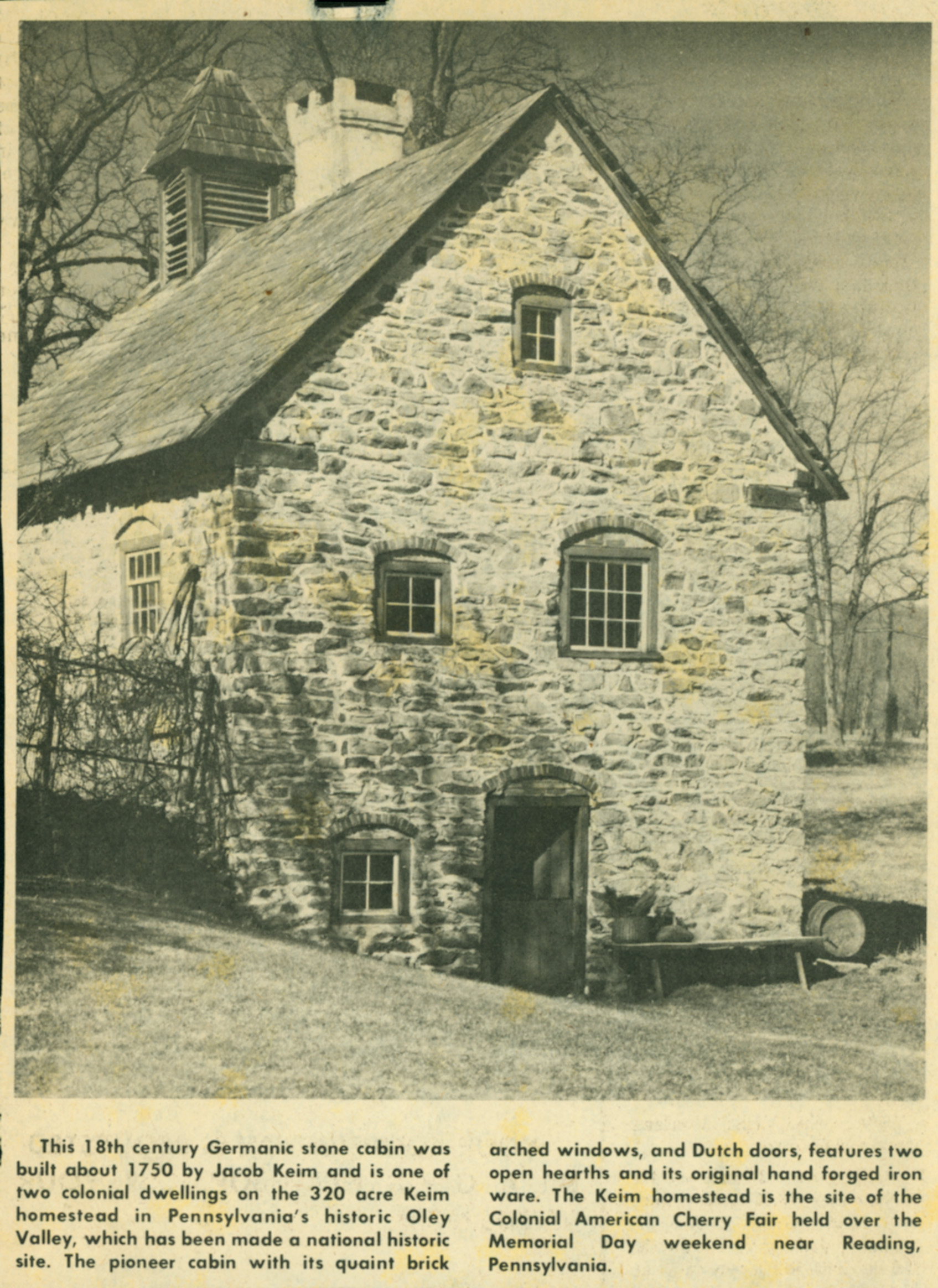
Clipping from an unknown newspaper showing the Keim Ancillary Building (formerly called a "cabin" under the speculation that it had been a Keim "settler's" dwelling preceding the 1753 house) and including a very brief history of the building. Later research determined a construction date of c.1753 and a determination that it was a multi-function farmstead "ancillary" building [Pendleton, Philip, "Oley Valley Heritage, The Colonial Years, 1700-1775," p. 91, caption, and accompanying text, pp. 90-92].
Laurence Ward, updated February, 2021
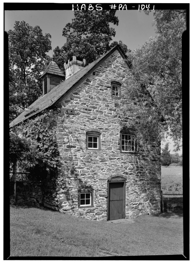
Digital image of Keim ancillary building (formerly called a “Cabin”) from original photographic print from a HABS survey. Details include: random-rubble masonry, brick relieving arch, casement window, central chimney, two-leaf (Dutch) door, 19th century dovecote and slate roof.
Original HABS caption for the image is as follows:
"Historic American Buildings Survey, Cervin Robinson, Photographer August, 1958 SOUTH ELEVATION."
Data sheets for HABS images (KCPH5 thru KCPH9--1002.01.031, .032, .033, .034 & .035) associated with the Keim ancillary workshop building (“Cabin”, a misnomer) appear in MULTIMEDIA LINKS or see Archive record KCTX1--1002.01.037.
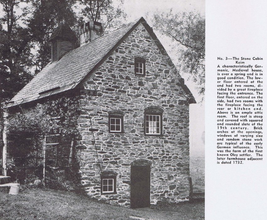
Keim ancillary workshop structure, halftone image from photo, with descriptive caption, published in the "Dutchman," Winter, 1954, page 18.
Brick arches shown are "relieving" elements when properly constructed to transfer structural loads to the masonry abutments flanking the door and windows. Stonework is laid in random-rubble masonry method.
Details include short timber corner ties joined to wall plates on top of eaves walls. These ties also serve as the eaves-level "quoins" which, with the alternating longer masoned stones stacked at each corner, bind the vertical mortar joints of the corner piers. Similar (though twice as long) embedded timber "plates" appear in both gable walls of the Johan DeTurk house [see DTR09PH100--1001.01.192, and DTR09PH93--1001.01.185].
Later research indicates a construction date of 1753, contemporary with the Keim farmhouse a few yards away and not an early "settler's cabin" as peviously thought (Pendleton, Philip, Oley Valley Heritage, The Colonial Years: 1700-1775, p. 91, caption and accompanying text, pp. 90-92).
Laurence Ward, updated February, 2021
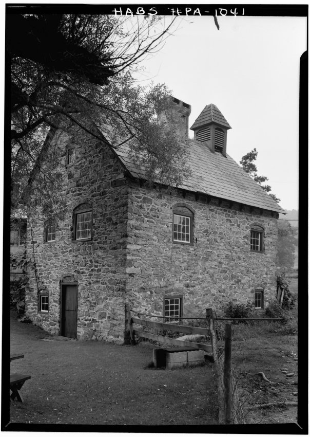
Digital image of Keim ancillary workshop building from original photographic print showing south gable elevation and eastern eaves wall.
Details include: random-rubble masonry, brick relieving arches, casement window, central chimney, two-leaf ("Dutch") door, 19th century Dovecote [or Bell tower?] and slate roof
Original HABS caption for the image is as follows:
"Historic American Buildings Survey, Cervin Robinson, Photographer August, 1958 SOUTH ELEVATION."
Data sheets for HABS images (KCPH5 thru KCPH9--1002.01.031, .032, .033, .034 & .035) associated with the Keim ancillary building appear in MULTIMEDIA LINKS or see Archive record KCTX1--1002.01.037.
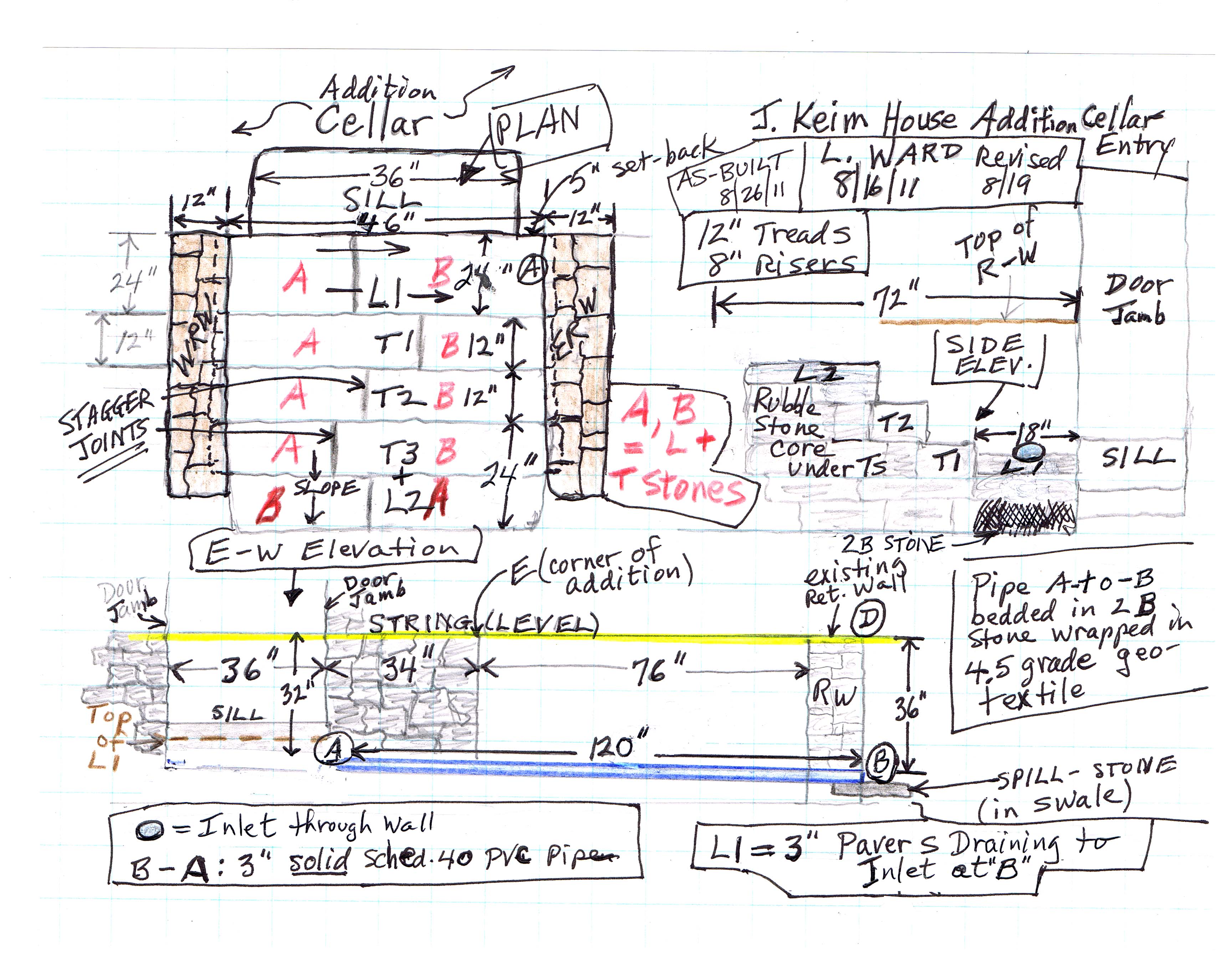
Digital images of 2 field notes drawings and a series of 8 digital photographs showing the cellar entryway constructed in summer, 2011 at the c.1800-1820 addition to the Jacob Keim House. During most of the past 90 years, the addition-cellar doorway [Image #3, photo 3676, 5/23/11] and its approach, an earthen ramp, were sheltered against direct precipitation and roof runoff by the porch built in about 1930 [see Record KR11PH3]. Removal of the porch in July, 2011 eliminated the shelter it afforded, and exposed the cellar doorway and the ramped grade-path to direct precipitation and roof runoff, as well as ground-surface "sheet" flow to the doorway, a virtual "funnel" located at the low-grade along the southern foundation walls [Image #4, photo 5310, 8/13/11]. Significant rainfall and the resulting surface-flow inundated the addition cellar between the time of removal of the porch and the installation of the retained cellar steps and pipe draining the paved lower landing of the new stair-block.
The stone stairway and retaining walls shown in the two sets of drawings and photographs in this record were designed to mitigate the ground and roof runoff into the addition cellar through this doorway. The integrated stair-wall structure consists of:
(a) a lower landing floored with flat stones ["flags"] laid in a random ["crazy"] paving pattern [Image #5, photo 5642, 8/25/11, and Image #6, #5804, 9/1/11]
(b) two intermediate steps formed by two stones ["treads"] each, with their inward faces constituting "risers" and
(c) two larger stones forming an upper landing and creating a natural riser, with treads level with the existing grade situated 24 inches above the lower landing pavement.
The tread-stones and two-stone upper landing are supported on a "rubble" stone core set in mortar, and bedded several inches into the adjacent retaining walls, producing reciprocal mechanical bond and a strongly integrated stair-block.
The walls flanking the steps will serve the usual function of retaining the soils abutting the stairwell, and will provide the additional benefit of diverting the ground runoff around the entry-way to swales conducting the flow down-grade [to the south] from the yard area south of the house and federal-era addition [Image #7, photo #5841, 9/3/11].
Roof runoff and direct precipitation into the "catch-basin" formed by the lower landing will be conducted to an absorption and discharge area by a solid 3-inch Schedule 40 PVC pipe extending at a ¼-inch per foot pitch through the backfill and two retaining walls to the lower grade 9 feet east of the cellar doorway.
The backfill around the new cellarway structure includes a bed of small stones serving as a "French" drain wrapped in a 4.5 gauge geo-textile filter fabric deployed to minimize clogging from soils above the stone drainage course. The water collected in this system will pass through the earlier retaining wall within the opening serving as the conduit for the drain pipe from the lower landing.
Tamped clay was back-filled against the building and retaining walls after insertion of a vertical sheet material forming a water barrier ["Delta-Drain"; see photo Image #8, #5650, 8/26/11] to protect foundation mortar from disintegration. Mixed soils were then filled-in on top of the clay. The area will be sodded or seeded to inhibit erosion.
The as-built stair-wall structure is shown in photos Image #9, 5834 and Image #10, #5836, 9/3/11.
DETAILED CAPTIONS
Image #3, 3676: Doorway to addition cellar prior to removal of porch and construction of retaining walls and stone steps.
#4, 5310: Excavation for cellar steps and cheek walls.
#5, 5642: Retaining walls, steps and landings substantially completed, prior to leveling ["flushing"] up east retaining wall.
#6, 5804: Both retaining walls leveled; Delta Drain membrane set in vertically against sub-grade stonework to conduct soil moisture to stone drainage course.
#7, 5841: Rough grades and drainage swales established.
#8, 5650: 3-inch stones back-filled as drainage path.
#9, 5834 and #10, 5836: Completed walls, steps and raked grades.
Laurence Ward, 2011; updated January, 2021
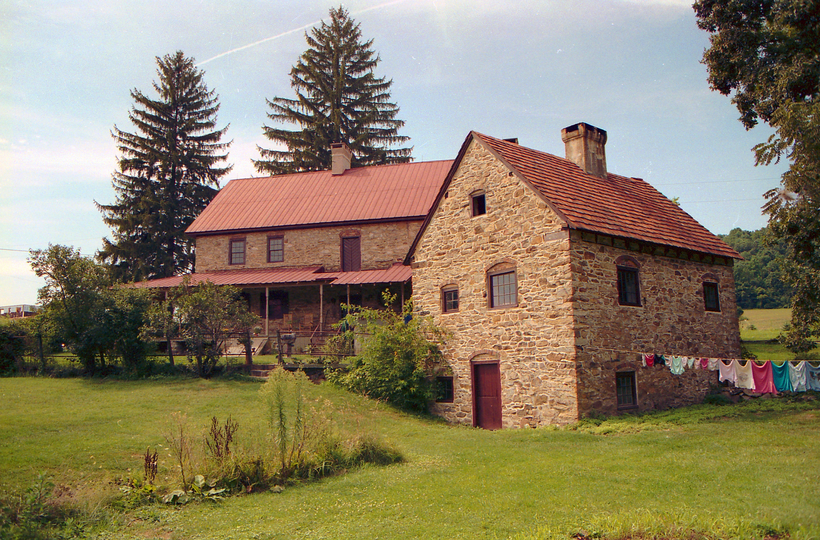
Frame # 6 of 16 (2-17) from 35mm color negatives, all various views of the buildings on the Jacob Keim Farmstead.
Southeast perspective view of Keim house and ancillary building (cabin). 20th-century Victorian-style porch on house.
Record Updated February, 2021, Laurence Ward
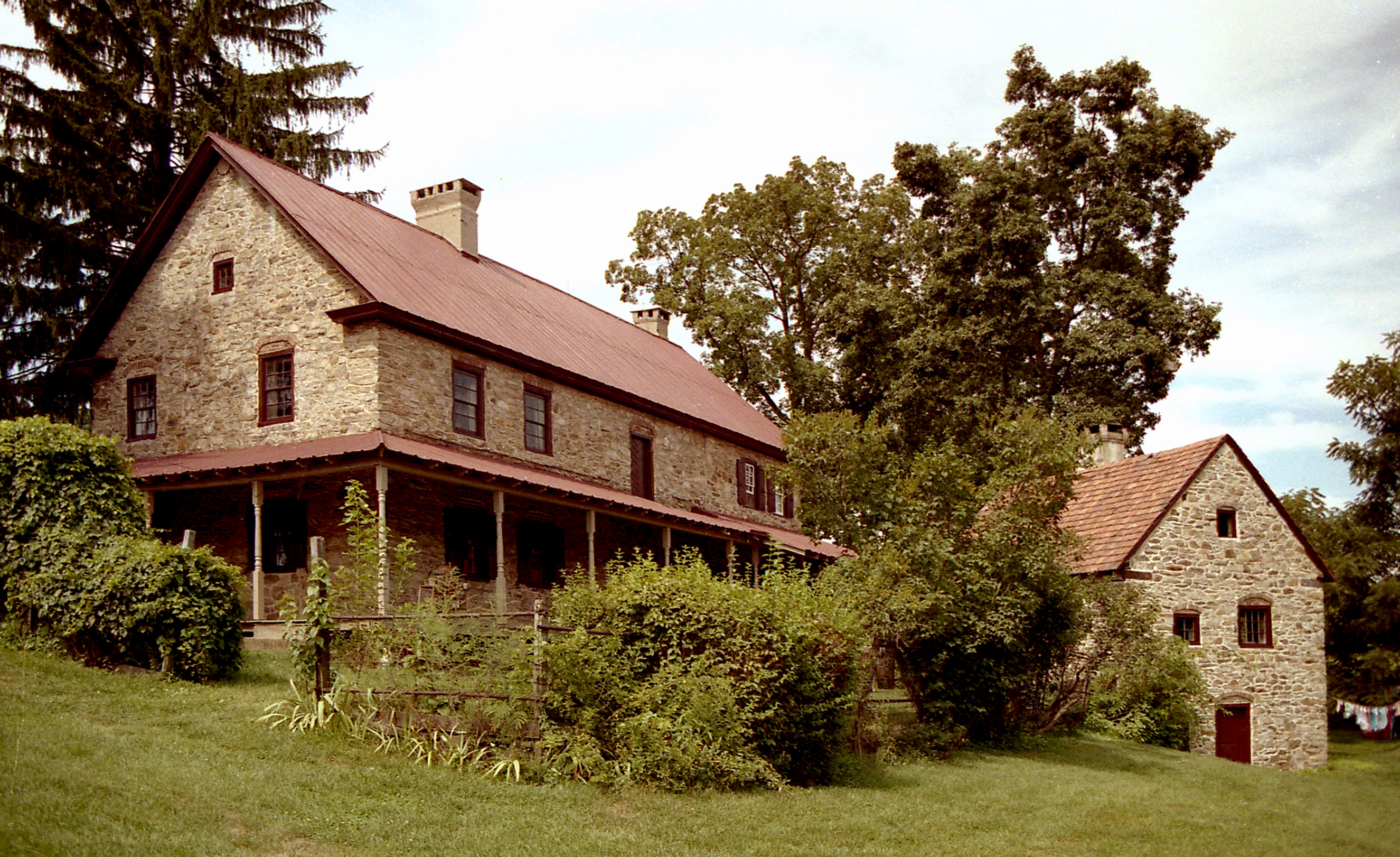
Frame # 2 of 16 (2-17) from 35mm color negatives, Farmhouse and Cabin, from a set of various views of the buildings on the Jacob Keim Farmstead.
Southwest perspective view of Keim house and ancillary building; 1930s Victorian-style porch on house; southern gable-end and re-tiled roof of ancillary multi-function structure (right). The porch and overgrown shrubbery, both since removed, had obscured rare and important architectural features, orientation, and proportions.
Updated, Laurence Ward, February 2021