Collection

Morlatton

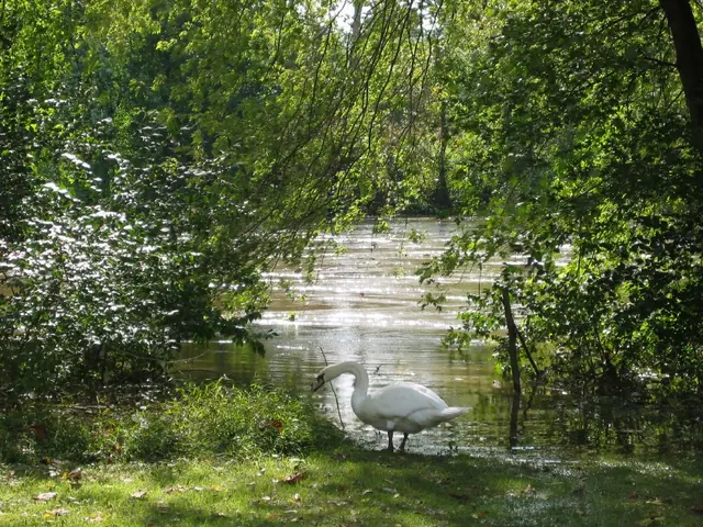
Schuylkill River levels at Morlatton Village, October 1, 2010 (image#1)
Photos 1003.01.052

Schuylkill River over banks

Morlatton · 10/01/2010

Series of four color digital photographs showing water levels after heavy rainfall on September 30 & October 1, 2010. From mid-morning on September 30, 2010 through mid-morning October 1st, six inches of rain fell in the Schuylkill River channel at Pottstown, PA, as measured at the United States Geological Survey (USGS) Station located 75 feet upstream from

View record
Morlatton village, southwest perspective view (1971)
Photos 1003.01.031

Southwest perspective view

Morlatton · 1971

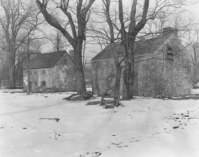
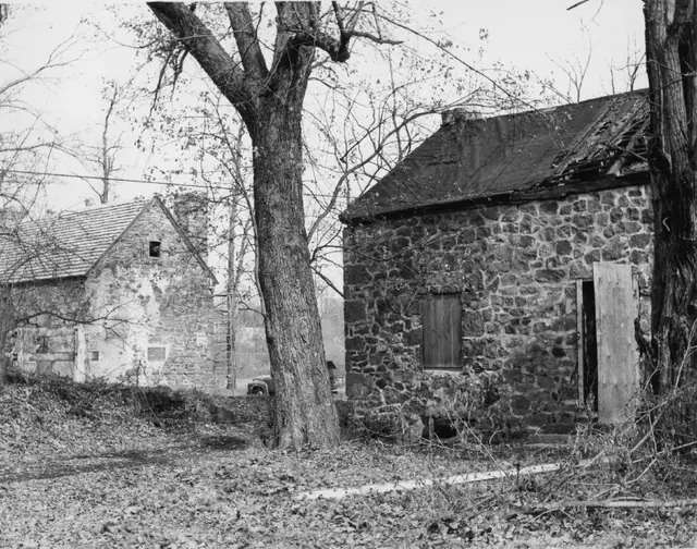
Black & white photographic print showing southwest perspective view of Mouns Jones House (left) & Bridge Keeper's House (right) in 1971. Details include: Replaced roofs; restored masonry walls and chimneys; restored window and door frames. Note written in blue pen on verso reads, "Picture showing The Mouns Jone House and the Bridge House 1971" Addit

View record
Morlatton Village, southwest perspective view (1966)
Photos 1003.01.032

Southwest perspective view

Morlatton · 1966

Black & white photographic print showing southwest perspective view of Mouns Jones House (left) & Bridge Keeper’s House (right) in 1966. The Board minutes for 1966 confirm that the roof on Mouns Jones house had been replaced in that year and “the windows boarded.” Details include: parged masonry, replaced roof, and restored corner chimney on Mouns Jones H

View record
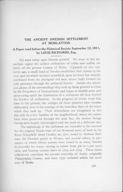
Essay on swedish settlement @ Morlatton, HSBC Transactions vol. III (1923)
Archives 1003.01.006

The Ancient Swedish Settlement at Morlatton

Morlatton · September 12, 1911

Excerpt from the "Transactions of the Historical Society of Berks County Volume III: Enbracing Papers Contributed to the Society 1910-1916" published by the Historical Society of Berks County in 1923 in Reading, PA. Eight-page excerpt begins on page 125 and is titled "The Ancient Swedish Settlement at Morlatton." Paper focuses on a brief history of Moralt

View record
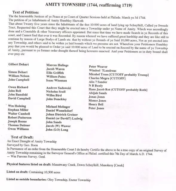
Morlatton Village, transcript of Amity Township Petition, image #1 (1744)
Archives 1003.01.061

Transcript of 1744 Petition to create Amity Townwship and survey map; also plot plan and survey “draught” of Swedes’ Tract

Morlatton · 03/03/1744; plot plans undated

Series of six digital images: a transcript of the second Petition [the first one was described as “lost”] to establish Amity Township, the accompanying survey drawing. Image #3 and #4 show the original approximately 10,000 acre Penn Grant of the “Swedes Tract” to the Swedish Lutheran Pastor Andreas Rudman, to be divided into parcels for conveyance [by “warra

View record
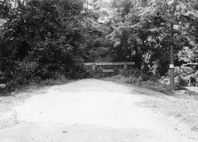
Morlatton Village, former access ramp to covered bridge (1969)
Photos 1003.01.037

View of access ramp to covered bridge

Morlatton · 1969

Black & white photographic print showing view of former access road & ramp to covered bridge before removal. Road to bridge ran between Bridge Keeper's House and mouns Jones House. See additional image for notes stamped in black ink and written in blue pen on verso.

View record
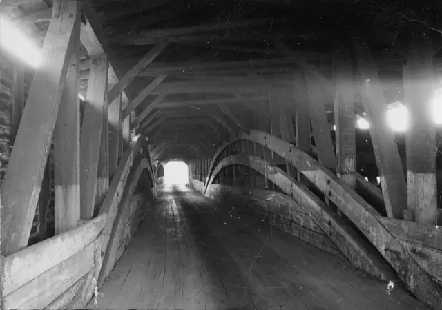
Moraltton Village, covered bridge interior, image #1 (c.1926-1951)
Photos 1003.01.002

Views of Covered Bridge

Morlatton · c.1940-1950

Series of 9 images showing various views of the covered bridge at Morlatton Village. Image #1: Interior black and white photograph of one lane of the “double-barrel” covered bridge crossing Schuylkill river from Morlatton Village, Douglassville, Berks County to Union Township, Berks County. This bridge was constructed c.1832-33 and appears in this locati

View record
Cover page
Archives 1003.01.001

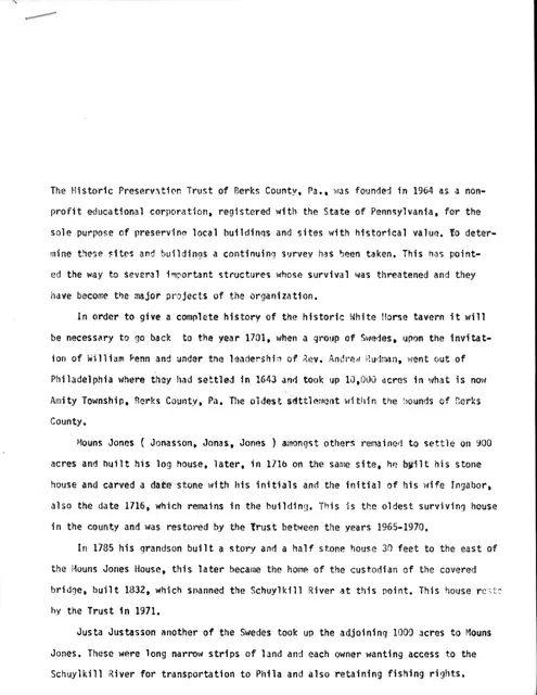
White Horse Tavern History

Morlatton

Copy of a five-page typed history of sites and structures within Morlatton Village, particularly the White Horse Tavern. The first page is a rewrite of the second page (or vice-versa). It summarizes event dates, family history, ownerships and architectural development. View additional images or MULTIMEDIA LINKS for full text.

View record
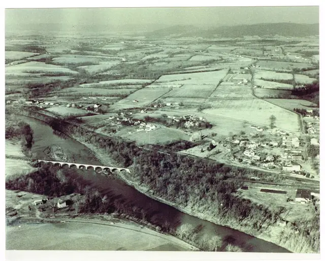
Aerial view of Morlatton Village, Oley Valley and Amity Township
Photos 1003.01.064

Print, Photographic

Morlatton

Aerial view of Oley Valley, Amity Township, and Morlatton Village. The Mouns Jones House and the Michael Fulp House appear in the lower right corner. The Oley Valley extends to the upper left of the photo, with Amity township in between. The original Mouns Jones tract would have extended about halfway from the lower right corner to the upper left corner.

View record
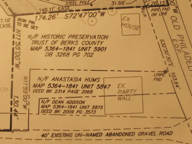
HPT cottage plot plan
Archives 1003.01.174

Drawing

Morlatton

Survey drawing with adjoiners, and cropped lot plan of HPTBC's "Cottage Lot" fronting on Old Phiiladelphia Pike and including a corridor to Swede's Lane.

View record