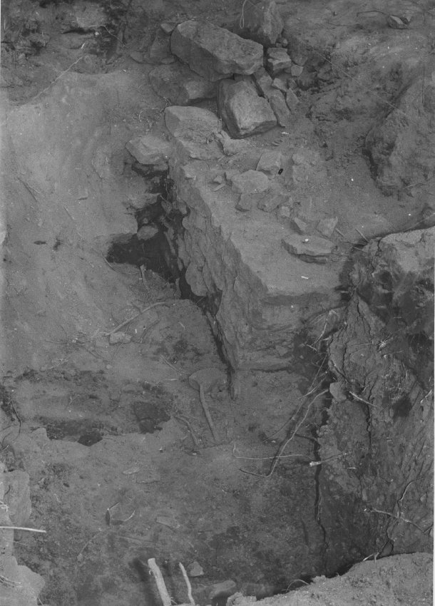
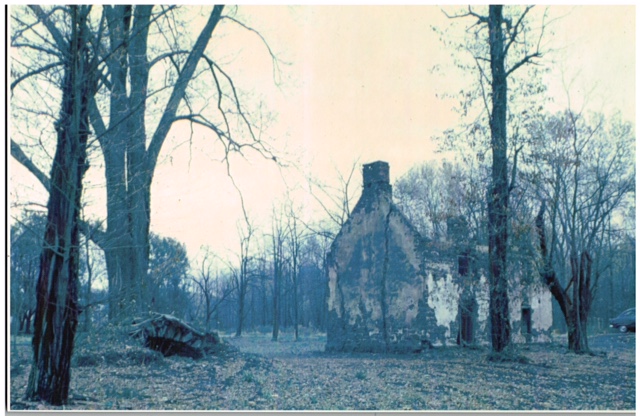
Image #1: Black and white photographic print showing detail of amateur archaeological excavation outside the west eaves wall of the Mouns Jones House in 1969 or 1970.
Image #2 shows text of notes written in blue pen & red pen on verso, which refer to "this wall against the south [sic: closer to southwest] wall of the House--we do not know if this would be the wall to his early house 1701{n} or to an out building [sic]."
{n} The reference to an hypothesized 1701 dwelling is apparently based on the date of William Penn's grant ["warrant"] of approximately 10,000 acres in Manatawny to Swedish settlers, including Mouns Jones and his wife and six children{1}. It is unlikely that Mouns’ first dwelling was constructed much before 1704, when Reverend Sandel noted that he had taken up residence at Manatawny.
Alternatively, some of the sub-grade stonework uncovered in the 1969-70 and 2011-2014 archaeological investigations southwest of the house might have been the disturbed remains of piers or footings ["sleepers"] supporting the porch shown in the photographs in records MJHPH1--1000.01.001, MJHPH62--1000.01.067, MJHPH65--1000.01.070, MJHPH96--1000.01.107, and MJHPH97--1000.01.108. Image #
The two large stones under the plinth masonry in image #3 are probably the base stones [or a fractured single base stone] which originally supported the stone sill under the original doorway. The sill under the relocated doorway will be placed under the re-centered doorway on the premise that it is plausibly the original sill.
Jones' parcel, surveyed or plotted according to the authority of the prime patentee [land title recipient] Andreas Rudman comprised slightly less than 500 acres, with frontage on the eastern banks of the Schuylkill River, which was then the primary artery of transportation and communication between Philadelphia and its expanding northwestern frontier. Jones house was, at the dawn of the 18th century, the outermost homestead settled by a European on the northwestern perimeter of Penn's Philadelphia County; see the history and analysis of the Manatawny "Swede's Tract," including Mouns Jones's parcel, by Philip Pendleton in the September 1988 issue of "The Historical Review of Berks County.".
Rudman did not participate in the land grant motivated by personal avarice. He served for years without salary and often paid church debt out of his own funds. His relatively short tenure in "Molatton" and his hyphenated term as leader of the Swedish Lutherans in Philadelphia [Wicaco Church] is detailed in an essay entitled The Life and Influence of Andreas Rudman, First Minister in Berks, by Ronald W. Oudinot, published in The Historical Review of Berks County, Volume XLIV, Number 2, Spring, 1979, at page 59, et seq.
According to one unpublished account, Jones built "his original log cabin" in 1701 adjacent to the White Horse Ford crossing the river. The same account asserts that Jones and his wife and children "moved in 1704 to Manatawny (Douglassville) in Amity Township, Berks County…." This assertion was probably based on a 1704 letter from a traveling minister [Andreas Sandel] stating that "Mans Jonson" had "taken up" residence there.
In 1709 Mouns and neighboring owners petitioned the Provincial Council for a road from the outskirts of Philadelphia to their "plantations" at Manatawny. The road had not been laid out or physically opened by 1715, when another petition was initiated by Jones and other planters in the region. However, a 1719 Draught shows the proposed extensions of the “Oaley” road to the ford across from Millard’s mill [see record # MVFN01].
By 1712 the Jones family had been ensconced in their first dwelling in the Manatawny settlement, for at least eight years. Assuming river frontage of about a quarter of a mile, Jones's narrow tract extended about two miles northeastward from the river.
In May 1712 a letter from Charles Gookin, Lieutenant Governor of Pennsylvania, cites a Mouns Jones letter dated May 4, 1712 to the Governor requesting that a meeting with four "Indian Kings" be convened "at the said house of Mouns Jones of Manatawny."
Images #4 and 5 [#8916, 6/7/14] is a collection of pottery sherds found during the 1969-70 archaeological campaign; these fragments, mostly slip-decorated or incised redware, were returned to the site in 2011 by a participant in the 1970 "dig". A careful re-excavation and documentation of the sub-grade curtilage west of the existing stone house has been conducted from 2011 through 2014 to determine whether any further findings might shed light on the early construction sequence and purpose of this stonework. The 2014 excavations have unearthed early slip-decorated artifacts including redware sherds and additional sub-grade stone wall segments [Images 6 & 7].
FOOTNOTE
{1} See the history and analysis of the Manatawny "Swede's Tract," including Mouns Jones's parcel, by Philip Pendleton in the Sept., 1988 issue of "The Historical Review of Berks County."
Laurence Ward, April 2010
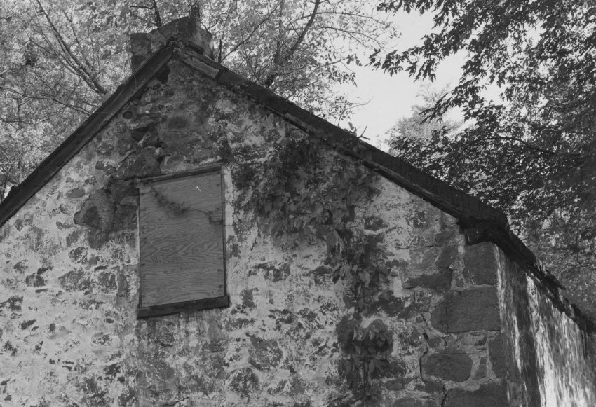
Digital image of a black & white photographic print showing detail of north gable of Fulp House.
Details include: parged random rubble masonry; stove chimney (since removed); beaded rake ("barge") board; attic window in gable wall; quoin corner pier.
The small stove chimney seen in this photo and in records MFHPH18--1005.01.019, MFHPH46--1005.01.047 & MFHPH48--1005.01.049 is structurally integral to the apex of the gable masonry. In plan, it was no wider than the thickness of the gable wall and therefore needed no additional structural support in the interior of the building. The chimney stonework on this north gable wall collapsed in 1967, and no evidence remains concerning the type of stove or the probable date of installation or the configuration of its exhaust piping. However, the off-axis position of the attic window and the triangular masonry segment above the window would have accommodated the entry of a stovepipe into this chimney [see MFHPH39--1005.01.040]. The stove would typically have been placed on the first floor, with its piping extending to the chimney through the floor above into the garret, providing additional heat in the "dormitory" space. This might have occurred shortly after acquisition of the house by George Douglass II from Michael Fulp's Estate in 1808. This "home improvement" and modernizing campaign by the entrepreneurial Douglass might also have included the chair rail molding and skirt-board on the first and second floors(a), and possibly larger windows than in the original fenestration program. Both the attic window in the south gable wall and the chair rail on the first floor level of the north gable wall were fastened with cut nails which were more consistent with the early 19th century than the early 1780s, when hand-wrought iron nails were still prevalent.
(a) A November, 2011 paint analysis report concluded that the chrome yellow paint which appeared to be the first finish on the chair rail is an early 19th-century color, indicating either that the rail was originally unpainted or was not installed until c.1825-30.
Free-standing{1} iron stoves for heating [and baking in ten-plate types, in the four-plate interior oven], many cast within a few miles of Morlatton, became available in the late 1760s{2}. During the last quarter of the 18th century they were "widely used …as an efficient heater of large halls and public buildings in America(b)" ["Heat and Style: Eighteenth-Century House Warming by Stoves" by Samuel Y. Edgerton, published at pages 20-26 of the Journal of The Society of Architectural Historians, Vol. XX, No. 1, March, 1961]. At a typical cost of $20 new, "ten-plate" stoves and their piping, plus installation costs, "were a rich man's luxury" [ibid., p. 22, footnote 9]. However, Christian Bauer, a Swiss native who probably originally immigrated to Pennsylvania, then moved to Carroll County Maryland, constructing a stone house in 1785, left at his death in 1790 three "pipe stoves" with their values recorded in his estate inventory. This designation provides no details on the construction or design of the stoves, but clearly refers to a cast iron plate stove exhausting through a "pipe" which would have been vented through the masonry chimney flue. It seems probable that Bauer would have acquired the stoves based on awareness of the plate-stoves appearing in Pennsylvania before he migrated to Maryland. The Bauer House and Christian Bauer's stoves are discussed in "A Pennsylvania German Vernacular Structure in Maryland-The Christian Bauer House" by Joseph Getty, published in "Der Reggeboge, Journal of The Pennsylvania German Society", Volume 19, no. 2 (1985), pp. 42-54. See also footnotes {1}and {2} below.
(b) notably Independence Hall.
Whether Michael Fulp, described in tax and census records as a "laborer" and later a "yeoman"[n] farmer, could have afforded the cost of a free-standing stove, including the significant stonework associated with its installation at the time [c.1782-83] he constructed his modest stone house, cannot be determined with certainty. However, Fulp incurred considerable debt during his farming days (dying insolvent) and could have financed a stove on credit(c). Nevertheless, only a "Duch oven," valued at less than 15 shillings, appears in his estate inventory. Thus it seems reasonable to infer that the stove and the chimney visible in this photo were installed after Fulp's death in 1808.
[n] Michael Fulp, of German lineage [also “Folb” in Berks County Deed records] qualified quite literally as a “yeoman” (in the British tradition), since he owned his own home and for about ten years, from 1795 to c.1804, farmed his own land, the forty acre Douglass Township tract along the Schuylkill River about a mile from his riverside house in Amity township. In this context “yeoman” is to be distinguished from “cottier,” who farmed another person’s land and lived in the owner’s cottage; see Lay, Edward K., “European Antecedents of Seventeenth and Eighteenth Century Germanic and Scots-Irish Architectire in America,” published in the "Pennsylvania Folklife" issue for Autumn, 1982, page 32.
(c) Fulp did have a credit arrangement, as indicated by Day-Book entries in the Douglass-Jenkins and Amity store records. These credits were derived from commodity-barter transactions and day-labor by Fulp [see archive record HPTOBJ1--1008.01.022]. The records available start in 1786, so no transactions are recorded for the period of construction of the Fulp house, and no Fulp entry [1786-1808] has been found involving a stove.
Fulp was indebted to George Douglass at Fulp's death for 25 pounds on a "Note and book debt."
Note in pencil on verso of this photo reads: "Toll House, a good view of plate 6 x 8 and beaded board."
Note in blue pen on verso written over "Toll House" reads: "BRIDGE HSE." This correction was probably motivated by the discovery{3} that the toll house for the covered bridge at this early ford-site was located on the opposite side of the Schuylkill River in Union Township, where the Kulp family served as toll collectors for much of the period of private ownership of the bridge [c.1833-1885]. Tax, census, and other public records will be consulted to determine the dates and details of the Kulps' activities relating to the bridge.
This structure was also called the "custodian's" house and the "Bridge House" [see image #2 in MFHPH45--1005.01.046].
Since the names traditionally applied to the other two houses in Morlatton Village derive from the original owner/occupants of the structures, this modest house will be called the "Michael Fulp House," at least until it is documented that a bridge custodian, tender, or "keeper" actually lived there. The only "keeper" who is reputed by oral tradition to have resided in the Fulp house was a woman who "tended" the bridge in the 1940s.
FOOTNOTES
{1} Earlier "Franklin" stoves [his "Pennsylvania Fireplace," designed before 1744, appeared by 1750] and similar forms were designed to sit in the masonry fireplace or on a "front hearth," and were vented through pipes into the original fireplace chimney.
{2} The earliest ten-plate stoves, c.1765-1767, are discussed in Mercer, Henry, ”The Bible in Iron,” Doylestown, PA (1941), pp. 140-150; and Gemmell, Alfred, ”On the Trail of America’s First Cook Stove,” published in The Historical Review of Berks County, Vol. XV, Number 1, p. 142 (October, 1949). Neither of these sources discusses when stoves installed independently of the fireplace chimney were introduced into rural housing in the region.
Fulp’s house on the Schuylkill River in Amity Township, with its fireplace against the gable wall in the southeastern corner of the house, had no “stove room” (or “stube”), referring to the parlor containing the jamb stove inserted into the “stove-hole” aperture through the back wall of the kitchen (“kuche” or “kich”) fireplace in the classic Germanic three room, central chimney house type. As noted above, Fulp’s stove was at the north end of the living space where the stove-chimney is situated as seen in this photograph.
Heating stoves of the “jamb” type, fueled and vented through the back-wall of the fireplace, and free-standing stoves vented independently of the fireplace chimney, were apparently efficient only in a relative sense: A letter sent by a “correspondent in Philadelphia” to the Boston Evening Post during a heat wave in July, 1749 commented “How warm our Stove-Rooms seem in Winter! and yet the highest they ever rais’d my thermometer was to 56 degrees.” Dow, "The Arts & Crafts in New England," 1704-1775, Topsfield, MA (1927), p. 214.
{3} Possibly from the hand-colored map of Amity Township appearing on page 27 of the 1876 "Atlas of Berks County," published by the Reading Publishing House, which captions a building near the Union Township bridge approach (across the river from this building) as a "toll house." The nomenclature becomes a bit more ambiguous when one considers that the original owner/occupant of the "Bridge Keeper's House," Michael Fulp, died approximately 25 years before the first bridge was built at this site. One tradition says that the occupants of this house cleared snow drifts from the approaches and portals of the bridge, and spread snow through the length of the bridge deck to accommodate sleigh traffic. From this anecdotal fragment the inference is drawn that the occupants were the bridge's "keepers" or "custodians." This inference was probably reinforced in the 20th century by the proximity of the 1783 house to the eastern ramped approach to the 1833 covered bridge [see Image #2 in record MFHPH46--1005.01.047].
Laurence Ward, June 2016
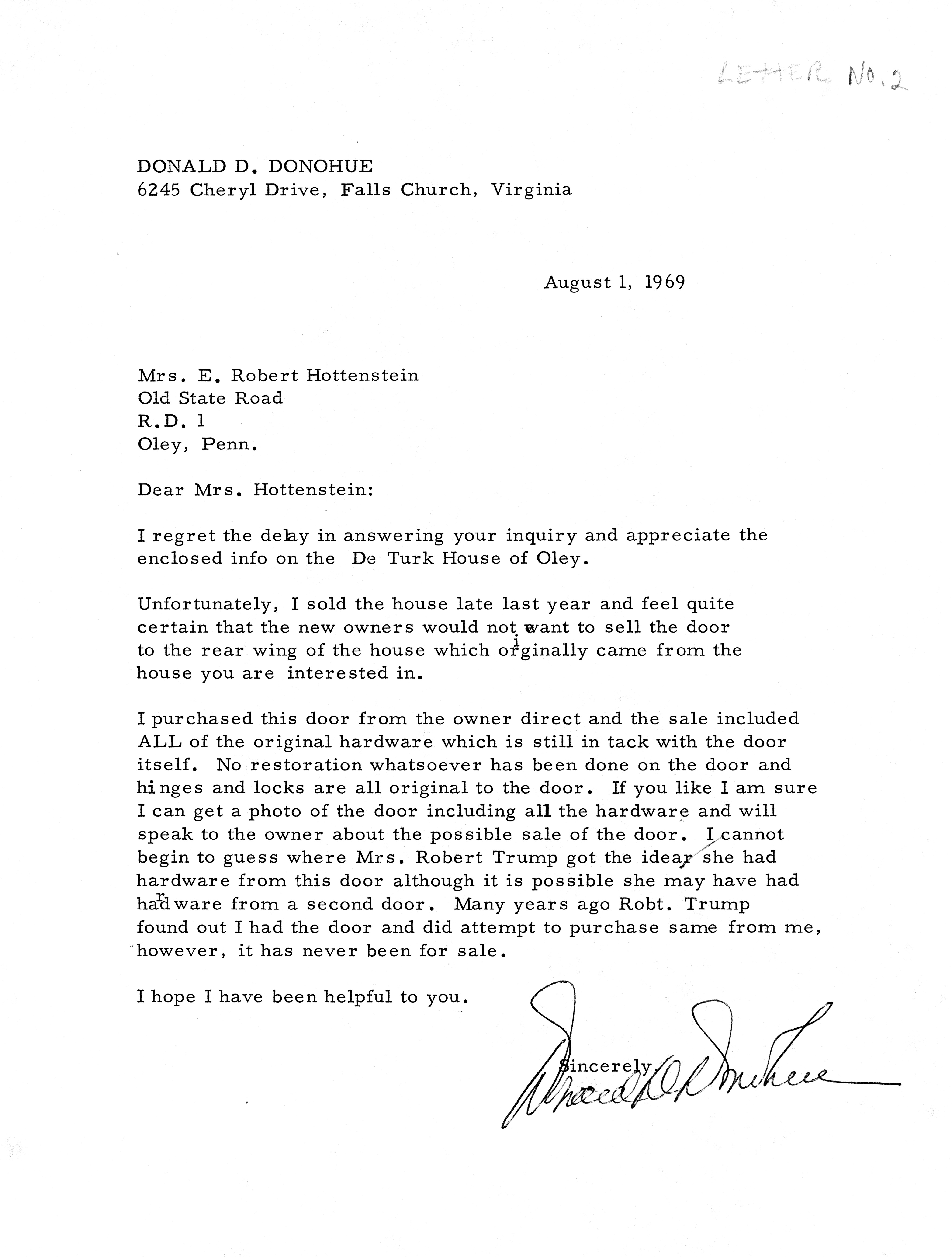
Letter in reply to HPTBC's Mrs. E. Robert Hottenstein from Donald D. Donohue, antique dealer of Falls Church VA, dated 08/01/1969. No copy of the letter from Mrs. Hottenstein has been found.
"Letter No. 2" is printed in pencil in the upper right corner. This apparently refers to a series (numbered 1 to 6) of inquiries to various sources about the De Turk property made by Mrs. Hottenstein.
The subject is the location of a door and its hardware from the first floor, south elevation of the DeTurk house, and the possibility of purchase by HPTBC. Mr. Donohue's reply is negative.
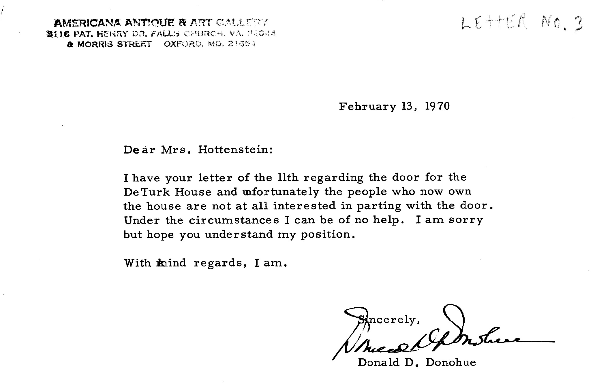
Letter from Donald Donahue, antique dealer of Falls Church VA, dated Feb. 13,1970, in reply to a letter dated August 14, 1969 from Mrs. E. Robert Hottenstein, , to. A copy of the letter from Mrs. Hottenstein is posted in record DTHTX10.
"Letter No. 3" is printed in pencil in the upper right corner. This apparently refers to a series (numbered 1 to 6) of inquiries to various sources about the DeTurk property made by Mrs. Hottenstein.
The subject is the location of a door from the first floor, south elevation of the DeTurk house discussed in previous exchange of letters. Mr. Donohue indicates he can be of no further help in procuring the door from the current owners.
However, approximately 40 years after receipt of this letter, the estate of the owners in Virginia donated the original door and its hardware to the historic Preservation Trust. These precious artifacts are preserved and exhibited by the Trust.
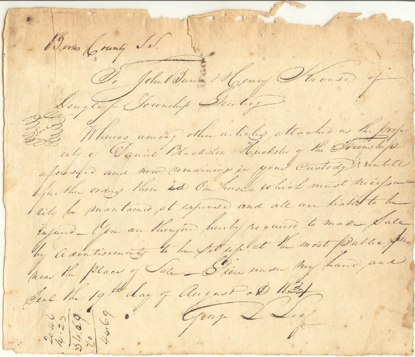
A draft of a letter concerning the approval of the sale of Daniel Blackston's horse.
The letter reads:
Berks County S.S.
to John Bunn and Henry Krouse
Douglass Township Greetings
[Seal] Whereas among other articles attached as the prop
erty of Daniel Blackston Huckster of the Township
aforesaid and now remaining in your custody untile
further orderz there is one horse which must of necessity
be mainted at expense and all are liables to be
infund-ed You are therefore herby required to make Sale
by advertisment to be set up at the most public place
near the place of Sale. Given under my hand and
Seal the 19th day of August ad 1834
George L Leaf
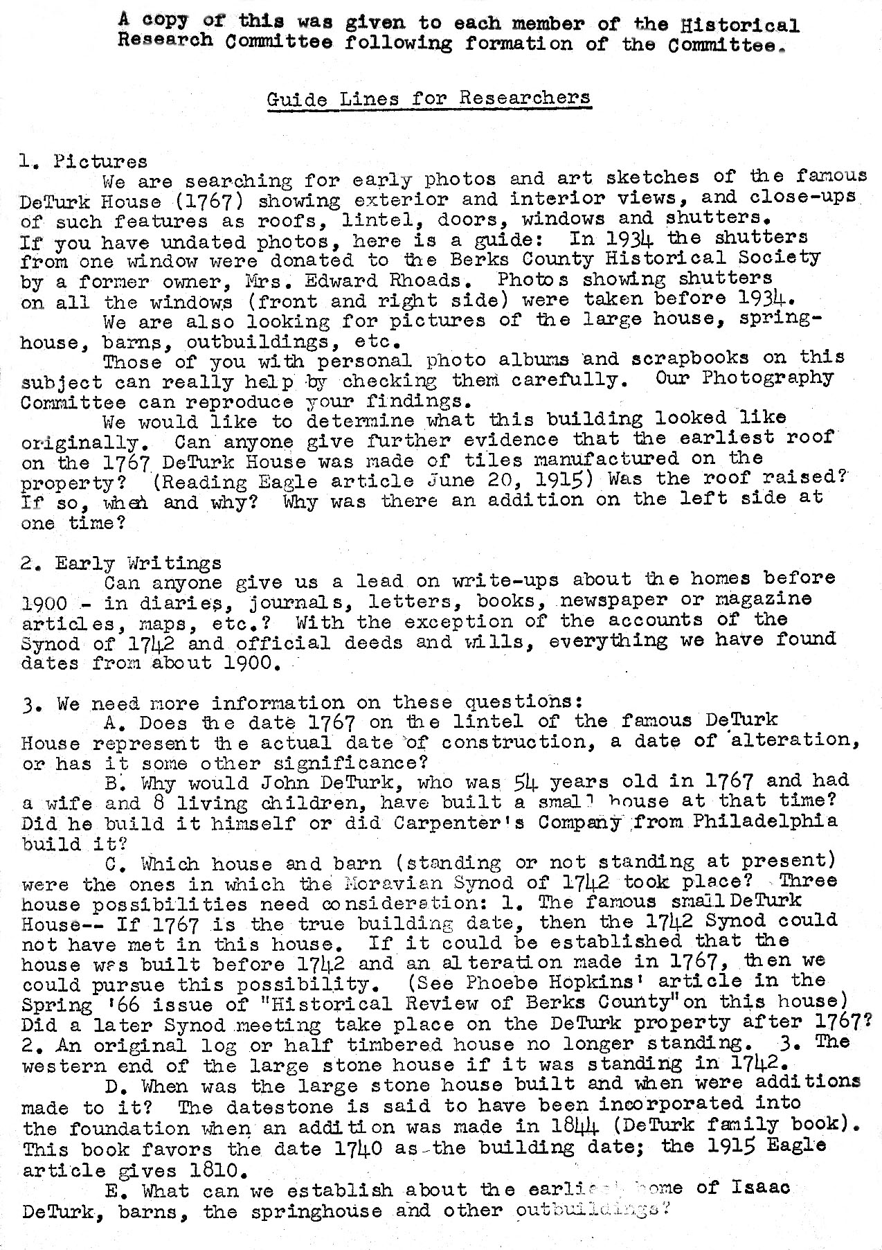
Letter from chairman Betty Hottenstein (Mrs. E. Robert) to all members of the Historical Research Committee, outlining needs for data on De Turk genealogy, deeds, descriptions of buildings and Moravian connections.
Archives record DTTX6--1001.01.013 is the 1970 report of this committee.
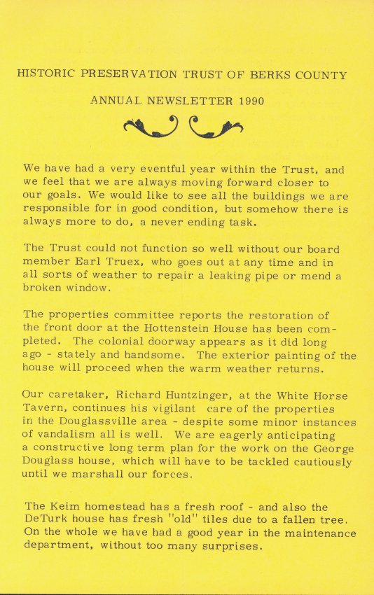
Four page newsletter of the Historic Preservation Trust of Berks County printed in 1990. Piece contains a letter from Mary Pendleton (then Trust president ) updating readers on the restoration progress made at various properties in addition to thanking volunteers, acknowledging donations, etc.
For full text of newsletter see additional images.
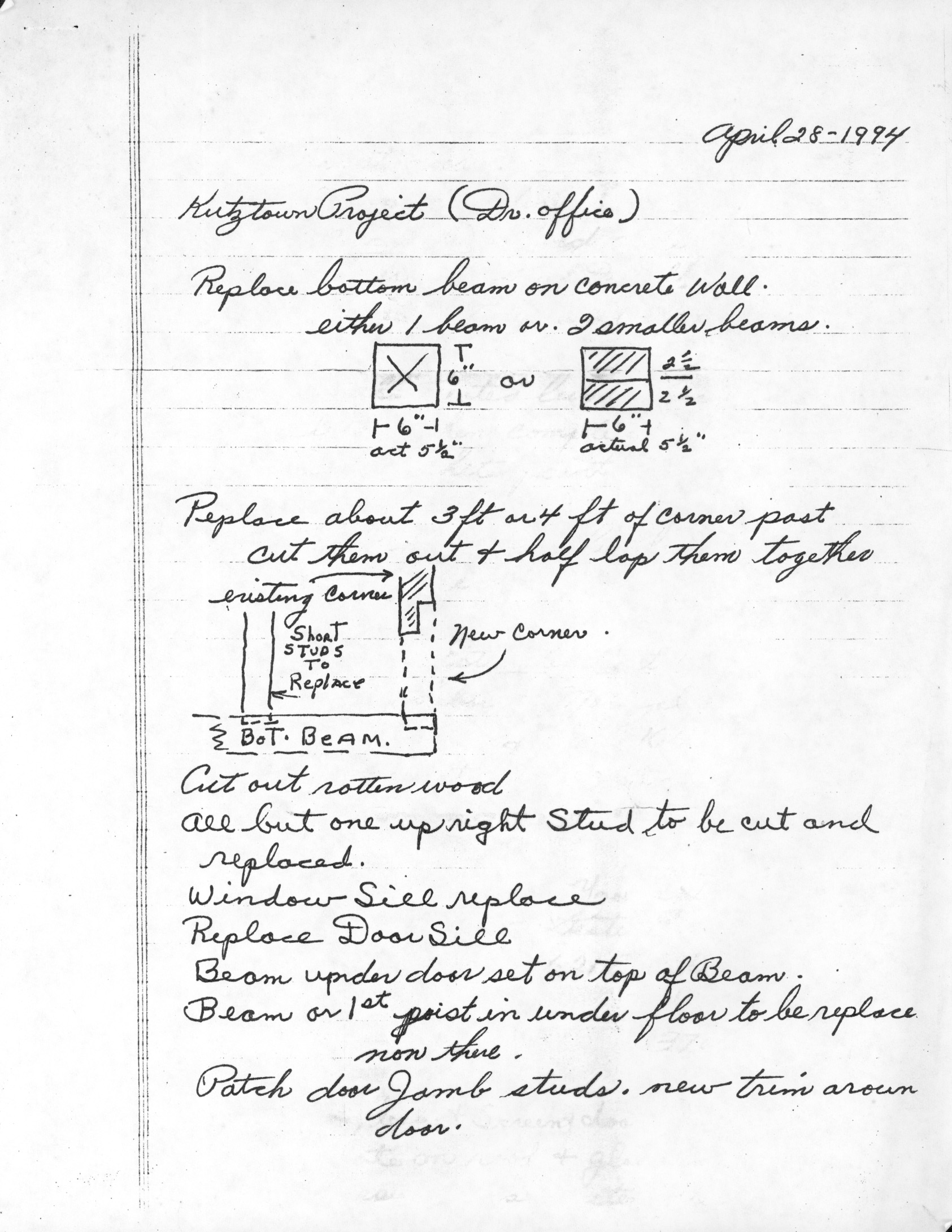
Proposal for necessary restoration of the frame Doctor's Office Building on the Hottenstein Site.
Proposal in letter form, signed by Lester E. Groff.
(Two Pages)
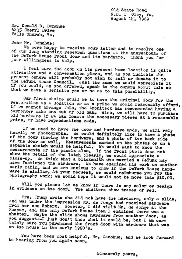
Letter Aug 14, 1969, by Mrs. E. Robert Hottenstein in reply to the Aug. 1, 1969 letter from Donald D. Donohue. There is further discussion of the De Turk house door and its hardware, and the details necessary to have reproductions of these made if the originals cannot be purchased.
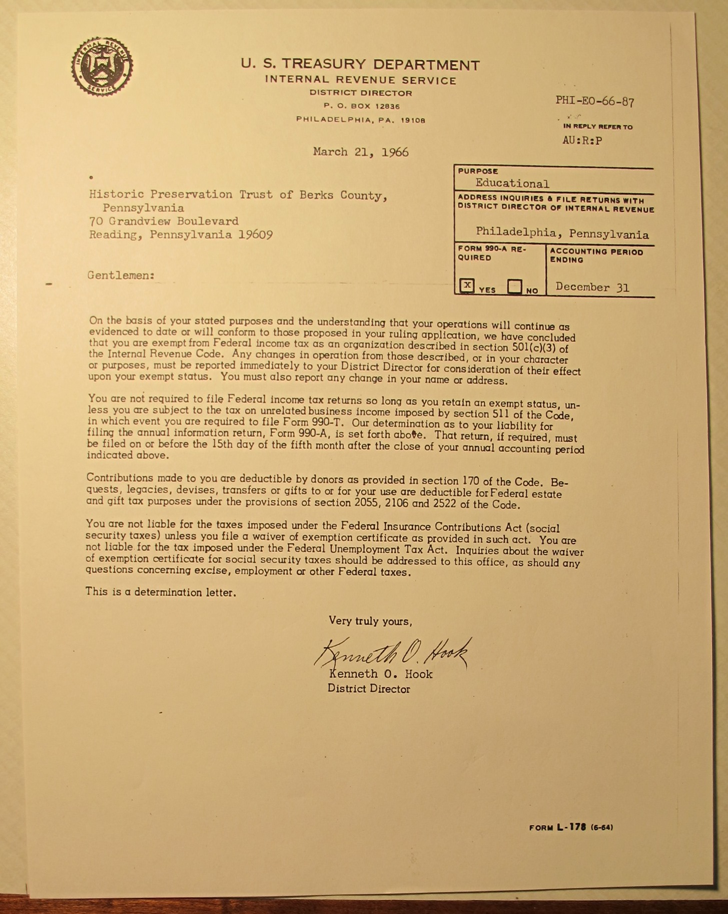
copy of 1966 letter from the IRS exempting the Trust from Federal income taxes as a qualified 501(c)(3) corporation within the Education category under the IRS Code and Regulations.
Larry Ward, May 2022
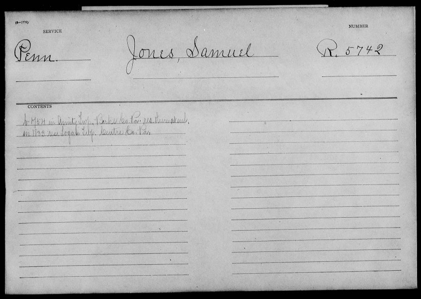
A application for receiving military pension for Samual Jones. Application is dated 1833. Samuel Jones's application was rejected for reasons of "not serving at least the required amount of time of six months," according to the ruling.
Included:
manuscript documents in support of the Application and Supporting Documents [image#1]{n}
{n}Five page manuscript documents of the Application for Samuel Jones's Military Pension, sent by J.James Gilliland, sent to the "State of Pennsylvania" and "Berks County." The letter consist of five handwritten pages [images#2, image#3, image#4, image#5].
Manuscript documents in support of for the application of military pension:
-Manuscript document of Rejection (no 24295) signed by James Gilliland [image#6]
-Manuscript document in support ofhe War Department document with "statements of witness" to provide evidence in favor of Samual Jones pension application. Signed by J.L Ewards, Commisionor of Pension [image#7]
-Copy of "Regulation Under the Act of June 7, 1832" page 3 of 4 [image#8]
-Copy of "Regulation Under the Act of June 7, 1832" page 4of 4 [image#9]
-manuscript document of an "offiical rejection," with case number 5742 [image#10]
-manuscript documents of "rejection," with case number 5742 [image#11]
-A transcript of a note; "James Gilliland Bellafonte(top margin), "Re vol 9 PA 254" (bottom margin) [image#12].
-Manuscript document of rejection from the War Department ; signed by J. Gilliland [image#13]
-[ATTACHED AS A PDF FILE] A transcript copy of the of the process of application for the receiving of military pension for Samuel Jones; compiled by W.F. Wagner, MD
^Added Note:
Early 20th century historian and President of the Berks County Historical Society from 1902 to 1917 read a paper to the Society on September 12, 1911 entitled “The Ancient Swedish Settlement At Morlatton”. This address was published in 1923 in Volume III of the “Transactions of the Historical Society of Berks County.” Included is the statement that
“The region for many miles surrounding was known in provincial history as Manathanim, derived from the Indian name of the Creek…The name Morlatton, by which this church has been known for nearly a century and a half is, I have no doubt, a corruption of Manating, a later version of the name Manathanim…subsequently …employed to designate the locality.”
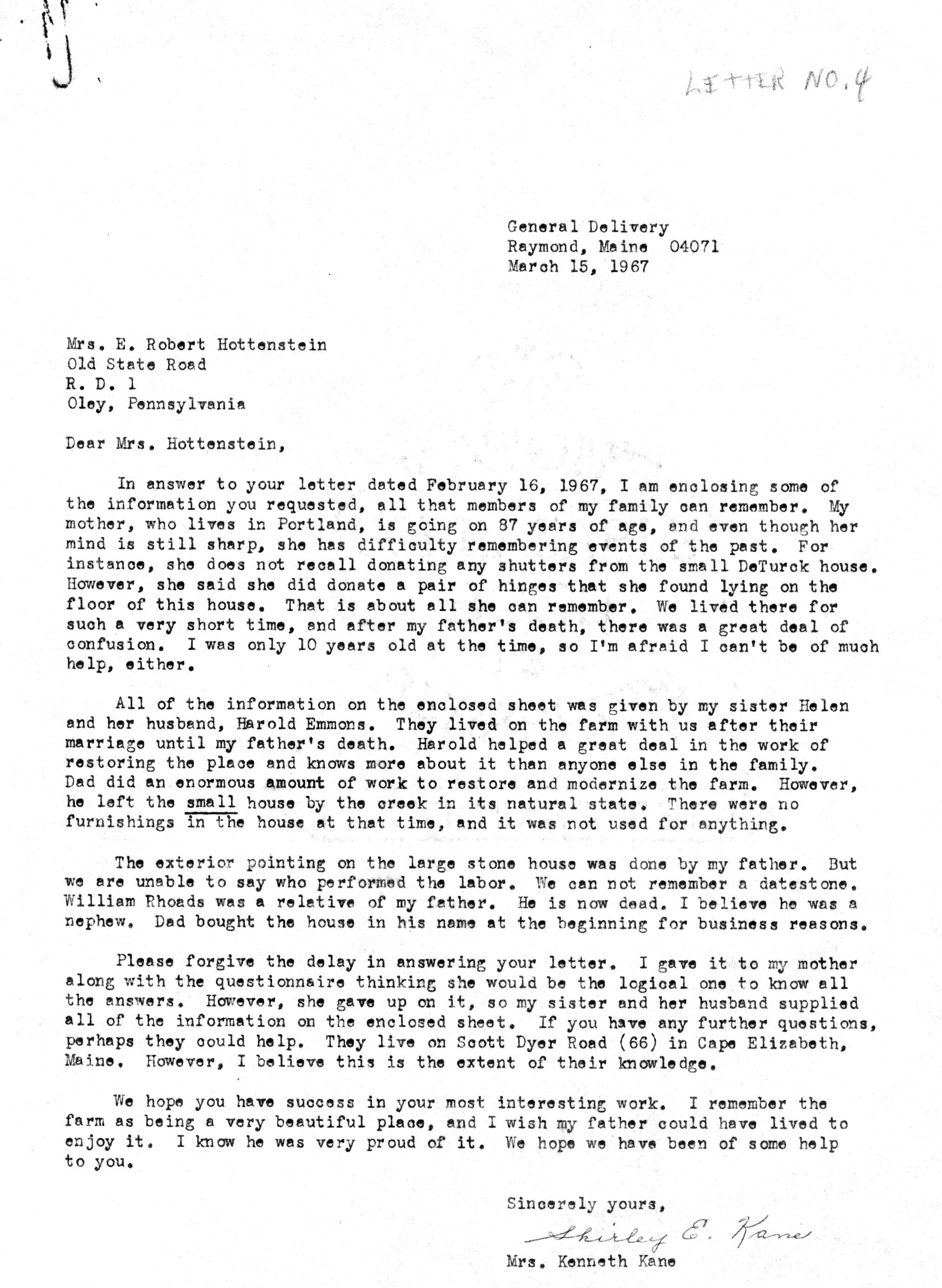
Mrs. Kenneth (Shirley) Kane, former resident on the DeTurk farmstead, replies to a Feb. 16, 1967, inquiry by Mrs. E. Robert Hottenstein of HPTBC on property details she may recall.
In addition to this one-page letter of March 15, 1967, Mrs. Kane's second sheet is a copy of the original question list submitted by Mrs. Hottenstein.
The third page contains Mrs. Kane's replies to the questions.
"Letter No. 4" is printed in pencil in the upper right corner. This apparently refers to a series (numbered 1 to 6) of inquiries to various sources about the De Turk property made by Mrs. Hottenstein.
Mrs. Hottenstein's original covering letter of February 16, 1967, has not been found.
See RELATED for photos from Mrs. Kane
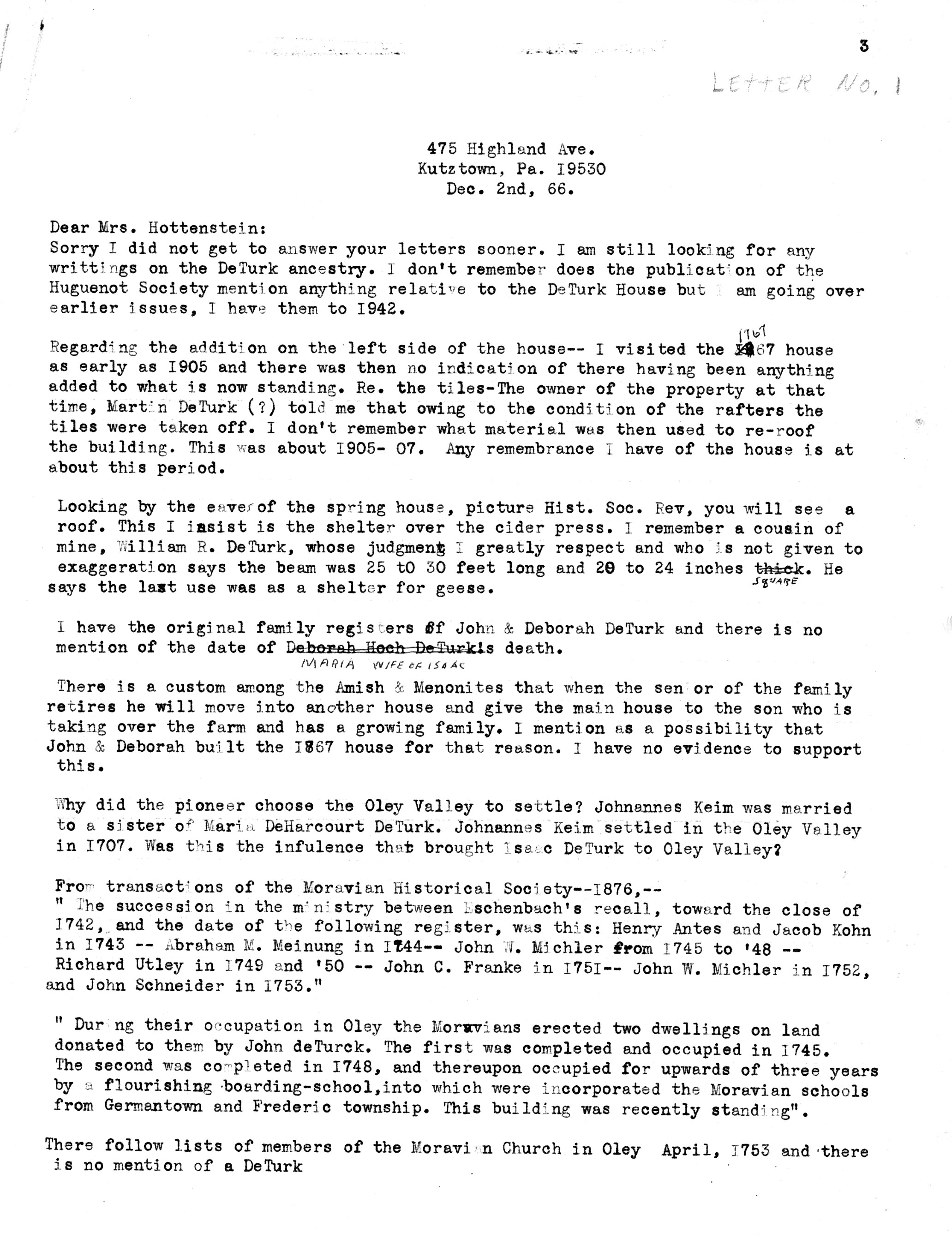
Letter in reply to HPTBC's Mrs. E. Robert Hottenstein from Laurence A. De Turk of Kutztown. No copy of the letter from Mrs. Hottenstein has been found.
"Letter No. 1" is printed in pencil in the upper right corner. This apparently refers to a series (numbered 1 to 6) of inquiries to various sources about the De Turk property made by Mrs. Hottenstein.
The letter covers many aspects of DeTurk genealogy and local history in the area, topgether with details on the properties and buildings involved.
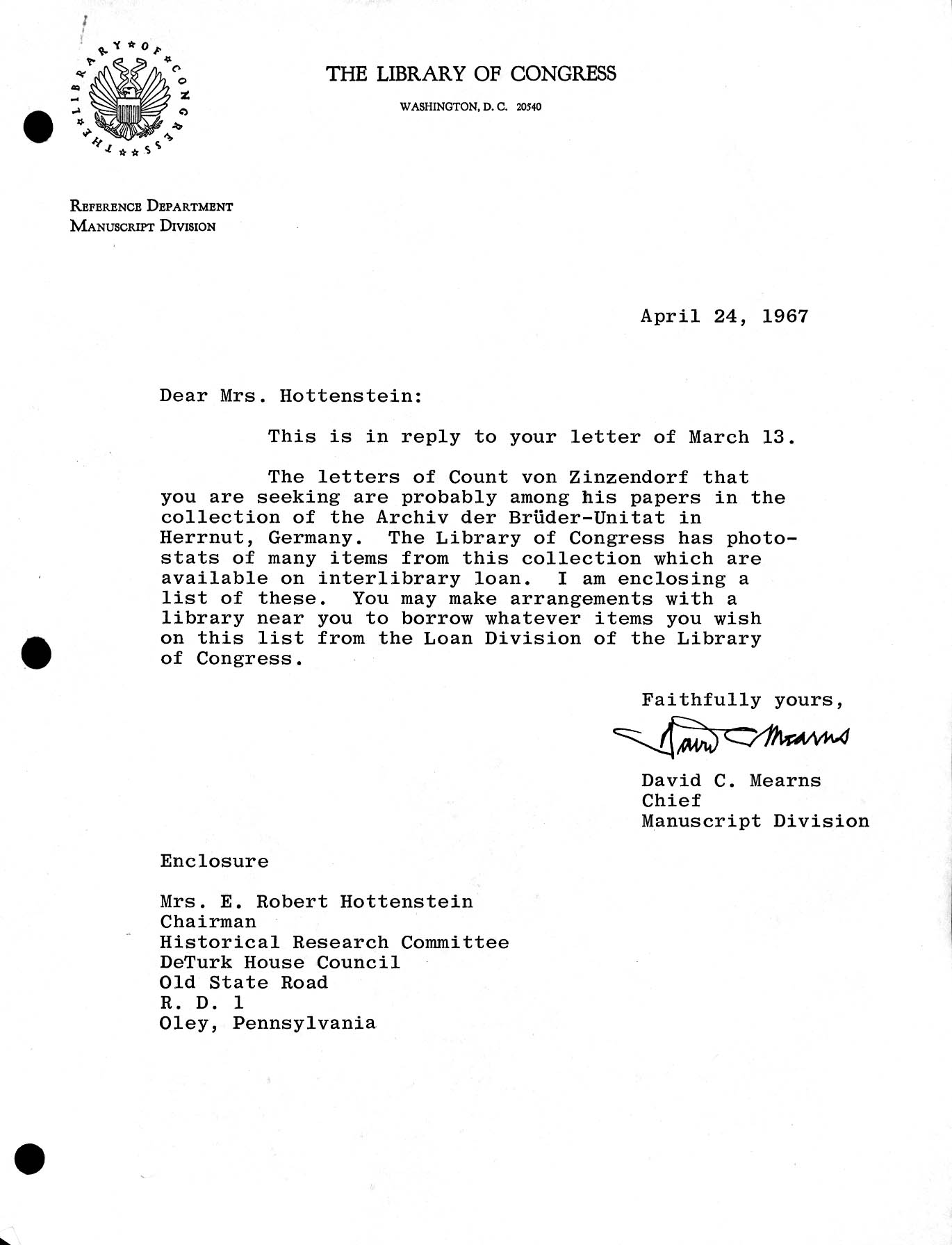
Letter from Library of Congress, David C. Mearns, Chief of Manuscripts, in reply to Mrs. Hottenstein with regard to Letters of [Moravian] Count Zinzendorf. He has forwarded a 4-page list from which specific documents can be loaned via interlibrary.
That list is cataloged as 1001.01.020--DTTX9.
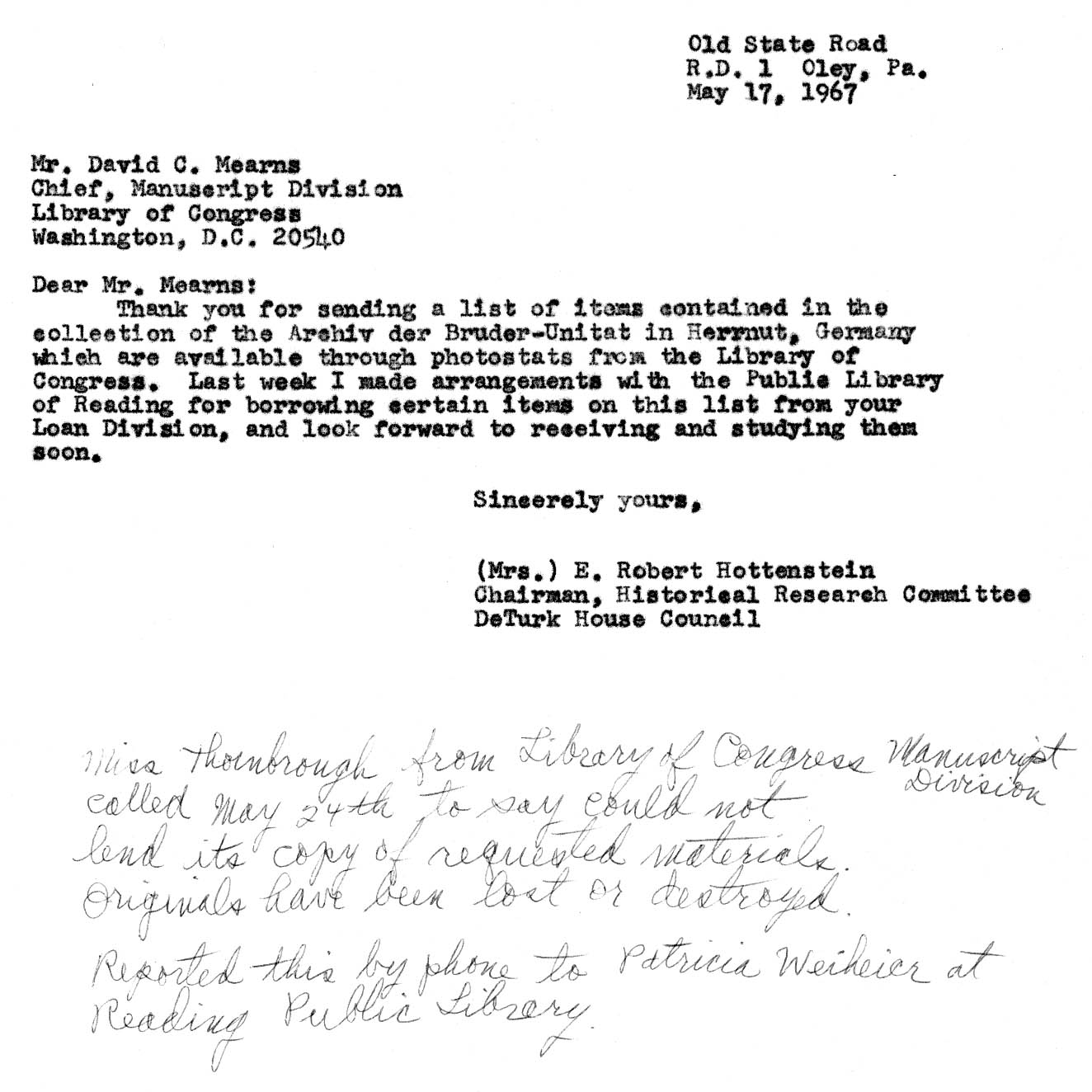
Letter Hottenstein to Mearns , Library of Congress, thanking for Zinzendorf manuscript list,telling of follow-up with Rdg Library for copy.
Hand-written note below typed letter indicating that documents sought could not be loaned out by L of C.
Press "Related" button for other documents in this letter interchange.
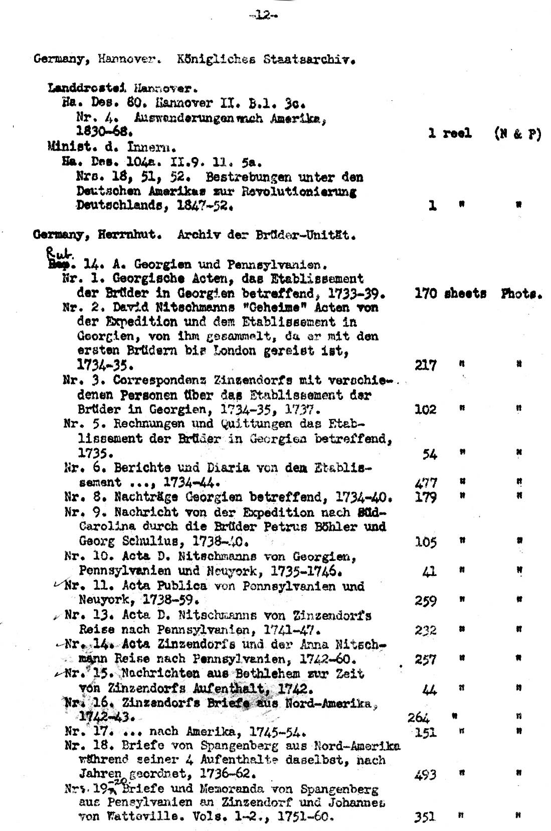
List of correspondence manuscripts [4 pages, German language] by / to / for Count von Zinzendorf, 18th century leader of the Moravians, with their presence in southeastern Pennsylvania. It was sent by Mr. Mearns of the Library of Congress at the request of Mrs. Hottenstein., seeking information on Moravian use of one of the De Turk buildings.
Press "Related" button for other documents in this letter interchange.
See additional images or MULTIMEDIA LINKS for full text of the list.
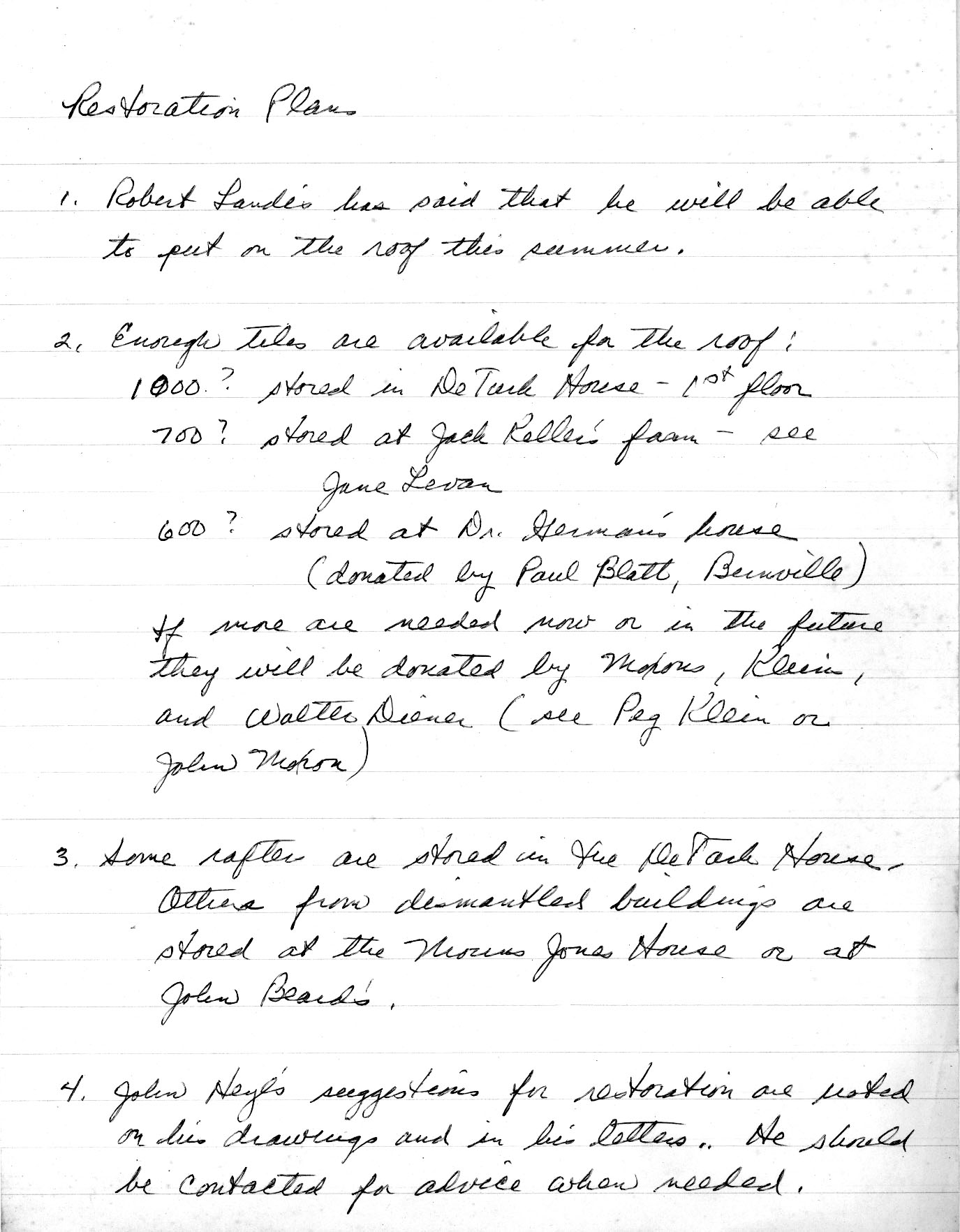
An unsigned, undated manuscript on one page of lined tablet paper, relating to the location of the clay tiles available for the roofing of the De Turk house. Roofing to be done by Robert Landis. Various members of HPTBC are mentioned in connection with the project.
Reference is made to the restoration notes on the drawings (See atlas sheet #54) and in letters of John Heyl.
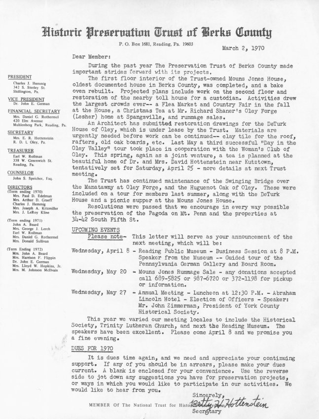
One page letter written by Betty Hottenstein (then secretery of the Trust) in March 1970. Letter requests that exisiting members of the Trust renew their membership and pay their dues and annouces the date for the annual membership meeting. Also, letter briefly discusses restoration work performed on Mouns Jones House and planned for the DeTurk House. Maintenance of other sites and landmarks is also discussed.
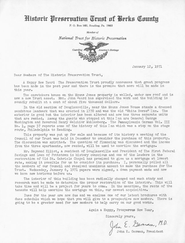
One page letter written by Dr. John E. German (then president of the Trust) in January 1971. Letter requests that exisiting members of the Trust renew their membership and pay their dues. also, letter briefly discusses restoration work performed on Bridge Keeper's House as well as the acquisition of the White Horse Tavern.
Series of seven images illustrating the variations in the place-names describing the area in which Mouns Jones settled in 1704 and which the Trust now calls Old Morlatton Village, situated between the Village of Douglassville and the Schuylkill River in southeastern Amity Township, Berks County, PA. More toponyms and variant spellings will be added to this record as sources are verified.
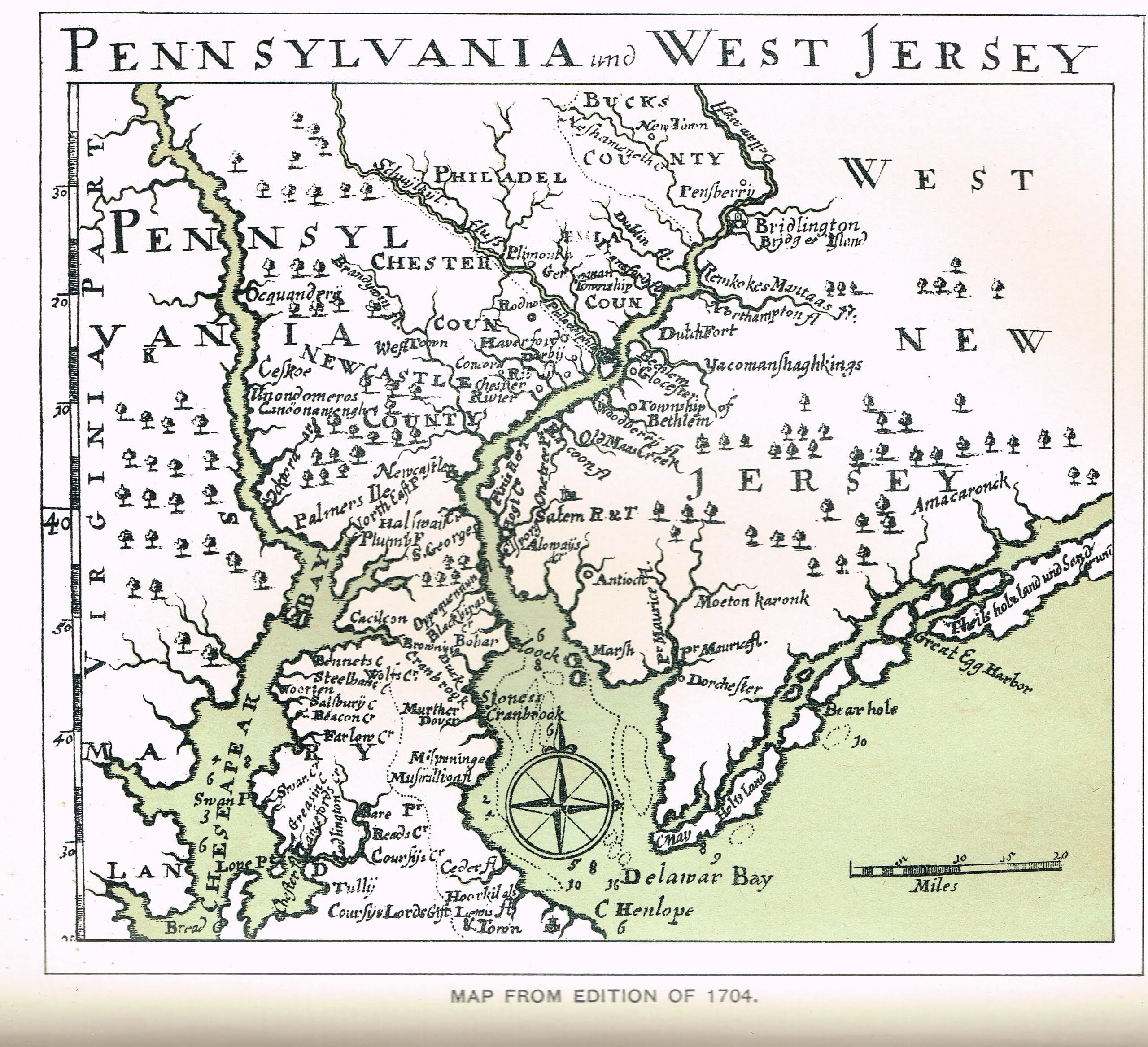
Daniel Falckner's 1704 map [Image #1] of Pennsylvania and West New Jersey records no place-names or identified waterways near the location of the embryonic Manatawny {a} settlement on the upper reaches of the Schuylkill River. Although a few tributaries are shown northwest of "Plimouth" in present-day lower Montgomery County, none are indicated for the confluences of the Manatawny, Monocacy, or French creeks with the River. Nor is there any cartographic notation of the presence of Mouns Jones, any of his family members, or his riverfront "plantation" within the blank frontier ["backcountry"] zone on Falckner's map.
Reverend Andreas Sandel's 1704 letter to his Lutheran superiors in Stockholm stated that "Mans" had "taken up residence" {b} in Manatawny by that time. However, Falckner's cartographer, probably working from slow-moving topographic and demographic information collected in the first few years of the 18th century, was apparently unaware of the presence of the first European settler on the banks of the Schuylkill River between the two tributaries defining the Manatawny region{c}.
Typically, the map also ignores the presence hundreds of First Native families and clan and community members hunting, fishing, and growing crops on their ancestral homeland along the Rive. During the first quarter of the 18th century, the Indians were trading with Mouns Jones, his immediate family, and his partner Anthony Sadowski, as well as with the French traders{d} Peter Bezaillion, James and Ann LeTour, Martin Chartiere and others engaged in the frontier river and creek valleys of southeastern Pennsylvania.
{d} After whom French Creek was named.
An extract from the "Reformed Church Record" of Jan. 24, 1907, published on page 134 of the "Pennsylvania German" magazine issued in March, 1907, records that in 1693 Swedish Lutheran church leaders in Pennsylvania petitioned officials in Sweden for two additional ministers for their flock. One of the appointees was Anders [sometimes "Andreas"] Rudman [e], who applied for and was granted 10,000 acres by William Penn in 1701, to be distributed among himself and his fellow Swedes who were willing to take up land in the remote region between the confluences of the Manatawny and "Manakesy" Creeks with the Schuylkill River. Mouns Jones was granted slightly less than 500 acres of this immense Penn grant in 1705, when he received his patent [essentially a Deed and confirmation of title], having "taken up" [occupied] the parcel in 1701 or 1702 and, by inference from Reverend Sandel's letter, having constructed his first dwelling there by 1704.
{e} Reverend Rudman's pastoral and diplomatic careers are detailed in "The Life and Influence of Andreas Rudman" by Ronald W. Oudinot in The Historical Review of Berks County, Volume XLIV, Number 2, Spring, 1979, starting at page 59.
Archaeological excavations on the river side and to the northwest of the 1716 house, begun in 2012 and continuing through 2016, have unearthed well-masoned wall segments and possibly a stone stair to an opening in the wall [photo # 5918, 11/26/13]. Excavations in 2016 unearthed the remains of a root cellar [photo # 20, 10/15/16 shows the arched entrance to this structure in a photo of c. 1960 by Harry Stauffer], and a masoned stone well, with a dressed-and rubble-stone retaining ring at grade [photo 14, 10/19/16]. These features will be explored further to determine their original forms, dimensions, and artifact context.
It seems reasonable to assume that Mouns' wife and six young children delayed their move to the new "plantation" until the erection of the first dwelling and reasonable assurances of amicable relations with the natives, which contingencies were probably not met until after 1704. Mouns annexed acreage to his Kingsessing land as late as 1708, indicating that he, possibly in conjunction with his brothers, still had an interest in the family holdings on the lower Schuylkill.
An analysis of the historical interaction and land transactions between the Swedes and the Quakers, leading to the Swedish settlement at Morlatton, appears in "The Origin of the Swedish Settlement At Old Morlatton" by Philip Pendleton, published in Historical Review of Berks County, Vol. LIII, Number 3, Sept. 1988, pages 129 et seq. This study is based on wide-ranging research in contemporary public records and other primary sources. The complex and controversial relationship between the Swedes and William Penn is acknowledged and analyzed, while recognizing that the primary chronicler of the facts and legal nuances from the Swedish landholders' perspective was "highly biased." There is no question that Penn's sons and agents assumed an aggressive posture toward Swedish land-title claims in Penn's "Green Country Towne" and the contiguous tracts. Nevertheless, neither Penn's policies and tactics nor John Bartram, had anything to do with Mouns Jones divestment of his Kingsessing land holdings and stone house.
The notion that Mouns Jones conveyed his Kingsessing house and land to John Bartram [or to anyone else] under duress or threat of an adverse title claim asserted by Penn or his agents is unfounded mythology. The first phase of the two-step "exchange" would have consisted of Mouns Jones' acquisition of the Manatawny tract by 1704, when he was in residence there according to Reverend Sandel's letter. In 1704, John Bartram was about five years old.
Mouns continued until 1712 to hold title to his house and a share of the family land holdings southwest of Philadelphia near the Schuylkill River just above its confluence with the Delaware. In 1712 the house and Mouns and Ingeborg's share of the family acreage was conveyed to their son-in-law Frederick Schopenhausen and their daughter Christina, then 16 years old. John Bartram, then about three years younger than Christina, would not acquire the Mouns Jones farmstead for another 16 years, when he purchased it at a Sheriff's sale occasioned by Schopenhausen's insolvency. The Penn Proprietors had no involvement in any of the land transactions involving Mouns Jones or his real estate in 1702-04, 1712, or 1728. There was simply no "exchange" between Mouns Jones and Bartram, brokered or coerced through "Friendly Persuasion" by Penn interests or otherwise.
The 1701 land grant of 10,000 acres to the Swedes, represented by Reverend Andreas [Andrew] Rudman 50 miles northwest of Philadelphia, was not an isolated or spontaneous gesture by William Penn, but was a rational component of the plan to populate his well-wooded and generously watered Province. In his 1683 "Letter…to the Committee of the Free Society of Traders," Penn manifested a grand vision for settlement of the valley corridor straddling the "Skulkill," which he believed to be "an hundred Miles Boatable above the Falls{d}, and its Course North-East{e} toward the Fountain [headwaters] of the Susquahanna [sic]….it [the Schuylkill Valley] is like to be a great part of the Settlement of our Age."
According to Penn, conditions in the southeastern valleys of his Province were ideal for pioneering planters, traders, "yeoman" and skilled journeymen and their families who would fulfill his economic, ecumenical, and social vision: "The Air is sweet and clear, the Heavens serene…the Waters…good," and the Natives, though benighted in religious matters, "liberally" friendly and benevolent trading partners and, for the time being, amicable neighbors.
In 1702 the early Pennsylvania German Pietist Daniel Falckner answered "The 59th Question" posed to him respecting the virtues of Pennsylvania and America for prospective immigrants by comparing the manifold watersheds in the new territories to "an irrigated garden," an impression undoubtedly shared by Penn and woven into the marketing plan for his vast neo-feudal holdings.
In 1709 Mouns Jones and others signed a Petition to the Court in Philadelphia representing that they "had plantations"{f} which required a road for access to and from Philadelphia and Germantown, averring that it was "difficult" for the Petitioners to "pass and re-pass unto their plantations" in "Mannitawny". The Petition was not acted upon, and another (successful) plea for a road was submitted by Jones and his neighbors in 1715 and granted by 1719, as confirmed by the "Draught" published in archive record #MVFN1.
DETAILED CAPTIONS
Image #1: Falckner 1704 MAP: Digital reproduction of map published in a 1704 edition of Daniel Falckner's "Curieuse Nachrichte von Pensylvania in Norden America."
#2: photo 2598: title page from 1829 American Sunday School Union imprint ["Stories from the Scriptures" by "A Grandmother"] appearing in the St. Gabriel's Church ibrary.
#3: photo 2599: printed ownership bookplate, opposite the title page of image #2598, describing the Church's location as "Morlattin, Berks County".
#4: photo 5918: Below grade masonry walls and passage opening within 20 feet of the 1716 house.
#5: photo 20: Exterior ["extrados"] of arched root cellar.
#6: photo 14blue-tone "cyanotype" photo by Harry Stauffer showing stone-arched entrance to a root-cellar.
#7: photo 14, 10/19/16: Stone well and abutments [pump-platform base?] at grade.
FOOTNOTES:
{a} Also spelled "Mannitawny," "Mannatawny and "Mahanatawny by Henry Melchior Muhlenberg and other 18th century journalists.
{b} under a warrant issued by 1702 and conferring the right to possess and eventually purchase the tract. Sandel's letter makes no mention of Mans' wife or children, who probably remained for a time period on the earlier Nilsson-Jonasson [later "Jones"] farmstead.
{c} The "Mannitawny" [also "Mahanatawny" and "Manatawny" in contemporary records and accounts] Creek, providing the place-name for the region, and the other tributary to the north, called the "Monakasy," later "Monocacy." Paul Wallace's rendering of the Perkiomen "Indian Path" shows native American Indian village sites at the Manatawny confluence [present-day Pottsgrove] and near the Douglassville [then "Manatawny"] site where the path, and subsequent road-beds, turned northward toward present day Amityville. Wallace notes that Manatawny was "an important station for a principal body" of migrant Delaware Indians [Indian Paths of Pennsylvania (1965), p. 127]. Thomas Kitchin's Revolutionary War era map of the "Seat of War in the Environs of Philadelphia" designates the village on the Reading-Philadelphia Road and nearby Creek as "Monotomy". The map appears as the frontispiece to Vol. III, Pennsylvania Archives, Series III, Harrisburg (1875).
{d} Presumably the falls at the confluence of the Schuylkill with the Delaware southwest of Penn's "Green Country Town."
{e} Penn's geographical references to the "Skulkill" apply more accurately to the orientation and compass bearing of the Delaware River channel, which projects generally "North-East" from Philadelphia as far as Trenton. The Schuylkill's channel reaches toward the northwest from Philadelphia. Most of the Schuylkill waterway is shallow much of the time, but would nevertheless be frequently navigable ["Boatable"] for the shallow-draft flatboats [sometimes called "canoes" in the period] fabricated and deployed by the Swedes and Finns in the region.
(f) see record #MJTX10 for a discussion of the dual meaning of "Plantation" in early Pennsylvania
{g} As narrated on pages 945 and 946 of "History of Berks County in Pennsylvania" by Morton L. Montgomery, Philadelphia, Everts & Peck (1886), excerpted from the published Colonial Records. See archive record MJHTX5--1000.01.093 for a catalogued copy of the 1709 manuscript Petition.
Laurence Ward, October 2016, updated December 2016.
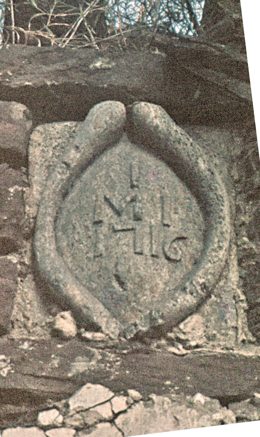
Photo #1 is a c. 1957-1965 image of the original datestone after collapse of roof in c.1957.
2d Photo was taken after 1965-72 restoration, on a bedstone in niche under stone lintel; roof and upper wall masonry have been re-constructed.
Photo #6 show the relief inscription on the restored date-stone restored date-stone, after its rescue and return to the site after having been "lost" [see footnote "{n}" in record no. MJHPH6.] The inscription lettering and numerals mean: I[ngeborg] and M[ouns] [I (for J)ones] 1716. These designations are framed in animal bones, apparently symbolic of welcoming and shared bounty.
Larry Ward, updated May, 2022 and May 2023
Mouns Jones Root Cellar
A 1962 photograph [photo #19, 11/21/17] by Harry Stauffer, the Farmersville, PA "printer, tinker, and furniture maker", and, most significantly for the PA preservation and rural history community, a prolific and perceptive avocational photographer, was the first-noticed piece of evidence that a root cellar existed to the northwest and within the curtilage of Mouns Jones 1716 stone house. The blue-toned "cyanotype" print of the photo is in the collection of the Historical Society of the Cocalico Valley, and is used here with its generous permission. The stone-arch visible in Stauffer's photograph delineates the entry-wall of the cellar, which lacks its barrel-vaulted ceiling which was demolished between 1962 and 1972. However, the angled "springer" stones forming the transitional bearing elements between the "impost" stones and the arched vault remain in place on the northern foundation [photo #1, 9/26/17].
The approximate interior dimensions of Mouns Jones Root Cellar are ft. wide at floor level inside the entry gable-end, ft. long, and 80 inches in height at the apex of the assumed intrados of the vault. The "herringbone" pattern brick floor is approx.. …ft. below the early exterior grade, from which the cellar was accessed by two stone steps [photo #7, 9/26/17] descending to the brick floor. The arched entry in the Stauffer photo suggests that the rubble-stone exterior ["extrados"] of the barrel vault projected about 3-4 ft. above modern grade (but probably 5 to 6 feet above the early grade at the entrance). The interior ceiling ["intrados"] would have followed the arch profile established by the temporary "centering" supports left in place until the arch stones ["voussoirs"] "set up" sufficiently to be structurally self-supporting. Amos Long, op. cited below, pp. 160-162, surmised from oral tradition and personal observations that average dimensions for root cellars in SE Pennsylvania were 9-12 feet wide, 12-18 feet in length, 6-7 feet high from floor to apex of ceiling ["intrados"],
The Mouns Jones structure appears to exhibit stone foundation walls separated from and parallel to the longitudinal walls abutting the root cellar and serving structurally as its foundation. These perimeter walls on the long axis of the structure provided both compressive (gravitational) bearing support for the vault and adequate countervailing force to neutralize lateral and radial shear from the oblique thrust transmitted through the arched voussoir stones and angled springers. Apart from serving as lateral (and probably redundant) abutments for the vault, these long walls quite probably served as the foundation for a small gabled building similar to the presumed bake-house [photoKH4, Oct, 2010, c. 1897] a few feet east of the Federal-era addition to the 1753 Keim house.
In this Keim and Mouns Jones root cellar type the springers terminating the arched barrel vault are integrated directly into the long foundation wall supporting the vault, with insulating in-fill of earthen materials packed into the tapering space between the vault extrados and the interior face of the foundation walls of the superstructure.
Another example of the Jones-Keim type is the root cellar beneath the outbuilding north of the early mansion house at Pine Forge [photo #212], a few miles north of the Mouns Jones house and constructed with similar "New Red" sandstone as that used for the 1716 jones house.
In another structural variation, the springers terminate and bear directly on imposts embedded in foundation walls or internal piers or partitions in the building forming the superstructure. Examples of this class of root cellars are:
(1) The southern half of the cellar under the extant 1767 DeTurk "Grossmutter's House" in Oley Township, which also incorporates an attic granary and a large farmstead fireplace in the space adjacent to the embanked root cellar [photo 906, 1/1/80]. One run of springers in this embanked cellar bonds into the southern (road-side) gable-end foundation of the host building; the parallel set of springers beds in the stone partition wall that divides the root cellar from the farmstead kitchen and, formerly, the farmstead "wash house" (as it was called in an early 19th century DeTurk Will) in the northerly portion of the cellar spaces. The sole access to the cellar kitchen is the hooded doorway from the lower grade south of Little Manatawny Creek;
(2) In the plastered root cellar under the smoke chamber between the Federal-era Amity Store attached to 1765 George Douglass House in Morlatton and the one-story ancillary building into which the smoke-chamber/root cellar structure inserts at its northwestern corner [photos #2221, 4/22/13 and 2126, 4/18/13]. One set of springers in this vault beds in the southern foundation wall of the Amity Store addition to the George Douglass House and the other in the northern basement walling of the adjoining one-story ancillary building. Photo 16 shows the typical warm-air vent under the intrados high in the end-wall. Also visible in this photo to the right in the end wall is the arched passage through which air convects into the cellar after being cooled by the endothermic process of evaporation of the condensation formed on the exterior brick wall of the well seen through the passage{n1}.
{n1} Long notes at p. 60 of his Family Farm book that wells were sometimes constructed "in common" with a root cellar or with an opening built into the cellar wall "so that the cool air from the well could flow freely into the cellar area", which consequently "provided a cool storage space during the summer."
The root cellar under the Hans Herr house in Lancaster County [photo #1306, 1/1/80 ], also displaying a vent window ( called by Amos Long a "ventilation duct" when the walling below the opening is tapered to funnel-out the rising warmer air), The Pennsylvania German Family Farm, caption to photo on p. 101, which also shows a "cooling closet", ceiling meat hooks, and plastered and whitewashed walls.
Chapter 21 of The Pennsylvania Society for Archaeology has been methodically excavating the remaining walls and "herringbone" pattern brick floor of the masonry food storage space, called by various names including "cave" and "ground" cellars; see Long, Amos, Pennsylvania Cave and Ground Cellars, in Pennsylvania Folklife Vol. 11, No. 2, (1960), p. 36 et seq., and his farm-structures "bible", The Pennsylvania German Family Farm..[p. 156, et seq.]. Long also called this type of storage structure an "arch cellar" [ibid. p. 101], in which was stored cider, vinegar, many vegetables and fruits [p. 100].
The primary, but not exclusive, uses of early root cellars{n2} was as an embanked stone vault "where we [in Pennsylvania] keep our apples [photo #, a c. 1940 photo, above 6/18/14, showing the traditional function of sorting apples in a Pennsylvania root cellar in c. 1940 Adams county]…turnips, cabbages, potatoes, and pumpkins" and "cider, milk, butter, meat, and various necessities…" in cellars under houses. Both types of cellars were designed for "preservation of…roots and vegetables in the winter, turnips, pumpkins, cabbages, potatoes, [quoted in Gage, James, E., Root Cellars in America, 2010, 2d ed., p. 6 et seq., citing de Crevecoeur's 1782 "Letters".
{n2} ('commonly called a Dutch cellar' according to de Crevecoeur, J. Hector St. John, in his "Letters from an American Farmer and Sketches of 18th century America", 1981 Penguin trade paperback edition, at p. 315),
Long also notes the storage of meats, milk, butter, beer, wine, root vegetable (parsnips, salsify, horse radish, beets, turnips, and presumable others).
Similar subterranean ["banked"] wooden storage cellars existed in America in the 17th and early 18th centuries [Long].
Laurence Ward Feburary, 2018
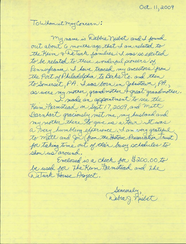
Letter from Debbie Nisbet thanking Matt Barnhart for giving her, her mother, and her husband a tour of the Keim house.
Letter states that Ms. Nisbet is a descendant of both the Keim & DeTurk families. $200.00 check to be used for Keim Farmstead and DeTurk house was enclosed with letter.
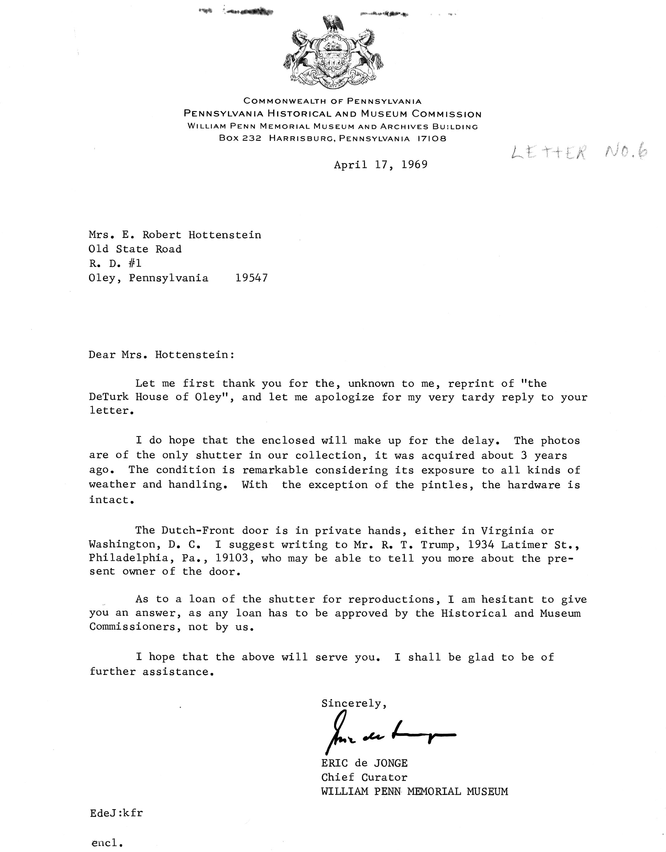
Letter from PHMC, Eric deJonge, dated Apr 17, 1969, in reply to letter of inquiry from Mrs. J. Robert Hottenstein. Subjects include DeTurk house shutters and the possible loan for copying of the one in PHMC hands. He also indicates that the Dutch-Front door of the building is in private hands in Virginia or Washington D.C., and suggests corresponding with a Mr. R. T. Trump for more information.
"Letter No. 6" is printed in pencil in the upper right corner. This apparently refers to a series (numbered 1 to 6) of inquiries to various sources about the DeTurk property made by Mrs. Hottenstein.