Three-pages of short articles from Volume II, No. 5 (February , 1974) issue of "American Folklife," a monthly newspaper devoted to the American culture published by the American Folklife Society.
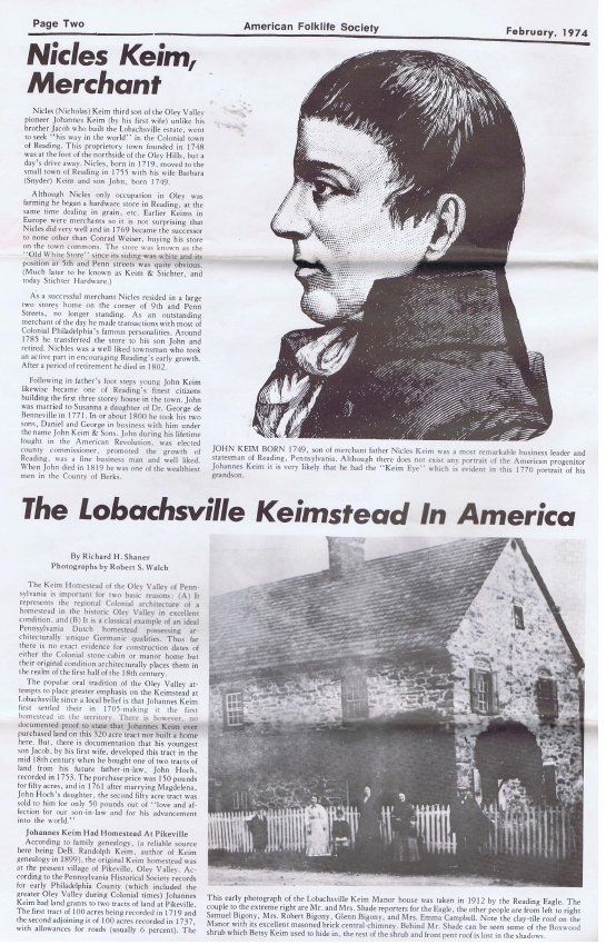
First article, appearing entirely on page 2 and titled "Nicles Keim, Merchant," gives a brief history of Nicles Keim, third son of John Keim by his first wife and older brother to Jacob Keim who established the Keim Farmstead in Lobachsville.
Second article, beginning on page two & ending on page three is entitled "The Lobachsville Keimstead in America" was written by Richard Shaner with photos by Robert Walch. This article presents a brief history of the Keim family as well as evidence supporting the fact that Jacob Keim (NOT John) established the farmstead at Lobachsville. Also presents evidence that John settled near Pikeville.
Third article (with photos), appearing entirely on page four and titled "Folklife Plans," features information about the American folklife Society's restoration of the Keim Farmstead buildings, mainly the house and the cabin. Subjects briefly discussed include returing a later modified doorway into a window opening as well as the discovery of colonial brick flooring.
See additional images or MULTIMEDIA LINKS for complete images of pages two, three, and four.
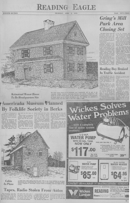
Half-page article with drawings (by Gerald O'Brien) from the Thursday April 5, 1973 edition of the "Reading Eagle." Article appears on page 53, Fourth Section.
Article briefly discusses American Folklife Society's (owner of Keim farmstead in 1973) plans for converting the Keim farmstead into a history museum & national headquarters site.
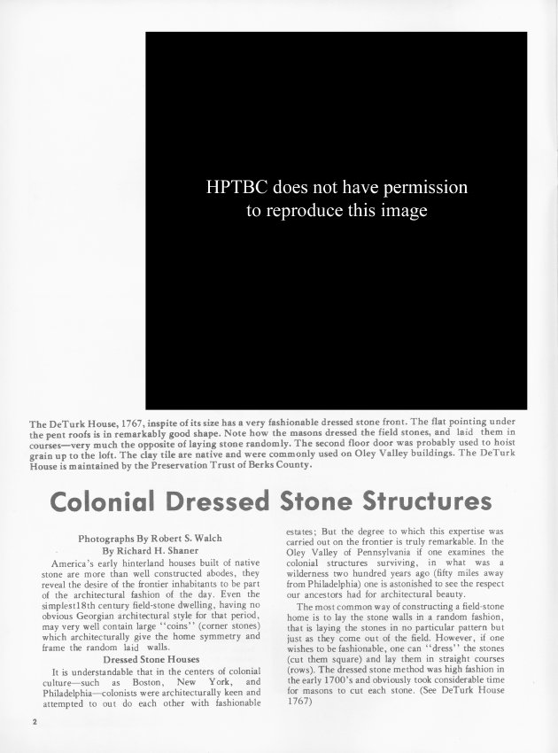
Seven-page article (with photographs) appearing on pages 2-8 in the Fall 1975 (volume IV, Number 1) issue of "American Folklife," journal of the American Folklife Society. Article titled "Colonial Dressed Stone Structures" discusses dressed stone houses, V-pointing & flat pointing, brick arches & dressed stone, etc.
Approximately half of the article uses four separate current Trust properties as examples of dressed stone structures: DeTurk House, Keim Cabin, White Horse Tavern, and Douglass Mansion. Other buildings used as examples are the LeVan Manor House, Cook Mansion, Kaufman Manor House.
See additional images or MULTIMEDIA LINKS for full text.
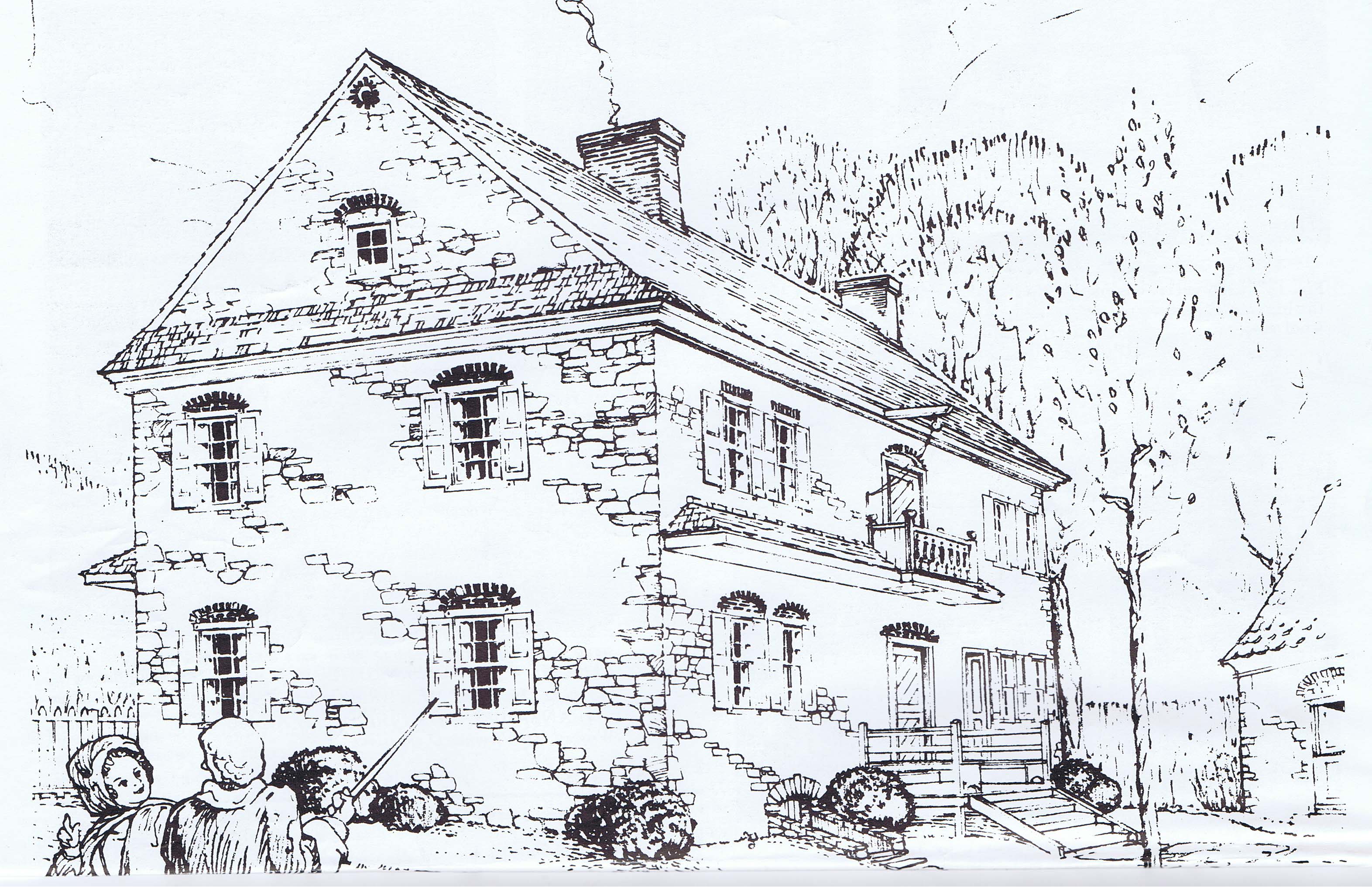
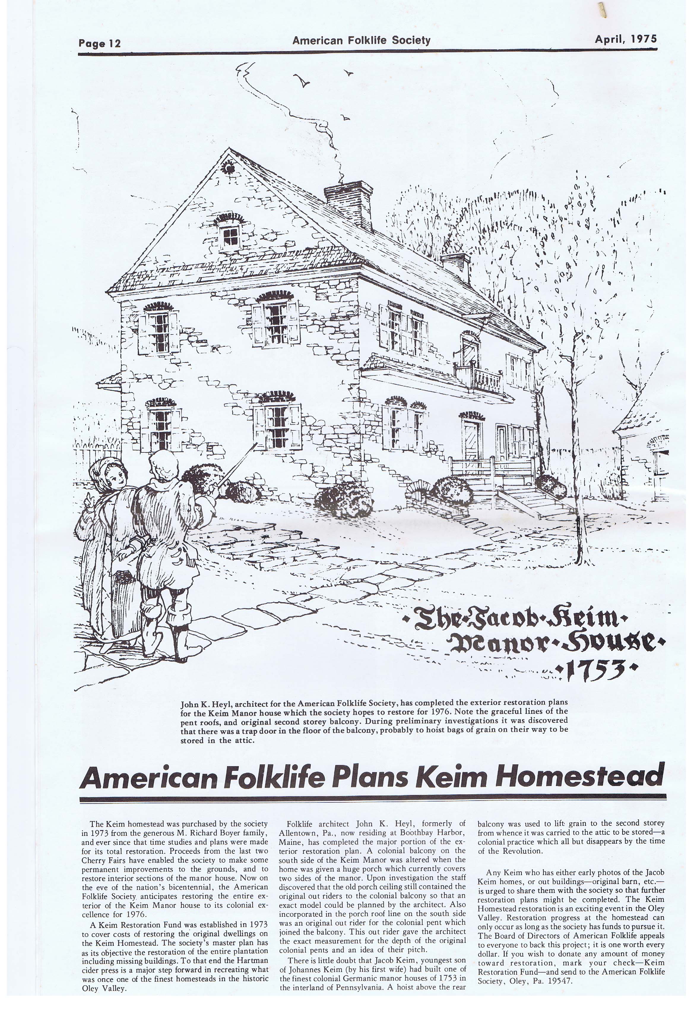
Perspective drawing of the Jacob Keim “Manor House” from the southwest, published in the copyrighted April, 1975 issue of “American Folklife, A Monthly Newspaper Devoted to the American Culture”. This image and the text excerpts are published here with the generous permission of Richard Shaner, Publisher, Managing Editor, and principal contributor to the essays and captions of "American Folklife."
In the text accompanying this rendering, Mr. Shaner observed that “A colonial balcony on the south side of the Keim Manor was altered when the home was given a huge porch which currently covers two sides of the manor. Upon investigation the staff discovered that the old porch ceiling still contained the original out riders to the colonial balcony…. Also incorporated in the porch roof line on the south side was an original out rider for the colonial pent which joined the balcony. This out rider gave…the exact measurement for the depth of the original colonial pents and an idea of their pitch.”
The perspective of this rendering suggests a symmetry in the façade that did not exist in the main elevation of the original 1753 house. The added bays to the east [right] of the door and balcony date to about 1800. The originally asymmetrical placement of the door in the east end-bay resulted in a “side-passage” alignment of the kitchen entry and second story balcony. Most of the antecedent and contemporary houses with a balcony were central-passage “Pennsylvania-Georgian” types such as “Grumblethorpe” in Germantown [Lithographic perspective view in "Quaint Old Germantown," Plate VIII], the Peter Wentz house in Worcester Township and Muhlenberg Houses in Trappe (both in Montgomery County), and “Bellaire” in Philadelphia [see "Worldly Goods," p. 84, and Kornwolf, Vol. two, p. 1223]. All houses cited except Wentz currently display a balcony surround of neo-classical turned balusters and molded handrail; Wentz’ rendering is scroll-sawn “splat” form, apparently based on the choir-railing at Trappe Lutheran Church.
The Keims were wood turners by trade, producing lathe-turned spindles and possibly balusters in the nearby and contemporaneous workshop structure southeeast of the house. Nonetheless, the vernacular Georgian houses cited above, with centrally-aligned balconies with turned balusters, would not seem to provide compelling templates for re-producing a balcony for the decidedly Germanic, asymmetric, and uncoursed masonry façade of the Keim house. Currently under consideration is a plain or edge-beaded board form, as suggested by a board railing on the second floor of the house.
The porch on the west gable wall and south eaves wall mentioned in this article was almost certainly added in the 1930s, based on photographs and analysis in record KR11PH3 [see photos and accompanying text in archive records KHPH8--1002.01.027, KHPH9--1002.01.044 & KHPH13--1002.01.057], and is without historical precedent as to form or appropriate scale with respect to the earliest bays of the house. The intermediate porch [see KHPH9--1002.01.044]--probably constructed circa mid-nineteenth century after disintegration or removal of the original pent roof--did not wrap around the corner or extend across the gable wall. Neither porch roof tucks closely under the projecting stone flashing course, which therefore does not effectively protect the joint between the porch roof and the masonry wall from moisture infiltration, as it did for the original pent roof [see pent on road-front (north) eaves wall, which provides a virtual template for the proposed pent roof on the south eaves wall].
Other period or recreated early details rendered in this drawing include: central chimney on original bays; gable-end chimney on early addition [right bays]; pent eaves on west gable; pent roof on south eaves wall; second storey “colonial balcony”; brick oculus vent in west gable apex; brick relieving arches; western corner of original pent roof on north eaves wall; stone-arched cellar entry; northwest corner of 18th-century ancillary building [right edge of drawing].
See KHTX2--1002.01.021 for the full text printed below this drawing reproduced on page 12 of the issue cited.
Archive record KHTX8--1002.01.048 is the text accompanying a conceptual northwest perspective drawing of the original manor house by Gerald O’Brian, rendered without the early eastern addition, and published on page 12 of the April, 1974 issue of Richard Shaner’s “American Folklife.”
Laurence Ward, Updated 2020
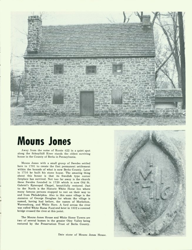
One-page article with photos from a booklet titled "Oley Valley, An American Cultural Island" (vol. I , No. 7) published by the American Folklife Society in 1973.
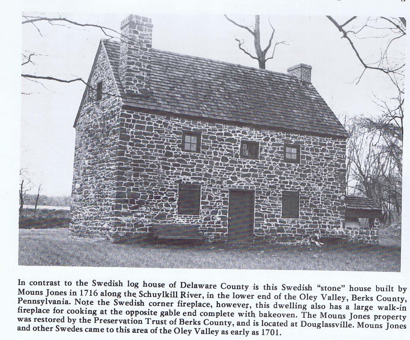
Article briefly discusses location and history of the Mouns Jones House.
Mouns Jones Root Cellar
A 1962 photograph [photo #19, 11/21/17] by Harry Stauffer, the Farmersville, PA "printer, tinker, and furniture maker", and, most significantly for the PA preservation and rural history community, a prolific and perceptive avocational photographer, was the first-noticed piece of evidence that a root cellar existed to the northwest and within the curtilage of Mouns Jones 1716 stone house. The blue-toned "cyanotype" print of the photo is in the collection of the Historical Society of the Cocalico Valley, and is used here with its generous permission. The stone-arch visible in Stauffer's photograph delineates the entry-wall of the cellar, which lacks its barrel-vaulted ceiling which was demolished between 1962 and 1972. However, the angled "springer" stones forming the transitional bearing elements between the "impost" stones and the arched vault remain in place on the northern foundation [photo #1, 9/26/17].
The approximate interior dimensions of Mouns Jones Root Cellar are ft. wide at floor level inside the entry gable-end, ft. long, and 80 inches in height at the apex of the assumed intrados of the vault. The "herringbone" pattern brick floor is approx.. …ft. below the early exterior grade, from which the cellar was accessed by two stone steps [photo #7, 9/26/17] descending to the brick floor. The arched entry in the Stauffer photo suggests that the rubble-stone exterior ["extrados"] of the barrel vault projected about 3-4 ft. above modern grade (but probably 5 to 6 feet above the early grade at the entrance). The interior ceiling ["intrados"] would have followed the arch profile established by the temporary "centering" supports left in place until the arch stones ["voussoirs"] "set up" sufficiently to be structurally self-supporting. Amos Long, op. cited below, pp. 160-162, surmised from oral tradition and personal observations that average dimensions for root cellars in SE Pennsylvania were 9-12 feet wide, 12-18 feet in length, 6-7 feet high from floor to apex of ceiling ["intrados"],
The Mouns Jones structure appears to exhibit stone foundation walls separated from and parallel to the longitudinal walls abutting the root cellar and serving structurally as its foundation. These perimeter walls on the long axis of the structure provided both compressive (gravitational) bearing support for the vault and adequate countervailing force to neutralize lateral and radial shear from the oblique thrust transmitted through the arched voussoir stones and angled springers. Apart from serving as lateral (and probably redundant) abutments for the vault, these long walls quite probably served as the foundation for a small gabled building similar to the presumed bake-house [photoKH4, Oct, 2010, c. 1897] a few feet east of the Federal-era addition to the 1753 Keim house.
In this Keim and Mouns Jones root cellar type the springers terminating the arched barrel vault are integrated directly into the long foundation wall supporting the vault, with insulating in-fill of earthen materials packed into the tapering space between the vault extrados and the interior face of the foundation walls of the superstructure.
Another example of the Jones-Keim type is the root cellar beneath the outbuilding north of the early mansion house at Pine Forge [photo #212], a few miles north of the Mouns Jones house and constructed with similar "New Red" sandstone as that used for the 1716 jones house.
In another structural variation, the springers terminate and bear directly on imposts embedded in foundation walls or internal piers or partitions in the building forming the superstructure. Examples of this class of root cellars are:
(1) The southern half of the cellar under the extant 1767 DeTurk "Grossmutter's House" in Oley Township, which also incorporates an attic granary and a large farmstead fireplace in the space adjacent to the embanked root cellar [photo 906, 1/1/80]. One run of springers in this embanked cellar bonds into the southern (road-side) gable-end foundation of the host building; the parallel set of springers beds in the stone partition wall that divides the root cellar from the farmstead kitchen and, formerly, the farmstead "wash house" (as it was called in an early 19th century DeTurk Will) in the northerly portion of the cellar spaces. The sole access to the cellar kitchen is the hooded doorway from the lower grade south of Little Manatawny Creek;
(2) In the plastered root cellar under the smoke chamber between the Federal-era Amity Store attached to 1765 George Douglass House in Morlatton and the one-story ancillary building into which the smoke-chamber/root cellar structure inserts at its northwestern corner [photos #2221, 4/22/13 and 2126, 4/18/13]. One set of springers in this vault beds in the southern foundation wall of the Amity Store addition to the George Douglass House and the other in the northern basement walling of the adjoining one-story ancillary building. Photo 16 shows the typical warm-air vent under the intrados high in the end-wall. Also visible in this photo to the right in the end wall is the arched passage through which air convects into the cellar after being cooled by the endothermic process of evaporation of the condensation formed on the exterior brick wall of the well seen through the passage{n1}.
{n1} Long notes at p. 60 of his Family Farm book that wells were sometimes constructed "in common" with a root cellar or with an opening built into the cellar wall "so that the cool air from the well could flow freely into the cellar area", which consequently "provided a cool storage space during the summer."
The root cellar under the Hans Herr house in Lancaster County [photo #1306, 1/1/80 ], also displaying a vent window ( called by Amos Long a "ventilation duct" when the walling below the opening is tapered to funnel-out the rising warmer air), The Pennsylvania German Family Farm, caption to photo on p. 101, which also shows a "cooling closet", ceiling meat hooks, and plastered and whitewashed walls.
Chapter 21 of The Pennsylvania Society for Archaeology has been methodically excavating the remaining walls and "herringbone" pattern brick floor of the masonry food storage space, called by various names including "cave" and "ground" cellars; see Long, Amos, Pennsylvania Cave and Ground Cellars, in Pennsylvania Folklife Vol. 11, No. 2, (1960), p. 36 et seq., and his farm-structures "bible", The Pennsylvania German Family Farm..[p. 156, et seq.]. Long also called this type of storage structure an "arch cellar" [ibid. p. 101], in which was stored cider, vinegar, many vegetables and fruits [p. 100].
The primary, but not exclusive, uses of early root cellars{n2} was as an embanked stone vault "where we [in Pennsylvania] keep our apples [photo #, a c. 1940 photo, above 6/18/14, showing the traditional function of sorting apples in a Pennsylvania root cellar in c. 1940 Adams county]…turnips, cabbages, potatoes, and pumpkins" and "cider, milk, butter, meat, and various necessities…" in cellars under houses. Both types of cellars were designed for "preservation of…roots and vegetables in the winter, turnips, pumpkins, cabbages, potatoes, [quoted in Gage, James, E., Root Cellars in America, 2010, 2d ed., p. 6 et seq., citing de Crevecoeur's 1782 "Letters".
{n2} ('commonly called a Dutch cellar' according to de Crevecoeur, J. Hector St. John, in his "Letters from an American Farmer and Sketches of 18th century America", 1981 Penguin trade paperback edition, at p. 315),
Long also notes the storage of meats, milk, butter, beer, wine, root vegetable (parsnips, salsify, horse radish, beets, turnips, and presumable others).
Similar subterranean ["banked"] wooden storage cellars existed in America in the 17th and early 18th centuries [Long].
Laurence Ward Feburary, 2018
Full-page article with illustration from page 12 the April 1975 issue of "American Folklife," newsletter of the American Folklife Society.
Article briefly outlines restoration plans for the Jacob Keim Farmstead, focusing on balcony, porch, and Hartman cider press. Also requests Keim descendants to share property photos as well as an appeal for funding.
At the time this article was written Keim Farmstead was owned by American Folklife Society.
Also see record KHDWG1--1002.01.070 for further information regarding the drawing that appears as part of this article.
One-page article with photograph from page 2 of April 1973 issue of "American Folklife," newsletter of the American Folklife Society.
Article briefly discusses Colonial American Folklife Fair held at Keim Homestead, During Memorial Day weekend of 1973.
At the time this article was written Keim Farmstead was owned by American Folklife Society.
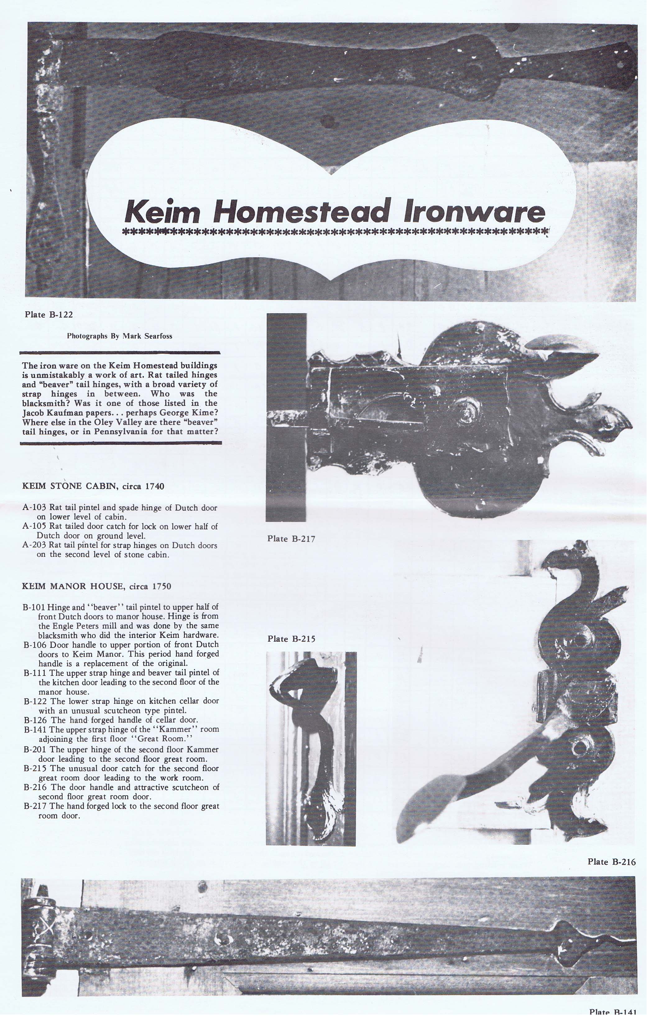
Two-page article with 14 photographs from pages 10 and 11 of American Folklife, newsletter of the American Folklife Society.
Article briefly discusses door hardware from the Keim homestead, focusing on hinges and catches.
At the time this article was written Keim Farmstead was owned by American Folklife Society.
Image is of first page only. See MULTIMEDIA LINKS or additional images for second page.
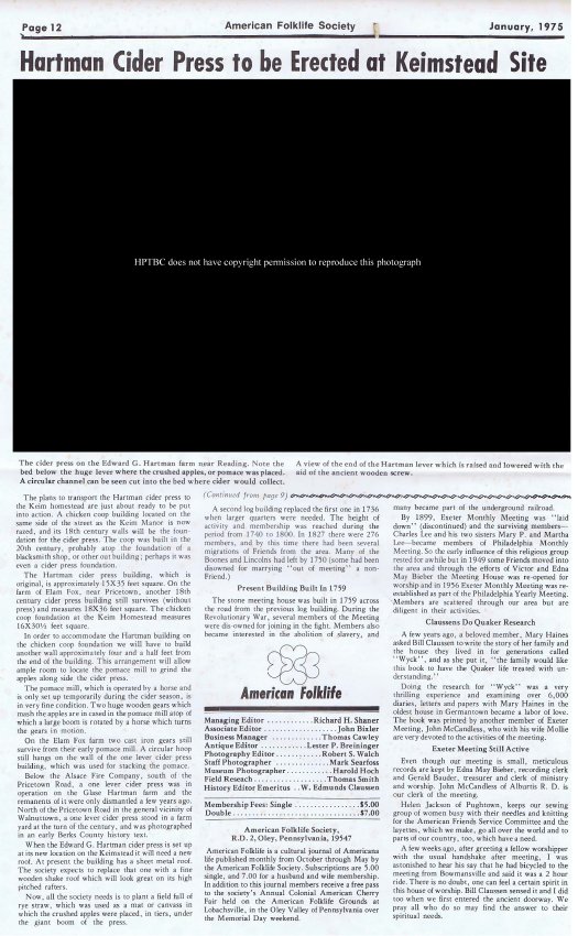
One-column article from page 12 of January 1975 issue of "American Folklife," newsletter of the American Folklife Society.
Article briefly discusses relocation of the Hartman cider press to the Keim Homestead.
At the time this article was written Keim Homestead was owned by American Folklife Society.
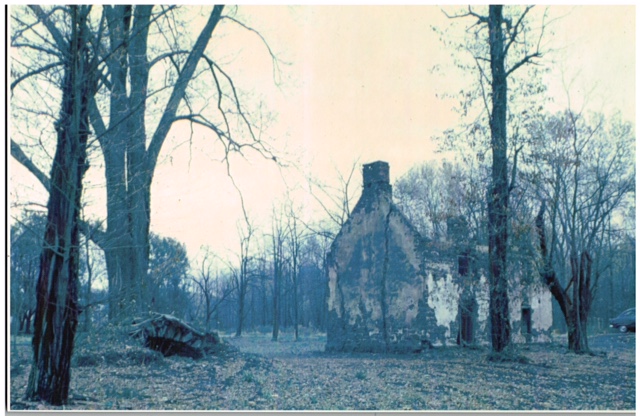
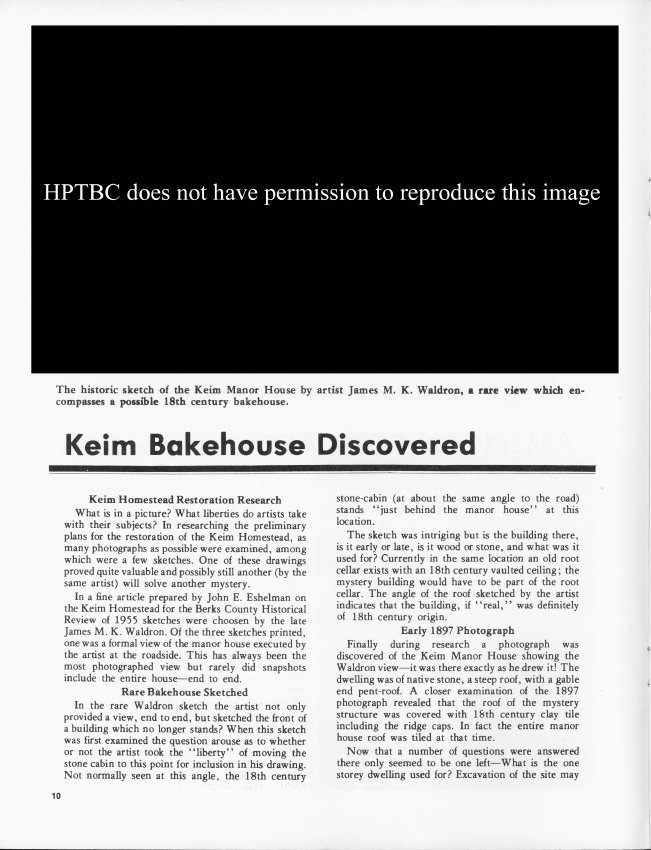
Two-page article appearing on pages 10-11 in the Winter 1974 issue of "American Folklife,"journal of the American Folklife Society. Article on Keim Farmstead discusses the depiction in a drawing of a structure (bakehouse) not present on the site in 1974. The vaulted “root” cellar remains, and will be exhibited under a roofed shelter.
Article also discusses how the presumed bakehouse was discovered in an 1897 photograph of the property. [See archive record KHPH13--1002.01.057 which reproduces the 1897 photograph from a halftone.] Both the drawing that initiated the controversy and the discovered 1897 photograph are reproduced in the 1974 article.
Image is of first page only. See additional image or MULTIMEDIA LINKS for second page text.
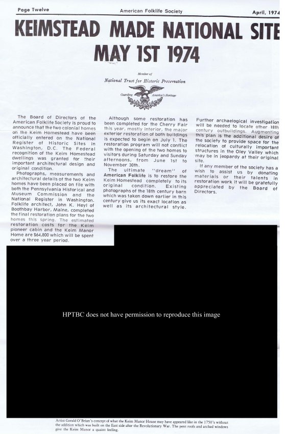
One-page article with conceptual perspective drawing (by Gerald O'Brian) from page 12 of April 1974 (Volume II, No. 7) issue of "American Folklife," newspaper of the American Folklife Society.
Article briefly discusses the appointment of the farmstead's two colonial homes [Keim Cabin & Keim House] to the National Register of Historic Places as well as restoration plans for the site and public access to the buildings.
At the time this article was written Keim Farmstead was owned by American Folklife Society.
Since 1974, considerable research has been done on the Keim farmstead structures by Philip Pendleton [primarily in his book “Oley Valley Heritage, The Colonial Years” and notably in his successful application for the designation of the 1753 Keim House and the “Ancillary” jointly as a National Historic Landmark [See summary in record KHTX13 in this archive]. New information and analysis have determined that the 3-level building formerly called the “Keim cabin” [or, even more speculatively, without documentation, the “Keim settler’s cabin”] was in the early period a multi-function building “ancillary” to the farmstead and the 1753 farmhouse, and housed the wood-turning craft engaged in by several generations of the Keim family. The “Ancillary” is now believed to be contemporary with the 1750s farmhouse rather than from an earlier generation of Keim settlers.
Updated August, 2020, Laurence Ward
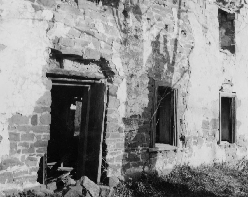
Series of 13 images (4 black & white photographic prints, 5 color digital images, one HABS data sheet, and one field notes elevation drawing) showing details of the west [river-side] elevation of the Mouns Jones House. Additional images illustrate similar houses and architectural details described in the text references to those images.
Details include:
A. Board-sheathed 19th-century doorway in north bay [color images show doorway appearance after removal of sheathing, and after 1960s reframing of doorway]
B. Modified fenestration, casement and hung-sash variations
C. Images #1 & #7 show remnants of pargeted masonry walls, and sockets cut into masonry and window sill for 19th-century porch rafters; note written in pencil on verso of Image #1 reads, "MJ--elevation detail (c.1965)"
D. Image #4 shows the present elevation as interpreted in the 1965-70 reconstruction
E. Image #5 shows a possible restoration of the original façade, with a re-centered doorway; fenestration format is hypothetical, except that the second story window in the north [left] bay is based on the 1886 woodcut and pre-1966 photos. In 2015, the size and proportions of the window openings in this elevation was re-considered, based on evidence from surviving window frame elements and 20th century photographs [see record #MJHPH102].
F. Image #6 is the hypothetically restored view from the western banks of the Schuylkill River
G. Image #7 is a c. 1957-1965 detail view of the west eaves wall from a southwest perspective; H. Image #8 is a 1958 newsprint halftone detail view of the west eaves wall from a southwest perspective;
I. Image #9 is a c. 1958-64 NW perspective view taken after the c. 1957-58 roof collapse;
J. Image #10 is a 1985 digital copy of Barry Stover’s pencil Field Notes drawing of the western elevation, showing dimensions and framing annotations;
K. Image #11 is a 1985 HABS Architectural Data Form prepared by Architectural Consultant Barry Stover;
L. Image #12 is a perspective view of the Barns-Brinton House from the SE. M. Image #13 is a perspective view of John Chadd’s [or Chad’s] House from the SE.
M. Image #13 is a perspective view of John Chadd’s [or Chad’s] House from the SE.
Compare window openings, proportions, and alignment in Image #1 to the artist's woodcut rendition [c. 1886] in MJHDWG2--1000.01.089 and MJHTX4--1000.01.063,. The second story window in the south bay, the central window in the lower story, and the first floor windows in Image #1 are each aligned on a long vertical axis and set in masonry openings which had been altered substantially to receive the new hung-sash windows installed between 1886 and 1902 in replacement of earlier horizontally-aligned or roughly square casement windows. This chronology seems reliable, based on the 1886 woodcut [MJHDWG2--1000.01.089 and MJHTX4--1000.01.063] and a c.1902 photo [MJHPH65--1000.01.070]. The stonework bonding techniques and early mortar found in the jambs of the masonry openings during the 2015 deconstruction phase are consistent with the window and doorway locations and masonry opening dimensions shown in the elevation drawing included as Image #9.
The small first floor window installed south of the doorway in the 1965-70 restoration was probably aligned along the north margin of the early [probably original] doorway in this principal elevation. This doorway, located as indicated by masonry evidence in the exterior face of the wall, consisting of roughly vertical joints ("scars" or "witness marks") extending from the present grade upward through the projecting water table (structurally a "basement" or "plinth"), and terminating in the re-worked masonry below the present window in image #2 [photo #867, 11/12/10]. The vertical joints delineating the presumed central doorway are more clearly shown in photo #14 in record MJHPH2, which is an interior view after removal of the plaster applied during the 1965-1970 restoration of the house.This series of mortar joints extending upward to the lower corner of the present window sill is more clearly discernible than the meandering joint pattern south of the small central window, possibly because of more frequent and extensive disturbance of the southern masonry range in various re-workings of the walls and re-alignment of openings during the documented renovations of the interior. However, the parallel vertical joints in the interior face of the wall [photo #14, Mjhph 2] quite clearly delineate the original doorway, which will be re-established in the current [2015-2022] restoration campaign.
A notation on another drawing in the Trust’s possession notes the "vertical joints in stone-work-former door opening." These seams [“scars"], probably locating the masonry jambs of the doorway, are still discernible in several other photographs in this archive [See MJHPH43--1000.01.047, MJHPH57, MJHPH73--1000.01.078, and MJHPH86--1000.01.092]. The hung sash window which preceded the small casement near the center of this eaves wall was undoubtedly less than four feet wide, leaving room for the 19th-century interior partition noted on the HABS drawing, just south of the window.
The "South [sic, west] Elevation" drawing published on Sheet #2A of the Trust's "Atlas of Architectural Drawings" (2008) indicates these vertical joints in the exterior masonry just above grade, almost precisely where a central doorway would have been located in the west eaves wall centered under the original 1716 date-stone above. These "scars" are still discernible, and warrant further investigation of the interior wall behind the modern plaster coating,confirmed the original door opening
opposite the restored doorway in the eastern eaves wall.
Another detail supporting the centered doorway hypothesis is the pair of large limestone blocks below grade and closely centered below the current small window in the center of the wall, and indeed roughly centered between the vertical door-jamb joint “ghosts” [photo#2670, 6/18/13]. These stones are typical of larger stones placed to support a doorway sill, possibly the same sill as now, and prior to 1886, used as the door-sill at the probably re-located doorway in the northwestern end-bay of the river-side eaves wall.
The "South [sic, west] Elevation" drawing published on Sheet #2A of the Trust's "Atlas of Architectural Drawings" (2008) indicates these vertical joints in the exterior masonry just above grade, almost precisely where a central doorway would have been located in the west eaves wall. These "scars" are still discernible, and warrant further investigation of the interior wall behind the modern plaster coating, to determine whether additional evidence might verify the existence of an early centralized door opening opposite the more clearly indicated doorway in the east eaves wall. Another detail supporting the centered doorway hypothesis is the pair of large limestone blocks below grade and closely centered below the current small window in the center of the wall, and indeed roughly centered between the vertical door-jamb joint “ghosts” [photo#2670, 6/18/13]. These stones are typical of larger stones placed to support a doorway sill, possibly the same sill as now, and prior to 1886, used as the door-sill at the probably re-located doorway in the northwestern end-bay of the river-side eaves wall.
The full outlines of the east doorway masonry joints are visible in HABS photos and other vintage photos in this archive, and on drawings of the "North [sic: east] Elevation" on Sheets #1 & #1A of the Atlas cited above. The interior inspection will include a search for evidence of a partition south of the central door locations.
The un-filed HABS Architectural Data Form prepared for the Trust in 1985 states: "Two rooms in the first floor were divided with a north-south [sic: the partition would be closer to the east-west axis] partition just west [sic: south] of the entrance doors which are(b) opposite each other in the long walls." The door in the east eaves wall had been re-created in the 1965-70 reconstruction, but the doorway in the west eaves wall had been left in its 19th-century location in the northern bay.
(b) sic: the doors had been walled up long before 1985, and only the eastern door had been re-opened in the 1965-70 restoration program.
The partition noted on the 1985 drawing could not have been the same "board partition" mentioned in the 1957 HABS drawing [MJHDWG1--1000.01.019], which shows a "line of a former board partition" dividing the hall/kitchen on the north from the parlor(c) on the south. In the west [river-side] eaves wall, in the early form of the principal façade of the house, the HABS plan terminates the partition immediately south of the central window [as aligned in 1957]. A partition on this axis would have intersected the early centered doorway opening, which from masonry evidence was 6-8 inches wider than the window opening existing in 1957. Thus the HABS "board partition" would have passed through the original centered doorways in both eaves walls, and thus could not have been the original division wall between the hall and the parlor. The HABS partition was probably the board wall constructed when the doorway was moved northward from its original position, enlarging the parlor to include a segment of the original "hall" area. The HABS draftsman obviously was aware that his dotted-line "partition" intersected the doorway in the east eaves wall after it was closed up, and for this reason alone could not have been the earliest demarcation between the first floor living spaces. The earliest partition must have been located south of both doorways and their framing, establishing the hall as the larger space and the only room with exterior doorways.
(c) also called the "inner room" in the English tradition, because of the absence of an exterior entrance.
The drawing published as Sheet#2 of the Trust's "Atlas of Architectural Drawings" (2008) is entitled "Possible Scheme of Restoration." It proposes a partition north of the central doorway in the east eaves wall, dividing the smaller "Kitchen" from the larger "Chamber"(d), which includes the diagonal corner fireplace in the southeast corner. This division of floor area is inconsistent with the more typical dominance of the hall, often roughly square in plan view and larger in area than the parlor, in interior allocations of space in structures following the English tradition in the American colonies.
(d) In early Anglo-American usage, "Chamber" was usually invoked to describe an "above-stairs" room between the first story and the garret in a two-and-a-half story house [Whiffen, M., The Eighteenth Century Houses of Williamsburg (1969) ].
As discussed above, the original partition between the two rooms would most likely have been located south of the central doorways, probably 8-12 inches south of the HABS drawing location. The isometric drawing by Hope Levan, published at page 169 of "Oley Valley Heritage, The Colonial Years…" by Philip Pendleton, seems a more likely alignment for the partition wall, south of the co-axial eaves-wall doorways, than does the HABS location, or the proposed schematic in MJHDWG1--1000.01.019. The Levan-Pendleton interpretation is more consistent with the established British hall-parlor division of the interior space in early houses lacking a double-walled central passage. There is no notation on the plan as to whether a channel or other anchorage for the board partition was found in the walled-up doorway masonry, or whether any such evidence ["scars" or "witness marks"] was found for an earlier partition south of the doorways. Later inspection, after removal of the 1970 interior plaster, did not reveal any unambiguous evidence of the location of the wall-channel securing a board partition.
Images #3 & #4 [photos #878 & 879] demonstrate that the centered doorway location would position the datestone directly above the primary entrance, a more typical and symmetrical pre-Georgian alignment. Several of the three bay Anglo Pennsylvania houses cited in this record exhibited primary entrances centered under a date-stone [e.g. …]
The central door location would also place the two doorways "opposite each other" [cfr the 1985 HABS data sheet prepared by Barry Stover] on the same transverse axis through the hall. This alignment is quite common in first floor two-room house plans of the period in areas settled by English immigrants [see MJHPH60--1000.01.065 for a discussion of the dominant influence of Anglo-Pennsylvania domestic architecture in the period preceding construction of Mouns Jones' house].
A direct entry into the kitchen in a floor plan lacking an enclosed hallway or passage is also considered to be a Pennsylvania Germanic [continental] detail; however, the two-room, single-pile plan of the Jones House, with its gable-wall fireplace locations, is more closely aligned with the British prototypes emerging in frontier Philadelphia County and neighboring settlements. This transitional three-bay{1} type would soon evolve into the five-bay, center-passage [or "center-hallway"], double-pile "Georgian" plan-form in parallel Germanic and "Anglo-Pennsylvania" lines of development.
Image #5 is a hypothetical reconstruction of this elevation, superimposing a central doorway and symmetrical casement windows on the façade as a possible restoration program. This photo is included primarily to show a plausible interpretation of the early three-bay river façade, with the doorway location centered under the datestone, and not to suggest an original balanced window alignment.
Assuming a six-beside-six casement window in the first story of the northern bay, the suggested re-alignment of door and window openings would present a remarkably symmetrical pre-Georgian "transitional" façade. However, if the 1886 woodcut and the 1965-70 interpretive restoration more accurately reflect the early casement sizes, arrangement, and glazing, the riverfront elevation would express a more "medieval" asymmetry, determining the sizes and locations of windows from the practical consideration of cost, interior function, and convenience. However, an asymmetric window arrangement is common to both sets of antecedents, and therefore is not solely determinative of the probable façade design-sources. Far more important than stylistic or presumed ethnic influences in determining fenestration geometry and details is the architectural evidence in the masonry and timber framing, if any elements survive from the building’s early periods.
The 1886 woodcut indicates that the eastern doorway was walled up prior to that date, creating a "blind" central bay in this eaves wall, and more privacy in the partitioned interior. It seems likely that the non-bearing board wall between the hall and parlor was moved northward during the same interior renovation, intersecting the walled-up former doorway openings and increasing the size of the parlor. This alteration would account for the findings supporting the HABS' dotted-line location for an inferred 19th-century board partition. This might also have been the renovation, perhaps after a structural failure in the southern range of the west eaves wall, which resulted in the polychrome effect of the wall's exterior stonework, now composed of red-brown sandstone and gray-tone limestone "units." If the stucco pargeting appearing in the 1886 woodcut and in photos from the first half of the 20th century was applied ["rendered"] on the walls in the same pre-1886 campaign, this would explain the indifference in laying the wall up with stones of a random and incompatible color palette. The sub-grade stonework visible in the 1970 archaeological photo and images of the excavations of the past several years could be remnants of a foundation for an earlier dwelling, an early summer kitchen or other out-building, or a later-period addition to the original stone house. If the latter, the central passage doorway into the addition at the "back" of the dwelling could have been walled up when the addition was removed. There is no evidence of a date sequence for these hypothetical alterations, except that it is inferred that the west doorway, almost certainly centered in the eaves wall in the earliest period of the house, was closed up and relocated to the northern bay prior to the 1886 woodcut date.
Historically, the Mouns Jones House is the earliest surviving stone dwelling in present-day Berks County. Architecturally and demographically it was (in 1716) the outermost stone "plantation" [see discussion of the connotations of “Plantation” in early Pennsylvania in record #MJHTX….] house on the northwestern frontier of rural Philadelphia County. Fronting on the Schuylkill River "highway," it was an imposing provincial example of an evolving Anglo-Pennsylvania type of dwelling built in the Philadelphia region by and/or for Quakers. This three-bay, single-pile, two and a half story hall-parlor house with gable-end fireplaces defines the architectural group to which the Mouns Jones house clearly belongs.
It seems evident that this house, on the northwestern perimeter of Penn-era Philadelphia back-country, was constructed well within the craft proficiencies and design vocabulary of Anglo-American artisans, many of them Quakers, including experienced "journeymen"{2} in the architectural crafts. The small group of Swedish settlers in the Manatawny community, emigrants from Philadelphia [the southwestern precincts then known as Kingsessing], would have been acquainted with masons and timber framers working in Philadelphia and Chester Counties in 1716 who would have been quite competent to construct this impressive "plantation" house in a familiar design-form. This simple, traditional, and externally symmetrical type had been developing and spreading radially from Philadelphia for two generations.
Both Mouns Jones and his father Jonas Nilsson(s) owned buildings in Kingsessing in the late 17th century. In his 1940 book "The Swedish Race in America," Abram C.F. Ottey, Litt. D., offers a segment on "The Old Swedes House and Marker, Douglassville, Berks County, Pennsylvania" [p. 106, et. seq.], in which Ottey calls "Monce" Jones' house "a very substantial stone building, thirty-six feet long and twenty feet wide…two stories high [which] in the past had a deep cellar"(t).
(s) Ottey published several factual errors in these few pages on "Monce" Jones and his Manatawny home, including the almost inexplicable assertion that the name which was "Anglicized" to "Jones" by Mouns and his family was "Nilsson," the derivative surname of Mouns' father Jonas Nilsson, whose father's first name was apparently "Nils." It seems obvious that Mouns' "Anglicized" paternal name was "Jonasson," phonetically contracted to "Jones" and retained by Mouns, his family, and his offspring for many generations during the past three centuries. The author also calls Berks County "Bucks," and recites numerous incorrect dates for events which are dated differently by reliable documentation.
[t] Other sources indicate that no cellar ever existed under Jones' house, basing this conclusion in part on the finding of stone joist-piers inside the perimeter foundation. Future archaeological analysis might resolve this ambiguity.
Although Mouns Jones father's home in Kingsessing was apparently of logs set on a stone foundation, Mouns reputedly lived in a stone house in the Philadelphia environs, and both he and his father were aware of the 17th-century random rubble masonry jail ["House of Meditation"] in Essington, PA on Tinicum Island [see Ottey, op. cit. ,p. 107, including a photographic halftone of the window-less structure]. There were obviously stone masons working on domestic structures in the Philadelphia settlement by the last third of the seventeenth century and Mouns Jones could journey to the Manatawny frontier with confidence that Quakers or Quaker-trained craftsmen were capable of building a substantial stone house for him and his family.
Without the benefit of surviving timber elements or joinery evidence(n) which might shed light on the ethnic or indigenous influences on framing techniques, structural methods, and other construction details, assigning Mouns Jones' house to a particular European design-source or ethnic methodology remains somewhat conjectural. Random rubble masonry walls with "quoin" corner piers and gable-wall fireplaces and chimneys appear in both British and "continental" antecedents. Germanic stone dwellings built in the hills and valleys to the north of Morlatton in the decades following 1716 [log construction prevailed for most of the first two decades] tended to display three-room plans, "central" chimneys serving fireplaces which are integral to interior bearing walls, and asymmetric entry and fenestration patterns. These houses rising in the Oley Valley exhibited a clear divergence from the set of decidedly Anglo" plan-form, spatial allocations, and details informing Mouns Jones' plantation house.
(n) Other than roof shingles and fireplace lintels, virtually all of the wooden fabric of the house was lost in the 1950s partial collapse, earlier interior fires, floods, and in the controlled demolition-and-removal preceding the 1960s reconstruction.
The pioneering founders of the forges and furnaces in nearby emerging communities employed masons in the construction of mill buildings and their dependent structures in the first three decades of the 18th century. This group of experienced craftsmen, though not trained in a European-style master-journeyman-apprentice guild system, could surely have provided the vernacular design sources and traditional masonry methods [in medieval terms, the “art and mystery” of their craft] for building Mouns Jones’s stone house. The masons and carpenters and other craftsmen from the Philadelphia environs [English masons were working in Philadelphia as early as 1689: Cox, B.] were capable of developing the necessary plans, elevations, and interior spatial arrangements based on their hands-on training and experience, while adapting some details to Jones’ preferences. If he selected the convex cross-corner fireplace based on his Swedish heritage, the growing clan of skilled Quakers and other Anglo-Pennsylvania artisans had constructed numerous fireplaces in similar alignment in houses designed and built independently of Swedish influence, and were quite capable of producing this feature for their Pennsylvania-Swedish client. The Jones corner fireplace lacks the iron oven integrated into some Swedish-influence examples.
However, in the presumed construction period of Mouns Jones stone house, c.1715-1716, he would not have had to seek competent builders from as far away as Philadelphia. Thomas Rutter and his Quaker family, including his son-in-law Samuel Savage (described in a contemporary Deed as a “Manatawny Mason”) built a “bloomery” wrought iron forge a few miles to the northeast, by 1716. Rutter and his corps, or other craftsmen with the necessary experience (and proximity) could have provided the labor, means, and methods to erect Jones’s river-side plantation house. Rutter’s initial iron production efforts and early buildings are discussed at p. 42 and elsewhere in Pendleton, P, “Oley Valley Heritage…,” cited above and by Melissa Pilar LaValley in “Pine Forge Iron Planatation, history, building chronology…,” a thesis submitted to the University of Pennsylvania in 2002, and published on the internet.
Examples [and variants] of this two-and-a-half story type, several of one-room deep ["single-pile"], three-bay arrangements similar to the 1716 Mouns Jones House, are depicted in photographs by Ned Goode in "An Album of Chester County Farmhouses," published in "Pennsylvania Folklife," Vol. 13, No. 1, Fall, 1962. Included in the Folklife essay [and documented in the HABS archives by photos, text, and sometimes dimensioned drawings], are the following examples, each including a non-bearing partition wall creating the division between the hall and parlor:
Barnes-Brinton House, c.1704--not later than 1722 [two-room first floor plan, brick construction, gable-end chimneys centered on roof-ridge, 19th-century hung-sash windows]; see photo #4929, 05/15/15 attached
Abiah Taylor House, 1724 [two-room hall-parlor first floor plan, brick construction, datestone centered above central doorway in eaves wall, gable-end chimneys centered on roof-ridge, 19th-century hung-sash windows], asymmetrical fenestration, and a diagonal corner fireplace, is a representative Chester County example constructed eight years after Mouns Jones House in a similar form [see the article "Vernacular Expression in Quaker Chester County…" by Arlene Horvath published in "Perspectives in Vernacular Architecture, II," page 150 et seq. (1986), which thoroughly analyzes this house and notes that most Chester County houses of the early eighteenth century were influenced by the English hall-parlor plan, and specifically the "Quaker Plan," consisting of two or three rooms and a corner fireplace.
The Joseph Collins “Mansion”, constructed for a Quaker family, is a small [23 ft. x 21’6” (see HABS Nomination text)] “Philadelphia Style” detached townhouse like the Letitia House, is roughly square in plan, three-bays in width, and has a façade doorway centered under its original 1727 date-stone and a “pent-eaves” pediment base across the gables. A leaded casement window frame survives. A 20th century drawing shows fixed upper lights and pivoting casements filling the larger lower segment [see Images ##......., in this record].
John Chad House ["Chadd's House"], c.1710-1720 [random rubble stone masonry with "quoin" corners, a bank house with kitchen on lower level, pent roof, gable end chimney centered on ridge, and diagonal corner fireplace with vertical chimney stack, asymmetric secondary ["back"] eaves wall, 19th-century hung-sash windows ] see Image #...., photo #4919, 5/15/15.
Another Pennsylvania house of this type is documented as HABS No. PA-174 [but not included in the "Pennsylvania Folklife" essay cited above], moved in 1968 from Concordville to Bacton, Chester County] is a three-bay, center entry, frame and weather-board dwelling built c.1720. The hall had a fireplace flat against the gable wall in the same relative position as that in the Mouns Jones House, and a diagonal corner fireplace in the same location as in the Jones parlor. A brick chimney emerges from the lower range of the roof plane near the gable wall. The chimney from the rectilinear fireplace is not shown in the HABS photos.
The early manor house and a tenant house on the Warwick Furnace site in Chester County should be studied for evidence of an early three-bay house possibly of the same type as Mouns Jones masonry plantation house.
Two other examples of contemporary English ["Quaker"] plan houses of brick in West New Jersey [east of the "Wertenbaker line" (generally accepted as the demarcation between brick and stone prevalence) are the John Denn and James Evans houses of c.1725 and 1728, respectively, which are analyzed in the article by Michael Chiarappa, "The Social Context of Eighteenth-Century West New Jersey Brick Artisanry," pp. 38-39, published in "Perspectives in Vernaculary Architecture, IV" (1991).
Other houses of this type built in the first quarter of the 18th century within a 50-mile radius of Philadelphia include two in the "Lower Counties" [now Delaware]:
[A] the Robert Ashton House in St. Georges Hundred, New Castle County, Delaware, c.1700, was built for an immigrant Quaker cousin of William Penn. The early frame house [the earliest documented surviving dwelling in Delaware(f), now primarily of brick, expanded, and altered] consisted of a single-pile, hall-parlor first floor plan with exterior doors centered in the eaves walls; parallel fireplaces on the gable walls; and casement window openings in the brick structure. The HABS record includes first and second-floor plans.
(f) See the HABS survey report, HABS DE-240, compiled by Dr. Bernard L. Herman, then (1986) associated with the Center for Historic Architecture and Engineering, University of Delaware
[B] The patterned-brick Abel & Mary Nicholson House [1722], Salem, New Jersey, classified as "Postmedieval English" in the National Register form, and built for a prominent Quaker [Salem Meeting] family in southern New Jersey. It is a single-pile, three-bay, hall-parlor plan. Like the Jones house less than 50 miles to the northwest, "the primary access…faces…a watercourse, historically the initial mode of primary transportation to the property at the time of construction." [NRHP Registration Form, page 6]. Comparable to the Mouns Jones House in size, it is considered a "mansion" in the architectural context of the period in the southern range of the Delaware Valley [Ibid, page 11].
Other contemporary English settlements east of the Manatawny community, and approximately the same distance from Philadelphia, included structures such as the two-and-one-half story 1708 Isaac Watson House, located on the eastern bank of the Delaware River within present-day Trenton. This West Jersey hall-parlor dwelling, built for Quakers in a Quaker community, features random-rubble masonry construction, a central doorway in the principal eaves wall, fireplaces on the gable walls, a datestone over the principal doorway, a pent roof across the entire span of the primary eaves wall, and a controlled asymmetry in the fenestration pattern. Although 50 miles to the east, the Watson manor house is relevant to consideration of the architectural influences on Mouns Jones House, as both were most probably built by immigrant or second-generation English masons and carpenters, including master craftsmen and journeymen{2} trained in Philadelphia and working in the expanding reaches of the early "Penn" Counties.
The import of this group of English-influence rural domestic structures is not that any particular house provided the prototype for Mouns Jones House, or that their common elements directly influenced Jones' floor plans, elevation details, or interior spatial disposition. The more compelling inference is that a three-bay, two room, two-and-a-half story Anglo-Pennsylvania rural house type, featuring a symmetrically "Georgian" or "post-medieval" primary façade, was well-established in the territory{g} most likely to have provided craftsmen, most of them English and Welsh immigrants, capable of erecting a rather imposing masonry "plantation" house of this type in the frontier Manatawny community in 1716.
(g) Similar early houses exist in rural Montgomery and Bucks Counties. Undoubtedly many more houses constructed in the early period following this plan have collapsed, burned, been dismantled, or become altered beyond recognition.
Anglo-colonial houses of this transitional style, many in the hall-parlor ["parlour" in England and sometimes in New England and Virginia] plan and some with rudimentary hung-sash windows(h), also appear in Virginia and other colonies with concentrations of English immigrants. An exposition of this set of houses appears on pages 25 through 41 in "Virginia Architecture In the Seventeenth Century" by Henry Chandlee Forman, Williamsburg (1957). Forman calls this type of house a "link" between 17th-century Medieval cottages, with small casement windows, and the fully developed Georgian manor houses of the following centuries. This "transitional" attribution is consistent with the "post-medieval" and "pre-Georgian" nomenclature assigned to the Mouns Jones House archetype by other commentators.
(h) Considered by Henry Forman in the work cited above as "crude" in construction and as dangerous as a wooden "guillotine." see the discussion of early hung-sash [“double-hung”] windows in “Thomas Banister on the New Sash Windows, Boston, 1701”, pp. 169-170, as published in the Journal of the Society of Architectural Historians, May, 1965, Vol. XXIV, Number 2.
Anglo-Virginia features in this type of house, with details in common with the original Mouns Jones' design, include opposing doors centered in the eaves walls; a full second story with a garret above, a fireplace on the gable wall with its chimney centered on the roof ridge; and a diagonal ["catercorner"] fireplace. Whiffen [Eighteenth Century Houses of Williamsburg] notes that in the Virginia tidewater, early three-bay houses often had an enclosed central passage with a "back" staircase built against one of the partition walls, in contrast to the hall-corner location of the Jones "winder" stair. With a single partition between hall and parlor rather than the more formal presentation of the double-walled central passage of fully developed “Georgian” plans, the Jones house and the majority of the related houses cited above express typical Quaker reticence in material things, conforming (consciously or otherwise) to the guiding precept embraced in the “Testimony of Simplicity.” Builders of this type of house, and their clients, apparently perceived no social imperative requiring sequestration of “private” family spaces from “public” areas where visitors were welcome, nor any impulse to isolate first floor living areas with a space-consuming two-wall passage [later “hall"] connecting the two doorways centered in the long walls.
In the period of Mouns Jones establishment of his "plantation" [c.1705-1709], through the traditional date of completion of his stone house [1716], and continuing for almost another generation, the Germanic and Huguenot settlers to the north of the Manatawny/Morlatton planters' community were building log homes with floor plans more typical of Continental precedents [three-room floor plans, "central" chimneys, asymmetric doorway and fenestration patterns, etc.].
Central-entry "Georgian" symmetry in the principal elevation of modest rural dwellings pre-dates the ascendancy of George I to the English throne in 1714. The dwellings cited above seem to demonstrate that, during the last quarter of the 17th century(n) and the first quarter of the 18th, a transitional form of English-influence farmhouse began to appear in Chester County and other areas south and east of the Manatawny/Morlatton community, influenced primarily by architectural traditions imported by Quakers and other English immigrants taking up Penn land patents and settling the regions radiating up the Delaware and Schuylkill Valleys from Philadelphia. Mouns Jones plantation house, to the extent that its characteristics can be reasonably determined, seems to be situated well within this affinity-group.
(n) This plan-form continued into the second quarter of the 18th century in the zone of Quaker influence between Philadelphia and its expanding periphery, as exemplified in the 1727 Amos and Mary Yarnall house in Willistown Township, Chester County, PA. The original Yarnall house was a three-bay, two-and-a-half story, “single-pile” {3} dwelling of un-coursed rubble-stone construction with doors centered in both long walls and a single partition wall separating the hall from the parlor. The cooking fireplace is aligned on the eastern gable wall of the hall.
FOOTNOTES:
{1} In the context of medieval architecture a "bay" was defined by the spans between primary supports such as columns, piers, posts, shafts, etc. forming the modular divisions within cathedrals, great halls, barns, and other substantial structures. As used here, and as generally applied to post-medieval domestic buildings, a "bay" usually denotes a division of the principal elevation delineated by vertical segments centered on doorways and windows, without regard to interior partitioning, framing, or structural support systems.
{2} The status of "journeymen" in the various construction trades in English craft guilds signifies someone who had completed his apprenticeship and was deemed qualified to "journey out" to construction sites to work within his craft for wages. In the continental Germanic Guild and Trade tradition, this was called “Wanderschaft Peregrination”, a one or two year “journey” to regions and cultures designed to afford knowledge and experience in trade practices and techniques outside the apprentices home region and widening the experience and skill-set of the “Handwerks-Bursch” [Travelling Journeyman] beyond the local methods absorbed in his youth; cfr. Rush’s Account of the Germans in Pennsylvania, as published in the Proceedings of the Pennsylvania German Society, Vol. XIX, at page 50, and Rupp’s footnote 23, ibid.
Many hundreds of records of Indentures of a large percentage of immigrants to Pennsylvania from 1771 to 1773 recite that the “Apprentice” or “Servant” was “to be taught the art, trade and mystery” of the designated occupational category; see records published on pages 1 to 325 of Pa German Society Proceedings, Vol. XVI (1907), essay entitled Record of Indentures of Individuals Bound Out as Apprentices, Servants, Etc. and of German and Other Redemptioners…October 3, 1771 to October 5, 1773.
{3} see definition and evolution of meaning of “double-pile” in record #....
Laurence Ward, June 2010, updated May, 2022
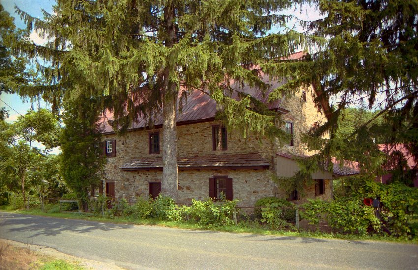
Series of 50 digital photographs depicting the removal of the c. 1930s porch from the Keim House {q}.
1. {q} Image #47 is a panoramic view of the Keim farmstead, a c. 1930, photo taken by Amandus D. Moyer, and is used with the generous permission of the photographer's granddaughter Susan Harvin. Note the absence of a porch on the west gable wall.
The two earliest Keim buildings, the 1753 farmhouse and its "ancillary" structure, and the Federal-era addition to the 1753 house formed an organic and architecturally distinguished farmstead which prospered during Keim family occupancy and administration for nearly sixteen decades. The surviving structures remain in remarkably well-preserved and substantially undisturbed condition, never having been substantially "improved" with interior plumbing, electrification, or other modern utilities, or structural or cosmetic "remodeling". The only significant exceptions include modification of the roof system and materials on the 1753 house and the early addition, and the construction and recent removal of the disintegrating 20th century porches on the south and west walls.
2. Fortunately, this unmolested status continued through the 65 years of Boyer family ownership which commenced c.1913 and ended with the Boyers' conveyance of the site and its structures to the Historic Preservation Trust of Berks County. The undisturbed condition continues under the stewardship of the Trust. Despite the passive preservation of the period buildings in their early condition throughout two and a half centuries, much of their distinctive architectural form, character, scale, and defining details were concealed and distorted for more than a century and a half by two successive porches joined to the south eaves walls. The 1930s porch extended the porch northward, appended to the west gable wall.
During the first 258 years of its existence, the 1753 house displayed three projecting roofed structures, a pent roof and 2 floored porches, appended in the following sequence to the south eaves wall. The porches described in "B" and "C" also extended across most of the contiguous eaves wall of the Federal-era addition; "C" also abutted the west gable wall, forming a prodigious L-shaped "piazza, in modern terms."
A.The first of these structures was a "pent"{a} roof, without above-grade flooring, probably un-ceiled{b}, integral with the original 1753 masonry wall construction, and carried on cantilevered "outlookers" which were cut off when the 19th-century floored porch described in "B" below was constructed. This early pent was structurally, dimensionally, and functionally equivalent to its counterpart, now reconstructed on its original outlookers on the north eaves wall of the 1753 house [Image #1, photo from record KHPH2--1002.01.009 and Image #11, photo 4300, 7/1/11].
{a} a contraction of "appentice," meaning an attached ["appended"] sheltering structure joined to a principal building [Lounsbury, Carl, An Illustrated Glosssary of Early Southern Architecture and Landscape, Univ. Press of VA, (1999), p. 267].
{b} This inference is based on the following considerations:
1) There is no framing evidence for a ceiling ["soffit"];
2) There is no soffit sealing the underside of the northern pent roof; and no evidence of nailing to the bottom surface of the outlookers carrying it.
3) The walling between the outlookers and the rafter tops is laid flush with the plumb-lines of the exposed masonry and pointed identically to the wall ranges of all exposed elevations of the 1753 house. When an 18th-century pent roof was ceiled [earlier, "sealed"], such as at the George Douglass House, the wall segment concealed by the pent roof and its ceiling is typically laid in the "random rubble" method without regard for uniform coursing or wall-plane consistency [Image #2, photo #3842, 6/5/11].
Pent roofs and hoods [usually referring to a projecting structure, pedimented or in shed-form, above a single door or window] were distinguishing elements of 18th-century vernacular architecture in the region. They served the same function in Anglo-Pennsylvania and Pennsylvania Germanic structures: protecting the woodwork and joints forming, framing, and securing wall openings, thereby reducing deterioration from saturation of mortar joints and foundation masonry .
The original pent roof framing on the north [road-side] eaves wall furnishes an ideal template and dimensional basis for framing and detailing a restored pent structure on the south elevation. Accordingly, the authentic reconstruction of the southern Keim pent roof will create a structure which is not cieled or sided, but returns to the masonry wall with a half-hip based on the existing pent on the north eaves wall. This framing system will consist essentially of a series of half-trusses composed of rafters footed on a front plate, and joists mechanically fastened to the original outlookers, which had been cut-off at the wall plane to accommodate the 19th century porch. Lath strips will support the authentic roofing material, clay tiles, the same material used on the original roof of the house, based on photographic evidence [see Image #11].
The original pent roof was joined with the eaves wall tightly under the flashing course, which consisted of horizontally aligned stones ["flags"], which are flatter than those in the ambient un-coursed wall ranges of the early house block. This projecting band of stonework [Image #3, photo 5522, 8/20/11] was designed to shelter the joint between the pent roof and the wall masonry from moisture infiltration. The thin stones forming this flashing ["drip course"] had been masoned into the original structure by embedding them as cantilevers with fulcrums at the wall plane. This structural integration demonstrates unambiguously that the pent roof and flashing course were part of the original 1753 construction campaign and survived as a sheltering "overhang" for a more than a century.
3.
Demolition of the pent roof in the 19th century, removing its cantilevered outlookers, and construction of a porch roof meeting the wall a foot below the projecting stonework rendered the flashing course conspicuously redundant. This anomaly was the least intrusive effect of the porches, as discussed below.
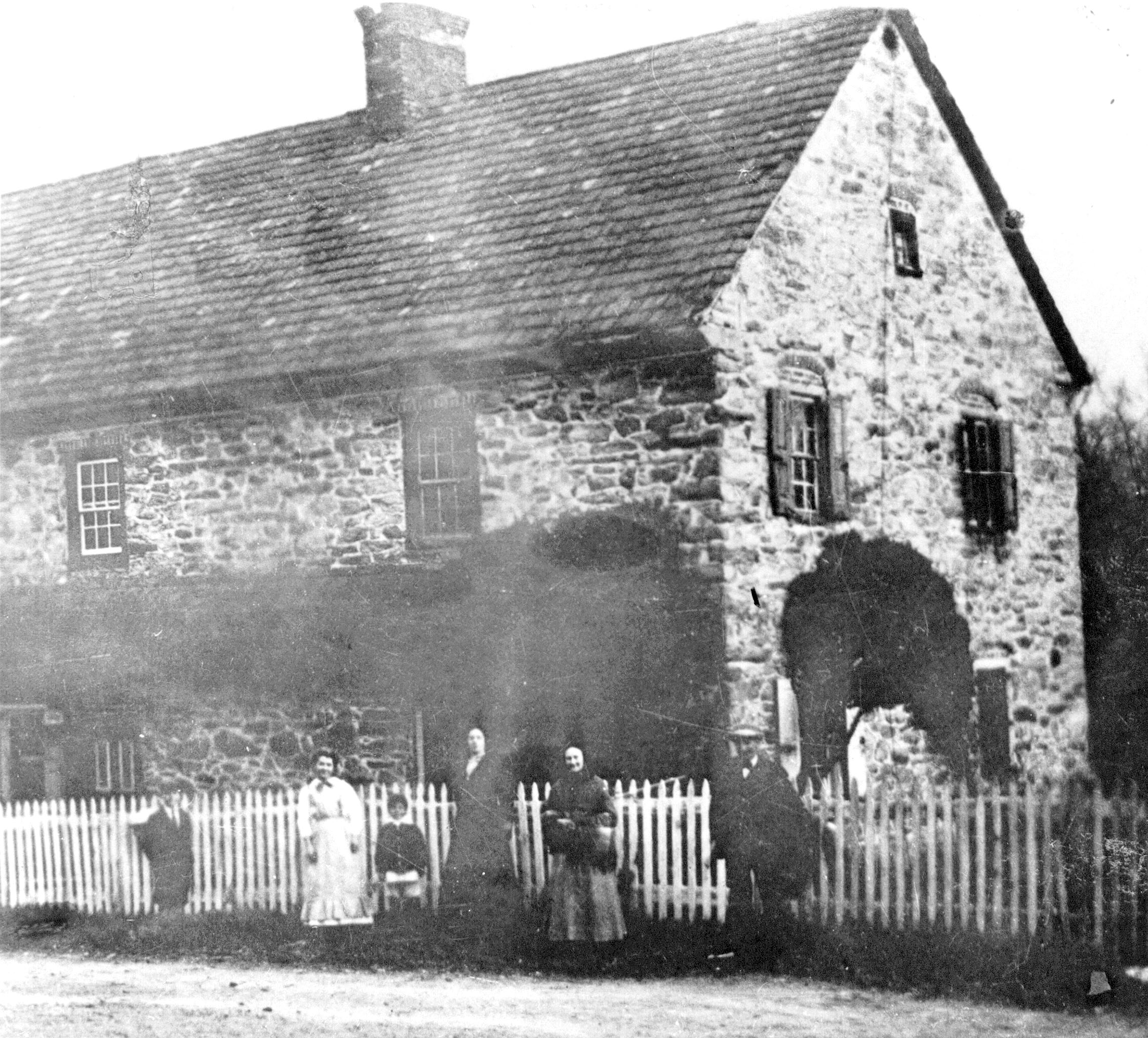
B. The first floored porch, with its roof carried on turned support posts, was erected during the second half of the 19th century in replacement of the original pent roof. [Image #4, Photo 2 from KHPH9--1002.01.044]. This 19th-century porch{c}, a structural and functional expansion of the first-period pent roof, survived all Keim family members who had occupied the farmstead through 1913.
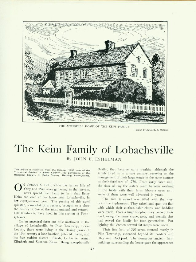
{c} This date attribution is based on the scale and profiles of the turned support posts (see photographic images in Archive record KHPH9--1002.01.044). This structure is probably the "back porch" which Betsy Keim, the last surviving Keim to reside at her ancestral farmstead, was sitting on when her photo [Image #5] was taken "in the "early 1900's" for the Reading Eagle newspaper [see the halftone reproduction of this photo on page 27 of "American Folklife," in the issue entitled "Oley Valley, American Cultural Island," Vol. 1, No. 7, published by the American Folklife Society in 1973, and the essay "The Keim Family of Lobachsville" by John E. Eshelman, published in The Historical Review of Berks County, October, 1955]. The photo was also published in the Reading Eagle on Sunday, November 5, 1911, within a few weeks after Betsy's death. An uncropped print of this photograph (showing Betsy bare-footed) was reproduced on page 15 of "The Oley Valley, A Photographic Journey," published in 2010 by The Oley Valley Heritage Association. The caption cites a probable date of "c.1910."
The pent roof and its "outlooker" supports were removed and replaced by the 19th century porch roof which was set at a lower level than the sloped plane of the early pent, and displayed the first floor deck raised above the exterior grade on stone piers, creating a sheltered outdoor extension of the interior living space. This was the first significant exterior modification of the original house after the Federal extension of the dwelling space more than a half-century earlier.
This 19th-century porch was laid out along the south eaves wall of the 1753 masonry block and a portion of the Federal-era addition, terminating at both ends and appended solely to the southern eaves wall. It sheltered wall openings and their woodwork, as had the early pent on the 1753 house block. It also provided cover for the exterior doorways into the kitchen of the original house and the Federal addition, and formed a canopy for outdoor communication between them.
As shown in Image #4, a J. Winslow Fegley photo taken c.1915-1925; see Farming Always Farming, p. 85], the first porch roof joined the masonry wall approximately one foot below the flashing course delineating the meeting of the original pent roof tiles and the eaves wall masonry. This vertical separation between the top of the 19th century porch and the flashing course confirms that the replacement structure was not the original roofed projection on the south eaves wall. The original "pent" structure would have fit snugly under the projecting "flag-stones" forming the sheltering "flashing" course, which would have provided negligible precipitation-shelter to a roof/wall joint a foot below it.
The 19th-century porch structure was undoubtedly removed preparatory to construction of the 1930s L-form porch discussed in "C" below.
C. The c.1930-1940 porch extended along the full extent on the south eaves wall of the 1753 house and the Federal addition, turning 90 degrees northward at the southwest corner of the early house and extending along the west gable wall [see Images ##6, 12, 13, and 31]. Its roof was of a different pitch and less vertical separation from the flashing course than the 19th-century porch roof [Image #4].
This later and dramatically larger porch roof was supported on posts of a bolder profile than the earlier porch [see "B" above]. The floor on the south eaves wall consisted of joisted tongued-and-grooved boards carried on massive stone piers butted against the foundation wall and "flashed" with a crude band of concrete at porch-deck level [Image #6, photo 3680, 5/23/11 and #7, 4284, 7/1/11 ].
The floor on the western gable-end wall was a thick poured concrete "slab," mixed, typically for the period between the two 20th-century world wars, with a dense "aggregate" [Image #22, photo 4394]. It buried and concealed two cellar openings in the west gable-end foundation, a ducted and grilled vent and a partially closed-up window [Image #8, photo 4266 and Image #9 photo 5854], both of which have now been partially unearthed and shielded from ground runoff by dry-laid stone "wells" seen in the photos cited.
In Image #10, photo #4339, 7/5/11, the broken red horizontal streaks on the wall [paint from the 20th-century metal porch roof] about 4-6 inches below the flashing course delineate the top of the porch removed in the 2011 project.
The 20th-century porch had not been built before 1912 [Image #11, the 1912 photo published in archive record KHPH13--1002.01.057. Also absent from the c. 1930 Amandus Moyer photo (Image #47), the removed porch was quite obviously constructed after 1929 and prior to 1941, when a HABS photo (Image #12, also in archive record KHPH8--1002.01.027) was taken, showing the L-form range porch surviving until its removal in 2011. Thus the 20th century porch was never a "Keim Family" addition to the living space, and there could not have been any association between the Boyer-era porch removed in 2011 and any Keim family member residing on the farm during the porch's life-span. The last Keim to reside on the farmstead was Elizabeth ("Betsy") Keim [Image #5], who died in 1911.
Since the latest porch does not appear in its two-wall configuration in the Moyer photo, (no porch appears on the west gable end of the 1753 house), it clearly was built after c. 1929 [and prior to 1941, when a HABS photo, Image #12, also in record KHPH8--1002.01.027], was taken, showing the two-range porch removed in 2011. Thus the 1930s-era porch was never a "Keim Family" extension of the living space and there could not have been any association between the Boyer-era porch removed in 2011 and any Keim family member living while the porch was appended to the house.
The construction date-range [c.1930-1940] for the modern porch falls a century or more after the conclusion of the "Period of Significance" for the Jacob Keim Farmstead. A structure as late and architecturally intrusive as the massive 20th-century Boyer "piazza" warrants removal from such an important vernacular architectural landmark, regardless of how pleasant an ambience it might have manifested during the interval of private ownership between the Keim family's tenure and the present and ongoing stewardship undertaken by the Historic Preservation Trust of Berks County.
PRESERVATION GUIDELINES
Transfer of the site and its surviving buildings to the Historic Preservation Trust of Berks County, Pennsylvania by Mr. and Mrs. Richard Boyer in 1978 imposed a set of custodial responsibilities that are fundamentally different from the essential attributes and relatively unconstrained rights of private ownership.
One of the primary obligations inherent in any preservation mission is to maintain and interpret architecturally and historically significant buildings in their documented historical context (the "Period of Significance") for the benefit and education of the organization's membership, its regional constituency, and the broader historic preservation community.
Performance of this core mission is guided by a complex and evolving (and sometimes controversial) code of principles and standards correlated to the importance, condition, extent, and architectural distinction of the surviving elements of the historic structures in the organization's custody. A fundamental axiom implicit in these guidelines requires the stabilization, preservation, and interpretation of as much of the original architectural "fabric" as survives reasonably intact, particularly those characteristic elements surviving from the historically appropriate early "periods."
Conversely, though equally compelling, non-period accretions must be removed if they are not compatible with [or, as in this case, aggressively interfere with] the essential attributes and architectonic composition and interpretation of the important early structures. A further corollary of this preservation mandate provides that intrusive or obstructive alterations must be removed, regardless of how beneficial, attractive, or appropriate they might seem in a non-historic or less architecturally significant context. When such non-period appended structures are in a deteriorated, unsafe, and architecturally intrusive condition, neither restoration nor reconstruction is an authentic or acceptable preservation option.
The National Register of Historic Places specifies 1750-1799{e} as the "Period of Significance" for the Jacob Keim Farmstead. A more recent [2007-8] Pennsylvania Historic Resource Survey Form prepared by Philip Pendleton suggests a period of significance spanning the years 1753-1830, the period during which 1753 house, the contemporary wood-turner's workshop building, the c.1800 addition to the 1753 farmhouse, and the root [also "cave" or "ground"] cellar{f} had all been constructed and functioning for over three generation of Keims as a prosperous family farm and industrial craft-enterprise.
{e} more precisely, 1753-1799, since 1752 or 1753 was the year in which the land was conveyed to Jacob Keim by his father-in-law Hoch, and 1753 is the documented year of construction of the early farmhouse.
{f} the surviving root cellar was originally the cellar of the small gabled and embanked stone structure described as a "bake oven" in the essay cited in KTX10--1002.01.050 ["Keim Bakehouse Discovered" by the late (2021) Richard Shaner, who, with the Boyer family, must be credited as the good stewards of the Keim buildings in their undisturbed forms. Research has confirmed that subsidiary trades, crafts, and commerce were common in the local agrarian culture; see Pendleton, Philip E., Oley Valley Heritage-The Colonial Years…, Chapter 2, "The Economy," pp. 29 et seq. Three generations of Keims working as wood turners would exemplify this tradition.
REMOVAL OF THE 20th-CENTURY PORCH
The modern-era porch, c.1930-40, had undoubtedly provided the Boyer family [purchasers from the Keim estate], their farm hands and loggers, and numerous visitors to the site with many hours of enjoyment and relaxation in a beautiful and historic rural setting. As a social convenience the porch was a pleasant addition to the old farmhouse and a haven for the private owners and their guests. The roofed deck also served as a comfortable meeting place and sheltered social venue during the first 33 years of the tenure of the Historic Preservation Trust of Berks County.
Nevertheless, in the context of the mission of the Trust the porch was substantially detrimental to the architectural and structural integrity of the 1753 dwelling and its Federal-period addition. Its horizontal and vertical projections and descending roof plane also destroyed the original function-based spatial relationship between the extended house and the early wood-turner's workshop nearby [with porch: Image #13, photo 3661, 5/23/11; after porch removed: Image #14, photo 5678, 8/26/11 and Image #49, photo 5529, 8/20/11].
After removal of the 1930s porch [accomplished in 2011] and reconstruction of the pent roof and balcony on the south eaves wall in 2012, the Keim House and its Federal addition now present the same iconic architectural expression as they displayed in the first period of the 1753 house and the second period included in the Period of Significance for the farmstead. This historically authentic appearance has been concealed or obscured for over half of the life of the structures by the 19th- and 20th-century porches. Their removal reestablishes the original articulation of form, function, detail, and spatial relationships of and between the period structures.
Removal of the porch was also urgent as a safety measure, considering the deteriorated condition of much of its structural woodwork [see Images #15, 16, 17, & 18, photos #4174, #4175, #4178, and #4179, 6/24/11]. Dismantling the porch also became the appropriate and necessary [and only] means of rectifying the following unacceptable conditions:
1. The massive porch, its deck and structurally compromised stone piers [Images #19, 20, & 21, photos #4189, #4190, and #4192, 6/24/11], the concrete slab under the western segment along the gable-end [Image #8, photo #4266, 7/1/11 & Image #22, 4394, 7/6/11], and the applied ["rendered"] concrete band [Image #23, photo #4162, June, 2011] serving as a "baseboard" at porch-deck level were destabilizing the stone walls by trapping moisture in the masonry. This persistent upwardly migrating moisture ["rising damp"] aggressively dissolved the lime in the early mortar and caused expansion fractures and disintegration during freeze-thaw cycles, leaving substantial quantities of degraded [sometimes, in scientific and engineering usage, "incoherent" or "friable"] and minimally functioning mortar residue [see Image #23, photo #4162, Image #24, #4185, and Image #25, #4188, 6/24/11].
Once a historic structure enters the stewardship of an organization dedicated to meeting prevailing preservation standards, the introduction of such "foreign" and destabilizing materials (such as 20th-century concrete) is "verboten"{f}. A rational corollary of this principle requires that, if present at the inception of the preservation stewardship, such infringing and destabilizing materials must be removed and the structure restored to its historic period-of-significance composition.
{f} The concrete forming the deck of the porch on the west gable end, the cellar steps, approaches, and retaining walls, amounted to approximately ten tons of extremely hard and dense aggregate, all 20th-century "improvements", which were broken up, with great difficulty, and removed from the site.
Image # 26, Photo #4180, 6/24/11 shows rotted "bulkhead" cellar doors; the cellar entry stone walls and steps have been reconstructed [see Image #27, photo # 5382, 8/19/11]. Image #28, Photos #4184, 6/24/11 and Image #29, Photo #4421, 7/9/11 show the decayed concrete retaining walls, which had replaced the original "raking" stone-masonry flank walls in the early 20th century.{n}
{n} By contrast with the massive concrete formations butted against the Keim buildings when the 1930s porch was installed, the stone "spillway" and retaining walls installed to protect and drain the west eaves wall of the DeTurk House a few miles south of the Keim site were not bonded to the early masonry, but were deliberately separated from the early walls by a pervious granular material. The stone units forming these structures function and are removable without damage or threat to the fabric of the 1767 DeTurk multi-use building.
2. The piers, roof, L-form floor deck, and superstructure of the porch, and the concrete bulkhead cellar-way concealed or visually distorted more than a dozen of the salient early elements of the 1753 house and the federal-era addition. The porch also obstructed the view of important early architectural details in the cellar foundation walls and the first floor ranges of the south elevation [Image #30, photo #3681, 5/23/11], and physically precluded reconstruction of the pent roof on the south eaves wall [Image #31, photo #3682, 5/23/11].
Any of these intrusions and obstructions warranted removal of the porch structure; all of them in combination produced an affirmative, mission-based duty to remove it.
The architectonic and spatial contrast with and without the porch is stunning: (With porch: Image #13, photo #3661, 5/23/11; after removal of porch: Image #32, photo #5867, 9/3/11).
The details concealed or optically distorted by the porch elements included: window frames and sash detail; brick relieving arches spanning window and cellar-vent openings [Image #33, photo #4533, 7/13/11]; original cellar doorways [or "openways" if lacking a door through the foundation wall but protected by a "cellar cap"], including the early stone-arched opening in the 1753 foundation wall [Image #34, photo #4571, 7/15/11] and a timber-linteled doorway in the federal-period addition [Image #35, photo #4378, 7/6/11]; early wrought iron grilled vent [Image #36, photo #4629, 7/16/11]; and masonry walls with early pointing [Image #25, photo #4188, 6/24/11].
3. Removal of the out-of-period and deteriorated porch was necessary to restore the organic integrity of the original house, revealing all of its elements, its architectonic scale and detail, its expressive and rationally asymmetric{g} Germanic composition, and the function-oriented relationship between the domestic and craft-industry structures.
{g} An example of this conscious departure from exterior symmetry in the disposition of fenestration elements is the northward shift of the windows off the central vertical axis of the west gable-end wall. The geometrically normal view is curious in this respect, unless one considers that the windows are centered on the early interior walls rather than on the central vertical axis of the exterior elevation. This anomaly inferentially derives either from interior partitioning and relative dimension of the "stube" compared to the smaller "kammer" in the three-space Germanic first floor plan of the 1753 house, or from the choice of window placement to achieve optimum interior lighting for domestic activities.
4. The construction of the 19th- and 20th-century porches forced the removal of the kitchen-doorway steps from the house wall, resulting in a horizontal separation of approximately eight feet. This re-alignment and the opaque elements of the porch superstructure transformed the original adjacent relationship between entry porch and house, displacing the steps outward to the southern edge of the porch and producing radically altered perspective views of the protracted elevation and its wall-plane openings [compare Image #6, photo # 3680, 5/23/11 to Image #37, a drawing from record KHDWG1--1002.01.070, a conceptually restored view showing a possible approach to reconstructing the steps and entry landing in their original location rising from grade to the threshold at the kitchen floor level].
5. The deteriorated support piers impeded access to foundation stonework that was in urgent need of stabilization. This phase of the restoration program consisted of resetting dislodged stones in a plumb and stable alignment, replacement of degraded mortar, and repointing.
6. The porch roof made it impossible to re-create the 1753 pent roof in its original position immediately under the stone flashing course designed to protect it. As the photographs demonstrate, the upper roof-line of both the 20th-century porch and the smaller porch it replaced met the eaves wall 6 to 12 inches below the projecting flashing course, rendering the protection it was meant to provide nearly useless.
In clear and compelling contrast, the original pent roof was positioned tightly under the overhanging stone cantilevers to ensure optimum shelter for the clay tiles and wooden framing and support elements forming the pent structure.
Several original oak outlookers that supported the original pent roof survive in eroded (though structurally sound) condition on both eaves walls. Interior framing evidence confirms that they were anchored through the wall as part of the original 1753 construction. They will be preserved and re-used in their original bearing functions for the "pent."
7. The porch roof and rafters interfered with preservation and reconstruction of the balcony that was carried on outlookers projecting at second floor joist level [Images #38 & 50, photos #3679, 5/23/11 and #4845, 7/26/11] outside the second story "chevron" door. The surviving elements will be carefully inspected, documented, and engineered to provide a mechanically sound and reasonably authentic basis for reconstruction. Image #37, a drawing from record KDWG1--1002.01.070 shows a conjectural but plausible form and scale, though not necessarily accurate in its rendition of the details of the board enclosure, as there is no surviving evidence or template for the balcony structure elsewhere in the building.
8. As emphatically demonstrated in the photos in this record, the modern porch superstructure and its stone and concrete supports were grossly out of scale with the original house, the Federal addition, and the c.1753 workshop building. Removal of the L-form "piazza" and its metal roof reveals the full two-and-a half story above-grade ranges of masonry walling, and re-expresses the proportions, massing, scale, and functional siting of the three structures.
9. The removed porch was misleadingly linear and modular, and consequently discordant with the eccentric but rational fenestration arrangement of the Germanic south and west elevations as originally composed in 1753. With the porch as a visual barrier presenting an exaggerated and "jetted" horizontal emphasis, there was no oblique vantage point for "reading" the fenestration{o} pattern of the three-story, five-bay wall or any opportunity to perceive the detail, scale, and pragmatically asymmetric disposition of the wall ranges and their penetrations{p}.
{o} In its traditional European origins and in architectural usage through the 19th century, "fenestration" denoted the spacing, sizes, and proportions of windows in a building façade; now, by modern extension, the term is often applied to the arrangement of window and door openings.
{p} For example, the windows in the west gable wall are not symmetrical from a normal exterior perspective, nor is the array geometrically centered in the polygonal elevation. However, they are centered or otherwise disposed in the interior walls to provide the optimum light and axial symmetry in their respective wall locations.
10.Approximately twenty-eight deep punctures had been cut into the masonry walls to bed the 20th-century porch roof rafters [Images #39, 40, 41, & 42, photos #4314, 7/5/11, #4802, 7/22/11, #4786 & #4787, 7/22/11], which were secured in the pockets with steel "S"-hooks embedded in the mortared ["mudded-in"] sockets. Unlike the structurally integrated joist-extension "outlookers" supporting the early pent roof, these intrusive "pockets" had severely degraded the wall masonry and diminished its monolithic structural integrity. The original wall-bonding had become perforated and potential entry portals for moisture.
11. The construction of the porch had been preceded by a radical change of grade along both walls appended by the porch, burying two cellar vents in the west gable wall [Image #8, photo #4266 from KH070111]. The western cellar window in the south eaves wall, originally exposed above the built-out plinth that extended down to the base-blocks ["groundwork"] of the foundation, was re-exposed by removal of the porch [Image #33, photo 4533]. This tapered foundation system, wider at its base than the above-grade walling for mechanically efficient distribution of loads on the clay sub-base, has traditionally been called a "spread" foundation. In modern terminology, the base blocks would be "footings".
Careful excavation has reliably determined, by reference to soil striation, the early grade levels and below-grade depths ("inverts") of cellar openings. The exposed sub-grade also revealed the irregular plane, rough contour, and thicker section ["plinth"] of the supporting masonry. This coarse exterior facing indicates that the plinth was intended to be covered either by ground-fill [obviously not feasible without retaining walls] or, at the margins of the cellar doorway, a retaining wall joined to the projecting stones of the door jambs [see Image #29, photo #4421, 7/9/11]. See archive record KR11PH1--1002.01.087 for discussion and photos of the evidence for early retaining walls at the cellar entry and a concept plan for their reconstruction [concluded in the Fall of 2011]. The uneven and random exterior wythe of the foundation suggests that it was built from inside the cellar excavation ["cellar-hole"], much like the Michael Fulp House foundation enclosing the half-cellar of that modest 1783 house in Morlatton Village on the Schuylkill River.
REMEDIATION
The necessary intervention designed to achieve well-defined preservation objectives required that the deteriorated "L"-shaped 20th-century porch be carefully removed, and the gaping and invasive wall-voids which served as "pockets" for the porch rafters be skillfully re-woven structurally into the masonry fabric. [see: before re-masoning: Images 10, 39, 40, 41 & 42; after walling-in: Image #43, photo 5858, and (addition) Image #46, #4833, 7/26/11]. Both of these objectives were accomplished in this phase of the restoration campaign.
Eliminating the porch and the mixed soil materials piled underneath it re-established the early grade, which was properly contoured to the historic levels below the cellar window and vent sills, and filling to the original elevation aligned to the top courses of the foundation plinth [Image #44, photo 4733, 7/19/11].
Sub-grade openings which were protected by stone or brick encased "wells" were temporarily restored with conjectural re-creations of these enclosures [Image #9, photo 5854, 9/3/11]. The wall ranges above the plinth, which were never intended to be concealed by a porch or other structure, were more carefully laid and aligned into an approximately plumb vertical plane.
Submitted, 2012; updated November 27, 2016 and January, 2021.
Laurence Ward
Black and white photograph with caption appearing on page 3 of the January 1975 (Vol. III No. 4) issue of "American Folklife," the monthly newspaper of the American Folklife Society (Richard Shaner--Managing Editor).
Details include: gable-end chimney, random rubble masonry, corner chimney, projecting water table.
Eight-page article with photos from a booklet titled "Oley Valley, An American Cultural Island" (vol. I , No. 7) published by the American Folklife Society in 1973.
Article was reprinted from October 1955 issue of the "Historical Review of Berks County," by permission of the Historical Society of Berks County, Reading, Pennsylvania.
Article mainly discusses the history of the last generation of Keims to live at the Famstead: John Keim & his five unmarried sisters Sarah, Catharine, Anna, Elizabeth & Susanna.
See additional images or MULTIMEDIA LINKS for the full text.
The caption to image #1 as it appeared on page 2 of "American Folklife," (Vol. II, No. 5, February, 1974) the quarterly of the American Folklife Society, published by Richard Shaner, states in part: "This early photograph of the Lobachsville Keim Manor{1} house was taken in 1912 by the Reading Eagle. The couple on the extreme right are Mr. and Mrs. Shade, reporters for the Eagle, the other people are from left to right Samuel Bigony, Mrs. Robert Bigony, Glenn Bigony, and Mrs. Emma Campbell. Note the clay-tile roof on the original Manor [1753 farmhouse], with its excellent masoned brick central-chimney.…" The chimney, with Germanic Renaissance corbeling, quite pronounced in the upper courses, is set on a stone chimney stack rising through the attic to the cord across the span between the outside of the masonry jambs [Image #4, photo 003, 4/22/16]. The exterior brick chimney projecting through the roof ridge is aligned vertically by the flues it encloses and is inset on the stone base in the attic, choked down to the desired horizontal dimensions above the roof-planes.
{1} not literally a “manor” house, which from Medieval times was typically owned and occupied by a Lord of the Manor, who had legal authority to preside over a Court dispensing various aspects of legal recourse and remedies [see A Dictionary of Architecture by James S. Curl, Oxford University Press, 1999, p. 407, column 1]. A closer (conceptually and geographically) colonial analogue to the English “manor” would be George Douglass’s lands and stone house 10 miles to the south, where both George Douglasses, father and son, engaged in several commercial ventures, including iron trading, ownership of a wayside Tavern (the White Horse) and a “country store”, and both served as Justices of the Peace for the region in the 2d half of the 18th century.
Image #2 was taken in 1897, according to the caption accompanying a halftone print of this photo originally published in "The Keim and Allied Families in America and Europe" (1898-99) by de Benneville Randolph Keim, and reprinted on page 11 of "American Folklife," Winter, 1976, which in the accompanying text material identifies the individuals in the photo and mentions details of the "German colonial interior" of the 1753 house.
The text also notes that the "older portion" [two long bays to the right, with off-center chimney] "was erected in the summer of 1753 by “Irish” {2} masons brought in from Philadelphia" [reputed source: Moravian records]. A halftone of this photograph was also published in the essay "Keim Bakehouse Discovered" by Richard Shaner cited in archive record KHTX10--1002.01.050.
{2} During the re-stabilization of the south foundation wall of the 1753 farmhouse in 2011, the masons found a 1723 “Hibernian” coin in a mortar bed, probably having fallen into the mortar during the mixing process, and possibly depriving some poor lad of his beverage funding for the evening.
Image#3: Keim House, Southwest Perspective, after removal of 1930s porch and restoration of pent roof, wooden cellar cap over stone steps, and balcony above kitchen entry.
Note the absence of a porch or evidence of a porch structure or flashing course on the west gable wall in either photograph. This documents the hypothesis that the recently removed (in 2011) porch was not in existence during the lifetime of Betsy Keim, the last surviving Keim family occupant of the farmstead who died in late 1911; see archive record KR11PH3 regarding the history of the south pent roof and the two successive porches on the south eaves walls. As confirmed by a c. 1930 photograph taken by Amandus D. Moyer [see record #KR11FN1], there was no porch along the west gable wall as of the date of that photograph. Based on the c. 1930 Moyer photo and the 1941 HABS photo showing the porch along the south eaves wall and extending across the west gable-end, the "L" shaped porch [removed in 2011] was constructed between those dates.
Close scrutiny of form and alignment of roof covering material suggests the probability of a clay tile roof, as is seems quite clearly discernible in Images #1 & #2. This inference is also supported by oral tradition: William Parker, a farm hand and resident at the Keim farm in the late 19th century, and a frequent visitor there until the death of Betsy Keim in 1911, told an old friend and Oley Hills neighbor John E. Eshelman during a 1940s visit to the property "Why the old red tile roof ain't on the house no more"{a}, indicating that the tiles had been removed between 1911 and c.1940. Parker also indicated that the "new owner" [Mahlon Boyer and his son Charles Boyer owned the farmstead from 1913 to 1978, when the buildings and about 10 acres were conveyed to The Historic Preservation Trust of Berks County] had "builded" a "fancy barn."
{a} "The Keim Family of Lobachsville" by John E. Eshelman, published in The Historical Review of Berks County, October, 1955.
The small stone pedimented-gable building to the left of the "manor house" in Image #2 (c.1897) is deemed in the essay by Richard Shaner cited above to have been a bakehouse, which no longer exists. The banked and vaulted root cellar under the bakehouse (until at least the end of the 19th century) remains and was stabilized in 2011. The arch-form exterior vault stonework [the "extrados"] will be permanently exhibited under a roofed shelter.
Other details include: circular brick ["oculus"] vent in upper gable {b}, with headers glazed to inhibit absorption of moisture into the bricks; flashing course immediately above pent roof on eaves wall, brick relieving arches over brick infill in gable wall; hung-sash windows; remnants of plastered cove cornice, with half-round "bull-nose" bed moulding and a simply profiled moulding at the upper terminus of the radial cornice transition. The combination of brick relieving arches{c}, a corbeled fireplace chimney constructed of brick set on a stone chimney-stack up to the roof-planes in the attic, and a plastered concave ["coved"] cornice appeared a few years earlier in the 1749 Horsefield house in Bethlehem, PA [see Murtagh, Moravian Architecture and Town Planning…, 1967, photograph at p. 71.
{b} a similar "ocular" opening appears in the attic level eastern gable wall of the 1753 house, now enclosed in the attic of the late federal addition [see Image #6, photo # 48, 4/25/16] in this record.
{c} Image #5, photo #31, 4/25/16 shows a segment of the brick "relieving" arch, with moisture-resisting glazing on the brick faces exposed to weather, over the attic window open in in the eastern gable wall, now also enclosed in the attic of the addition.
Laurence Ward, May, 2016 and Update, February and March, 2021
Three black and white photographic prints (two showing southeastern perspective views and one southwest perspective view), of the Mouns Jones House in the 1940s, before its partial collapse prior to 1958; a photo of notes on the verso of Image #1; one color photo of subgrade masonry on the river-side of the house; a map of the “Philadelphia Trading Area”; and a color interior photo of the masonry delineation of the roughly centered early doorway in the SW eaves wall.
Image #1 (c.1948-50) was taken from across the roadway [lighter colored material across bottom quarter of photo] which crossed the covered bridge to Union Township.
See image #2 for pencil note ["Old Swede's House, Oldest Home in Berks Co."] and "1950" stamped in black ink on verso.
Image #3 (c.1948) more clearly depicts the vertical frames for hung-sash windows in the east eaves wall and shuttered attic window/access door. In these views the two visible walls appear to be intact up to the eaves and rake boards. Severe roof damage is more evident in Image #3, partly because of the perspective. The southeast corner chimney shows significant loss of stonework below the ridge-plane.
Image #4 is a map of the "Philadelphia Trading Area" as of c. 1760.
Image #5 is a perspective view from the southwest taken from near the ramp to the covered bridge, which was demolished c.1951.
Image #6 [photo 5916, 11/26/13] appears to show stone steps descending through a passage between sub-grade walls.
Image # 7 [photo #6863, 1/30/14] is a photo of the interior stonework ["wythe"] of the western eaves wall, clearly showing the masonry delineation of the original centered doorway.
An August, 1958 HABS photo from a southeast perspective shows that the roof, eastern wall plate[a], and significant stonework from the upper range of the east eaves wall had collapsed [see MJHPH16--1000.01.016].
[a] also called a "rafter plate" when the rafter feet are seated on or notched through the timber plate.
Details in Images ##1, 3, and 5 include: Vertically-framed window openings in the eaves wall and gable; battened shutters; random-rubble masonry corner chimney; capped brick gable-end chimney; eroded pargeting residue; roof damage exposing earlier shingles, rafters, and lath. Photographer of Image #3 was Walter A. Romanski; thanks to George M. Meiser IX for generous permission to publish an edited print of this image from Passing Scene Volume 9, page 247 (1994).
The 1716 "Oldest Home" has also been designated as the oldest "surviving" dwelling in Berks County; the "first" house in Berks; the longest surviving stone structure; and similar labels. The extant masonry structure was not Mouns Jones' first house in present-day Berks County, but was, in 1716, probably one of the few outermost plantation houses on the northwestern frontier of Philadelphia County. It survives indisputably as the longest-standing well-documented dwelling in Berks.
An extract from the "Reformed Church Record" of Jan. 24, 1907, published in the "Pennsylvania German" magazine issued in March, 1907 at page 134, recites that in 1693 Swedish Lutheran church leaders in Pennsylvania petitioned Church officials in Sweden for two additional ministers for their flock. One of the appointees was Andreas Rudman, who applied for and was granted 10,000 acres by William Penn in 1701, to be distributed among himself and his fellow Swedes who were willing to take up land in the remote region between the confluences of the Manatawny and Monocacy Creeks with the Schuylkill River. Mouns Jones was granted slightly less than 500 acres of this immense Penn grant in 1705, when he received his patent, having "taken up" [accepted a warrant for survey, and agreed to acquire] the parcel in 1701 and having constructed his first dwelling there by 1704.
Colonial records of 1704 include correspondence from a traveling minister [Reverend Andreas Sandel] indicating that "Mans Jonson" had "taken up" residence in Mannitawny, probably in a log or plank-sheathed house which served the eight-member family until the stone house was ready for occupancy by 1716. The Sandel letter makes no reference to any family members in residence as of 1704. It should be noted that Mouns Jones continued in ownership of his share of the family's Kingsessing Township holdings until 1712, and that he purchased meadow land adjoining the family farmstead as late as about 1708, suggesting that he was not completely divested of his working interest in the Kingsessing tract four years after first "residing" at his Manatawny plantation.
A comprehensive analysis of the historical interaction and land transactions between the Swedes and the Quakers, leading to the Swedish settlement at Morlatton, appears in "The Origin of the Swedish Settlement At Old Morlatton" by Philip Pendleton, published in Historical Review of Berks County, Vol. LIII, Number 3, Sept. 1988, pages 129 et seq. Swedish minister Justus Falckner's 1704 map of Pennsylvania and West New Jersey [see record #MVTX5] records no place-names or waterways near the location of the embryonic Manatawny settlement on the upper reaches of the Schuylkill River.
Although a few tributaries are shown northwest of "Plimouth" in present-day lower Montgomery County, none are indicated for the confluences of the Manatawny and Monocacy creeks with the Schuylkill River, or for the mouth of French Creek (south of “Mahanatawny”), where Peter Bezaillion had taken over a trading post and built a house by 1700 [see footnote {g} below]. There is no cartographic indication of the presence of Mouns or any other member of his family striving, with considerable success [including substantial mercantile activity involving imported goods purchased from James Logan and trade with the indigenous natives], to develop their farmstead and to co-exist in secure "amity" with natives within the blank frontier along the upper margin of Falckner's map.
A partial chronology of Jones activities relating to his "plantatation" on the Schuylkill River appears in archive record MJHPH57--1000.01.061. An on-line historical and genealogical account has asserted: "Situated adjacent to the White Horse Ford{b}, his original log cabin built in 1701 was replaced by a stone dwelling in 1716." No source is cited for the 1701 date ascribed to the log house, and it probably relates to Mouns Jones having "taken up" the warrant for the acreage in October of 1701. The "Patent" [Deed-equivalent] for the land was issued to Mouns on May 15, 1705, confirming his ownership].
{b} this statement is anachronistic, since the White Horse Ford did not bear that name until the mid-18th century according to contemporary maps, approximately in the same time period in which Huling's Publick House [in his "former residence" near the river some few hundred yards south of Mouns Jones's house] was first called the "White Horse Tavern", later moved to the present tavern structure north of Old Philadelphia Pike. It is also incorrect as to the location of the White Horse Ford, almost certainly crossing the river a few hundred yards north of Mouns Jones house, near the extant stone pier-abutment for the railroad bridge, where the slopes on both sides of the river are much less severe than those fronting Jones's house lot. An archaeological excavation immediately northwest of the river-front eaves wall has been ongoing since 2011 and extended in 2015 toward the north. One objective of this dig is to determine the extent, and hopefully the function, of the sub-grade stonework visible in 1970 photographs in the Trust's archives [see MJHPH57--1000.01.061] and in Image #6 in this record, [photo 5916, 11/26/13] which appears to show stone steps descending through a passage between the sub-grade walls.
It is possible that the masonry unearthed in 1970 and again in 2013 was a foundation for an earlier house [possibly the c.1702-1704 log cabin], with a cellar entry; an ancillary "plantation" structure; an addition to the surviving house; a porch or similar extension of the living space; a stoop foundation; or a retaining wall. See Image #7, photo 5361, 11/4/13. The doorway near the center of the east wall (facing away from the river) had been closed up with masonry in-fill before 1958: see photos in MJHPH40--1000.01.044, MJHPH43--1000.01.047 & MJHPH73--1000.01.078]. It seems likely that the door was walled up for reasons relating to a re-allocation and partitioning of the interior space on the first floor. If the partition wall between the hall and the parlor was originally south of the doorways aligned on an eccentric transverse axis, both exterior doors would have provided direct access to the hall-kitchen. This arrangement would isolate the smaller parlor as the more private space, accessible only from the hall through the doorway in the interior partition wall [removed prior to the 1957: see the HABS drawing in archive MJHDWG1--1000.01.019].
This privacy feature and interior access through the Hall provide the basis for the term "inner room," an early English equivalent for "parlor", expressing a common plan-form in transitional Anglo-Pennsylvania three-bay houses of the period, most of which include a pre-Georgian single partition dividing the hall from the parlor. Walling up the central doorway in the east eaves wall and relocating the doorway in the west [river-side] eaves wall to the north bay allowed the shift of the board partition northward, enlarging the parlor at the expense of the "hall", perhaps relegating the latter space primarily to that of a kitchen. According to the 1957 HABS drawing [Atlas sheet #1A], the 19th century partition terminated at both eaves walls at the masonry which closed-up the original centered doorways, so it could not have been the original alignment of the partition between the Hall and the Parlor. This closure would have achieved the objective of establishing a relatively larger, but still more private, parlor space.
In 1709 Mouns Jones and others signed a Petition to the Court in Philadelphia representing that they "had plantations" which required a road for access, averring that it was "difficult" for the Petitioners to "pass and re-pass unto their plantations" in "Mannitawny"{c}. The Petition was not acted upon, and another plea for a road was submitted by Jones and his neighbors in 1715. The regional road system was in fuller development by 1719 [see "Draught" of a road survey in this record]
{c} As narrated on pages 945 and 946 of "History of Berks County in Pennsylvania" by Morton L. Montgomery, Philadelphia, Everts & Peck (1886), excerpted from the published Colonial Records. See archive record MJHTX5--1000.01.093 for a catalogued copy of the 1709 manuscript Petition. For reasons discussed in other records in this archive [see, e.g., the discussion of the 1724 Abiah Taylor House below, and similar houses listed in MJHPH67--1000.01.072], the extant Mouns Jones masonry house expresses many Anglo-Pennsylvania attributes{d} and at least one element, the corner fireplace, which is ambivalent as to ethnic architectural influence. Numerous diagonal ["cross-corner"] fireplaces appear in Quaker and other English Hall-Parlor type dwellings in southeastern Pennsylvania, as well as in 17th- and early 18th century Pennsylvania-Swedish log houses{e}.
{d} The three-bay English transitional house type, emerging between "Medieval" forms and Georgian "detached" prototypes, usually featured a centered doorway in the primary façade, though not always expressing perfect symmetry in fenestration. The doorway in the west eaves wall is now in the northern bay of that elevation, entering directly into the northern ['fireplace"] bay, where it has been located since 1886 or earlier. The Quaker form typically separates the hall from the parlor with a single partition wall, creating the desired privacy in the "inner room" [parlor] and the functional expansiveness of the hall-kitchen.
{e} One example on Darby Creek near modern Clifton Heights is well documented in a series of HABS drawings captioned "Lower Swedish Log Cabin…Survey…PA. 135". Other surviving examples of early Pennsylvania-Swedish two-room log cabins set along Darby Creek , also with corner fireplaces, are described and shown in photos in the essay "17th Century Swedish Log Cabins Survive" by Thomas Smith appearing in the January, 1975 issue of "American Folklife," Vol. III, No. 4, page 2.
The documented masonry evidence is consistent with central {x} locations for both original doorways aligned on a common transverse axis through the eaves walls [see Description and footnote {1} in MJHPH67--1000.01.072, and images #2 and in that record]. The mid-20th-century HABS and other pre-1966 photographs clearly show the "ghost" outline of a centered doorway in the east elevation. See MJHPH67--1000.01.072 for further discussion of the probable original central alignment of both doorways in the eaves ["long"] walls and other attributes of the Anglo-Quaker type manifested in Mouns Jones' house. Photo #6863 in this record shows the delineation of the centered doorway after recent removal of the 1970 plaster coating from the interior west eaves wall, confirming its typical location under the date-stone.
Although it is possible that Jones specified a corner fireplace as a domestic element from his Swedish heritage, it is equally likely that the vernacular artisans who built his imposing 1716 house, including the fireplace masonry work, were drawn from the large and experienced corps of English and Welsh masons, carpenters and joiners, and journeyman in both trades. English craftsmen were erecting stone buildings and producing fine carpentry and joinery in Philadelphia in the early 1680s. Mouns Jones father Jonas Nilsson operated a masonry trading post west of the lower Schulkill River in the region then known as "Kingsessing". Journeymen trained in Philadelphia in the "art and mystery" of their trades had "journeyed out" to developing communities to earn their livelihood. These builders were undoubtedly available in Chester County, Pine Grove, and other settlements in the expanding "Philadelphia Trading Area"{f}. They were perfecting their skills by experience as apprentices and journeymen under earlier immigrant or 2d generation "masters". This growing corps of craftsmen built numerous houses during the first quarter of the 18th century in the basic form prescribed or authorized by Mouns Jones. This type was prevalent in the "Trading Area", which was co-extensive with the widening zone of architectural influence [for further discussion of the Anglo-Pennsylvania influences on the hall-parlor plan-form and “single-pile” three-bay massing of this dwelling, see MJHPH67--1000.01.072].
{x} but not precisely centered: the original and now re-opened doorways are aligned approximately 5” south of the central vertical axes of the eaves walls.
{f} The attached image #4 is the portion of a map of the Philadelphia Trading Area which includes the Manatawny region. The entire map, showing the expanded radius as of 1760, is published in Winterthur Portfolio Volume 7, at page 162. This map shows the region of commercial and agricultural development within the sphere of influence of Philadelphia's culture, economy, and building-craft traditions. This interdependence between settlements in the region is the subject of the scholarly essay "Colonial Philadelphia and Its Backcountry" by John F. Walzer, beginning at page 161 of the Winterthur volume cited above. The "Trading Area" also closely approximates the zone of influence of early 18th century Philadelphia architecture, particularly Quaker design preferences, which are considered in MJHPH67--1000.01.072 as the probable source of the plan, interior spatial arrangements, and essential details of Mouns Jones' 1716 stone house. By 1716 a Quaker master mason in Manatawny, Samuel Savage, was living and presumably employing his craft in Pine Forge, just a few miles north of Mouns Jones's new stone house. Thomas Millard, a skilled carpenter trained in Philadelphia, had established his grist mill less than a half a mile downriver on the opposite bank several years earlier. Along the mid-Atlantic seaboard, a common English [but not necessarily Quaker] house form in the late 17th chamber, was composed of the "Hall," with exterior doors through both long walls, and the "Parlor," accessible only from the hall. This form prevailed in the southern portion of the region, though in its contemporary and parallel emergence in Virginia it tended to be erected to one-and-one-half stories no matter what level of affluence the owner enjoyed: see "Vernacular Domestic in Eighteenth-Century Architecture in Virginia" by Dell Upton, Winterthur Portfolio Vol. 17, Numbers 2/3 (1982), pp. 95-96. Pennsylvania houses following this plan, including all cited in this record, were likely to be two-and-on-half stories and one-room deep [sometimes called "single-pile", though not within the original meaning of this term]. In Willistown township, Chester County, 18th-century Quaker "Hall-parlor houses…are always 2 ½ stories high, with chambers on the second floor and attic storage." [Frens, Dale H., "Vernacular Plan Forms in Willstown Township Dwellings, published in "Acres of Quakers" (2006), p. 95, edited by John Charles Nagy and Penny Teaf Goulding]. This house type in Willistown also typically had aligned doors centered in the eaves walls, a large open-hearth fireplace and a box-winder staircase filling the gable end wall the hall gable wall, a fireplace-heated parlor entered only from the hall through a board partition wall, which was less-commonly plastered [Ibid]. All of these elements existed in Mouns Jones' house as originally configured. The first Abiah Taylor House [1724] is a representative Chester County example in brick, a hall-parlor plan with centered doorway in the long walls, asymmetrical fenestration, and a diagonal corner fireplace [see the article "Vernacular Expression in Quaker Chester County…" by Arlene Horvath published in "Perspectives in Vernacular Architecture, II" (1986), which thoroughly analyzes this house and the later Taylor-Parke House in their expression as Quaker prototypes]. Other contemporary houses of this Anglo-Pennsylvania" type are listed and briefly described in archive record MJHPH67, footnote {2}. The brick examples of this type prevail in the eastern portion of the region, including West Jersey{g}; random rubble or roughly coursed stone examples predominate in the western segment.
{g} In a scholarly analysis of 18th West New Jersey brick houses, Michael Chiarappa documents the "powerful role of Quakerism" in the social fabric and domestic architecture in his essay “The Social Context of Eighteenth-Century West New Jersey Brick Artisanry”, published in Perspectives in vernacular Architecture, Vol. IV, p. 31. This role seems to parallel the diaspora of architectural and cultural Quaker influence in the wide corridor linking Philadelphia and the contiguous unties northwest of Philadelphia and west of the Delaware River. Mouns Jones House was erected at the periphery of this radiating domain of Quaker influence; its three-bay, two-room plan with a corner fireplace is emblematic of a plan common in the first half century of Quaker influence in the "Trading Area." The type is expressed in numerous houses, extant and extinct, in the region.
As late as 1750, the population of the Schuylkill Valley region encompassing "Molatton" was still primarily of English ancestry, with nodules of Germanic[h] and Swedish Pennsylvanians straddling the river [see the demographic map prepared by Hope Levan, and the related analysis by Philip E. Pendleton on pages 17, 68, and 69 of "Oley Valley Heritage, The Colonial Years: 1700-1775," co-published by the Pennsylvania German Society and The Oley Valley Heritage Association in 1994].
French immigrants, including “Captain” James Le Tourt and Peter Bezaillion [various spellings] were engaged by the last decade of the 17th century in “the provision of trade goods for the Indians and shipment of furs to England.” [See “Peter Bezaillion’s Road” by Martin Hervin Brackbill, published as Volume XLIII, No. 1 of the Papers Read Before The Lancaster County Historical Society (1939). In extensive citation of Colonial records, Brackbill traces Bezaillion’s mercantile and land dealings through 1717, including his “having built a house in the fall of the year 1700 on a tract of land over against Mahanatawny…”. This tract, originally granted to Matthew Brooks, was situated on the west bank of the Schuylkill River near the mouth of French Creek in Chester County (near present-day Phoenixville), well south of the confluence of the Manatawny Creek with the Schuylkill River [Brackbill, p. 27]. Bezaillion’s 1700 house pre-dates Mouns Jones first residence in the northern sector of “Mahanatawny” by only a few years. Mouns Jones and Bezaillion were contemporaries living and trading in the Schuylkill Valley from the late 17th century through the first quarter of the 18th, purchasing wholesale lots of goods for re-sale and as barter for furs acquired from Native American trading partners.
{h} Demographically consolidated or ethnic population clusters do not prove attributable architectural influence on any particular or iconic characteristics in early houses. Nevertheless, a combination of a strong English presence in the developing populations of upper Philadelphia County, extending in the first quarter of the 18th century to the Manatawny settlement, and the documented availability of experienced English-tradition craftsmen in the early period, are consistent with the transitional "Anglo-Pennsylvania" characteristics of Mouns Jones house.
Laurence Ward, 2014, Updated June 2016, June 2018, Sept 2020