Person

Jones, Mouns

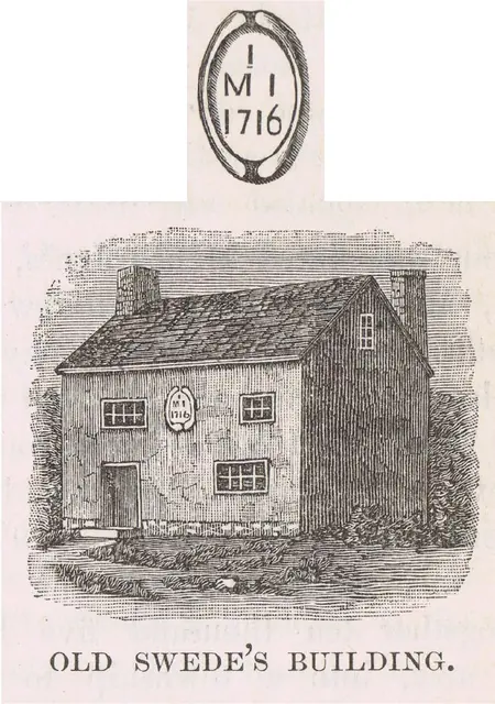
Woodcut perspective drawing of Mouns Jones House, image #1 (c.1886)
Archives 1000.01.089

Southwest perspective view from wood engraving

Mouns Jones · c.1886 & c.1948

Digital image of a perspective view of Mouns Jones House from woodcut engraving published on page 945 of “History of Berks County, Pennsylvania” by Morton Montgomery, pub. by Everts & Peck, Philadelphia. Montgomery describes the building as in a “good state of preservation”, of dimensions 36 by 21 feet. This is the earliest known image of Mouns Jones House,

View record
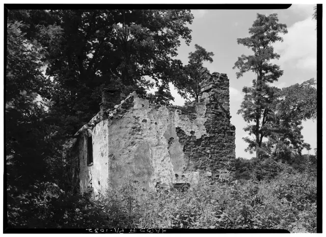
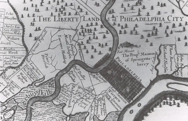
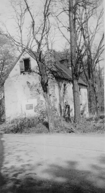
Image #1: Mouns Jones House, SW perspective view of surviving walls (1958)
Photos 1000.01.017

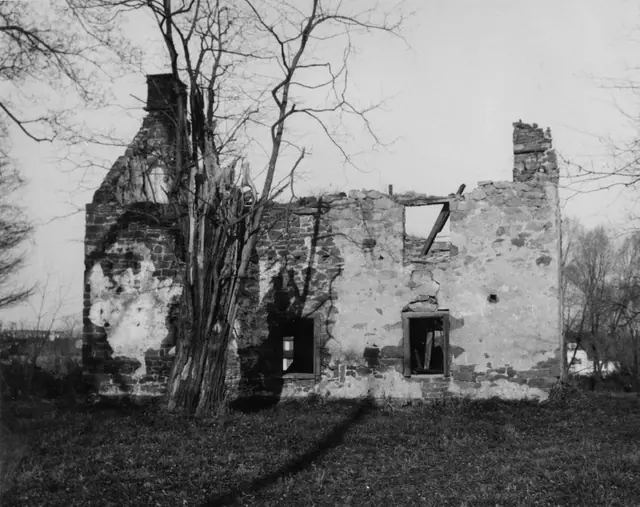
Southwest perspective view of surviving south gable, west eaves walls, northern chimney centered on roof ridge and SE corner chimney.

Mouns Jones · August 1958

Digital image from original photographic print showing southwest perspective view. Details include: corner chimney [near-right], north gable-end chimney [left background], pargeted random-rubble masonry. The coverage of the remaining "stucco," a 19th-century application designed to protect the mortar joints and "modernize" the exterior with a white-washed

View record
Thomas Holmes’ map of Pennsylvania (c.1688)
Archives 1000.01.118

Thomas Holme’s “Map of the Improved Part of Pennsylvania in America”, showing the land of “Mouns Johnson” west of the Schuylkill River

Mouns Jones · 1687

c. 1688 Thomas Holme’s map of Pennsylvania, showing the land of “Mouns Johnson” (Mouns Jones) west of the Schuylkill River, in Kingsessing, near Cobb’s Creek. Under his father Jonas Nilsson’s Will of 1693, Mouns inherited an additional 100 acres [see record MJTX1]. This map is held in the collections of the Historical Society of Pennsylvania, Philadelphia, a

View record
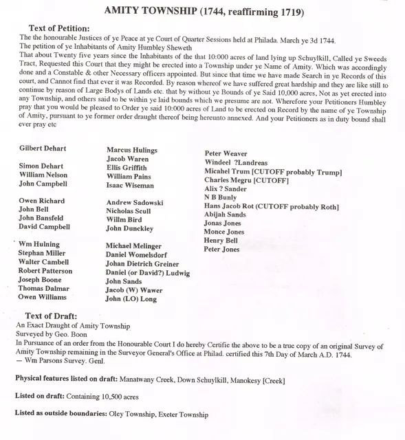
Morlatton Village, transcript of Amity Township Petition, image #1 (1744)
Archives 1003.01.061

Transcript of 1744 Petition to create Amity Townwship and survey map; also plot plan and survey “draught” of Swedes’ Tract

Morlatton · 03/03/1744; plot plans undated

Series of six digital images: a transcript of the second Petition [the first one was described as “lost”] to establish Amity Township, the accompanying survey drawing. Image #3 and #4 show the original approximately 10,000 acre Penn Grant of the “Swedes Tract” to the Swedish Lutheran Pastor Andreas Rudman, to be divided into parcels for conveyance [by “warra

View record
Mouns Jones House, southeast perspective view, image #1 (c.1946-47)
Photos 1000.01.065

Two southeast perspective views

Mouns Jones · c.1948-1950

Three black and white photographic prints (two showing southeastern perspective views and one southwest perspective view), of the Mouns Jones House in the 1940s, before its partial collapse prior to 1958; a photo of notes on the verso of Image #1; one color photo of subgrade masonry on the river-side of the house; a map of the “Philadelphia Trading Area”; an

View record
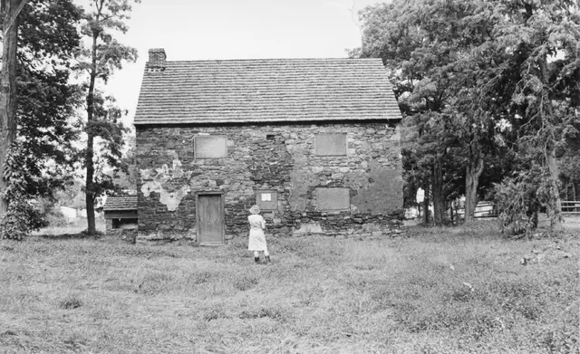
Mouns Jones house, west elevation view
Photos 1000.01.062

West elevation view

Mouns Jones · Unknown

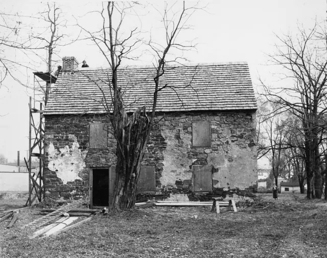
Black and white photographic print showing west elevation view of the Mouns Jones House after partial restoration, with unidentified person standing in front of building. The window openings have been modified to receive casement windows, perhaps based on consistently with an 1886 woodcut rendering of a southwest perspective view [see MJHDWG2--1000.01.089] a

View record
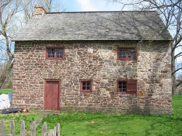
Mouns Jones House, west elevation view (2010)
Photos 1000.01.088

West elevation view

Mouns Jones · 03/26/2010

Details include: random rubble masonry; replacement casement windows; beaded board replacement door and frame; gable-end chimney centered on roof ridge; 1716 date-stone; replacement wooden-shingle roof; projecting "water table"{a} stonework at above-grade foundation of eaves wall; alternating-stone corner piers ["quoins"]; board-and-batten shutter. {a} A s

View record
Mouns Jones House, west elevation view after c. 1955-57 collapse of roof...
Photos 1000.01.071

West elevation view of ruins and surviving masonry walls and chimneys

Mouns Jones · c.1965

Black and white photographic print showing west elevation view of surviving masonry wall, chimneys, and fenestration openings on both stories of the Mouns Jones House. A HABS drawing dated 1957 shows the standing masonry walling after the collapse of the roof and flooring [see sheet # 1A of the Atlas of Drawings of Structures Preserved by The Historic Preser

View record
Mouns Jones House, partially restored W elevation view (c.1967-1968)
Photos 1000.01.080

West elevation view with replaced roof

Mouns Jones · c.1967-1968

Black and white photographic print showing west elevation view of the Mouns Jones House with replaced roof. Details include: 19th-century asymmetric fenestration prior to removal and replacement with casement windows; new brick gable-end chimney, laid in running ["stretcher"] bond; replaced wooden-shingle roof; surviving and rebuilt random rubble masonry

View record
Cover page
Archives 1003.01.001

White Horse Tavern History

Morlatton

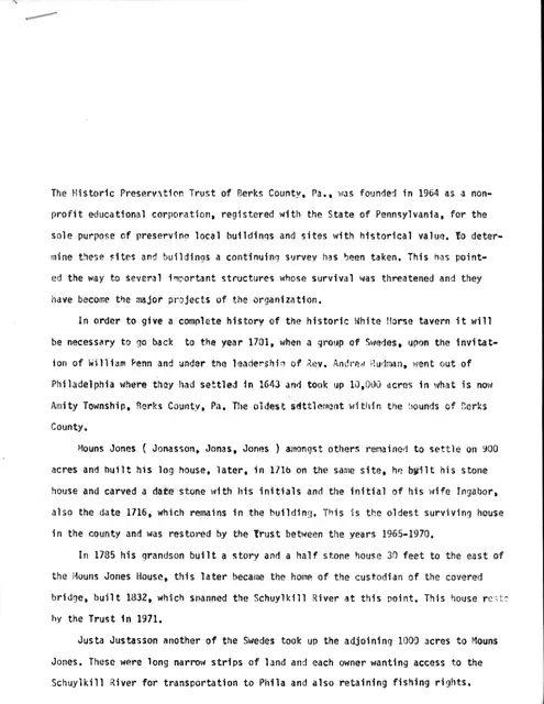
Copy of a five-page typed history of sites and structures within Morlatton Village, particularly the White Horse Tavern. The first page is a rewrite of the second page (or vice-versa). It summarizes event dates, family history, ownerships and architectural development. View additional images or MULTIMEDIA LINKS for full text.

View record
Mouns Jones, cover page & 5-page text descriptions of HABS documents (1961)
Archives 1000.01.018

WRITTEN AND DESCRIPTIVE DATA

Mouns Jones · January 1961

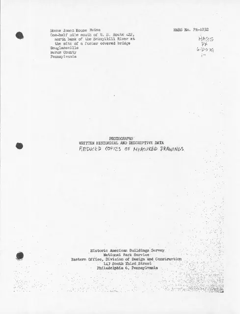
Background text accompanying Historical American Buildings Survey photographs and drawings. Five pages of text describe Location, Historical Information, Architectural Information, etc. of the Mouns Jones House. For full text refer to MULTIMEDIA LINKS or additional images. Also, see MULTIMEDIA LINKS for drawing (1000.01.019--MJDWG1) and photos (1000.01.01

View record