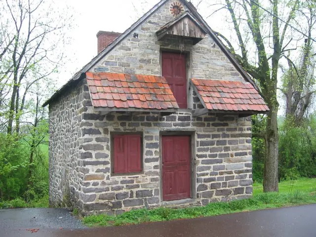
Photos 1001.01.082
Southwest perspective view
Digital photographic print showing a southwest perspective view. Image shows exisiting conditions immediately prior to the 2009 restoration of building. This is a low resolution image.
View recordPerson
195 records
Search the archive Digital photographic print showing a southwest perspective view. Image shows exisiting conditions immediately prior to the 2009 restoration of building. This is a low resolution image.
View record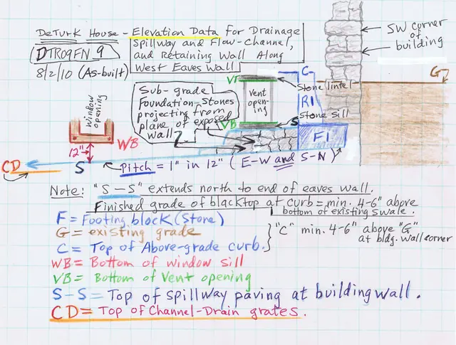
Sketch plan drawing of June, 2010 installation of stone-paved spillway, drains, and battered retaining wall at DeTurk House west eaves wall. These installations will deflect, intercept, and collect more than 90% of the roof runoff and ground-surface sheet flow incursion into or against the building through the vent and window openings, and by penetration
View record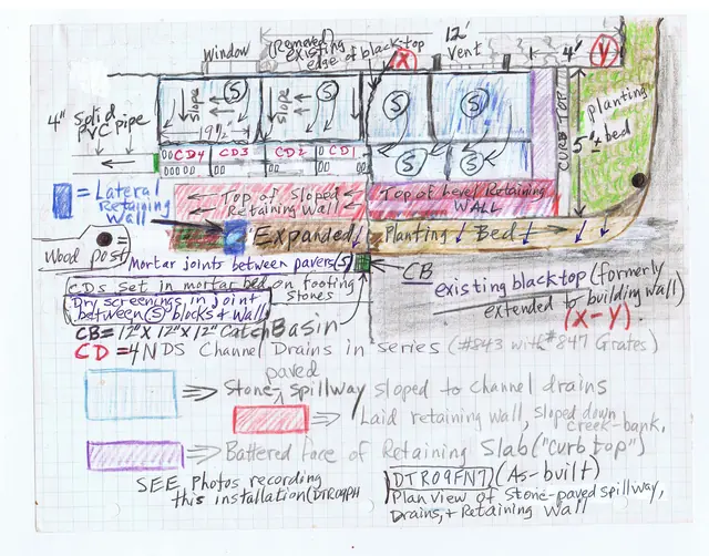
Sketch plan drawing of June, 2010 installation of stone-paved spillway, drains, and retaining wall at DeTurk House kitchen-cellar entry. Also see DTR09FN8--1001.01.237, DTR09FN9--1001.01.238, and DTR09FN10--1001.01.239 for alternate views of this installation. See DTR09PH134--1001.01.230 for photographs of this installation.
View record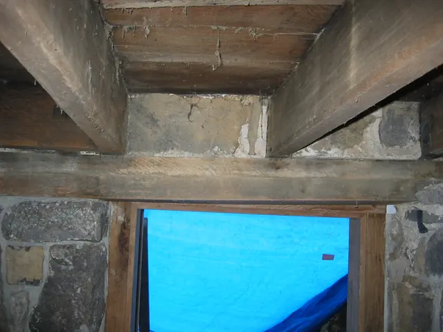
Interior view of the pair of stacked “wall plates” spanning the kitchen doorway and originally providing a level bearing support for the chamfered floor joists. These timbers, approximately the same dimensions as floor joists laid flat, serve as relieving lintels discharging the loads above the doorway and window frame to the abutting masonry piers. The long
View record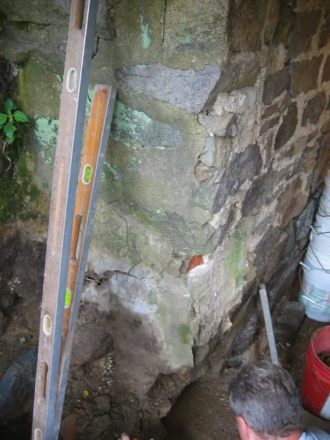
Exterior corner (“quoin corner”) of pier to left [south] of cellar doorway after removal of later door frame and non-original jamb-plinths. View prior to removal of displaced and unstable masonry, re-alignment to original position, and re-laying of pier stonework. Darker stones at foundation level (which were below the modern grade) have been excavated an
View record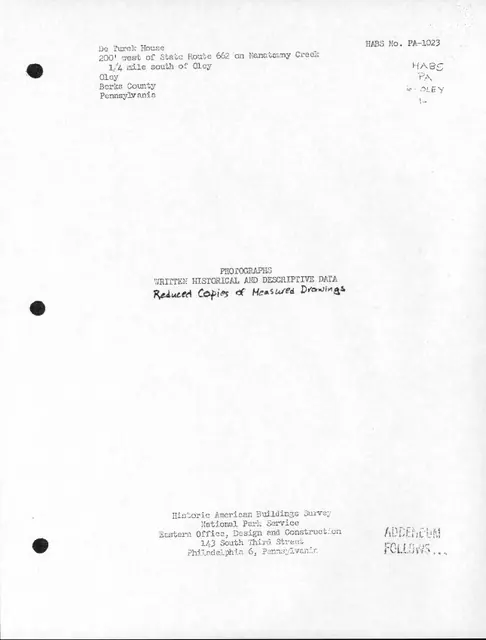
Background text accompanying Historical American Buildings Survey photographs and drawings. Six pages of text contains "Location," Historical Info," "Architectural Info," etc. on the DeTurk House. For full text see additional images or refer to MULTIMEDIA LINKS. Full contents of HABS file may also be found in MULTIMEDIA LINKS.
View record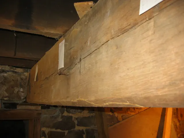
Description: This series of 33 photos documents the removal, restoration, reconstruction, and re-installation of the 9" x 12" "summer"{1} beam which spans from a lapped meeting with the fireplace lintel to the masonry bearing pocket in the "cross" wall between the ground-level kitchen and barrel-vaulted "root" cellar. The upper projecting segment [tenon] of
View record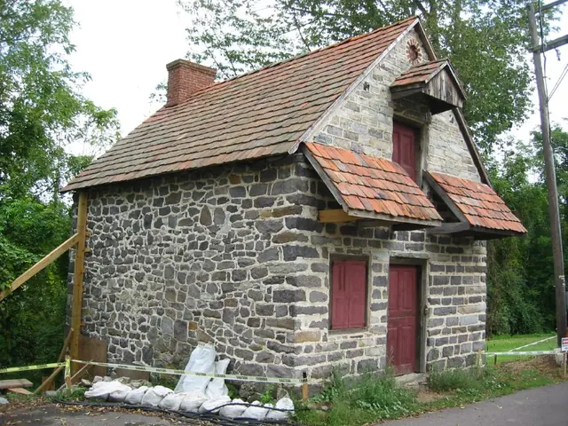
Digital photographic image showing a southwest perspective view of the DeTurk House.
View record![Temporary shoring ["centering"] frame supporting DeTurk cellar vault (2009)](/media/57b5c03c-f7d2-56d5-a763-024421ec7315/thumbnail)
Temporary shoring [”centering” {1}] frame supporting root cellar vault during restoration of vault abutment wall. This is the upper segment with a sheet of plywood ”scribed” to the ”intrados”{2}. FOOTNOTE {1} "Centering" (“false-work” in early usage) is the term customarily applied to the timber frame supporting an arch or vault during construction until
View record![Temporary shoring ["centering"] frame supporting DeTurk cellar vault (2009)](/media/cf441602-b982-5a3d-a1e1-0895533b5d83/thumbnail)
Lower elements of the temporary shoring ["centering" {1}] frame supporting the root cellar vault during restoration of vault abutment wall. See DTR09PH130--1001.01.226 showing the upper portion of this shoring frame. FOOTNOTE {1} “Centering” [“false-work” in early usage”] is the term customarily applied to the timber frame supporting an arch or vault dur
View record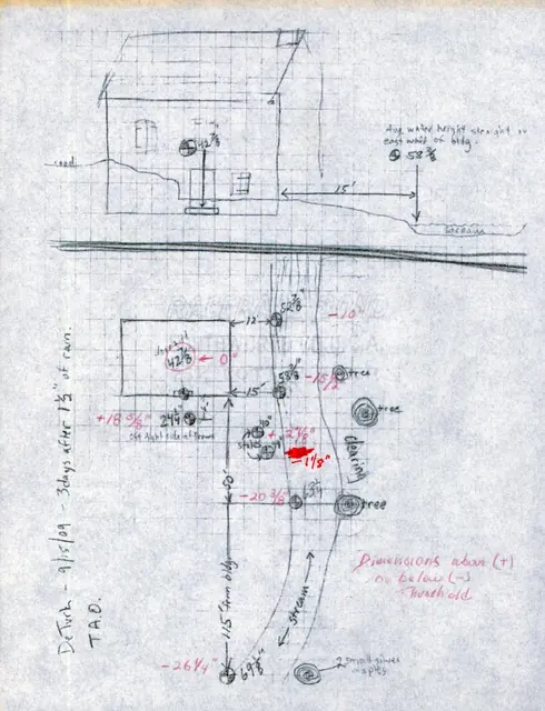
Photo copy of Field Notes Drawing by Thomas A. Opitz, historic restoration carpenter, with measurements of water table and other elevations surrounding DeTurk House 3 days after 1.5 inches of rain.
View record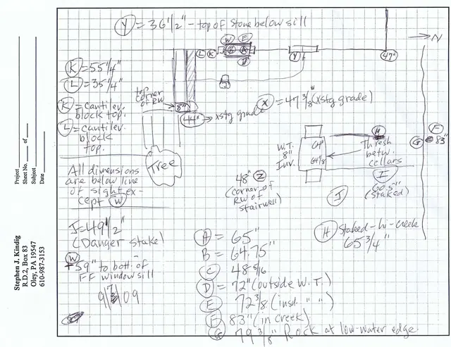
Field drawing of topographical features and elevation measurements east of DeTurk House south of Little Manatawny Creek with dimensions. See Multimedia links or additional image for sheet explaining Topographical Conversions in inches
View record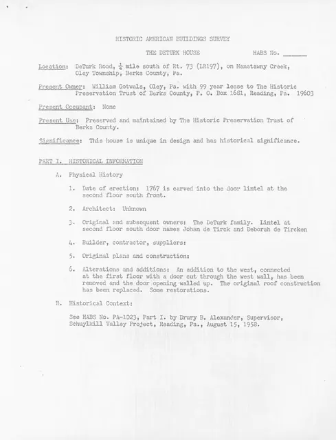
Photocopy of a ten-page report prepared by Barry K. Stover for Historic American Buildings Survey (HABS). Form was prepared in order to update existing HABS information on the DeTurk House already on file at the Library of Congress in Washington, D.C. Unfortunately, this information was never filed with HABS. Topics discussed include: Hisotrical Informati
View record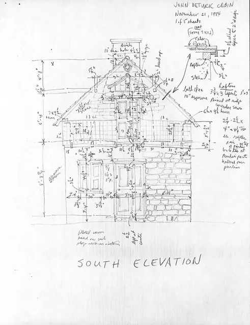
*Series of five field notes drawings accompanying an unfiled information form prepared by Barry K. Stover for Historic American Buildings Survey (HABS). Form and drawings were prepared in order to update existing HABS information already on file at the Library of Congress in Washington, D.C. Drawings represent the DeTurk House's south elevation, east elev
View record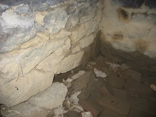
A pre-restoration view of the corner of the ground-level kitchen and original floor bricks, laid in running bond, showing the 20th-century floor level approximately 18-20 inches above the original 1767 brick floor, which was found by excavations along the east wall of the kitchen and against the eastern pier ["leg"] of the kitchen fireplace. This view shows
View record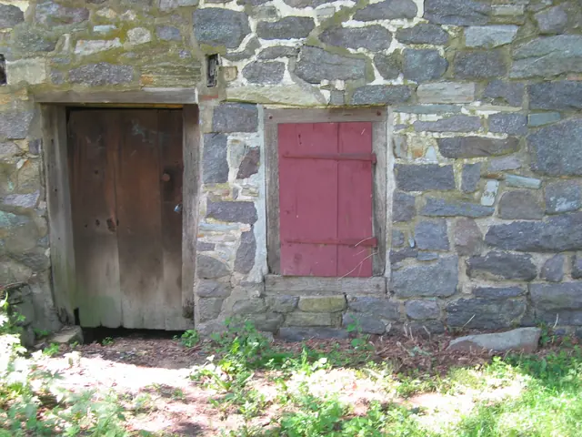
Detail of DTR09PH106--1001.01.202: East kitchen cellar door and shuttered window prior to restoration and regrading. The existing grade is approximately 16 inches below the window sill and approximately 18 inches above the original grade at the kitchen-cellar entry "threshold" [top of stone door-sill]. These dimensions were established by excavating to t
View record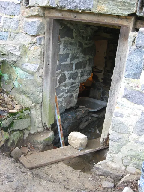
East cellar doorway prior to replacement of door-frame and masonry restoration. Restoration of the doorway and kitchen floor to their original elevations {1}, which are only marginally higher than the flood levels of the Creek and the high water table, will require diversion and mitigation measures to minimize water incursion. A stairwell from the restore
View record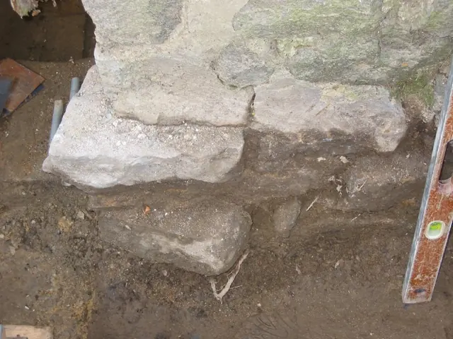
Foundation of pier north of east cellar doorway after partial excavation prior to restoration. The displaced stones above and below modern grade [stones darkened by wet soil were below modern grade prior to excavation] are shown after removal of rotted later-period jambs. The early setting and pointing mortar, a typical lime-sand mix, applied between the
View record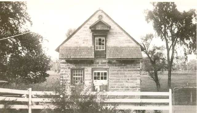
Digital image from a photographic print showing view of south gable wall elevation. Details include: original oculus vent above attic-door hood, pedimented gable hood, original attic door with later glazed sash, hyphenated pent roof, later glazed first floor door, eight-over-eight window, coursed masonry. Larry Ward, updated September, 2022
View record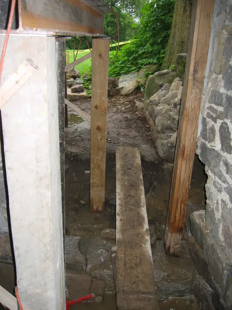
View to the east along root cellar partition wall from inside kitchen door sill after installation of south replacement door jamb on original stone sill. The cavity to the right of the jamb [just below the horizontal mid-line of the photo] will be relaid in plumb alignment with the jamb [see lower left corner of DTR09PH4--1001.01.124 for pe-restoration view
View record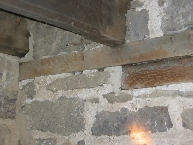
White oak embedded wall plates and stop-chamfered first floor joists in east masonry wall of DeTurk kitchen. The lower and shorter oak plate serves as a relieving lintel, transferring much of the wall loads to the piers abutting the kitchen doorway and window openings. The longer upper plate performs a similar bearing function, in addition to its effect as a
View record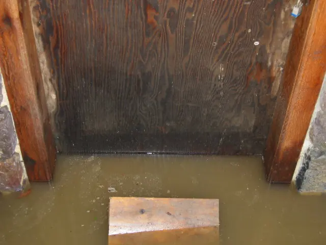
The water level [“table”] evident in this photo [12/09/09] is two inches above the original stone sill, a typical level after several inches of rainfall, which occurs several times each year or more frequently [as in 2009]. This varying frequency of inundation has historically been sufficient to subject the jambs and door to destructive fungus-rot [see photo
View record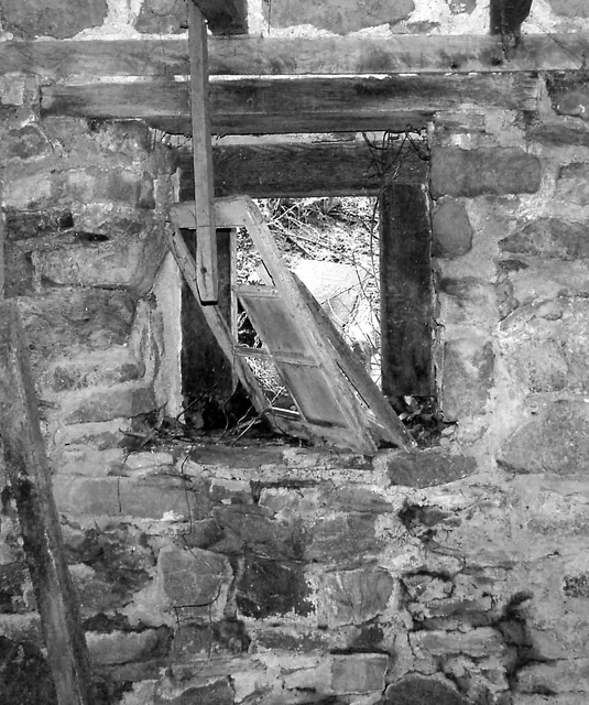
B&W Digital photographic image of DeTurk House showing interior view of 1st floor window in western eaves wall.
View record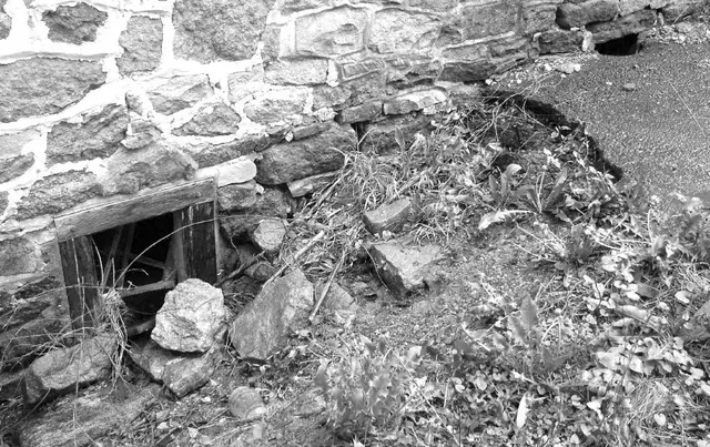
Digital photographic print showing western grade with eroded macadam surface and slope to creek, conditions which allowed incursion of surface drainage into cellar through opening at grade as seen in photo.
View record