Subject

Mahanatawny

Mouns Jones House, archaeological dig photos (1969-70, and 2011-2014)
Photos 1000.01.061

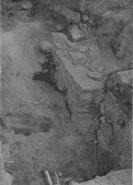
Archaeological dig outside southwest eaves wall

Mouns Jones · 1969

Image #1: Black and white photographic print showing detail of amateur archaeological excavation outside the west eaves wall of the Mouns Jones House in 1969 or 1970. Image #2 shows text of notes written in blue pen & red pen on verso, which refer to "this wall against the south [sic: closer to southwest] wall of the House--we do not know if this would be

View record
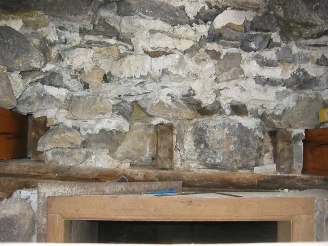
DeTurk , deconstructed masonry wall above kitchen doorway (2009)
Photos 1001.01.208

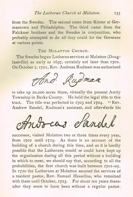
Core of random rubble masonry wall above kitchen doorway during restoration

DeTurk · 12/07/2009

View of wall above kitchen door after removal of exterior layer [“wythe”] of stones, which were distended and out of plumb. Stones removed from above the doorway were laid out on the ground in "mirror" position and were re-laid and "mudded in" [set and bonded in bed and joint mortar] in their original positions. Repointing of this wall segment was complet

View record
Morlatton Village, church history, page #235 (1902)
Archives 1003.01.062

Excerpt from book "The Lutheran Church in Pennsylvania: 1638-1800" featuring the church at Morlatton (now St. Gabriel's)

Morlatton · 1902

Series of three digital images depicting a 5-page section from the book ”The Lutheran Church in Pennsylvania (1638-1800),” Vol. I, by Theodore Emanuel Schmauk, D.D., Lancaster, PA, The Pennsylvania German Society (1902). The section herein is featured on pages 235-239. The excerpt gives a brief history of the church at Morlatton (in text referred to as Mo

View record
Limestone vein in Little Manatawny Creek east of DeTurk House (2009)
Photos 1001.01.181

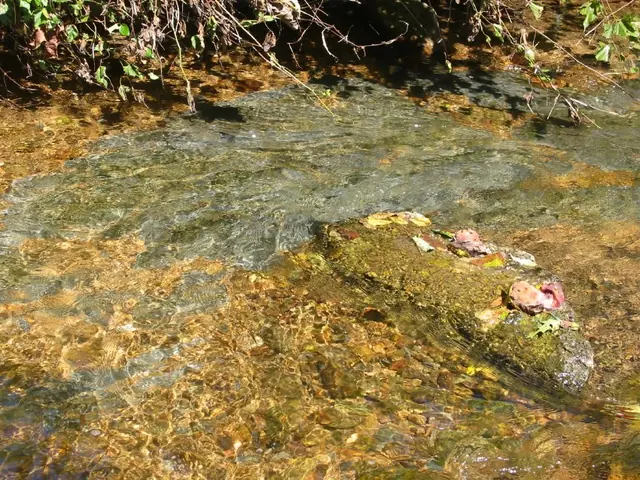
Limestone vein in creek bed.

DeTurk · 09/03/2009

Limestone vein ["shelf" or "bench"] in bed of Little Manatawny Creek east [downstream] from the DeTurk House. This bedrock layer ["shelf"] forms the natural bedrock "footings"{1} bearing the foundation walls of the house, which has been more accurately described as an "ancillary," multi-purpose structure, acknowledging its affiliation with the original (expa

View record
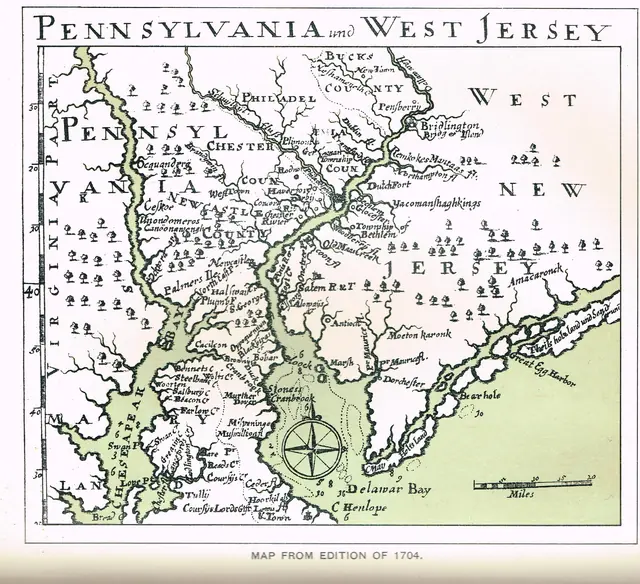
Falckner 1704 MAP: Digital reproduction of map published in a 1704 edition
Archives 1003.01.054

Morlatton Village, history & Nomenclature

Morlatton · various

Series of seven images illustrating the variations in the place-names describing the area in which Mouns Jones settled in 1704 and which the Trust now calls Old Morlatton Village, situated between the Village of Douglassville and the Schuylkill River in southeastern Amity Township, Berks County, PA. More toponyms and variant spellings will be added to this r

View record
image#1: DeTurk House, NE perspective view, (1941)
Photos 1001.01.029

Northeast perspective view

DeTurk · Summer 1941

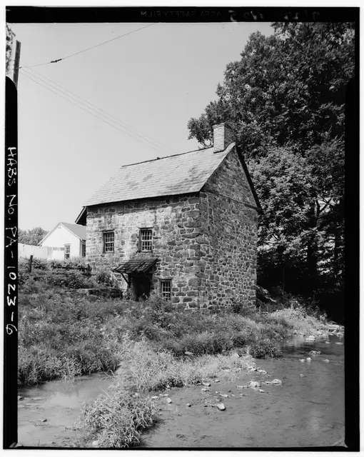
Series of 3 digital images from photographic prints showing NE perspective view of DeTurk House, showing the Little Manatawny Creek; images 4 & 5 show details discussed below. Image#1 details include: 20th-century braced clay-tile roofed pent hood over lower-level kitchen door, 19th-century slate roof [replaced with clay tiles in the 1970s], gable-end chi

View record
DeTurk House, pointing variations, image #1 (2009)
Photos 1001.01.216

Pointing variations

DeTurk · 2009

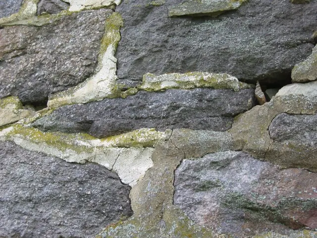
Series of 9 digital photographs showing the diverse array of mortar types in the joints and beds of the exterior walls of the DeTurk "ancillary" house. The dates of the extant pointing range from the original construction in 1767 through the most recent restoration work in 2009 and 2010. These photos illustrate the variations in color, texture, and surfac

View record
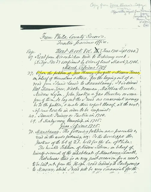
Mouns Jones, road petition
Archives 1000.01.093

Quarter Sessions Office, road petition

Mouns Jones · Unknown

Photocopy of a photocopied page from a Berks County Quarter Sessions Office{1} records book . Highlighted line begins discussion of a petition to build a road from ”Edward Lane’s” to “Mannitawny”. Peition was made by Henry Sprogel and ”Mounce Jones” on behalf of themselves and others. In the full text of the Petition, not transcribed in this abstract, Mounce

View record
Image #1: Mouns Jones House, NW perspective view before restoration, (1962)
Photos 1000.01.013

Restoration of Mouns Jones house

Mouns Jones · c.1960-65

A series of three photographic views (image #1 is a digital image and #2 and 3 are color photographic prints) showing pre-restoration northwestern perspective views of the Mouns Jones House after the collapse of the roofing and flooring in the 1950s. Image #1 is a digital copy of a photographic print [Stauffer #1000], published here with the generous

View record
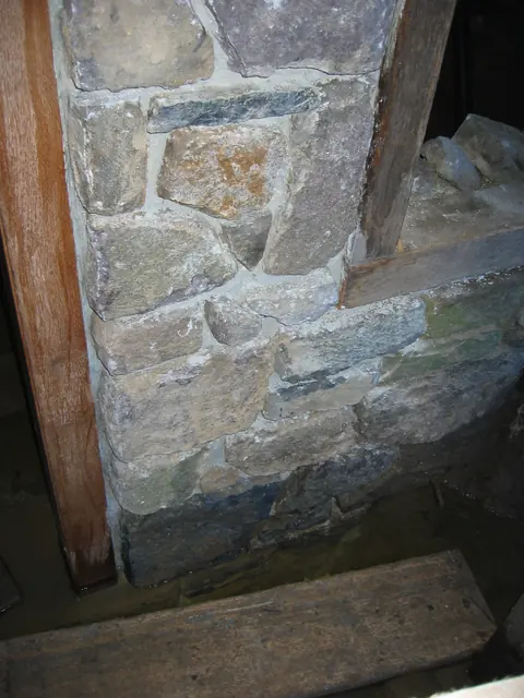
Restored N masonry pier, kitchen cellar doorway, before repointing (2009)
Photos 1001.01.138

Restored masonry pier

DeTurk · 08/10/2009

Digitial photograph of realigned and reconstructed masonry pier abutting the north jamb at the DeTurk kitchen doorway. The joints were repointed in the traditional convex double-struck “V” method{1}, using sand from the adjacent Little Manatawny Creek, mason’s lime, and a small percentage of Portland cement. A higher proportion [about 20%] of Portland cement

View record
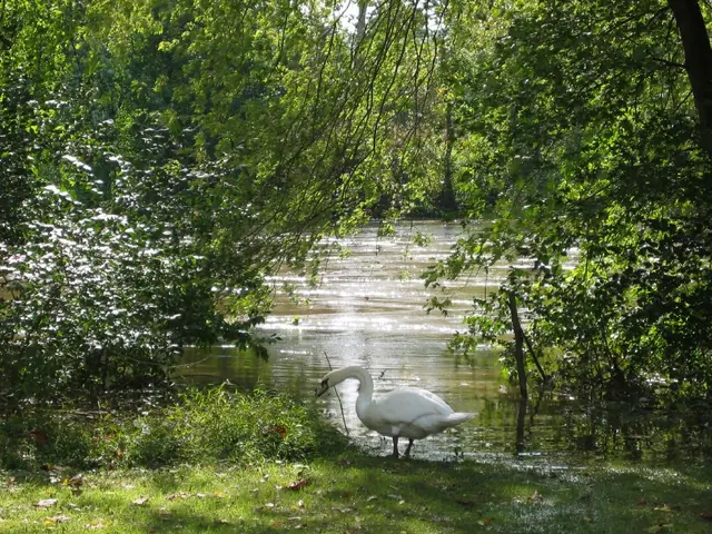
Schuylkill River levels at Morlatton Village, October 1, 2010 (image#1)
Photos 1003.01.052

Schuylkill River over banks

Morlatton · 10/01/2010

Series of four color digital photographs showing water levels after heavy rainfall on September 30 & October 1, 2010. From mid-morning on September 30, 2010 through mid-morning October 1st, six inches of rain fell in the Schuylkill River channel at Pottstown, PA, as measured at the United States Geological Survey (USGS) Station located 75 feet upstream from

View record
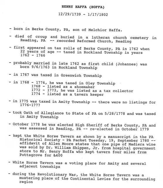
White Horse Inn, timeline for Henry Haffa, page#1
Archives 1007.01.071

Timeline of Innkeepers at the White Horse Inn

White Horse Tavern · Unknown

Series of two digital pages outlining the progression of a few of the known Innkeepers at the White Horse Inn. In addition research conducted by Phil Pendleton has also identified the following innkeepers of record, with their dates: INNKEEPER TIMELINE 1750, 1751: Public House License issued to Philip Cresman [also called Philip Balthasar Craessman i

View record
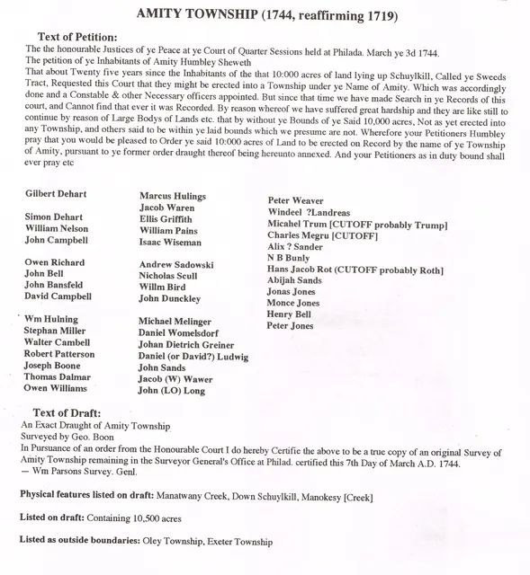
Morlatton Village, transcript of Amity Township Petition, image #1 (1744)
Archives 1003.01.061

Transcript of 1744 Petition to create Amity Townwship and survey map; also plot plan and survey “draught” of Swedes’ Tract

Morlatton · 03/03/1744; plot plans undated

Series of six digital images: a transcript of the second Petition [the first one was described as “lost”] to establish Amity Township, the accompanying survey drawing. Image #3 and #4 show the original approximately 10,000 acre Penn Grant of the “Swedes Tract” to the Swedish Lutheran Pastor Andreas Rudman, to be divided into parcels for conveyance [by “warra

View record
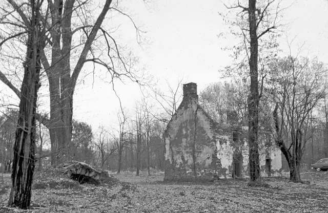
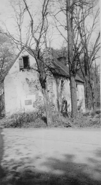
Mouns Jones House, southeast perspective view, image #1 (c.1946-47)
Photos 1000.01.065

Two southeast perspective views

Mouns Jones · c.1948-1950

Three black and white photographic prints (two showing southeastern perspective views and one southwest perspective view), of the Mouns Jones House in the 1940s, before its partial collapse prior to 1958; a photo of notes on the verso of Image #1; one color photo of subgrade masonry on the river-side of the house; a map of the “Philadelphia Trading Area”; an

View record
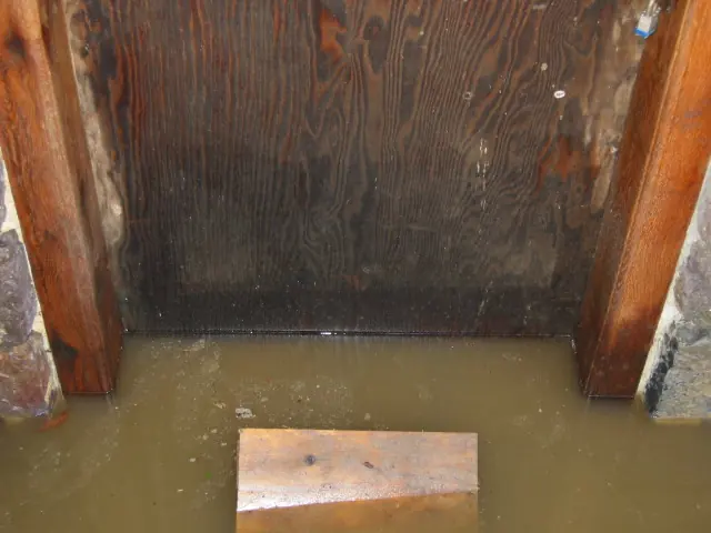
High water table at DeTurk kitchen doorway after heavy rainfall (2009)
Photos 1001.01.190

Water table at kitchen doorway

DeTurk · 12/09/2009

The water level [“table”] evident in this photo [12/09/09] is two inches above the original stone sill, a typical level after several inches of rainfall, which occurs several times each year or more frequently [as in 2009]. This varying frequency of inundation has historically been sufficient to subject the jambs and door to destructive fungus-rot [see photo

View record